
When UCLA and the University of Hawaii’s research programs need high-resolution 360° imagery of wildfire aftermath, they turn to Mosaic cameras.
As climate change accelerates, communities around the world face increasingly frequent and destructive natural disasters. From record-breaking wildfires to flash floods in urban centers, these events are not only more intense but also more expensive, both in terms of human lives and their financial impact.
It is up to researchers of various disciplines to discover patterns in the climate, investigate natural disasters, and report their findings to prevent future disasters and loss of human life.
Due to the expenses associated with climate change-related disasters, they are among the top research opportunities for world-class universities, particularly in environmentally vulnerable areas, such as California and Hawaii. These states lead the way in environmental studies because deadly wildfires, droughts, and strong ocean storms frequently impact them.
As we attempt to adapt to a rapidly changing climate, there is an urgent need for better tools to document, analyze, and respond to these evolving threats. To perform a thorough investigation after a catastrophic event like a wildfire, researchers need to collect accurate visual and geospatial data as quickly as possible. Capturing high-resolution imagery immediately after a natural disaster is important for preserving the scene before response crews or the weather changes the evidence. This is where Mosaic mobile mapping systems come into play.
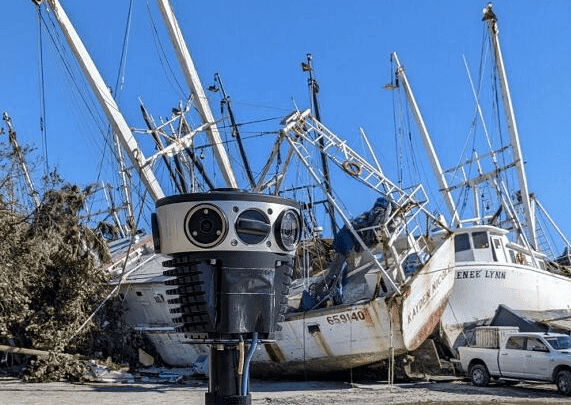
Following the destructive Lahaina Wildfire in 2023, the University of Hawaii at Manoa utilized imagery gathered with the Mosaic 51. For the most recent LA wildfires in January 2025, both the University of California, Los Angeles (UCLA) and the University of Hawaii used Mosaic cameras to capture data. These research teams plan to use the data to streamline the immediate cleanup process and improve long-term weatherproofing as they rebuild.
The 2023 Lahaina Wildfire
The National Disaster Preparedness Training Center (NDPTC) at the University of Hawaii develops and delivers “training and educational programs related to homeland security and disaster management, with a specific focus on natural hazards, coastal communities, and the special needs and opportunities of islands and territories.” It is under the direction of Dr. Carl Kim, who reached out to Site Tour 360 after the August 2023 wildfire that engulfed the entire town of Lahaina, Maui.
The NDPTC worked alongside Site Tour 360 to provide critical data for FEMA, local authorities, and researchers following the unprecedented wildfire fueled by the high winds from a nearby Category 4 hurricane.
They captured the high-resolution imagery and had it available to authorities via Esri ArcGIS within 24 hours of the data capture.
NDPTC’s data processing
With a Mosaic 51 mobile mapping system, the NDPTC captured data in the immediate aftermath of the wildfires to help emergency response professionals allocate their limited resources and guide the debris management teams within 24 hours.
Wildfire data in action
The most important parts of the post-disaster research process and FEMA recommendations for Lahaina are identifying weaknesses in the emergency alert systems, improving emergency response times, and rebuilding with wildfire prevention methods in mind.
One of Dr. Kim’s long-term goals for the dataset is to focus on the historical preservation of several sites in Lahaina. This would involve analyzing the imagery captured from the Mosaic 51 and comparing it to old maps and historical photographs.
Losses from the Lahaina Wildfire
In total, the fire burned more than 2,100 acres, causing 102 confirmed deaths and leaving two missing. It leveled much of Lahaina’s historic district, and financially, FEMA and the Pacific Disaster Center estimate rebuilding costs at $5.5 billion. Beyond physical damage, the fire obliterated centuries of cultural heritage and community identity tied to the former Hawaiian capital, disrupting both tourism and local traditions.
The 2025 Los Angeles Wildfires
The Los Angeles wildfires ignited on January 7th, 2025, most notably the Eaton Fire in Eaton Canyon and the Palisades Fire in the Santa Monica Mountains. These fires burned until full containment, a few weeks later on January 31st.
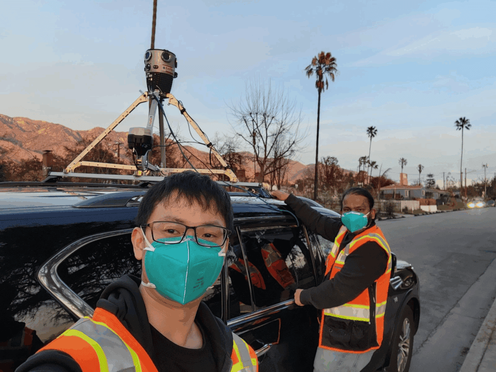
Mosaic cameras were among the first on the scene, gathering data for both UCLA and the University of Hawaii’s NDPTC.
UCLA conducts research close to home
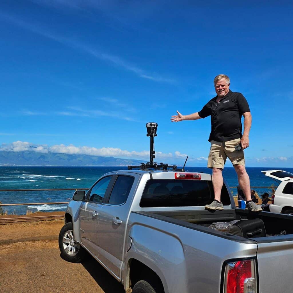
As a silver lining in the smoke and destruction, Los Angeles’s own scientists at UCLA’s B. John Garrick Institute for the Risk Sciences took the opportunity to document the burned areas with a Mosaic X. They were able to quickly gather crucial data to support wildfire resilience research, thanks to the Mosaic X’s universal design, which fits on top of a standard vehicle.
UCLA’s data collection goals
The UCLA research team had two major goals for the Mosaic X imagery:
- Create a comprehensive set of visual data for fire damage assessment, environmental recovery planning, and efforts to rebuild the affected neighborhoods.
- Test the speed, accuracy, and effectiveness of mobile mapping systems for documenting natural disasters immediately after they occur.
NDPTC in Los Angeles
UCLA wasn’t the only educational organization working in Los Angeles after the wildfires. Dr. Kim of the NDPTC at the University of Hawaii reached back out to Site Tour 360 after the successful data capture in Lahaina back in 2023.
Results that matter
The data capture and post-processing after the LA Wildfires mirrored many of their experiences from the 2023 Lahaina Wildfire. This imagery helps researchers develop fireproof communities by learning which building materials are the most fire-resistant, how wildfires spread, and the best evacuation routes for each unique landscape.
The 360 Imagery Comparison Viewer
One important product of this data capture process was Site Tour 360’s 360 Imagery Comparison Viewer. This tool, modeled in the video below, takes data from 360Camsters, Google Street View, and satellite maps to create a 3-window viewer. Users can move down the streets of Altadena and the Pacific Palisades and compare imagery from before and after the fires – all on one monitor screen.
Impacts of the LA Wildfires
Although Southern California is no stranger to wildfires, the destruction was unprecedented. By month’s end, over 18,000 buildings had been lost or damaged, more than 200,000 residents had been evacuated, and the fires consumed 57,636 acres. The economic toll has been estimated between $76 billion and $131 billion in total damage and losses; insured losses alone may exceed $45 billion, including the destruction of public infrastructure.
In response, Governor Newsom signed a $2.5 billion emergency relief package on January 23, 2025, while the fires still burned, and FEMA allocated over $2 billion in home and business loans. State and local officials project rebuilding will take years.
The 29 lives lost in the immediate aftermath and the staggering financial losses stress the importance of high-quality research into climate-protective measures as LA rebuilds its destroyed neighborhoods.
When drones aren’t enough
While drone footage and aerial surveys have become popular tools for capturing large-scale environmental data quickly and with ease, they often miss critical street-level details. Damaged infrastructure, minor road blockages, or the exact condition of buildings are details that make a substantial difference in disaster response and long-term planning, but they are often missed in overhead views.
Street-view imagery, like that captured by the Mosaic X and Mosaic 51, fills this important data-capture gap. These camera systems enable the comprehensive documentation of past and present conditions of neighborhoods and critical infrastructure from an eye-level perspective. This visual record is essential for assessing damage, planning repairs, documenting for insurance policies, and understanding how a disaster unfolded block by block. It also provides a baseline for comparison over time, making it easier to track long-term climate impacts and mitigation efforts.
Who benefits from street-view imagery after disasters?
The results of academic research on climate change can take years, or even decades, to uncover, but that doesn’t mean data gathered from street-view imagery can’t have an immediate impact on our everyday lives. Street-view imagery has a wide range of uses outside of the scientific research community that can be felt before, during, and after a natural disaster. You definitely do not need to be a geospatial expert to benefit from 360° imagery.
Local Governments
Your local government plays a vital role in land use, resource allocation, and upholding the law in the midst of natural disasters.
Before disaster strikes
Street-view imagery plays a vital role across multiple local government sectors, even without the looming threat of natural disasters. Mobile mapping is the latest technology that is replacing manual surveying and paper maps. Within the bounds of cadastral surveying, it streamlines the process of maintaining up-to-date records on land use, legal boundaries, and zoning changes.
Instead of deploying teams of surveyors to physically inspect and measure properties, cities can now drive the streets in an afternoon, capturing detailed data more quickly and affordably. Surveying becomes cheaper and faster without sending a team of a dozen surveyors out to block traffic so they can manually measure and photograph every angle.
During the disaster
Immediately after a natural disaster, historical records of street-view imagery are important for identifying boundary markers and returning lost or damaged property to its original owners. It also can give residents early information about the state of their homes. Re-capturing imagery of damaged areas once it is safe to re-enter helps determine emergency resource allocation strategies without putting too many people at risk. With Mosaic 360° cameras, for example, a single operator in a standard car can go out into the field to gather imagery.
The aftermath
360° street-view imagery is very important for long-term reconstruction plans. If experts discover patterns in the post-disaster research process that determine, for example, that a part of the city is particularly prone to flooding, local governments may make changes to the building code or flood plain demarcation to reflect that newfound threat. As destructive as climate-related weather events may be, they are an important time to re-evaluate how we build cities and find areas of improvement.
Insurance Companies
Insurance companies, too, depend on street-level data both before and after a disaster. Pre-disaster imagery aids in risk analysis and policy pricing, while post-disaster imagery accelerates claims processing, especially when access to the area is unsafe. Digital tools like mobile mapping can significantly reduce insurance processing times, ensuring faster recovery for policyholders.
For one Mosaic client, McKenzie Intelligence Services (MIS), their primary customers are insurance companies, which use MIS’s data to understand property damage, expedite claims, and optimize response efforts. With street-view imagery, the insurers have access to near-real-time and historical disaster data. With a mix of machine learning and human intelligence expertise, they can establish and validate insurance claims quickly and accurately.
Cultural Preservation Experts and Historians
Finally, street-level imagery contributes to cultural preservation. Documenting homes, streets, and landmarks before they are lost to fire or flood keeps the memory of these places alive, offering historians and future generations a visual archive far richer than paper registries alone. When it comes time to rebuild after a natural disaster, this imagery becomes not just a record of what was, but a guide for what can be restored. This is especially important for rebuilding after the Lahaina wildfire, which destroyed the historical capital of the Kingdom of Hawaii.
Conclusion
In sum, as climate change reshapes the physical world in unpredictable ways, street-level imagery has emerged as a vital technology for adaptation, planning, and preservation. It offers clarity when the ground is shifting, both literally and figuratively, and ensures that the memory and structure of our communities are not erased in the aftermath of disaster.
For researchers at UCLA and the University of Hawaii, high-resolution 360-degree imagery is one of many new technologies they are adding to their tool belt to meet the challenges that come with a changing climate. Mosaic is meeting that need with a suite of professional-grade mobile mapping systems that are ready to be deployed at a moment’s notice with very little training.


