
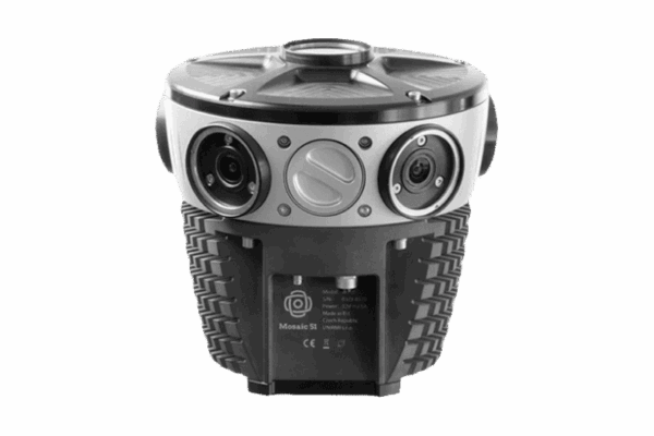
Mosaic Camera Systems
![]()
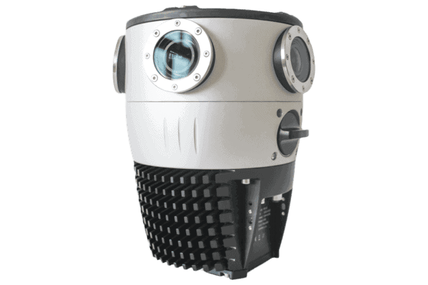
Capture high resolution 360 imagery, GNSS data, and LiDAR data

Mosaic Camera Systems
![]()
Capture high resolution 360 imagery, GNSS data, and LiDAR data


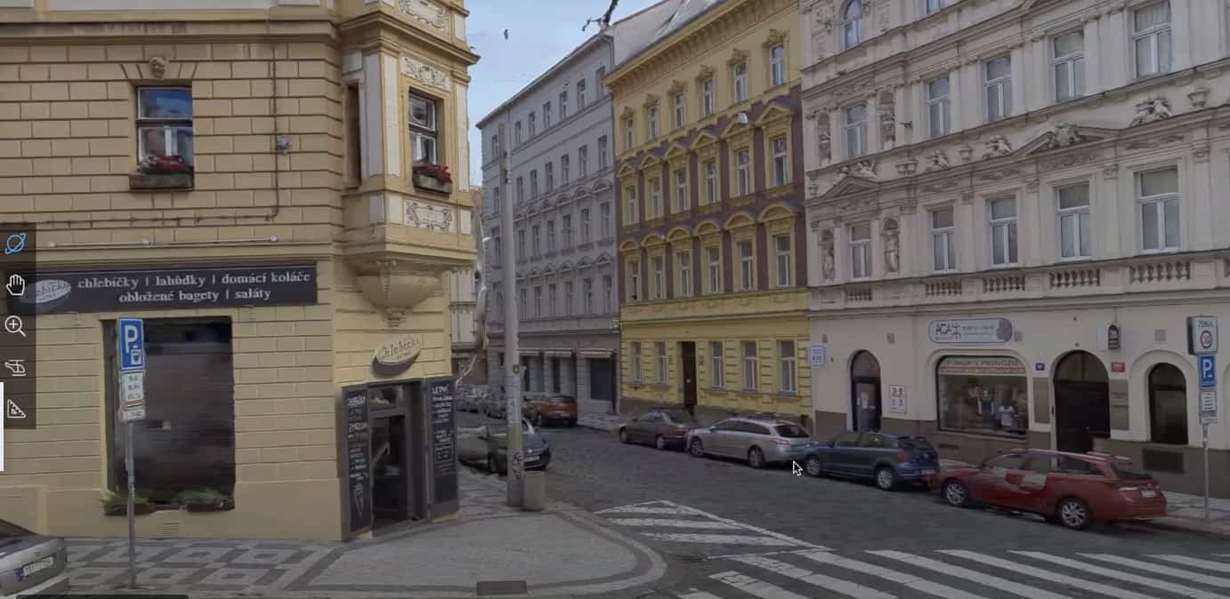
Mapillary
Collaborative platform for street-level imagery. Users can upload unlimited images, which are processed for face and license plate blurring and analyzed to detect over 40 object types and identify more than 1,500 road signs. Results are georeferenced and made available for GIS applications.

Nodeology
Provides tools like Vidgeo for ArcGIS and Site Viewer 360, tailored for integrating geospatial imagery within the AEC (Architecture, Engineering, and Construction) industry.

Pano2VR
Versatile tool for creating immersive virtual tours, combining 360° imagery, videos, audio, and custom graphics for professional results. Perfect for marketing materials or curated highlights from Street View collections, but struggles with large-scale projects.

Simerse
AI-driven platform for mapping and managing infrastructure. It processes this imagery to identify and inventory assets, creating a detailed, shareable record. The platform includes tools for tagging, commenting, and exporting data to GIS or other formats

Mapersive
A customer-developed platform, recommends Mosaic cameras for seamless integration and enhanced functionality.

Vulcan Line Tools
Their proprietary software - Azmyth - uses 360 street view imagery to streamline the planning and engineering for fiber-to-the-premises (FTTP, FTTX, FTTH) projects and infrastructure asset management.

AVAG Pro
Focused on drone data and geospatial analysis tools, offering solutions to manage and visualize aerial datasets alongside street-level imagery.

Celantur
AI-powered anonymization for imagery and video, ensuring compliance with privacy regulations. Detects and blurs faces, license plates, entire people, and/or entire vehicles with on-site and cloud options for using their tool.

AerialSphere “XPGEO”
Transform complex location-based data into actionable insights, helping you visualize, manage, and integrate imagery effortlessly. Perfect for showcasing properties, land development projects, and more.

Urban Explorer
Focused on extraction of data from imagery. Their current focus is on pavement analysis, feature extraction and reporting on their own GIS dashboard.

Autori
Manages road and infrastructure maintenance. Supports asset inventory and inspection workflows helping cities and utility providers monitor conditions and plan maintenance with imagery and geospatial inputs.
Pathfinder
Pathfinder by New Compass is a web-based viewer for panoramic imagery, point cloud, and extracted features, which allows in-platform analysis and measurements.

ESRI ArcGIS
ESRI’s ArcGIS enables spatial data visualization, management, and analysis with advanced tools for oriented imagery and LiDAR. Mosaic imagery integrates directly with Oriented Imagery Layer tools, so no additional software or third party tools are required.

TopoDOT
TopoDOT is a point cloud processing solution designed for infrastructure projects. It enables precise 3D modeling and assessments for roadways, utilities, and other critical assets.
Ranger
Ranger by New Compass is a cloud-based LiDAR asset extraction platform with customizable data dictionary tools and integrated QA/QC capabilities.

Fior Innovations
Specializes in hosting both imagery and point cloud data, offering solutions that integrate diverse datasets for geospatial analysis.

Pointerra
A cloud-based platform for storing, visualizing, and analyzing large 3D datasets like LiDAR, enabling real-time access and sharing.

PCS (Point Cloud Scene)
A platform for manual and semi-automatic feature extraction from point clouds, combining GIS and CAD tools for enhanced functionality.

Pointly
A cloud-based platform for managing, annotating, and classifying 3D point cloud data. Streamlines workflows with efficient labeling, segmentation, and visualization for surveying, construction, and asset management.

TerraSolid
Provides advanced tools for point cloud visualization, feature extraction, and classification. Widely used for infrastructure and road projects.

Autodesk Software
Covers a wide range of engineering and design needs. Includes tools for point cloud display (ReCap), 3D modeling (Revit, Civil3D), and full BIM project management.

Bentley
Known for software catering to infrastructure projects like road and railway design, with strong plug-ins like TopoDOT and TerraSolid for added functionality.

CloudCompare
A free, open-source software for visualizing, analyzing, and processing LiDAR data. Ideal for academic use or small-scale applications.

Geo-Plus
Software solutions for land surveying, civil engineering, and point cloud processing since 1987. Their Vision suite includes over 16 applications, such as VisionLidar and VisionCivil Pro, which integrate with platforms like AutoCAD and MicroStation.

iTwin Capture Manage & Extract
Designed for managing and extracting information from reality models and point clouds. Supports both automated and manual feature extraction workflows. Built for engineering and infrastructure use cases.

Skyline
Process, build, analyze, save, and share your 3D/2D geospatial data.

Agisoft Metashape
Stand-alone software product that performs photogrammetric processing of digital images and generates 3D spatial data to be used in GIS.
iTwin Capture Model
(Formerly Context Capture) Used to generate reality meshes and 3D models from drone imagery or street-level data. Often applied in infrastructure, urban planning, and construction.

Orbit GT
Orbit 3DM Content Manager, Orbit 3DM Publisher, and Orbit 3DM Cloud (formerly Orbit GT) provide solutions geared towards the management and publication of large-scale 3D mapping data.
"I really appreciate that Mosaic doesn’t lock us into proprietary formats or software. That flexibility has made it much easier to tailor our pipeline and continue experimenting as needs evolve."

"We are excited to be able to host Mosaic data in our platforms. The Meridian mobile mapping system data speaks for itself, with excellent point cloud and imagery quality that makes extraction easier than ever, and their team has deep industry knowledge and clear enthusiasm for mapping technology. We look forward to innovating together!"

“For our customer, it was necessary to transform the coordinate system, create vector trajectories, and meet other specified standards. The Mosaic X’s imagery far exceeded their requirements and greatly improved our project’s quality.”

“I’m glad to see this new partnership with Mosaic happening. Integrating their robust 360 imagery technology into our GIS platform presents incredible opportunities for theirs and our users. I see a huge value proposition in the combination of 360 imagery with GIS, especially 3D GIS and Reality Mapping. That brings a new level of detail and immersion to spatial analysis and visualization.”

“I compared four cameras for our county. On every single metric, the Mosaic 51 beat out its competitors: its image quality is best, it came with a powerful script to stitch the imagery together and save us enormous amounts of processing time, and the imagery is nonproprietary so it comes in seamlessly to our ESRI software.”

"We use the Mosaic X camera system to collect imagery for our proprietary software, Azmyth. Accuracy is crucial for Azmyth, as we use it to deliver precise measurements of distribution power pole heights for electric utilities and communication companies. Using the camera and an external GNSS, we are able to consistently make measurements within two and a half an inches of accuracy.”

“Users of the cameras have noted that using Mosaic 51 reduces the time needed for data capture and processing due to its high-resolution and efficient imaging capabilities."

“Customers are starting to see the value of image data combined with their existing core business processes and data management... By integrating Mosaic’s high-quality imagery with Autori SaaS solutions, we’re creating a solution that’s both powerful and easy to use, enhancing work efficiency and quality.”


