
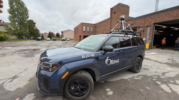
Have you seen a City of Ottawa SUV driving around the city with a camera on it?
The Mosaic Meridian got a moment in the spotlight on local Ottawa news as city officials implement Smart City technology.

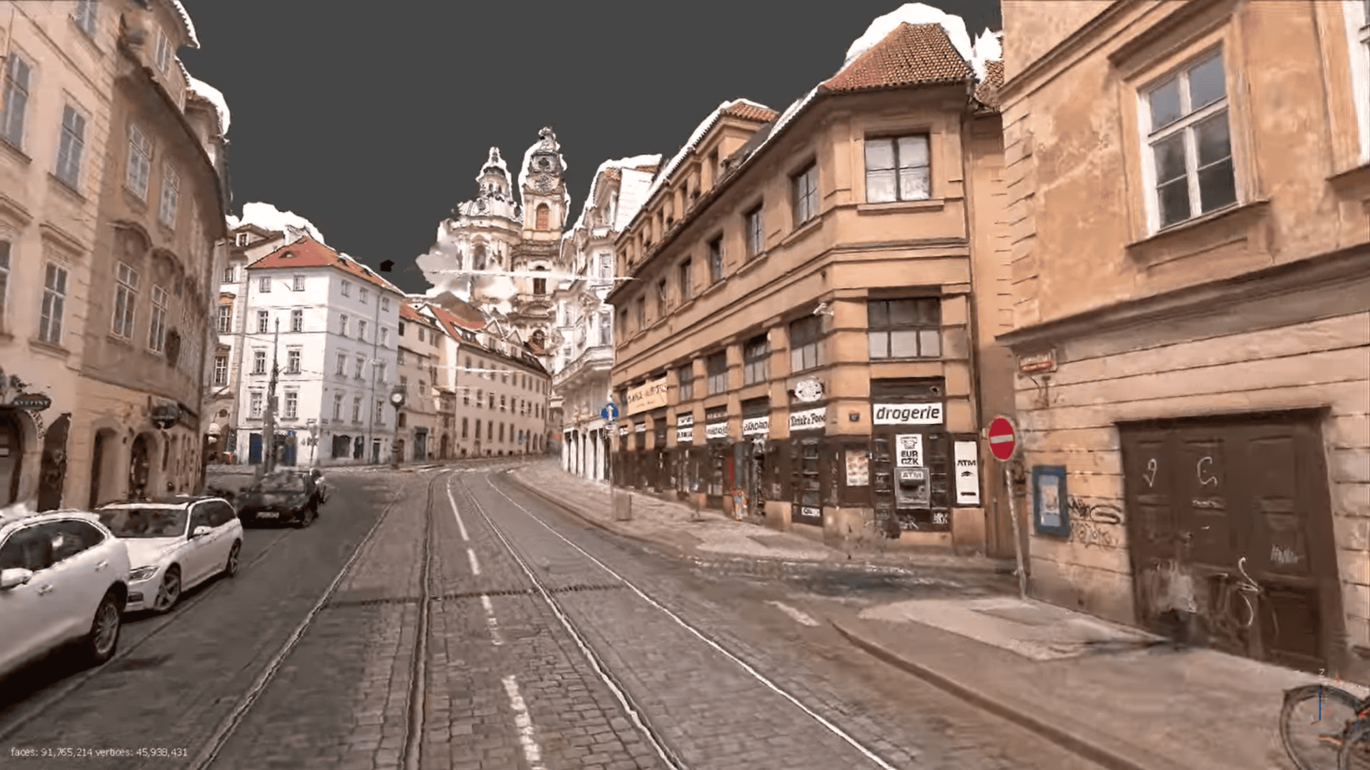
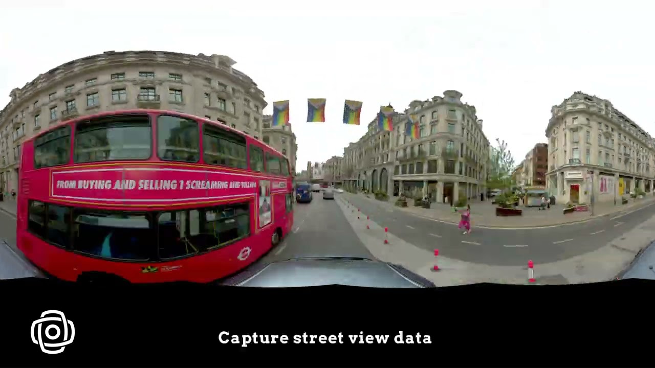
How Mosaic’s 360° cameras for local governments are benefiting towns around the world

Aerial imagery and satellite data have long been the default tools for city mapping – but people don’t live from the sky. Local governments need to understand their cities at street level: the condition of a pavement, the visibility of a road sign, whether a streetlight is working, or how much public space a business is occupying.
Mosaic cameras give local governments a ground-level view of everything in the right-of-way – captured quickly, across the entire road network, and detailed enough to read street numbers, assess asset conditions, and feed directly into GIS and asset management workflows.

Local governments consistently face the same challenge: large geographic areas to manage, finite budgets, and not enough people to be everywhere at once. Mosaic cameras let small teams cover an entire municipality quickly, capturing a detailed visual record of roads, assets, and public spaces that would otherwise require months of manual fieldwork.
Staff can assess conditions, respond to citizen complaints, verify compliance, and plan maintenance from the office – reducing the time and cost of field visits while making sure resources go where they’re genuinely needed most.

The best decisions about a community come from understanding how people actually live and move through it. 360° street-level imagery from Mosaic camera systems gives local governments that ground-truth perspective – the ability to remotely assess conditions, verify complaints, monitor public space usage, and identify issues before they escalate into citizen complaints or costly repairs.
The same dataset can serve multiple departments simultaneously, from taxation and code enforcement to public works and urban planning, without anyone needing to return to the field. When city staff can do more from their desks with data they trust, residents get faster, more responsive services.

The Mosaic Meridian got a moment in the spotlight on local Ottawa news as city officials implement Smart City technology.

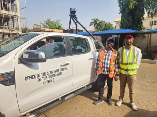
Building smart cities starts with a smart digital model. Follow Nigeria’s largest cities as they use mobile mapping to improve infrastructure.

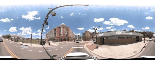
Discover how the Orlando Downtown Development Board used the Mosaic 51 camera to cut data capture from two weeks to three days, delivering high-resolution imagery and accurate GNSS data in tough urban areas.
Whether at the town or city level, Mosaic 360° cameras are helping collect, evaluate, and garner insight from data about their communities to better serve local businesses and citizens.