Virtual Space and Mosaic are Changing How We View the Cayman Islands
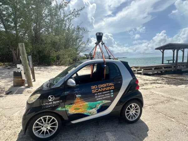
Virtual Space is meeting the unique mapping needs of the Cayman Islands with the Mosaic 51.

Accurate valuation assessment and risk management with Mosaic's 360° cameras for real estate agencies


Virtual Space is meeting the unique mapping needs of the Cayman Islands with the Mosaic 51.
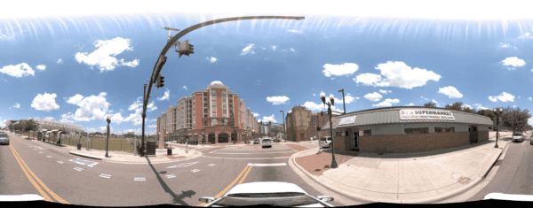
Discover how the Orlando Downtown Development Board used the Mosaic 51 camera to cut data capture from two weeks to three days, delivering high-resolution imagery and accurate GNSS data in tough urban areas.
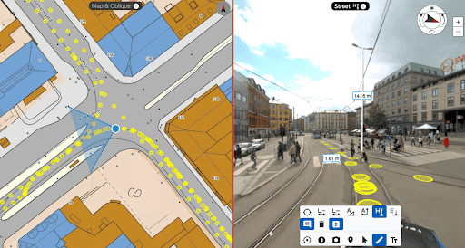
Discover the transformative power of the Mosaic Viking 360º Mobile Mapping Camera. Learn how it enhances operational efficiency and cuts costs in geospatial projects, providing unmatched benefits for operators and clients alike.


