
Unlock the potential of the Mosaic Viking 360º Mobile Mapping Camera for your geospatial needs. See how this premium tool increases efficiency and lowers operational costs, offering unparalleled advantages for both users and clients.
Challenge:
Maximize the full potential of a premium, top-tier geospatial instrument to deliver unparalleled benefits for both operators and end-users.
Results:
An increase in efficiency, trimming down costs associated with manpower and equipment.
Introduction
In the realm of geospatial and mobile mapping technology, the Mosaic Viking 360 ° mobile mapping camera has emerged as a game-changer. Recognized for its exceptional capabilities, this case study examines why this innovative solution stands out and is worthy of investment. We will explore the challenges posed by previous camera systems and how the Mosaic Viking’s extreme resolution not only delivers superior image quality but also revolutionizes operational efficiency.
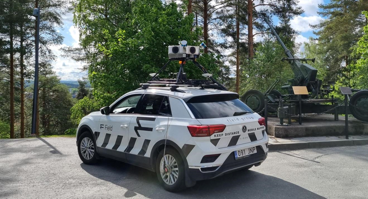
Discover why the Mosaic Viking users, including Field Group (the first to experience and benefit from the Mosaic Viking), see how their upfront investment in a brand-new geospatial technology has proven itself profitable in the long run.
The Challenge of Low-Resolution Cameras:
“Cities and surveying professionals have long grappled with the limitations of low-resolution cameras, many of them possessing only 30- to 40-megapixel sensors or data. That has for years been a standard and created anxiety and low trust in the quality of single exposure at a larger range, “ explains Arkadiusz Szadkowski.
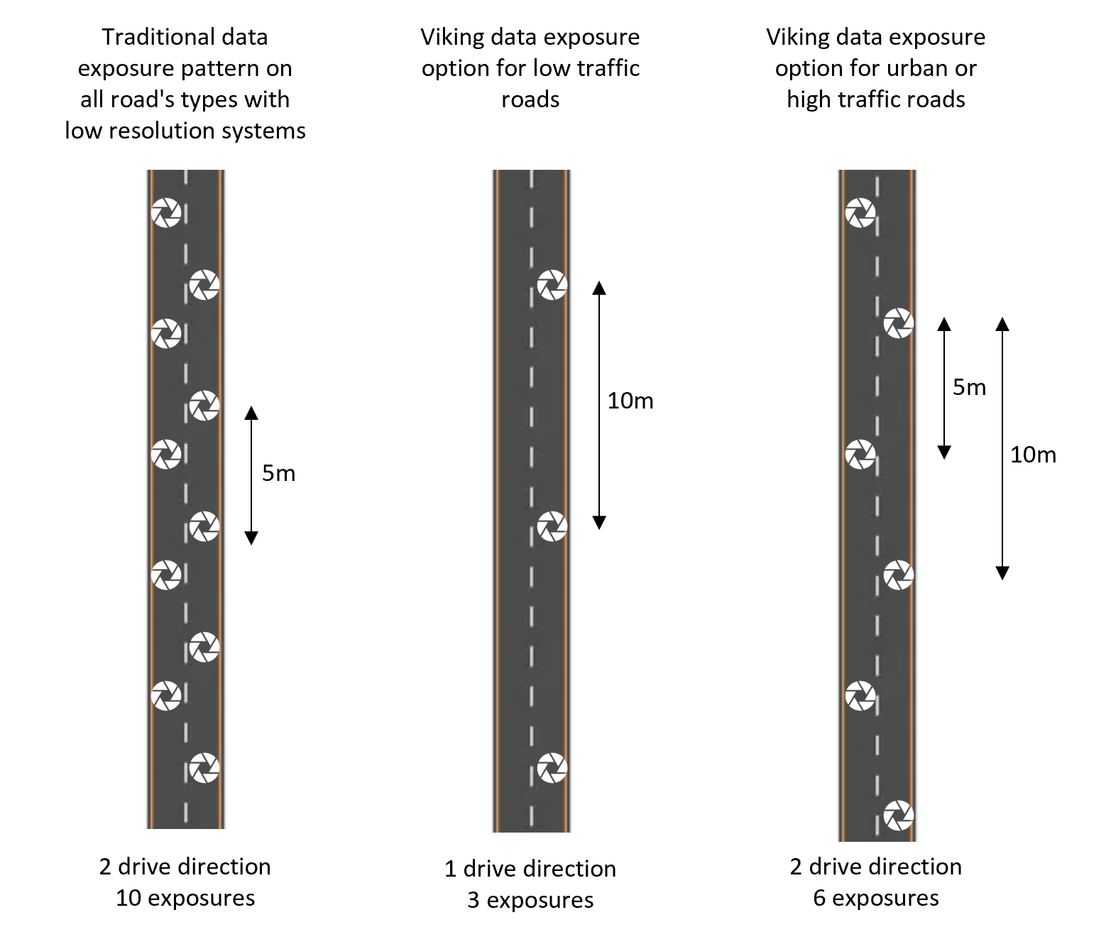
The standard practice involved capturing images every 5 meters, driving the vehicle in both directions to ensure object recognition.
“This method was born out of fear that low-resolution cameras wouldn’t provide the clarity needed for tasks like asset management, road surveying, and infrastructure monitoring. Consequently, this led to increased fieldwork, data collection, and environmental impact due to extra driving and data processing.”
Mosaic Viking: Redefining Efficiency
The Mosaic Viking challenges the status quo with its extraordinary resolution and adaptability. With the introduction of a camera possessing 6 x 31.5 MP high-end sensors, capable of generating equirectangular resolution of 200MP. Here’s how it reshapes the landscape of geospatial mapping:
Resolution Revolution
Mosaic Viking’s high resolution eliminates the need for frequent image captures. For narrow roads with minimal traffic, a single pass suffices, cutting fieldwork in half. The camera’s superior back-looking capabilities ensure that the extra two meters to the sideline don’t compromise quality.
Customized Solutions
Even for cities or larger roads, Mosaic Viking offers flexible solutions. If the requirement is to capture data every 5 meters, the system can achieve this while minimizing the number of images captured. This means faster processing and delivery, all without compromising image quality.
Sustainability Bonus
Less driving translates to reduced CO2 emissions, aligning with sustainability goals. This eco-friendly aspect adds a cherry on top of the efficiency benefits.
Operational Time Savings
By eliminating the need to expose every 5 meters and drive in both directions, Mosaic Viking saves a significant amount of time in the field. This translates to increased operational efficiency, reducing costs associated with manpower and equipment.
“Sometimes projects are large and require multiple cars and cameras to capture within a limited timeframe. Using the Mosaic Viking’s superior resolution and allowing for driving one way only allows the user to successfully operate with fewer cars or in fewer days.”
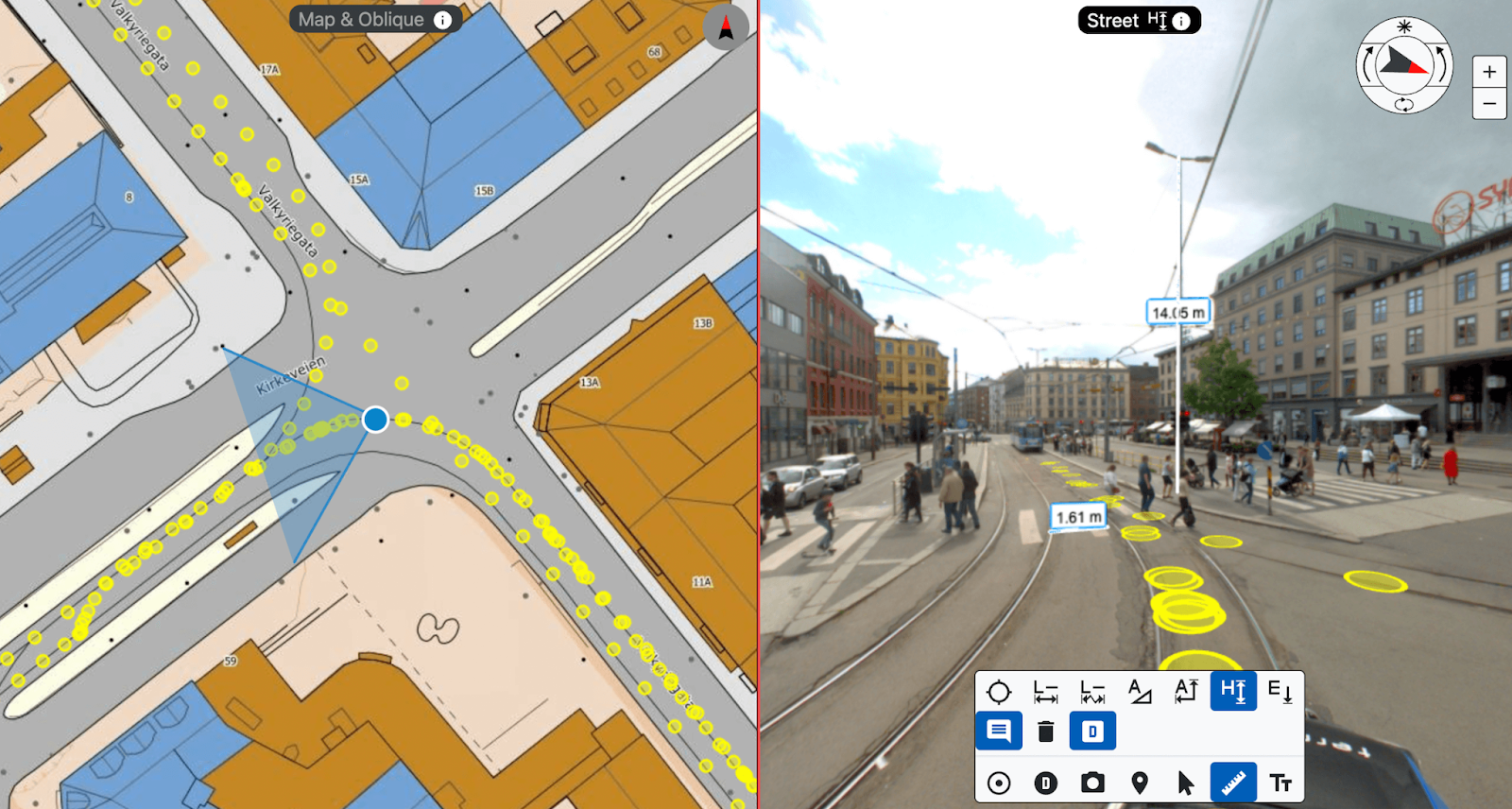
Viewing solutions
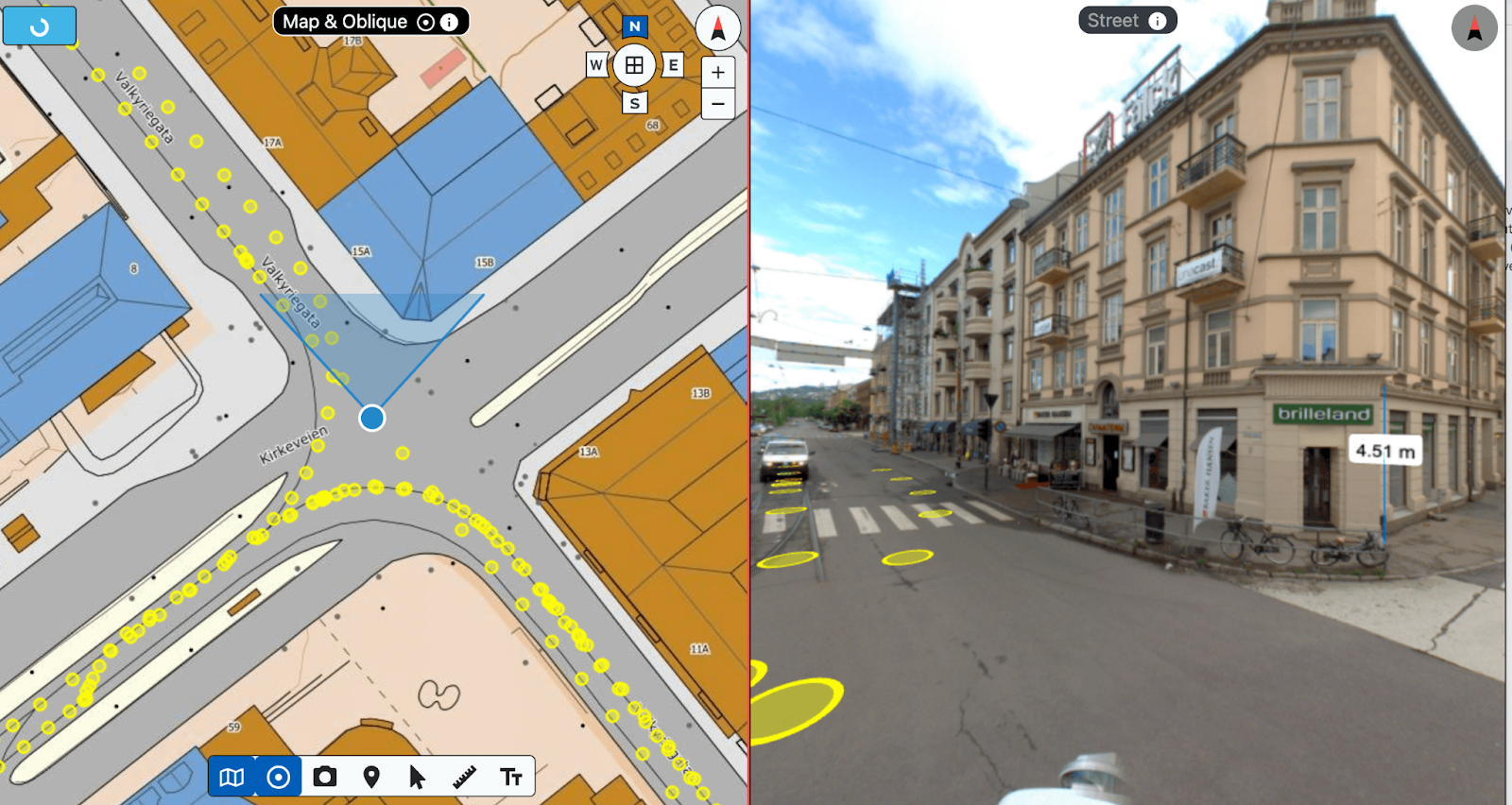
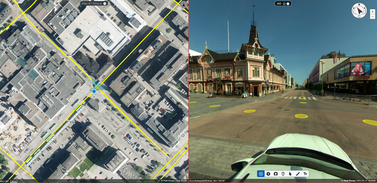
Once the images are captured and processed, the users would most likely want to view their high-resolution images. The Mosaic Viking images are fully supported by the Mapspace Viewer provided by Field. Several clients in the Nordics are already using Mapspace to easily access and view images at specific locations within their cities. Mapspace will store the high-resolution images in multiple zoom levels, allowing high performance – without sacrificing image resolution or quality. The users can perform and export measurements and annotations, and it is easy to add overlaying data like sign inventory. And of course, the users will see the image location and viewing direction on the map.
High Resolution, Fewer Images
Mosaic Viking’s unique approach involves capturing images at wider intervals while maintaining image quality. This results in fewer data points, faster processing, and more efficient data delivery.
Conclusion
The Mosaic Viking 360º camera isn’t merely an upgrade in the world of mobile mapping. It’s a monumental shift in the geospatial and mobile mapping industry, offering exceptional image quality that correlates directly to significant operational efficiency and impactful sustainability gains.
The holistic solution allows users to inspect the same assets and roads as before with fewer exposures. This significantly minimizes fieldwork and prioritizes the environment, making the Mosaic Viking the preferred choice for cities and professionals looking to redefine their mapping strategies. It is helping to pave the way for a brighter, more efficient future in geospatial technology.
Learn more about Field Group and how they are working with their Mosaic cameras in previous articles here (scanning the non-electrified grid in Norway) and here (assessing road conditions in the Nordics)
And for more information about the Mosaic Viking camera and how to increase the operational efficiency in your street view data capture and processing pipeline, reach out to the Mosaic Sales Team below.


