
Take a lap through our list of the top systems that are mapping the future and discover the best mobile mapping cameras in 2024.
Explore the future of navigation with our guide to the Best Mobile Mapping Cameras in 2024, and find:
- Top contenders for the best mapping camera
- Latest advancements in mobile mapping
- Detailed reviews and insights on leading models
Introduction
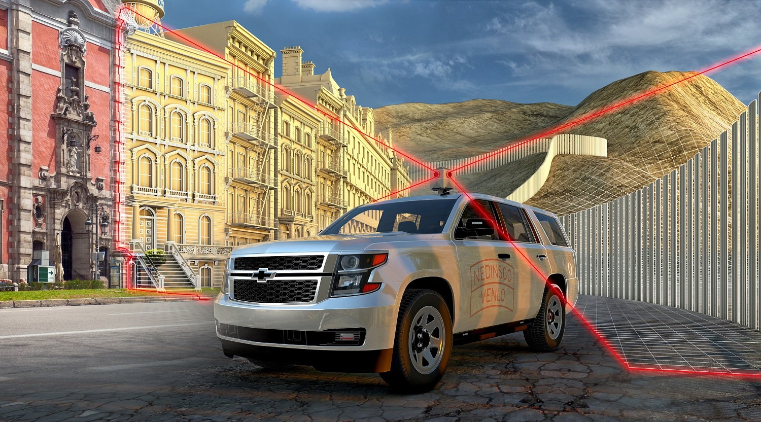
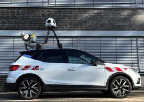
Mobile mapping cameras have become indispensable tools in the surveying sector, playing a crucial role in collecting geospatial data for governments, municipalities, logistics companies, and real estate entities. As we step into 2024, the landscape of mobile mapping cameras has evolved, with new contenders emerging to challenge established players.
In this article, we’ll explore the best mobile mapping cameras for 2024, focusing on their features, applications, and how they address the essential requirements for effective mobile mapping.
To check out the lists from previous years,
→ Check out our list of the top surveying cameras from 2021 or 2022
→ or see our list of the best mobile mapping systems from 2022
Understanding Mobile Mapping
Mobile mapping involves the integration of various technologies, such as GNSS, LiDAR, radar, and laser, within a camera-like device mounted on a mobile platform. These devices, equipped with cutting-edge sensors, provide the maneuverability needed to collect geospatial data efficiently. The applications of mobile mapping are vast, ranging from updating street signs and identifying road damage to aiding in flood management and contributing to green building initiatives.
Requirements for Effective Mobile Mapping Cameras
The rapid advancements in camera technology have led to more specific requirements for mobile mapping cameras. Key factors include robustness, durability, ease of operation, and compatibility with essential technologies like LiDAR and high-precision GPS. As we evaluate the top cameras for mobile mapping in 2024, we will consider these criteria to determine their effectiveness in real-world applications.
Top Mobile Mapping Cameras
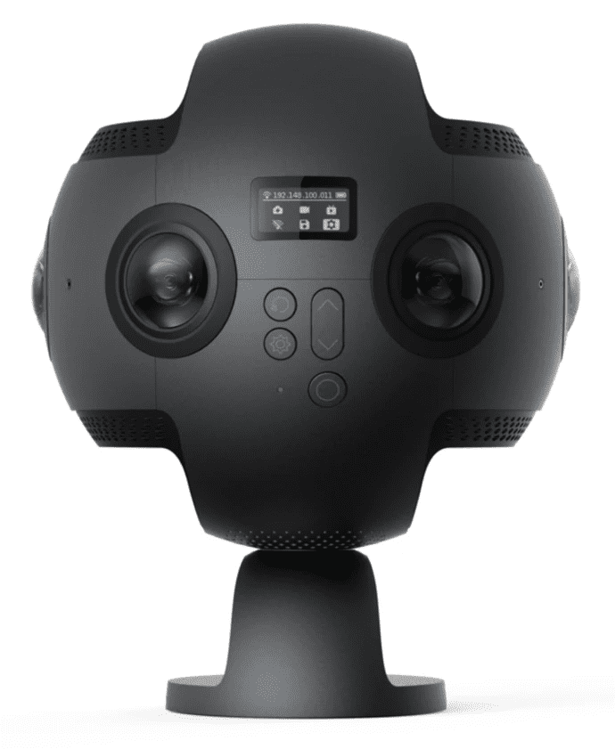
1. Insta360 Pro Camera
The Insta360 Pro Camera, recognized for its affordability in 360-degree image capture, offers a balance of cost-effectiveness and advanced features. It’s known for a smooth 30fps rate, making it suitable for dynamic scene recording, virtual reality content, and documentary filmmaking. Key advantages include its competitive price, no vendor lock-in, IP65 rating for durability, high 11K resolution, H.264 compression, and real-time image stabilization.
However, it has limitations like lower resolution compared to high-end models, no on-board GPU, absence of built-in memory, and lack of high-precision GPS. This makes it a go-to choice for economical yet quality 360-degree imaging, especially suited for users not requiring the utmost in precision or complex processing capabilities.
The Pros:
- Low price
- 30fps
- No vendor lock-in
- IP65
- 11K Resolution
- H.264 compression
- Real-time image stabilization
The Insta360 Pro Camera, known for its affordability, targets a wider market with quality imaging features. It captures at 30fps, suitable for dynamic scenes and VR content creation. Without vendor lock-in, it integrates easily into various workflows. Its IP65 rating indicates durability, and its 11K resolution with H.264 compression offers detailed and efficient content capture. Additionally, real-time image stabilization aids in steady footage capture under different conditions.
The Cons:
- Low resolution
- No on-board GPU
- No built-in memory
- No high-precision GPS
However, the affordability of the Insta360 Pro comes with trade-offs, including a comparatively lower resolution, limiting its precision in certain professional applications. The absence of an on-board GPU raises concerns about its processing capabilities for complex imaging tasks. The reliance on external storage solutions due to the lack of built-in memory adds an extra layer of consideration for users who prefer an all-in-one solution. Additionally, the absence of high-precision GPS may limit its suitability for applications requiring precise location data integration.
Conclusion:
The Insta360 Pro Camera strikes a balance between affordability and advanced features, making it an attractive option for a diverse range of professional applications. Its pros, including a low price, high capture rate, flexibility, durability, high resolution, efficient compression, and image stabilization, cater to the needs of users seeking cost-effective yet capable imaging solutions. The cons, such as lower resolution, lack of an on-board GPU, reliance on external memory, and the absence of high precision GPS, highlight areas for consideration based on specific project requirements. The Insta360 Pro stands as an accessible entry point to professional imaging, offering users a versatile tool with a keen eye on budget constraints.
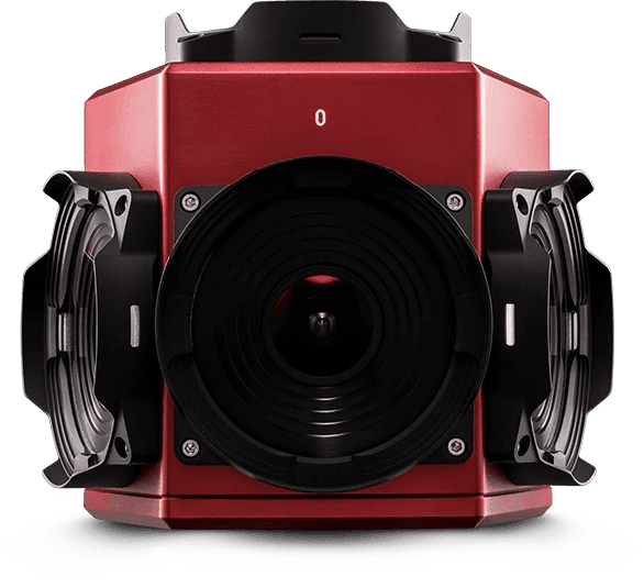
2. Ladybug5/5+Camera
The Ladybug 5 / 5+ Camera (originally by FLIR, now part of Teledyne) has been the go-to mobile mapping camera in the geospatial and surveying fields for the last decade or so. It has made a name for itself by integrating with the major mobile mapping systems, including Trimble, CHCNav, and RIEGL.
The Pros:
- 30MP
- No vendor lock-in
- IP65
- Calibrated from 2m and up
- 1 MB non-volatile memory
- Up to 14.5fps
The Ladybug5 and 5+ have been the industry norm for geospatial projects with an SDK that allows for integrations with various other powerhouses in the field, fostering a collaborative and adaptable mapping environment. With a robust IP65 rating, precision calibration fromz 2 meters and beyond, a generous 1 MB non-volatile memory, and an impressive frame rate of up to 14.5fps, the Ladybug 5 stands out as a versatile and reliable tool for professionals tackling diverse mapping challenges.
The Cons:
- Lacks built-in GPS or IMU
- No Onboard Storage
- 8K Resolution
- Complex data capture setup
The Ladybug 5/5+ camera presents several limitations in its design. Firstly, it lacks a built-in GPS or IMU, requiring additional devices for capturing timestamps and compromising seamless data integration. Furthermore, the absence of onboard storage necessitates a full external workstation for data operation, adding complexity to the overall setup. The camera’s resolution is capped at 8K, which may limit the clarity and detail of captured imagery. The complex data capture setup, coupled with the need for high bandwidth and additional hardware, further diminishes its user-friendly appeal, potentially impeding efficient and streamlined data collection
Conclusion:
The Ladybug 5 Camera stands as a technological powerhouse, trusted by many in the industry and featured in various mobile mapping systems. Its pros, including vendor flexibility, make it a versatile tool. However, users must navigate potential drawbacks, including user demands for higher than 8K resolution, and considerations for high-precision GPS. The Ladybug 5 Camera excels in precision mapping, but users should carefully assess their project requirements to maximize its potential impact.
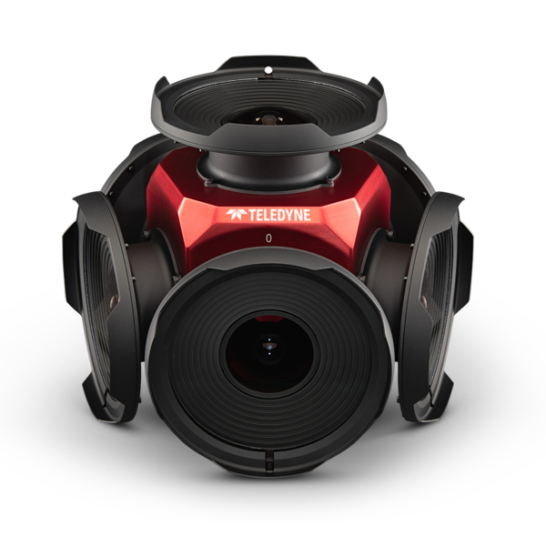
3. Ladybug6
The Ladybug6 Camera is designed to capture high-resolution panoramic images, offering a resolution of 72 MP. This camera provides clear visuals, suitable for applications that require precision and clarity. It has an IP67 rating, indicating that it can produce quality images and is also built to be durable, performing consistently in various environmental conditions. The calibration capabilities of the Ladybug6, effective from 2 meters and above, aim to improve the accuracy of data capture for different professional uses. Additionally, it includes 1 MB of non-volatile memory and supports a frame rate of up to 15fps, making the Ladybug6 Camera a functional choice for diverse imaging needs.
The Pros:
- 72MP
- No vendor lock-in
- IP67
- Calibrated from 2m and up
- 1 MB non-volatile memory
- Up to 15fps
The Ladybug6 Camera features a 72 MP resolution, delivering detailed panoramic images. Its IP67 rating indicates a level of durability, allowing use in different environments. The camera is designed to integrate easily into various workflows without vendor-specific restrictions. It offers a calibrated range starting from 2 meters, which aids in precision. Additionally, it has 1 MB of non-volatile memory for data storage. With a frame rate of up to 15fps, the camera can capture fast-moving scenes, making the Ladybug6 a functional option for a range of imaging applications.
The Cons:
- Lacks built-in GPS or IMU
- No onboard storage
- Complex data capture setup
While the Ladybug6 excels in many aspects, much like its predecessors, it lacks a built-in GPS or IMU, limiting its capacity for seamless integration of geospatial or inertial data. The absence of onboard storage requires external solutions, potentially affecting immediate data access. Additionally, the camera’s complex data capture setup may demand extra time and effort for optimal configuration. These limitations should be considered in contexts where specific data integration, storage convenience, or ease of setup are critical factors. Despite these considerations, the Ladybug6 remains a potent choice for those prioritizing high-resolution panoramic imaging in diverse settings.
Conclusion:
The Ladybug6 Camera addressed one of the major dilemmas of the Ladybug5/5+, emerging as a formidable imaging solution with its remarkable 72 MP resolution, IP67 rating, and versatile features. The absence of vendor lock-in ensures adaptability, while the calibrated range and non-volatile memory contribute to its reliability in professional settings. The high frame rate further enhances its suitability for dynamic applications. However, the lack of built-in GPS or IMU, the absence of onboard storage, and the complexity of the data capture setup could be considerations for users with specific requirements. Despite these limitations, the Ladybug6 Camera stands as a powerful tool for those seeking superior panoramic imaging capabilities in diverse environments, balancing its strengths with potential trade-offs.
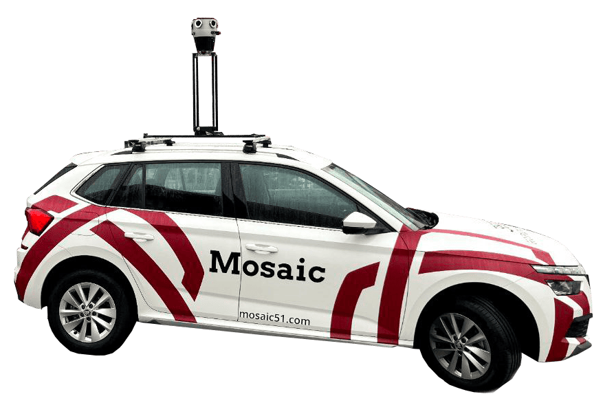
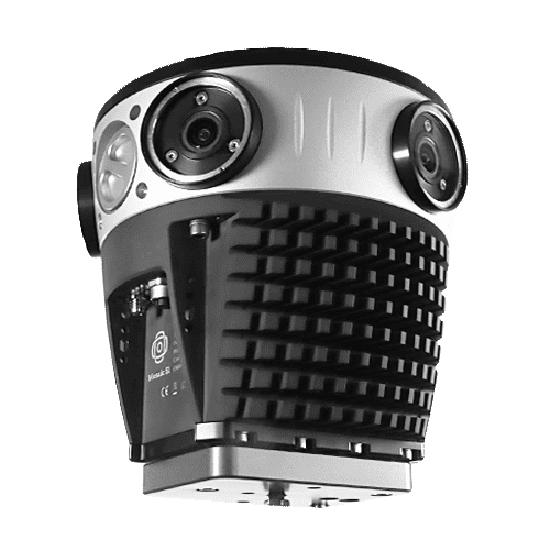
4. Mosaic 51 Camera
The Mosaic 51 Camera emerged several years ago to push the boundaries of innovation, offering the first all-in-one mobile mapping camera system combining advanced imaging capabilities with an intuitive, user-friendly design for a quicker adoption period and better end results. making it a reliable choice for applications that prioritize speed, efficiency, and quality.
Its commitment to vendor flexibility eliminates the constraints of proprietary ecosystems, providing users with the freedom to seamlessly integrate the Mosaic 51 into their existing workflows.
The Pros:
- On-board GNSS
- No vendor lock-in
- On-board CPU/GPU
- 12.3K Resolution
- H.264 compression
- Connections for GNSS and IMU
- Spatial accuracy under 2 mm at 10 m
The Mosaic 51 Camera combines advanced imaging capabilities with GNSS data for an all-in-one system. Its absence of vendor lock-in ensures seamless integration into diverse workflows, while the onboard GPU enhances processing power for efficient handling of complex imaging tasks. Boasting an impressive 12.3K resolution, a huge step up from the previous contenders at only 8K, the camera captures intricate details, setting a new standard for precision. The integration of H.264 compression optimizes data storage, and dedicated connections for GNSS and IMU enhance geospatial capabilities for accurate data integration.
The Cons:
- Rolling shutter sensors
- Built-in GNSS grants spatial accuracy between 1-2 meters
- An external battery means that the solution is not completely self-contained
However, the Mosaic 51 falls into the mid to upper price range, potentially limiting accessibility for budget-constrained users. While it features connections for GNSS, the lack of a built-in solution for millimeter accuracy may require additional equipment for users demanding extremely precise geospatial data. Additionally, the camera’s reliance on an external battery means it is not 100% self-contained, slightly impacting portability and convenience in certain scenarios.
Conclusion:
The Mosaic 51 Camera is a sophisticated imaging solution offering precision and enhanced security. Its standalone design, vendor flexibility, on-board GPU, high resolution, compression, and on-board GNSS make it a versatile tool. However, users must weigh the mid to upper-range pricing, the absence of built-in millimeter accuracy, and external battery dependency against their specific needs. The Mosaic 51 excels in providing a secure and precise imaging experience but requires careful consideration of budget and operational requirements for optimal utilization.
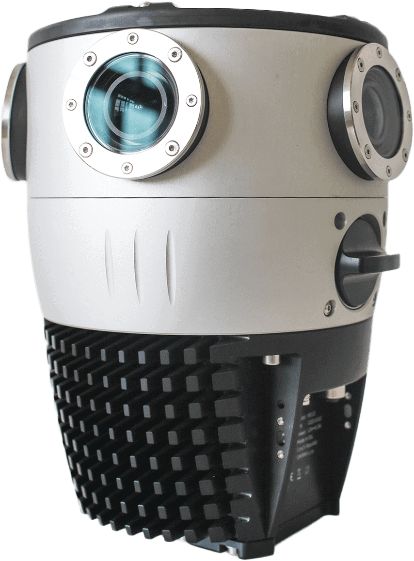
5. Mosaic X Camera
The Mosaic X Camera is an imaging solution designed for precision and versatility. With its global shutter, all-in-one design, and high-resolution sensors, Mosaic X sets new standards in capturing clear and detailed visuals. It provides users with extreme flexibility in its ability to integrate with a multitude of sensors and non-proprietary data delivery. The Mosaic X is as robust and reliable as its predecessor, the Mosaic 51, with industry-grade connectors and a frame built to withstand any weather or climate thrown its way.
The Pros:
- Global shutter
- All-in-one solution
- 13.5K resolution
- Robust frame and replaceable lens covers
- Non-vendor locked
- Spatial accuracy under 2 mm at 10 m
- Precise and stable optical calibration
The Mosaic X Camera introduces a new era in imaging with a multitude of strengths. Featuring global shutter sensors, it eliminates motion-related distortions, ensuring sharp and accurate images. This all-in-one solution stands out, offering simplicity and convenience by integrating various components into a single, cohesive unit. The inclusion of 6 x12 MP image sensors elevates the camera’s imaging capabilities, capturing detailed and high-resolution visuals across a wide field. Its robust frame and replaceable lens covers enhance durability, providing users with a reliable tool built for longevity. A significant advantage lies in its non-vendor-locked nature, offering users the flexibility to integrate the Mosaic X into diverse workflows without constraints.
Each Mosaic camera comes with its own calibration file, and all cameras have precise and stable optical calibration, allowing accurate measurements and 3D reconstruction with images only.
The Cons:
- Requires post-processing for image stitching
- Operates at a max of 10 FPS
- Lacks mm-level accuracy
While the Mosaic X Camera boasts impressive features, a few considerations merit attention. The data from the Mosaic cameras comes in 6 video container files in MP4 format. This is ideal for such post-processing tasks, such as ingesting into photogrammetry software and when doing 3D reconstructions, but for users who are looking to build a 2D 360º view of their roadside assets, this entails one additional step in the workflow.
Another consideration is the camera’s limitation in achieving millimeter-level accuracy, which may impact its suitability for applications demanding extremely precise measurements.
Conclusion:
The Mosaic X Camera emerges as a powerful imaging solution with its global shutter sensors, all-in-one design, high-resolution image sensors, durability features, and non-vendor-locked nature. However, users should be mindful of the fact that the source imagery from the camera is delivered in non-stitched panoramas. The absence of millimeter-level accuracy may influence its suitability for specific precision-focused applications. The Mosaic X Camera excels as a versatile imaging tool, offering a balance between convenience and functionality, but users must assess their specific needs and operational requirements to fully harness its capabilities.
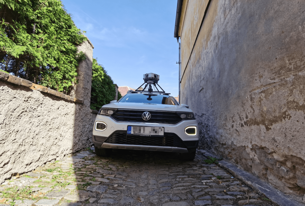
6. Mosaic Viking Camera
The Mosaic Viking is a state-of-the-art mobile mapping camera, renowned for its exceptional resolution capabilities. It boasts a 20K resolution, allowing for extremely detailed image capture, useful in creating rich point clouds and detailed 3D models without relying on LiDAR. The camera features 189 Megapixels with six 31MP APS-C sensors, offering unparalleled clarity and a 360-degree capture range.
The Pros:
- Exceptional high-resolution imaging (20K) for detailed data capture.
- Efficient operation, requiring only one driver, reduces costs and time.
- High-quality, crystal clear 180MP images.
- Sophisticated tech suitable for large-scale industrial projects.
The Mosaic Viking camera offers significant operational efficiency and environmental benefits. Its high resolution reduces the need for frequent image captures, cutting fieldwork in half for narrow roads. This translates to fewer images needed, faster processing, and more efficient data delivery. Additionally, its use results in reduced CO2 emissions, aligning with sustainability goals. The camera is particularly beneficial for large-scale projects, allowing operations with fewer cars or in less time, making it a sustainable and efficient choice for geospatial technology.
The Cons:
- It may be complex to operate for beginners.
- Higher cost compared to lower-resolution models.
- Potential overkill for smaller-scale projects.
- Requires robust data handling and storage solutions.
The Mosaic Viking camera, while delivering high-quality data, involves a few trade-offs. It represents a full car step up in terms of operational complexity, potentially complicating procedures for users. This added complexity might be challenging, especially for those new to high-resolution mobile mapping systems. However, it’s important to recognize that these considerations are in the context of the Viking’s exceptional data quality.
Conclusion:
Using the Mosaic Viking ensures high-quality data capture with unprecedented detail, ideal for mapping, surveying, VFX, gaming, and smart city projects. It speeds up data collection processes significantly while maintaining pixel-precision and color quality. The camera is particularly beneficial for creating photorealistic 3D models and environments, as well as for detailed surveys of infrastructure and landscapes.
Read more about the Mosaic Viking here –>
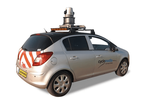
7. Cyclomedia
While not a camera itself, Cyclomedia’s data capture systems stand at the forefront of geospatial intelligence, offering a comprehensive suite of features that redefine mapping and data visualization. Leveraging the ArcGIS platform, users can seamlessly integrate Cyclomedia data into their workflows, unlocking advanced capabilities for spatial analysis and mapping. The inclusion of the Street Smart API enhances its versatility, allowing for easy integration with a variety of applications and systems, streamlining the extraction and utilization of geospatial information. Additionally, the Cyclomedia Camera’s compatibility with LiDAR point clouds provides users with a multi-dimensional perspective, enabling precise terrain modeling and comprehensive environmental analysis.
The Pros:
- ArcGIS
- Street Smart API
- LiDAR point clouds
The Cyclomedia Camera revolutionizes geospatial intelligence with its seamless integration into the ArcGIS platform, providing advanced spatial analysis and mapping capabilities. The inclusion of the Street Smart API enhances its adaptability, offering a user-friendly interface for easy integration into various applications and systems. Furthermore, the camera’s compatibility with LiDAR point clouds provides a multi-dimensional perspective, facilitating precise terrain modeling and comprehensive environmental analysis. These features collectively position the Cyclomedia Camera as a versatile tool for professionals seeking comprehensive geospatial data within the ArcGIS ecosystem.
The Cons:
- No hardware offered
- Limited by the car fleet
- Vendor lock-in
However, the Cyclomedia Camera faces limitations with the absence of offered hardware, requiring users to rely on existing infrastructure. The effectiveness of the camera is also contingent on the availability and accessibility of the car fleet equipped with the device, potentially impacting coverage in specific areas. Additionally, the challenge of vendor lock-in poses a constraint on user flexibility, urging careful consideration of long-term commitments when adopting the Cyclomedia Camera. Despite its advanced capabilities, users must weigh these limitations against their specific operational needs and infrastructure considerations.
Conclusion:
The Cyclomedia Camera presents a powerful solution for geospatial intelligence, offering advanced features such as ArcGIS integration, Street Smart API support, and compatibility with LiDAR point clouds. These features contribute to a versatile toolset for professionals engaged in spatial analysis and mapping. However, potential users should be mindful of the absence of offered hardware, the reliance on a limited car fleet, and the implications of vendor lock-in. While the Cyclomedia Camera excels in providing advanced geospatial capabilities, careful consideration of infrastructure, coverage limitations, and vendor commitments is essential for maximizing its effectiveness in diverse mapping applications. For end users who do not possess the workforce or expertise to undertake a large-scale survey on their own and would benefit from the final data output itself, this is the way to go.
8. Penta Pano
The Penta Pano 360 is a new addition to the 2024 mobile mapping camera list, although it has been a player for several years now. The camera offers 360° spherical image capturing, notable spatial accuracy, and effective data transmission. It features high-quality CMOS sensors and comes with SmartDelta software, aimed at providing clear images under various conditions. The shock-resistant build and wide operational temperature range contribute to its durability in different imaging settings. The Penta Pano 360 presents itself as a versatile option in the professional imaging field, emphasizing adaptability and precision.
The Pros:
- 360° Spherical Image Capturing
- Spatial accuracy (+/- 2 mm at 10 meters).
- CMOS sensors with global shutter and high-quality optics
- Captures, compresses, and transmits 8-bit or 12-bit pixel data.
- SmartDelta software for a feature-rich interface
- Shock-Resistant Design
- Wide Temperature Range from -30° C to 50° C
The Penta Pano 360 is an advanced imaging solution offering 360° spherical image capturing, providing a broad visual perspective. It features spatial accuracy with a +/- 2 mm precision at 10 meters, making it suitable for capturing detailed imagery. The camera incorporates CMOS sensors with a global shutter and quality optics, aiming to deliver clear images, even in less-than-ideal conditions.
In terms of data handling, the Penta Pano 360 is efficient in capturing, compressing, and transmitting 8-bit or 12-bit pixel data. It comes with the SmartDelta software, which offers a comprehensive interface for managing camera settings both before and after image acquisition. Designed to be shock-resistant, the camera is built for use in dynamic environments and is a dependable option for mobile imaging. Its adaptability is further supported by its wide operating temperature range of -30°C to 50°C, accommodating various climate conditions.
The Cons:
- May require users to become familiar with the advanced features of SmartDelta software
- Limited shock resistance details
While the Penta Pano 360 offers a feature-rich experience, users may encounter a learning curve with the advanced features of the SmartDelta software. Becoming familiar with its capabilities might require some time and training. Additionally, the limited details regarding shock resistance leave users without specific information about the camera’s durability in varying degrees of impact or harsh conditions.
Conclusion:
The Penta Pano aims to offer strong performance and versatility. It positions itself as a capable tool in imaging precision, featuring 360° spherical image capturing and spatial accuracy. Its efficient data handling capabilities add to its appeal for professional use. However, the Smartdelta software, despite being feature-rich, might present a challenge for those not accustomed to advanced imaging tools. While the camera’s design is shock-resistant and it operates across a wide temperature range, the lack of detailed information on its shock resistance could be a point of consideration. In summary, the Penta Pano stands out for its imaging capabilities, but potential users should consider the learning curve associated with its software and other factors to make an informed choice based on their needs and experience.
9. New Entrant: AquiView Panorama
The AquiView cameras by AllTerra Deutschland GmbH are designed for mobile mapping applications. They come in two types, each tailored for specific mapping and data collection needs. These cameras are equipped with advanced features suitable for a range of professional surveying and geographic information system (GIS) tasks. They offer high-resolution imaging and robust data capture capabilities, making them ideal for precise and detailed mapping projects. For further details and specific technical specifications, please visit the AllTerra Deutschland GmbH website directly.
The Pros:
- 6 x 24 MPix individual cameras – 134 MP as a composite image
- Output: Flat images / panoramic image
- Lens focal length: 6 mm
- Protection class IP64
- Accessories: mounting bracket, cable (plug and play)
- TMX sync software
- Syncs with Trimble MX9 or MX50
The Cons:
- Full camera weight 13kgs
- Rack weight 6kg
- Maximum 8 FPS
To achieve optimal data capture at intervals of 3 meters or less with the AquiView cameras, it is necessary to maintain a speed below 90 km/hr (55 mph). The combined weight of the camera and rack, totaling approximately 19 kg, may require two individuals for installation on a vehicle roof. The storage method and triggering mechanism for data are not specified in the available literature. These cameras are designed to sync specifically with Trimble MX9 or MX50 products, indicating a targeted use case for users of these systems.
Conclusion:
The AquiView cameras by AllTerra Deutschland GmbH are advanced mobile mapping cameras featuring 6 individual 24 MP cameras, claiming a composite image of 134 MP. They are suitable for professional surveying and GIS tasks, offering high-resolution images and robust data capture. Notable pros include IP64 protection, a variety of accessories, and compatibility with Trimble MX9 or MX50. However, they are quite heavy (total camera and rack weight 19kg) and have a maximum frame rate of 8 FPS. These specifications suggest a requirement for multiple operators and limitations in speed for optimal data capture. The cameras are specifically compatible with certain Trimble products, potentially limiting their use to those systems only.
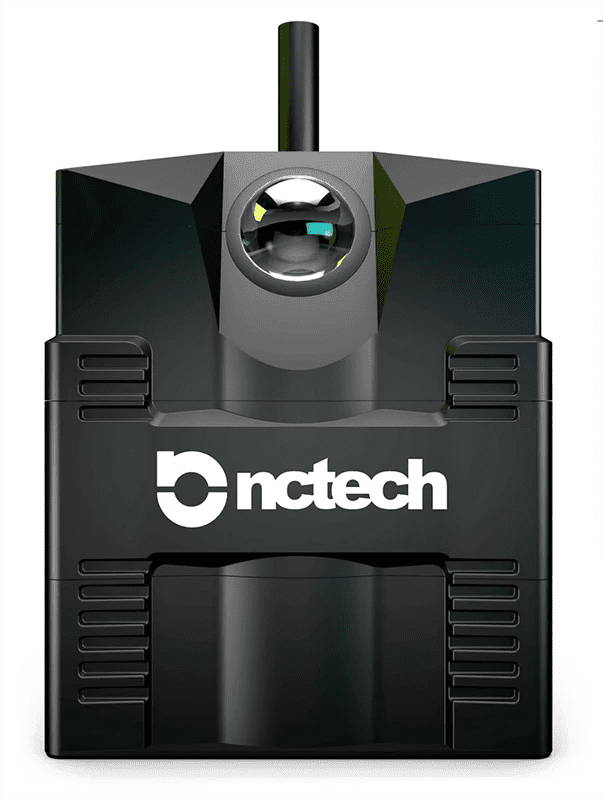
Legacy Pioneers: NCTech iSTAR Pulsar Camera (Discontinued)
NCTech’s iSTAR Pulsar camera, once a key product in mobile mapping, has been discontinued. This camera, known for its 11k resolution and integrated sensors, faced challenges like vendor lock-in and lack of high-precision GPS. Despite its 30 MP resolution, IP65 rating, and compatibility with various software systems, limitations like a 6-axis IMU and an 8K resolution cap impacted its market competitiveness. While NCTech promoted automated edge-to-cloud processing, the camera’s inability to meet certain integration and real-time data processing needs led to its phase-out, as the market shifts towards more advanced alternatives.
Conclusion and Round Up
The article provides an overview of the best mobile mapping cameras in 2024, focusing on their features, applications, and effectiveness for mobile mapping. It covers various models, detailing their strengths, weaknesses, and suitability for different professional applications.
The cameras reviewed include the Insta360 Pro, Ladybug5/5+, Ladybug6, Mosaic 51, Mosaic X, Cyclomedia, Penta Pano, AquiView Panorama, and the discontinued NCTech iSTAR Pulsar. Each camera’s performance, precision, durability, and specific functionalities are examined, making it a comprehensive guide for professionals seeking the best mobile mapping camera solutions in 2024.
If you require additional assistance in determining which mobile mapping camera solution is best suited for your needs, please contact us at [email protected].


