
See which mobile mapping systems made the cut – some old ones, some upgraded models, and one brand new one
While we step into new beginnings, precisely into a more tech-driven dawn, let’s take some time to dive into the mobile mapping system that has become the new language for data collection. Also, make sure you stick around till the end so you don’t miss our picks – the best mobile mapping systems for 2022.
What is a Mobile Mapping System?
Mobile mapping has been all over the news and science journals for quite some time now, mainly for its enormous contribution to providing location-based information to end-users. Here’s a quick recap of the mobile mapping system. To simplify things, firstly, you may want to know what mobile mapping is.
Mobile mapping is the process of collecting geospatial data by using a mobile vehicle – typically, a van, drone, boat, airplane, or car. These geospatial data can be aerial imagery or street-level images that are digitized to geo-referenced 2D or 3D images. This is achieved with the help of various mapping and positioning sensors placed within a moving vehicle, collectively called a mobile mapping system, hence the use of ‘system’. A mobile mapping system includes most or all of the following technologies: digital camera technology, radar, laser, LiDAR, or any type of remote sensing tools combined with GIS and IMU.
The Journey of Mobile Mapping Systems
Mobile mapping technology began its journey in the late 1980s as a need for highway infrastructure mapping services. Back in the day, these systems yielded poor quality images; in addition, the process was time-consuming and had significant errors. Above all, it was not economical. Technology has grown dramatically since then. Now, engineers have come up with integrated features that enable easy capture and error-free processing. Moreover, all the top mobile mapping systems are portable and include high-efficiency cameras to offer densely colored, rich 3D data sets that are easy to use. Today, mobile mapping systems use different software solutions that produce
- Direct georeferencing
- More accurate point clouds
- Live feedback in the field
- Noise-free clear results
How Is Mobile Mapping Technology Replacing Everything Else?
Many companies and businesses have realized the need to provide reliable and accurate time and location-based information services to enable cost-effective, futuristic planning of towns, transport, and services. In other words, the effectiveness of collecting more accurate data in one go and less time is the deciding factor of a successful mobile mapping system. As a report by Harvard Business Review puts it this way,
“As organizational decisions increasingly become more data-driven, businesses need to assure decisions are made with the most accurate data. That explains why so many organizations have made data collection and analysis a strategic and organizational priority and recognize data as a mission-critical asset to manage.”
Mobile mapping technology has already outpaced the traditional surveying methods in geospatial technology because of its cost-effectiveness and ease of use. They are much faster, more accurate, and more effective in offering comprehensive environmental solutions that are easy to visualize, measure, and analyze landscapes, features, and objects.
“How?” you may ask. Advancements in technologies like GNSS, GIS, and digital cameras enable a high-precision mapping solution with never-before-seen high-quality images. These are the wow factors of the modern mobile mapping system, enabled with the help of 360-degree cameras and other navigation sensors. Though it’s hard to imagine the efficiency of these systems that travel at highway speeds and beyond, they have a proven track record of providing accurate measurements to create 3D models. There’s no doubt they are going to shape the future for the better.
The Future of Mobile Mapping Systems
Today, you can rarely find a discipline where mobile mapping is not used- from logistics, financing, government contractors, to military and defence, and mobile mapping is used everywhere. Mobile mapping systems have various applications in surveying and mapping, including smart city planning, disaster management, construction, rail mapping, indoor mapping, and coastal and marine management. The growing applications of the technology have increased the demand for acquiring more data, which is both accurate and affordable. According to this report, the market for global mobile mapping systems was valued at USD 21.3 billion in 2020 and is expected to reach a market value of USD 63.32 billion by 2026 and grow at a CAGR of 22% over the forecast period 2021-2026. The Asia-Pacific region is said to see the fastest growth, while North America and Europe will see substantial growth.
The top five mobile mapping systems for 2022 are:
- Leica Pegasus:Two Ultimate
- Trimble MX50
- Lynx HS600
- RIEGL VMY-2
- Mosaic Viking
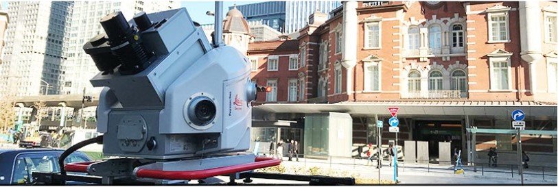
1. Leica Pegasus:Two Ultimate – Mobile Mapping System
The Leica Pegasus:Two Ultimate is the ultimate mobile mapping system with endless possibilities. It comes as the successful successor of the Pegasus:Two from Leica Geosystems. It uses two back-to-back camera systems and LiDAR data to produce 360-degree stitch-free high-resolution imagery at various lighting conditions. The system is capable of enabling a quick survey over a wide geographical area with brilliant accuracy and visualization.
It provides excellent photogrammetry and image quality with the help of 12 MP side cameras and onboard JPEG compression. One of the main features of the system is that it offers both point clouds and high-resolution images. Also viewable as an overlay.
Highlights of the Leica Pegasus: Two Ultimate
- 61° × 47° FOV
- 24 MP panoramic camera system
- Two high-performance laser scanners:
- Z+F Profiler, which comes with a range of 120 meters, 360-degree FOV, and a mirror spin rate up to 200 Hz
- Leica P2,0 which is a modified static scanner for mobile application,s with a range of 120 meters
- A removable SSD with an integrated USB 3.1 Gen1 interface
- Telescopic pole to prevent camera head damage
- Multiple sync ports and camera ports
- Cloud-based data storing and sharing
- Room for up to 2 additional external cameras
Drawback of the Leica Pegasus:Two Ultimate
- The system weighs 51 kg, which can be a hindrance to the ease of operation.
Price of the Leica Pegasus:Two Ultimate
Price varies as per customization. Contact a sales professional.
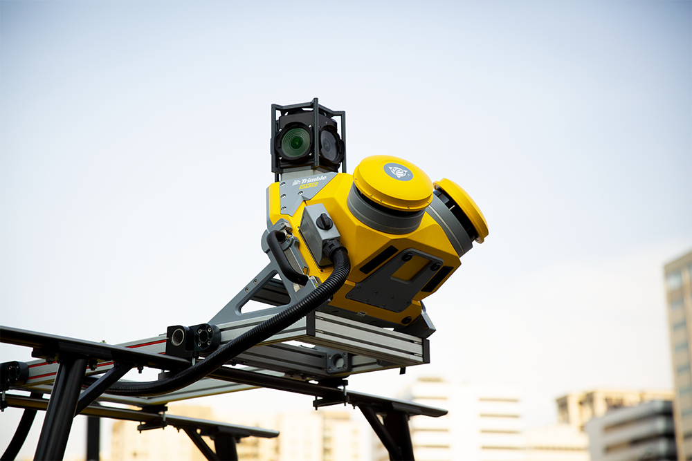
2. Trimble MX50 – Mobile Mapping System
The new Trimble MX50 is a perfect mid-range mobile mapping system. Given the fact that there is a huge market for asset management and mapping, the company boasts its MX50 as a practical field-to-finish mobile mapping solution for asset management, mapping, and road maintenance.
With improved technology and the company’s various integrated services, MX50 is indeed a practical and economical choice for road inspection and maintenance. Their high-volume data technology works in conjunction with their Geospatial Software Solutions. The best part is, they have implemented their own-made Laser profile technology for the first time. They use Applanix POSpac, a well-known GNSS-Aided Inertial post-processing software for analyzing the spatial data collected from the camera.
Highlights of the Trimble MX50
- Accurate point cloud along with images for road survey applications
- Two laser scanners with the Trimble LiDAR technology integrated with a reliable mobile platform
- A fixed 360-degree panoramic camera with 30 MP resolution
- Removable SSD card
- A complete field-to-finish workflow- starting from capturing, processing, extracting, and sharing
- Compatible with any smart device
- Simple installation
Drawbacks of the Trimble MX50
- Limited to just road surveying and mapping
- Has only one spherical camera
- Limited to a maximum vehicle speed of 110km/h (68 mph)
Price of the Trimble MX50
Contact a local survey sales professional.
3. Lynx HS600 – Mobile Mapping System
The Optech Lynx HS600 comes from the house of Teledyne Optech – a leader in high-accuracy 3D LiDAR survey systems, integrated cameras, and productivity-enhancing workflows. Following the Lynx HS series, the Optech Lynx HS600 is a premium mapping solution for high-speed platforms that provide survey-grade accuracy. It comes in two compact configurations as a dual-head Lynx HS600-D and a single-head HS600-S, as a solution to suit different business needs.
The biggest plus of the Lynx HS-600 is its scanner speed and its flexibility to cater to different solutions. At 600 scan lines per second and with an increased measurement efficiency, it captures and delivers high-resolution data at posted vehicle speeds. The single head configuration is integrated with a Flir Ladybug 5 camera, known for its global shutter sensors and high-resolution 360-degree image delivery. On the other hand, the dual head configuration allows for four additional 5-MP cameras along with the Ladybug 5 camera. It comes with in-built QA/QC tools to enable easy optimization of data accuracy without an external toolset.

Highlights of the LynxHS600
- Unobstructed 360° FOV
- Two high-speed laser scanners – 600 scan lines per second each
- Rich and uniform LiDAR data at highway speeds
- To the point, data accuracy plus resolution
- Automated Optech LMS workflow
- Real-time data processing
- Lynx HS600-S can be fully configured for the dual-head version
- Customizable with additional sensors
Drawbacks of the LynxHS600
- No removable SSD
Price of the LynxHS600
Contact a sales professional for customizations and pricing.
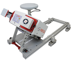
4. RIEGL VMY-2 – Mobile Mapping System
The RIEGL VMY-2 is a compact, economic, and efficient mobile mapping system that has a variety of applications, including offshore mining, open-pit mining survey, and city modeling. The system consists of two RIEGL miniVUX-series LiDAR sensors mounted in a well-proven angled orientation, as its predecessors, RIEGL VMX mobile mapping systems. This orientation also enables simultaneous forward and backward-looking to reduce scan shadows. The best part is that a maximum of four cameras (optional- Ladybug 5+ and Nikon D850) can be integrated into the system and in any combination.
The system is lightweight, easy to fold, and easy to operate. The RIEGL VMY-2 has its own RIEGL software package that offers comprehensive features in the data processing. They also have a user interface that enables quick and efficient workflow from data acquisition to processing and transferring them to any file format.
Highlights of the RIEGL VMY-2
- 360-degree full circle FOV
- High laser pulse repetition rate of up to 400 kHz
- 200 scan lines per second
- Can integrate up to four additional cameras
- Fully integrated INS/GNSS system
- VM-IU extended disk space to store data
- Multiple target capability
- Eye safe operation at Laser Class 1
Drawbacks of the RIEGL VMY-2
- Though efficiency is improved with the addition of four cameras, the LiDAR efficiency is lower.
Price of the RIEGL VMY-2
Contact a sales professional.
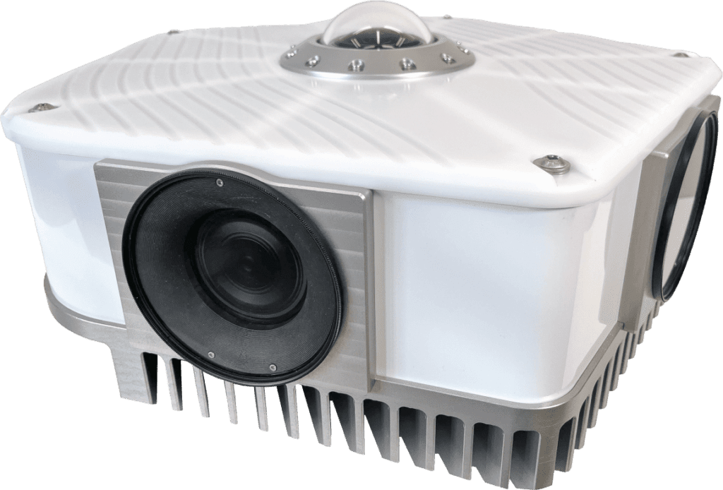
5. Mosaic Viking – Mobile Mapping System
Mosaic Viking is the highest resolution 360-degree camera system in the world. This robust camera system comes with six APS-C 31 MP Global shutter sensors that can run up to 5 FPS, enabling high-quality images even at higher highway speeds. It offers large-scale data collection and storage (60 gigabits per second) that is optimized to support digital twins and AR – no wonder it is among the top mobile mapping systems. It captures more realistic 3D models that are used in asset and facility mapping, real estate, media and entertainment, vegetation/ROW management, bridge, tunnel, and street mapping.
Highlights of the Mosaic Viking
- 22k resolution
- Six APS-C-sized 31 MP sensors
- Offers a total resolution of over 180 MP
- Global shutter camera sensors
- Seamless operation with six 10-25 GbE Ethernet cables
- Showcases real-time data with a live preview
- 12-bit uncompressed original raw data available
Drawbacks of the Mosaic Viking
- Does not include additional GNSS receivers
Price of the Mosaic Viking
Contact a sales professional to request for price and other specifications.
Which Mobile Mapping System is the Best?
There are a lot of great options out there, depending on your needs and of course budget, there is something for (nearly) everyone.
If you are looking for the best mobile mapping system for your business, contact Mosaic to help you find the solution that caters to your needs.


