
Everything you need to know about the BEAD Program
Answering your frequently asked questions about the Broadband Equity, Access, and Deployment (BEAD) program in 2026
Answering your frequently asked questions about the Broadband Equity, Access, and Deployment (BEAD) program in 2026

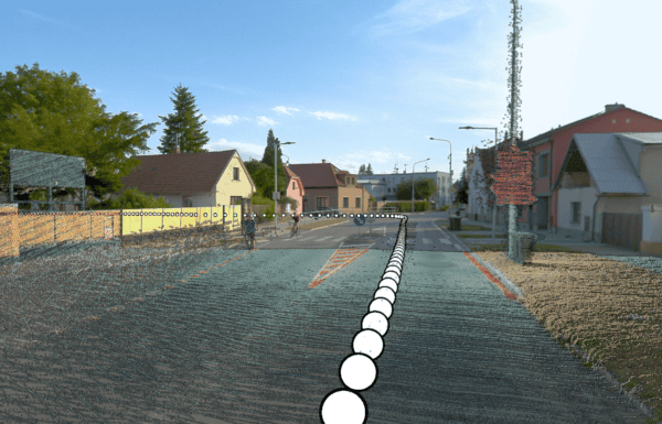
This new technology is making waves in the world of 3D modelling. So what are Gaussian Splats, and what makes them so
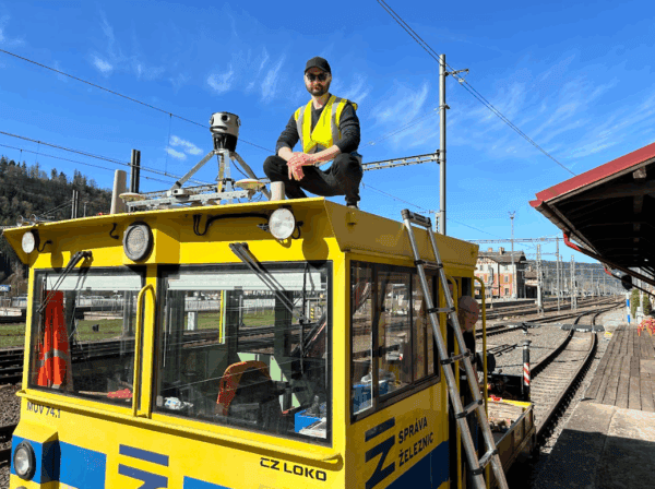
Our cameras aren’t just for cars! AirView and Mosaic mounted a camera onto a train to capture georeferenced imagery of railway corridors.
Mobile mapping is shrouded in myths and rumors. Read along as our sales team addresses potential clients’ most frequent concerns.

In a world full ‘all-in-one’ solutions that lock clients into subscription plans and software vendors, Mosaic is a trailblazer in returning data
Reality capture technology is revolutionizing the geospatial industry by delivering unprecedented accuracy and efficiency. As professionals in GIS, mapping, and BIM increasingly


