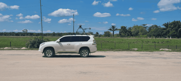
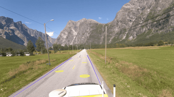
Inspect roadside assets with a robust 360º mobile mapping camera system.

Understanding current road conditions and knowing what road assets exist and where they are are all part of a safe and efficient road network.

Departments of Transportation (DOTs) and other organizations can benefit from the use of a 360º mobile mapping camera system which can both capture high resolution images of all roadside assets and infrastructure and also provide geo-referenced coordinates simultaneously. 

Increased Efficiency

One of the biggest mistakes before major projects is not knowing what is on your roads and where everything is.

Using a 360º mobile mapping camera for road asset inspection, road infrastructure surveying, and asset identification can greatly increase the efficiency of these processes. With the ability to capture 360º imagery in a single pass, large areas can be covered quickly and with minimal disruption to traffic flow. This eliminates the need for multiple passes or manual inspections, saving both time and resources.

Mosaic’s line of 360º mobile mapping camera systems come with built-in GNSS, ensuring that not only do you get the highest resolution images possible but you also get geographical coordinates which correspond to each captured frame.

Check out this case study highlighting the benefits of high resolution street view imagery for road surveying.

An architect working on a draft with a pencil and ruler
leif erik, terratec, field, mosaic camera

Mosaic camera systems on the road

Check out what Field says about why they chose to use Mosaic’s line of 360º mobile mapping cameras for road asset inspection. 

We started using the Ladybug but still the image quality isn’t always the best and the resolution is not that good.

We can acquire more customers because we have a better system and can compete with our competitors.

Improved Safety

Guarantee workers a safer environment to work in by removing the need for manual road maintenance tasks.

Traditional inspection methods for road maintenance often require workers to be in close proximity to moving traffic, which can be dangerous. A 360º mobile mapping camera eliminates the need for workers to be in these hazardous areas, as the camera can be mounted on a vehicle and operated remotely. This greatly reduces the risk of accidents and injuries, making the inspection process safer for all involved.

Discover how the world’s highest resolution 360º mobile mapping camera is giving Mosaic’s customer a competitive edge in road surveying.

white and red arrow sign on green grass field
data-analysis

Enhanced Data Analysis

A 360º mobile mapping camera also allows for enhanced data analysis of road assets and infrastructure. The high resolution images captured by the camera can be used to create detailed 3D models, which can be used for a variety of purposes, including road design and construction, asset management, and traffic analysis. 

Additionally, the camera can be used to capture data on road markings, signage, and other assets, which can be used to improve the overall safety and functionality of the road network.