
Electrical Grid Surveying – Saving Millions in Outage Mitigation
Combining thermal imagery and 360 street view for game-changing electrical grid surveying.

Transform utility mapping with accurate, high-resolution 360° imagery and data collection for efficient asset management and surveying.


Combining thermal imagery and 360 street view for game-changing electrical grid surveying.
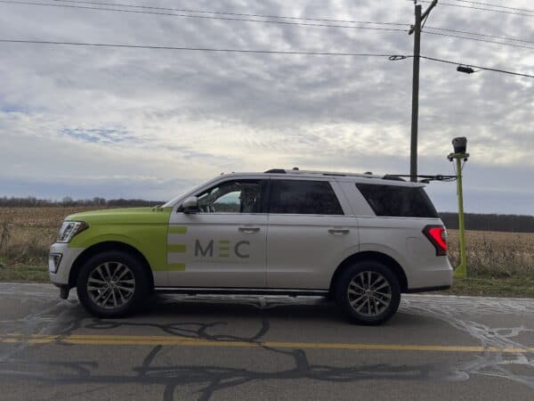
Read how Midwest Energy & Communications harnessed their Mosaic X camera for superior data capture, resulting in streamlined operations, improved safety, and high-quality infrastructure mapping, driving forward their utility services.

Case study: Dymaxion integrates LiDAR with Mosaic 51 for electrical grid and road inspection
Choose one of Mosaics 360 cameras for utility companies and experience the benefits of remotely surveying, planning, maintaining, and taking inventory, all while avoiding costly damages and risks to their assets. No more regular site visits and manual surveying, all of that can be taken care of with our HD 360 camera.
The Mosaic 51 is a 360-degree camera capable of capturing all views of a given location, providing vital information such as the local vegetation, the gradient of the roads, and the occurrence of hills and mountains.
With this information utility companies will be able to properly plan, schedule, and budget their projects from a remote location.
Check out one case story highlighting the benefits for one customer in electrical grid surveying.


The natural environment and climate can be unpredictable and changes can occur at the drop of a hat, causing potential issues for utility companies.
It is necessary to maintain a real-time map of the area and the assets, which is not possible with manual surveys or site checks. But an HD camera with mobile mapping abilities, like Mosaic camera systems, is the perfect solution to handle these sorts of constraints.
Read this case study about a Mosaic customer’s use of 360 imagery for utility inspection.
Unattended vegetation can lead to many problems down the road as it can interfere with cables, electrical lines, and poles.
Depending on the nature of the vegetation, it is possible that changes occur in a very short span of time, making it nearly impossible, or at the least, very expensive, for utility companies to stay on top of its management. However, mobile mapping technology is a fast, easy, and cost-effective way to be on the lookout for possible problems.
For more information about vegetation and utility companies, see this article.

Product or partnership inquiries?
Interested in more info?
Send a request and we’ll be happy to help.

At Mosaic we are pushing the limits of HD mapping; our mission is to build a better view of the world.
Just like our cameras, our insights keep you up-to-date on Mosaic and the 360º world. Sign up to stay updated.

© 2020-2024 Mosaic. All rights reserved.
Branding & Design: Brandician