")
How 360 street view imagery is enhancing Team Midwest’s utility mapping and understanding of their environment when planning new FTTX projects or inventorying electric infrastructure.
Introduction
“In a constantly changing world, we at Midwest Energy & Communications are embracing the future head-on. Our partnership with Mosaic cameras is not just about capturing images; it’s about envisioning a safer, more connected community where every decision is data-driven and every service is customer-centric.”
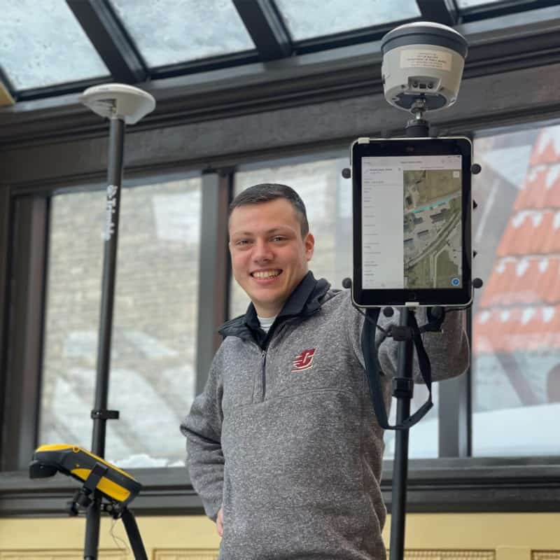
Nick Bogen, GIS Developer at Midwest.
Midwest Energy & Communications, with its roots firmly planted in the provision of reliable electric services, stands as a testament to the enduring power of community and innovation. From the hum of transformers to the expanse of the electric grid, electricity is the heartbeat of their operation. This foundational focus on electric services has fueled their growth and their unwavering commitment to the communities they serve.
“Our company is extremely involved in the community,” explains Bogen.
As a forward-thinking utility company, Midwest Energy & Communications has always been at the forefront of adopting technology to enhance service delivery and operational efficiency. Their recent venture into fiber internet (FTTH/FTTX) has marked a new chapter in their commitment to providing unmatched services to their community. But their dedication to infrastructure excellence remained unchanged. The fiber engineers, while leading the charge in the utilization of the Mosaic X camera, are part of a larger vision that encompasses a comprehensive inventory of the electric infrastructure.
Background
Traditionally, Midwest Energy & Communications had relied on external sources for their utility mapping and surveying data collection needs, which often resulted in limited control over the quality and timing of the street view imagery crucial for their infrastructure development. With a vision to revolutionize their approach, they embarked on an ambitious initiative to bring this capability in-house. The objective was clear: to capture high-quality, detailed imagery that could serve not only their immediate mapping needs but also pave the way for future advancements in data analysis and machine learning applications.
As the company sought to expand its fiber internet services, a comprehensive, accurate view of the existing infrastructure was imperative. The challenge was to find a solution that could offer detailed street view imagery and data with the precision required for planning and implementing a fiber-to-the-home (FTTH) network.
The Decision Process
When Midwest Energy & Communications set out to enhance their data collection capabilities, they realized that relying on Google Street View (GSV) was not a viable option. When mapping utilities in rural areas, there is often a complete lack of service area capture. The infrequency of updates and the quality of the imagery available on GSV posed significant limitations. The images on GSV did not support the advanced machine learning applications Midwest envisioned. They needed imagery that gave full control over the data, including precise locations, to effectively train their AI/ML models. The company required a more agile and sophisticated solution to meet their specific needs, especially for creating safe digging routes and maintaining up-to-date infrastructure data.
Why Other Solutions Fall Short:
- Google Street View:
- In rural areas, more times than not, service areas were never captured
- Infrequent updates can lead to outdated information.
- Image quality may not meet the high standards required for machine learning applications.
- Consumer Cameras (like Insta 360 Pro):
- Typically constructed from plastic and employing active cooling, they are not well-suited for situations where fragility and vulnerability to damage from shocks or moisture are concerns.
- Designed for urban and low-speed environments, unsuitable for rural or high-speed data collection.
- Limited in capturing the vast distances needed for utility and telecommunications work.
The Implementation and Usage
“The journey from traditional methods to implementing the Mosaic X camera was a leap towards innovation. We needed a tool that could keep up with our drive for excellence and precision. Mosaic stood out with its robustness and ability to deliver high-speed, quality data that is changing how we work.”
Bogen
Speeding up data collection
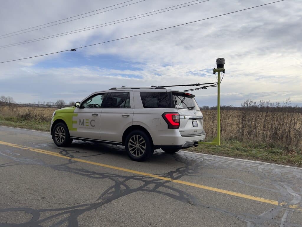
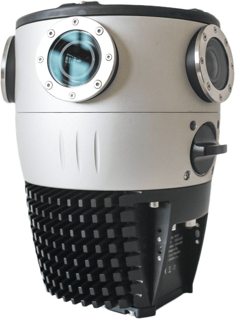
The quest for a more tailored tool for utility mapping and surveying led Midwest to the Mosaic X camera. Dismissing alternatives like the Insta 360 Pro, which was unsuitable for the rural and high-speed environments due to its urban and low-speed design, Midwest needed a robust solution capable of capturing detailed imagery across vast distances—approximately 1,000 miles, generating about 2TB of data.
Offering versatility to data capture
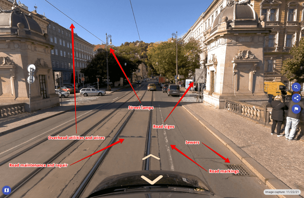
The Mosaic X camera system has been put to the test, proving its worth across a variety of use cases. It offers up-to-date imagery, which is pivotal for planning and identifying potential obstacles that could impact critical decisions. The camera has been instrumental in surveying bridges, culverts, gas lines, and other telecom infrastructures. It has been particularly effective in creating “drop maps” that detail the service lines from the main network to houses, which is essential for Midwest’s operations.
“How are we going to get the service to the people’s house? Is there an existing Right-of-Way that we can see? Are there other polls that we can attach to other obstacles and we need to avoid when we’re doing it?”
Bogen
Increasing accessibility to data with a unified utility mapping process
Accessibility of this high-quality data was another significant improvement. Where previously an engineer might make personal notes on the data, the Mosaic X has allowed for a centralized database. This database can be easily shared and accessed by different team members, eliminating the need for repetitive drives.
Packaged in a robust, industry-grade structure
The team highlighted that the robust and rugged design of the Mosaic X camera emphasizes its durability. This stands in stark contrast to off-the-shelf consumer-grade cameras. These cheaper models typically have a plastic composition and rely on active cooling. They exhibit fragility and susceptibility to damage from shock or moisture. The Mosaic’s passive cooling and integration of solid-state components underscores its commitment to providing a durable and reliable imaging solution.
Nick Bogen, GIS Developer and part of the Information Systems Research & Development Team at Midwest, highlighted the community involvement aspect. He is reinforcing the company’s commitment to not only service delivery but also to community welfare. The Mosaic X camera was an extension of this ethos, contributing to safer and more efficient infrastructure development within the community.
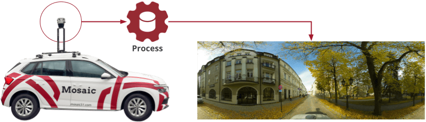
The benefits of the Mosaic X camera are clear and multifaceted. Its durability and ability to capture clear, high-speed imagery at 55mph without blurring are game-changers. The camera’s stitching is flawless, creating a seamless panoramic view. The calibration file provided by Mosaic’s vision engineers ensures that the images were not only accurate but also reliable for all intended uses.

Advantages of Mosaic Cameras:
- Up-to-date and high-resolution imagery for accurate planning and decision-making.
- High-speed capture capability, enabling data collection at 55 mph with no blurring.
- Rugged construction of the Mosaic X, including the passive cooling, rugged, and solid-state components of the Mosaic.
- Flawless stitching technology produces seamless panoramic views.
- Excellent durability suitable for varied and challenging environments.
- Advanced calibration ensures reliable data for precise machine learning applications.
Results and Benefits
“The clarity and detail that the Mosaic camera brings to our data collection process have been a game-changer. We’re not just seeing our community with greater clarity, but we’re also able to make decisions with confidence, knowing that we have the most accurate and up-to-date information at our fingertips.”
Bogen
How Midwest is using 360 street view imagery in utility mapping
- inventorying electric infrastructure
- locating poles and their associated assemblies, foreign attachments, etc.
- other infrastructure components (pad-mount transformers, substations, etc.)
- hazards to this infrastructure (vegetation, maintenance needs, etc.)
- Right-of-Way inspection for planning
- surveying bridges, converts, gas lines other telecom infrastructure
- identifying services from the main line to houses, known as “drop maps”
The deployment of the Mosaic X camera by Midwest Energy & Communications marked a significant enhancement in their operational capabilities. The immediate result was a substantial improvement in the quality and control of the street view imagery. This has directly influenced their infrastructure planning and maintenance strategies. With the ability to capture clear and up-to-date imagery, the company could make informed decisions about safe digging routes, thereby minimizing the risk of damaging underground utilities and ensuring the safety of their workers and the community.
The advanced imaging technology also allowed for the expansion of machine learning applications within the company. With precise, high-quality data, Midwest could train machine learning models to automate and improve the accuracy of identifying infrastructure components, further increasing efficiency and reducing the time required for manual inspections.
Another significant benefit has been the democratization of data within the company. The Mosaic X camera’s data is not only more accurate but also more accessible to various departments. Engineers and planners could collaborate more effectively, with shared access to the latest imagery, which has been crucial for timely and synchronized project planning and execution.
Operational Benefits Realized with Mosaic Cameras:
- Enhanced safety with accurate mapping for safe digging routes.
- Improved collaboration across departments with accessible and shared data.
- Streamlined data collection process, reducing the need for multiple site visits.
- Support for Midwest’s commitment to community service through enhanced infrastructure planning.
Future Outlook for Utility Mapping at Team Midwest
Looking forward, Midwest Energy & Communications is poised to continue leveraging the Mosaic X camera’s capabilities to expand its fiber internet services. The enhanced data collection process has laid a strong foundation for the company’s ambitious growth plans. As they extend their services, the ability to rapidly capture and analyze infrastructure data will be vital in scaling operations efficiently.
The camera’s impact extends beyond immediate operational improvements; it signifies a shift towards a more data-driven approach in community-based utility services. Midwest’s involvement in the community and its drive to give back are reinforced by its investment in technology that not only serves its business objectives but also ensures the well-being and advancement of the community it serves.
Nick’s vision for the company’s future is one that fully integrates the robust capabilities of the Mosaic X camera. The durability, speed, and flawless imagery quality are not just operational benefits but also represent Midwest Energy & Communications’ commitment to excellence and innovation. As they continue to push the boundaries of what’s possible in utility and communication services, the Mosaic X stands as a testament to their dedication to progress and community service.
Looking to do utility mapping or surveying for telecom asset inventory or Right-of-Way inspections?
Contact us today and see how Mosaic can help you!


