Building a solid baseline for insurance risk assessment: How Mosaic’s 360º street view image solutions redefine documenting ‘What was’ to ‘What is.’
Let’s discover how street view imagery collected with Mosaic’s range of mobile mapping camera systems can:
- Address the challenges of ambiguity in insurance claims
- Grant insights before catastrophic events
- Increase precision and confidence in assessment
And hear some ‘behind the scenes’ insight from real insurance claims investigators with several real life fraudulent insurance claims. Continue reading to hear the full story.

Introduction
The insurance industry is currently undergoing a significant transformation driven by the necessity to adapt to technological disruptions, climate change, economic instability, and evolving regulatory landscapes. In this article, we delve into the revolutionary impact of Mosaic’s 360º street view data capture technology on reshaping insurance risk assessment, providing a promising solution for insurers navigating multifaceted challenges.
The Changing Landscape of the Insurance Industry
The insurance sector is experiencing a seismic shift marked by changing customer expectations, technological disruptions, and the entry of highly capitalized market players. According to PwC’s 2022 Global Risk Survey, an astounding 84% of insurance companies anticipate revenue growth in the next 12 months, fueled by digitization, new products or services, and expansion into new customer segments. However, this optimism is tempered by the realization that modernization is imperative to manage both financial and nonfinancial risks effectively.
Amidst the changing dynamics of the insurance industry marked by shifting customer expectations, technological disruptions, and the entry of well-capitalized market players, Mosaic’s contribution becomes significant. The platform offers a transformative approach through its innovative 360º mobile mapping technology, presenting a strategic advantage for insurers venturing into modernization.
Challenges and Bold Moves in Modernization
Despite the potential for growth, insurers face challenges in embracing modernization as technological changes disrupt operating models, and distribution channels diversify. However, the industry is making bold moves toward technology adoption, accelerated by the COVID-19 pandemic. Insurers are now investing heavily in technology to streamline operations and navigate the intricacies of the modern insurance landscape.
In this context, Mosaic’s 360º mobile mapping technology stands out as a catalyst for change, providing insurers with tools to proactively manage risks and align with the industry’s growth goals. The technology becomes not just a solution but a strategic enabler for insurers in their journey toward modernization.
Risk Factors Facing the Insurance Industry
Let’s break down the main challenges that insurance companies are dealing with:
Climate Change and Sustainability
Problem:
Climate change is causing more frequent and severe weather events, leading to higher costs for insurance companies when they have to pay out claims or purchase reinsurance.
Impact:
Insurers also need to follow stricter rules about disclosing and managing climate-related risks, making it crucial to take active steps to reduce these risks.
Economic Instability: Liquidity and Capital Management
Problem:
Changes in the economy, especially when interest rates rise, can make it harder for insurance companies to manage their money effectively.
Impact:
Insurers have to be careful because economic downturns may mean fewer people buying insurance policies. This highlights the need for strong financial management practices to ensure there’s enough money to cover potential claims.
Regulatory and Legislative Change
Problem:
There are new rules and laws (like the Sustainable Financial Disclosure Regulation – SFDR) focusing on how insurers handle climate risks.
Impact:
To stay credible and trusted in the industry, insurers must keep up with these changing regulations. Meeting these expectations becomes crucial for maintaining a good reputation and building trust with customers and regulators.
Conversation on Evolving Damage Assessment Practices
The following two videos feature Thomas Brown, the Founder and CEO of E-Claim.com, a SaaS company revolutionizing the insurance industry and Timothy E. Molony AIC, Director of Business Development at BSC Forensics.
Insurance Claims Video #1: Market Calls – Getting to Amicable
The first video between these two individuals, both long time experts in the insurance claims business, focuses on the evolution of damage assessment practices, particularly after disasters.
Initially assessments were limited to visible damages, often overlooking undamaged areas. Over time, the industry demanded more thorough inspections of entire properties, regardless of damage presence, to prepare for potential litigation.
However, this increased scope hasn’t been matched with adequate compensation adjustments for adjusters. The speakers highlight the need for establishing a baseline before a loss occurs to better compare the pre and post-loss states, emphasizing the role of technology, like digital twins, in improving this process. This approach is seen as beneficial for detailed documentation and time framing, especially in high Total Insured Value (TIV) cases, but is not yet widely adopted.
Insurance Claims Video #2: Thoughts on Insurance Industry
The second part of this interview discusses the evolution of technology in insurance and touches on the use of street view imagery for fraud detection.
The discussion speaks to the fact that the adoption of aerial and street view imagery has revolutionized fraud detection within the insurance industry. This technology allows for detailed examination of claims and properties, significantly aiding in uncovering fraudulent activities.
“… .but I’ve really hit some huge home runs and things I could not have done when we started in the industry – the aerial imagery and street view imagery is something that I used to find a lot of insurance fraud.”
Tim Molony
Highlights from the videos:
Difficulties:
- Increased scope:
- Not knowing what to document
- Having the time, resources to properly document ‘everything’
- No increase in compensation
Need:
- Establishing a base-line ‘what was compared to what is’
- establishing a baseline before a loss occurs to better compare the pre and post-loss states
- Having an effective way to capture large amounts of data quickly and efficiently
Real Solution from Mosaic:
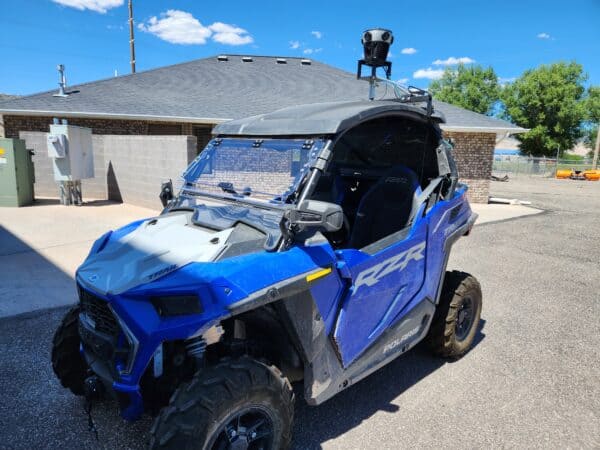
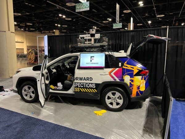
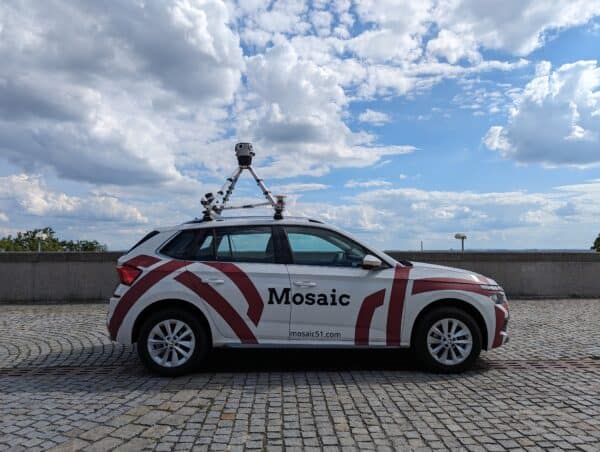
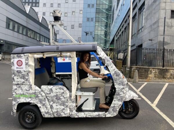
Mosaic mobile mapping cameras for detailed documentation and time framing, especially in high Total Insured Value (TIV) cases. This innovative technology addresses the challenges by providing comprehensive coverage, aiding in efficient data collection, and establishing a solid baseline for precise comparison before and after loss events.
Addressing Climate Risk with Mosaic’s 360º Mobile Mapping Technology
Mosaic’s 360º mobile mapping camera systems emerge as powerful solutions to aid in many of the challenges posed by climate change. In particular, financial and insurance companies can benefit from Mosaic’s offers of a comprehensive approach to rapid and highly actionable street view data collection for risk assessment utilizing innovative mapping techniques.
Let’s explore how Mosaic’s technology directly addresses these risk factors:
Mobile Mapping Data Collection for Road Surveying
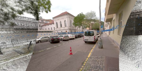
Mosaic’s mobile mapping technology facilitates precise 360º street view data collection for road surveying, enabling insurers to assess infrastructure risks with unprecedented accuracy and speed. The detailed street view data enhances risk assessment in the face of climate-related challenges such as extreme weather events.
Road Maintenance and Asset Inspection Solutions
The application of Mosaic’s technology in road maintenance and asset inspection provides insurers with a proactive means to identify and address vulnerabilities in infrastructure. This not only contributes to risk mitigation but also aligns with regulatory expectations on asset management and disclosure.
Public Safety and Monitoring Tools
Mosaic’s solutions extend to public safety, offering monitoring tools that empower insurers to respond rapidly to emerging risks. By harnessing geospatial technology and spatial data analytics, insurers enhance situational awareness, enabling real-time decision-making.
Innovative Imaging Technology and Insurtech Solutions
Mosaic’s innovative mapping technology and insurtech solutions empower insurers to stay ahead of evolving risks. By integrating cutting-edge technology, insurers can adapt their underwriting, reserving, coverage, and pricing strategies in response to climate-related challenges.
The Role of Mosaic’s Technology in Risk Mitigation
Mosaic’s 360º Mapping Technology goes beyond addressing climate-related risks; it plays a pivotal role in multifaceted risk mitigation, significantly impacting the insurance industry’s transformation.
In the wake of a major natural disaster in the U.S., the process of assessing damages, especially for large structures, reveals significant complexities. One primary challenge is evaluating the building’s fenestration, a critical part of its envelope, due to the lack of a baseline for comparison.
This makes it difficult to ascertain the extent of damages directly caused by the disaster.
In a scenario involving a substantial $100 million insurance claim, thorough analysis was essential. It was determined that $30 million of the damages were directly attributable to the disaster, while another $30 million were not.
The remaining $40 million represented a gray area, highlighting the intricate nature of categorizing damages after such large-scale events. This situation underscores the potential of mobile mapping camera technology to address these challenges by providing detailed, pre-disaster baseline imagery, thereby simplifying the assessment process and reducing ambiguities in damage evaluation.
Addressing the Challenge of Ambiguity in Claims
The insurance sector grapples with a persistent challenge: ambiguity in claims assessment. This inherent uncertainty underscores the crucial need for a solution that offers clarity and precision, two attributes that Mosaic’s 360º mapping technology promises to deliver.
This technology serves as a bridge across the ambiguity gap, providing insurers with a dynamic, evolving baseline for their assets. The ability to capture street view data with unprecedented detail becomes not just a tool for risk assessment but a transformative force that elevates the entire claims process.
Gaining Insights Before Catastrophic Events
The urgency to address risks before they escalate is underscored by a surge in catastrophic events. In this context, Mosaic’s 360º mobile mapping cameras emerge as a preemptive advantage for insurers, offering real-time insights into asset conditions before calamitous events unfold, with the capability to capture valuable street-level imagery.
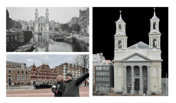
Imagine a scenario where insurers can anticipate the impact of a disaster by comparing pre-disaster images with the post-disaster reality through live overnight updates facilitated by repeated street view captures. This proactive approach not only aligns with industry trends but also positions insurers to make informed decisions that can significantly mitigate the financial fallout from catastrophic events.
Historical Data for Risk Analysis:
Repeated captures and historical data allow insurers to observe changes over time, aiding in risk prediction and management.
This data can be used to assess climate change impacts, urban development, and other factors relevant to insurance risk.
Precision in Assessment
The capability to identify specific areas of damage or lack thereof is crucial in the insurance industry. Mosaic’s 360º mobile mapping cameras enhance precision in assessment by offering a detailed view of assets.
This level of granularity empowers insurers to make informed decisions, reducing the margin of error in claims assessment and ensuring that payouts are commensurate with the actual damages incurred.
Previously, large scale data post disaster focused on the use of aerial imagery or satellite imagery. But this viewpoint does not allow for the full scope necessary for assessment.
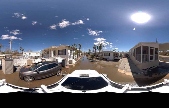
Users of street view data, combined with aerial or satellite imagery, have noted that there have been instances in which the roof of a building was fully intact following a natural disaster but that upon inspecting the street view imagery, the entire business was destroyed.
Increasing Customer Engagement and Transparency
Providing customers with visual documentation of their claims can improve transparency and trust.
It enables a more interactive and engaging claims process.
Cost-Effective Data Collection
Traditionally, insurers relied on manual inspections or aerial surveys, both of which are resource-intensive and time-consuming. Mosaic’s solution offers a cost-effective alternative by automating the data collection process. Equipped with 360º mobile mapping cameras, insurers can efficiently cover vast areas without the need for extensive human resources or expensive aerial surveillance.
This cost-effective approach not only streamlines the data collection process but also allows insurers to allocate resources more strategically. The financial savings achieved through Mosaic’s technology contribute to the overall efficiency of the insurance workflow.
Key takeaways:
Using these cameras reduces the need for physical site visits, saving time and resources for insurance companies.
The efficiency of data processing and image capture streamlines the workflow, enhancing overall operational efficiency.
Enhanced Fraud Detection
Insurance fraud remains a persistent challenge in the industry. By leveraging Mosaic’s 360º imagery, insurers gain a powerful tool for fraud detection. The comprehensive street view data serves as a reliable reference point, enabling insurers to identify inconsistencies between pre-disaster and post-disaster conditions.
Pre-disaster fraud prevention:
For instance, if a claim asserts damage to a property that was evident in pre-disaster images, insurers can swiftly identify the discrepancy and investigate the claim further. This proactive approach not only safeguards insurers against fraudulent claims but also acts as a deterrent, discouraging would-be perpetrators.
Post-disaster fraud prevention:
Additionally, it’s crucial to acknowledge that there can also be fraud in post-disaster work. Someone might ‘damage’ their own property after a disaster and claim it was due to the recent disaster. This underscores the importance of thorough investigations and advanced technologies to ensure the integrity of insurance claims and prevent fraudulent activities.
Key takeaways:
The Mosaic cameras’ detailed imagery significantly enhances insurance processes by accurately verifying claims to reduce fraud and effectively assessing damage through pre- and post-event comparisons.
Their quick deployment in post-disaster scenarios provides real-time, high-quality imagery, crucial for insurers to assess damage promptly and accurately.
Navigating Regulatory Compliance
The insurance industry operates within a stringent regulatory framework, and compliance is non-negotiable. Mosaic’s 360º mobile mapping camera not only aids insurers in risk assessment but also facilitates compliance with regulatory requirements. By maintaining an up-to-date repository of asset conditions, insurers can demonstrate due diligence in their risk management practices.
This proactive approach to regulatory compliance positions insurance companies as responsible and trustworthy entities. It not only satisfies regulatory mandates but also enhances the overall reputation of insurers, fostering trust among policyholders and stakeholders alike.
Key takeaways:
The high-resolution and comprehensive imagery can serve as evidence for compliance with various regulations.
Insurance companies can maintain accurate records of properties and areas for regulatory purposes.
Future Prospects and Industry Adoption
The insurance landscape is continuously evolving, making the adoption of innovative technologies a strategic imperative. Mosaic’s 360º mobile mapping camera represents a paradigm shift in risk assessment methodologies. This technology has the potential to revolutionize the insurance sector. It addresses longstanding challenges such as ambiguity in claims, precision in assessment, and cost-effective data collection. Additionally, it enhances fraud detection and ensures regulatory compliance.
Industry leaders are increasingly recognizing the value of Mosaic’s solution. Adoption rates are expected to rise as insurers seek to stay ahead in a competitive landscape. The transformative impact of this technology goes beyond operational efficiency. It fundamentally changes how insurers approach risk. This enables them to make more informed decisions and strengthen their position in a rapidly changing market.
Key takeaways:
Adopting Mosaic’s cutting-edge technology positions insurance companies as innovators, ready for future challenges.
Staying ahead with technology can lead to better customer service and more accurate risk assessment models.
Real-Life Insight: Uncovering $2 Million in Insurance Fraud
The situation:
One Mosaic customer reported providing an insurance claims investigator with street view data from data collected with their mobile mapping camera following a hurricane that destroyed many communities in the southern U.S. several years.
Through the use of the street view imagery provided, the investigator gained greater depth and more view points to more confidently confirm the original interpretation of the events.
By the end of the project, it was determined that there was several million USD in insurance fraud documented and proven through the use of aerial and street view imagery for this claim.
Conclusion
Mosaic’s 360º mobile mapping camera is emerging as a game-changer for the insurance sector. It offers a comprehensive solution to the challenge of ambiguity in claims assessment. This technology provides insurers with real-time, detailed street view data. It facilitates preemptive risk mitigation and enhances precision in assessment. Additionally, it helps reduce costs, detect fraud, and ensure regulatory compliance.
As the insurance industry grapples with evolving risks, Mosaic provides a beacon of innovation. It enables insurers to navigate uncertainty with unprecedented clarity. The combination of cutting-edge technology and risk management expertise positions Mosaic as a catalyst for positive change. This is crucial in an industry where foresight and precision are paramount.
Whether you are navigating risk assessment complexities or seeking a dynamic imaging solution, Mosaic is your partner. If you need to capture high-resolution 360º data for a clear view of roadside assets, Mosaic’s cameras are ideal. They have set a new industry standard. Our technology gives insurers detailed street-level insights. This improves risk assessment and enables proactive decision-making.
Contact our team today to learn more.

