Identifying the right Mobile Mapping System for your needs
What is a MMS?
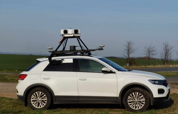
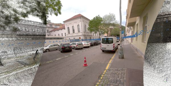
MMS, short for mobile mapping system, is the process of collecting geospatial data via a moving platform. Through the use of sensors on the platform, the data is captured and digitized into imagery.
‘Geospatial data indicate where objects are absolutely or relatively positioned on Earth’
Image credit: digital designer
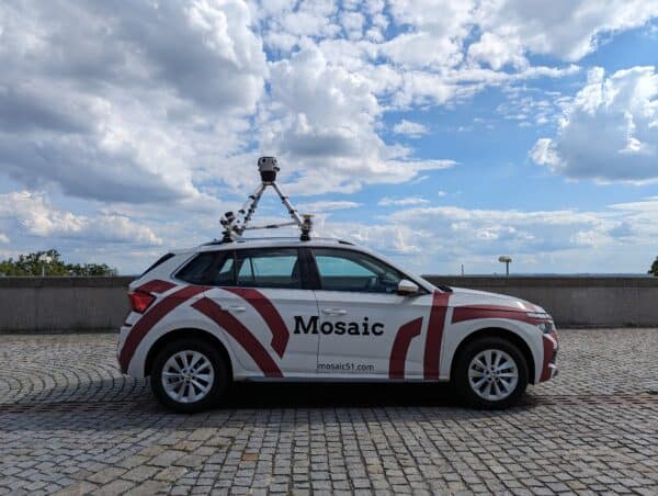
The most well-known example is the Google Street View car. The vehicle you’ve seen in your area and hoped that it did NOT just snap your street inclusive of you shuffling to the shop in festive pajamas. In March.
Questionable spring fashion choices aside, let’s dig a little deeper into MMS.
What does a MMS do?
The main objectives of a mobile mapping system are to:
- Capture imagery in high resolution
- Be accurate
- Process data to form a 3D map, street view, survey, etc.
As well as cars, data can also be collected via trains, airplanes, and drones through the use of sensors. There are a variety of sensors to choose from, and we’ll explore those a little further down:
- Cameras
- Radar
- LiDAR
- Positioning (GPS and GNSS)
Mobile mapping is beneficial to many key sectors. It allows companies in the public and private sectors to capture imagery and create accurate 3D model maps.
Who uses MMS?
Mapping is used by just about everybody.
It is utilized by governments in urban planning, in the monitoring of industrial construction, and railway network management. Mobile mapping is also implemented in surveillance and security, by global emergency response teams, and to observe environmental change.
It’s also used by you, using Google Maps on holiday to orient the streets of Naples in search of the city’s best pizza.
Mobile mapping is not limited to any given sector and there are many benefits to having such information. For example, building a real-life representation of our streets and communities, either through street-level view or a 3D scale, with speed and accuracy.
What Data is Collected with a MMS?
The type of data collected depends on the various sensors that are part of the mobile mapping system.
Cameras as a part of a MMS
The easiest example of data collection is a visual representation of the roads themselves, captured and displayed in applications like Google Street View or Google Maps. The data is inclusive of all kinds of infrastructure such as houses, storefronts, and bridges.
Less noticeable details such as the below are also recognized and stored:
- Road surfaces
- Road signs
- Street lighting
- Guard rails
- Manholes
- Roadside vegetation
This perspective is called ‘street-level’, the typical sight of a pedestrian or vehicle on the road.
This helps local governments identify required maintenance in communities, such as repair work for cracking or outdated infrastructure, to road lines needing a fresh coat of paint. This is indispensable in providing communities with up-to-date information.
Aerial imagery, captured by airplanes or drones, shoots large areas from above and isn’t limited to the thoroughfare on the ground.
Given the scale of imagery, the data collected varies based on the type of sensor:
Color
Color imagery is perfect for land planning, mapping vegetation growth/decline, and creating soil maps through means of color separation.
Not the sexiest sounding map perhaps, but hear me out. They are actually rather important.
Soil maps are used for general identification in characterizing soil property and diversity, and through this, the most suitable land can be determined for crop growth. So they have a direct influence on feeding the world.
In addition, land drainage, the PH balance of an area, and the base organic matter can be measured by use of a soil map. So not only is this great for general agricultural planning, but also in the wonderful conservation of our environment. David Attenborough salutes soil maps! (Probably.)
Black and White
Just as with black and white photography, these sensors work off the amount of light reflected from objects. Measuring solely in back and white allows for greater spatial resolution, thus higher quality and detail – overall great for any kind of surveillance.
LiDAR as a part of a MMS
A common form used in mobile mapping, LiDAR (Light Detection and Ranging) determines range by targeting a surface or object with a laser, then measures the time of the reflected light to return. It is very useful when collecting 360° spatial data.
To learn more about LiDAR, check out this article here.
Infrared as a part of a MMS
This sensor is available in black & white and color, using infrared waves it can pick up forms of vegetation as well as bodies of water. It can also be used to monitor weather, such as thunderstorms, by using thermal imagery.
Radar as a part of a MMS
A favorite with meteorologists, radar detects atmospheric phenomena and can provide general weather analysis, it also helps navigate ships among many other things.
Radio waves are cast out into space from the radar. A portion of those waves will hit targets, otherwise explained as the waves being intercepted by reflecting objects. Those objects echo back towards the radar, and the target location and size can then be obtained from the echo signal.
Satellite as a part of a MMS
For very big mapping, we’re talking planet size, satellites are in operation orbiting the Earth and taking a good look at what’s happening down below.
So aerial provides localized data on a larger scale than the street view, and satellite covers everything else.
Common uses are environment surveillance and human activity on earth, from global climate change to you running to the shop in your pajamas.
GPS and GNSS as a part of MMS
GPS is a household abbreviation for Global Positioning System. Widely switched on when getting in a car and tapping on that tiny mobile mapping screen to find the best route to the airport.
GNSS, or Global Navigation Satellite System, is actually an umbrella term which lil ol’ GPS falls under. GPS is the most widely used GNSS system in the world.
Both systems work by ascertaining a precise location, but GNSS works on a larger scale. Equipment compatible with this system can utilize signals from satellites in networks that are outside of the GPS scope.
So, both are essential for a mobile mapping system. It’s up to you to determine your needs and which positioning system suits you best.
Check out our two-parter on GPS accuracy:
GPS Accuracy and GPS Drift and Alternative to GPS: How to get better accuracy with images.
So now that you have a good overview of the different types of sensors and data collection devices used in mobile mapping systems, let’s explore the features and identify what to look for when looking for a MMS.
Features and Benefits of a MMS
Here are some key features to be considered when choosing a mobile mapping system:
Resolution
The first thing on your ‘list of musts’!
You want the highest resolution possible in order to get the crispest images. It is also good to consider how the cameras handle movement and the weather while snapping photos.
And if you are a stickler for having the best resolution possible when collecting street-level data, then look no further than the Mosaic Viking. It is, simply put, the highest resolution 360° camera in the world.
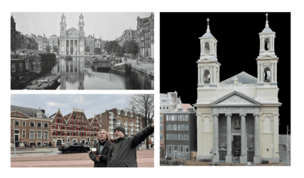
It is a mobile mapping system built with six APS-C 31 MP global shutter sensors that can run up to 5 FPS. In less technical terms, it captures impeccable quality imagery even at high speed to create photorealistic 3D models. This MMS can also map vast stretches of highway and create maps that allow the users to work comfortably from their desks while inspecting the tiniest details on the road.
Accuracy
This can be split into local (relative) and global (absolute) accuracy.
Local accuracy compares the scaled distance of objects on a map, with the same measured distance on the ground, and accuracy between points in a single location.
Global accuracy is ‘how close a measured value is to a known absolute true value’. In terms of scanners, this measures the accuracy of two points that are NOT captured in a single location. For example, the distance between opposite corners of a building.
The Lynx HS600 is a great example of accuracy due to its 3D LiDAR survey systems. It also optimizes data swiftly and with accuracy by utilizing built-in QA/QC tools.
Georeferenced abilities
There are many applications for mobile mapping systems, and some of the use cases require that image data is geo-tagged or georeferenced. This requires the use of GNSS devices. Some current MMS solutions come with built-in GNSS devices, while others might have it as an optional add-on.
The Mosaic 51 and Mosaic X cameras both come with a default GNSS device built into the camera giving it a relatively high level of accuracy.
For customers with a high demand for precise position data, the solution can easily grant centimeter level accuracy, utilizing RTK (Real-Time Kinematic).
This integration is possible due to the fact that both mentioned cameras have an AUX port which allows users to attach and sync data from additional devices, such as a GNSS device, IMU or LiDAR unit.
To learn more about this integration, check out this earlier article.
Cost
Cost is a key player in any field, and for any purchase. It’s important to understand what is good value and what is merely cheap.
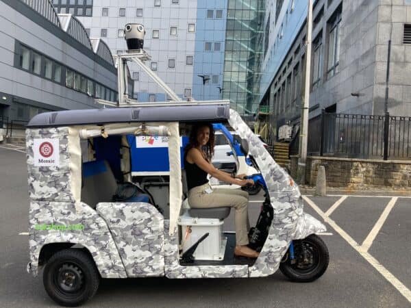
There are products on the market that fall more so into the areas of virtual reality or consumer products. Now they do capture imagery, and sometimes very well, but are not at all suitable to be placed on top of a moving vehicle! Nor are they efficiently equipped to handle variable weather and temperature.
Another peril with cheaper models is that again, they can have the ability to capture good imagery, but lack capacity when attempting to optimize data and convert it into 3D or 360 mapping.
On the other end of the price scale, some of the more well-known mobile mapping companies such as Ladybug 5, Insta360, Cyclomedia, and NCTech have great products but will occasionally have ‘hidden’ costs.
So their systems collect the data, but then the data is leased to you at a price. Usually, the data also needs to be run through their own software, which again adds to the cost of your system.
Durability
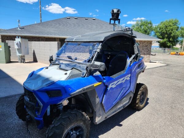
Another necessity is durability. Considering the system will be traveling over a mixture of terrains, it needs to be sturdy. Not every mapping situation calls for merely gliding over a smooth road on a sunny day.
The system needs to be waterproof, dustproof, and able to withstand extreme weather and rough terrain – and not let these affect the imagery captured.
The Insta360 Pro Camera, for example, is an affordable camera that possesses decent video capability. Where it is lacking, however, is in its durability.
The 200° fisheye lenses are easily damaged and are unfortunately not easily replaced. If you do end up with a cracked lens from a low-hanging branch or rouge pebble, the entire camera needs to be sent back to the manufacturer for replacement. Rather frustrating.
We have crafted our camera, Mosaic 51, to be as robust as possible. It lives in an entirely waterproof house with all its connectors also completely waterproof. The lenses, should anything catch them and cause damage, are easily replaceable.
So no time wasted waiting on servicing, or heaven forbid, an entirely new system from the manufacturer- win!
Data Protection
On the ground and in the air, mobile mapping systems often capture highly personal and individually identifiable data when snapping, such as people’s faces and their license plates.
Common privacy laws are consent-based. This means the subject in the data has to give explicit consent that their face can be shown. This is not viable given the vast scale of people captured during mapping, so software is later applied to recognize these features and blur them.
Mosaic cameras come with built-in GPU and CPU for future-proof ML/AI abilities including facial recognition and blurring.
So, this covers a nice amount of essentials to contemplate when researching and making a purchase of a mobile mapping system. More details such as software, user-friendliness, and aesthetics are all available to haggle over too.
Take a look at our article here where we go into more depth about mobile mapping systems of 2022, highlighting specifications for each system and we give you a nice comparison of different units.
After reading this, hopefully you’ve got a little more information on MMS overall, and you’re able to identify which features are a priority for you and your project.
Mosaic builds 360° mobile mapping cameras, the most robust and highest resolution cameras globally on the market. If you need further info or some questions answered, contact us and chat with one of our specialists to help you find the best solution to fit your needs.

