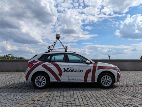
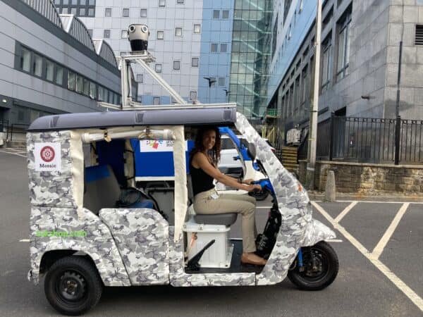
Breaking ground, Mosaic 51 is the #1 agriculture camera system for agriculture inspection
Despite the incredible speeds at which the world is changing, some things have not changed – the need for human beings to eat. Even with all that AI and IoT have brought to humankind, we all still need to eat on a daily basis in order to continue making further advances in AI and IoT. What has changed in the field of agriculture is the way in which we farm and the resources that we use.
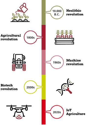
Previous Agricultural Revolutions – Our Past
The First Agricultural Revolution happened nearly 10,000 years ago when our ancestors moved away from hunting and gathering to a more settled, agrarian way of life. That lifestyle persisted for the next 10,000 years, hardly without change. Large portions of the populations across the world were farmers, producing enough food for themselves, their families and the nearby communities. Rarely were their goods shipped more than a few miles down the road.
The Second Agricultural Revolution occurred in tandem with the Industrial Revolution in the 18th and 19th centuries in which new technologies began to take root and allow for an immense increase in farm productivity. It was also one of the leading causes of the exponential growth in populations.
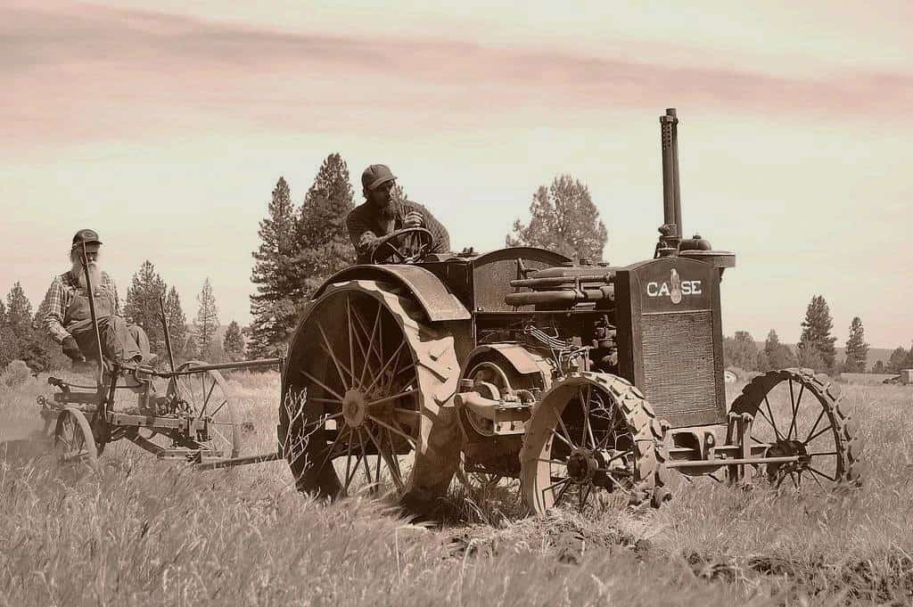
The Third Agricultural Revolution, also known as the Green Revolution, happened less than 100 years ago. This included the use of chemical fertilizer, pesticides and hybridization, all of which led to an even more drastic flourishing of populations throughout the world.
The Current Agricultural Revolution – Our Future
The latest advances in agriculture involve AI and IoT have incorporated machine learning and data analytics into a sector of our lives that previously was natural and wholly organic. In this newest stage of development, we humans attempt to use up-to-date, highly precise data to drive our decision making processes, with the ultimate goal of operating as cost-efficiently and productively as possible while at the same time, being mindful of the environment around us.
This is no small feat by any means and several solutions have arisen in the last decade or so. Those in the agricultural sector have sought solutions by combining various forms of technologies, mainly consisting of a camera for agricultural image gathering, alongside sensors such as GPS, LiDAR, and infrared cameras. This melding of images from an agriculture camera system with geospatial data has led to a superior form of data collection, one which is highly sophisticated and precise.
Current Solutions for Agriculture Inspection and Maintenance
One of the most well-known among those is the use of UAVs (unmanned aerial vehicles), or more commonly known as drones. However, while being the most ubiquitous, they are not necessarily the best solution for farmers, as we’ll see in a bit.
Another system often implemented is aptly named ‘near ground remote sensing system’, a stationed ground-based surveillance and monitoring system, consisting of a mechanical structure, a power supply and control parts, and onboard application components.
Both of these systems share many similarities and aim to accomplish many of the same problems: identify insects, crop diseases and nutrient deficiencies, as well as take inventory of livestock and crops. However, both have their limitations and there is something, quite literally ‘in the middle’ which solves problems experienced by both systems.
But before we get into this incredible, new solution in agriculture camera systems and smart farming, let’s look at and acknowledge the current uses and benefits of drones and near ground remote sensing systems in the agricultural sector.
Uses of remote sensing systems in agriculture
Since their advent into mainstream culture, drones have gone from a military device to a recreational toy to a highly functional form of monitoring and collecting data for a whole host of sectors, including of course – agriculture. A study by PriceWaterhouseCooper published in 2017 found that the total market value of drone-powered solutions was estimated at $127.3 billion; and following infrastructure, agriculture was the second leading industry at $32.4 billion.
Due to their easy maneuverability, they have become a popular means of surveying farms, including both livestock and vegetation. There’s a list of some of the tasks these remote sensing devices have taken over from humans in recent decades:
- Livestock inspection: drones can identify livestock which are ill, pregnant, or injured and allow farmers to better attend to the ones in need
- Pest detection and surveillance: drones as well as stationary near-ground level remote sensing systems have been fundamental in monitoring infestations such as locusts, allowing early detection and prevention
- Crop damage assessment and documentation: by capturing images before harmful incidents such as fires, floods, pests, and other natural disasters, farmers have future evidence of the land devastation in order to show insurance companies and governmental agencies when requesting assistance or making a claim
- Identify disease: crop diseases which quickly pop up and spread throughout acres of land can be identified and dealt with through the use of carefully gathered data such as images, GPS coordinates and infrared data.
- Analysis of field and soil: UAVs have allowed farmers to analyse larger patches of land to determine the nutrient-rich or nutrient deficient soils
- Plant counting and inventory assessment: due to high quality images, paired with advanced algorithms, it is possible to take inventory of fields of crops
- Estimation of crop heights: a combination of sensors and HD images also make it possible to monitor and estimate the height of crops, keeping tabs on their growth and maturity rate
- Monitor water levels: it is possible to identify leaky irrigation pipes or areas that are in need of more water with the use of cameras and sensors mounted on drones
- Detect crop temperature data: with the use of infrared cameras, it is possible to detect the temperature of crops to determine those which are water deficient
Benefits of data gathered from advanced agriculture camera systems
The data collected with UAVs and near-ground remote sensing systems have accomplished a great deal, helping to advance agriculture as we know it. Farmers today are better prepared and knowledgeable about the conditions of their livestock and crops, allowing them to make better-informed decisions when deciding where to send their cows to graze, where to water and how much water to give to a particular parcel of land, and which field is in danger of being attacked by a swarm of pests.
The benefits can be summarized into three categories: efficiency, effectiveness, and environmentally-friendly.
Efficiency
Drones, UAVs, near-ground remote sensing technologies are all much more efficient than human beings in capturing and storing data. They can operate more quickly in the case of drones, operate for longer periods of time in the case of near-ground solutions, and all have the ability to capture and store images, data, and insight for future use.
Effectiveness
The accurate and precise gathering and processing of data by cameras, sensors and machines provides farmers with knowledge that they can be assured is just that – accurate and precise. Rather than relying on subjective data gathered by humans, they can be confident in the objective data gathered by these tools.
One case study found that an agricultural leader using drones accelerated plot-based plant measurements by 2.5x and improved accuracy by 25% compared to hand counting. In addition, they were able to survey full plots instead of sampling 10% to 40% of the field.
Another case study found that gathering data by remotely powered vehicles led to a 10% increase in crop yields on average.
Environmentally-friendly
There are many eco-friendly and environmentally-friendly benefits which surface through the use of remotely-powered image and data collection information.
Efficiency and effectiveness often lend themselves to a more ecologically sustainable method of farming. With more accurate knowledge about the current state of their fields, farmers can make decisions about where to properly irrigate, nourish or protect crops according to the specific needs of individual plants.
And efficiency and effective farming practices also mean reducing waste on vital resources such as water, nutrients, soil, seeds, and pesticides.
By surveying their land more regularly, they will more quickly identify potential risks and be able to mitigate those risks with rapid recourse rather than discovering too late.
Ultimately, the goal of the vast majority of farmers can be assumed to be profitability, but most would argue that profits only come from effective, efficient and eco-friendly methods of farming.
A Better Solution for Agriculture Inspection and Maintenance
While drones and stationary remote sensors have both increased farmers’ yield, helping to increase efficiency and effectiveness while reducing waste, there are many disadvantages to these two systems.
The disadvantages of drones in agriculture inspection
- Privacy: it’s quite easy to quickly and unknowingly trespass onto another’s land
- Legislative uncertainty: there is not strict nor concrete law (in the U.S.) regarding the use of UAS and their movement, making it difficult to know when laws or regulations have been violated
- Flight route limitations: drones are often limited in where they are able to fly
- Safety throughout the operation of drones, to people, land, animals
- Vulnerable to wild animals
- Easily hacked: without proper security, drones can be hacked and sensitive data can be gathered by outsiders
- Weather dependent: the batteries powering drones are sensitive to moisture and drones are sensitive to wind speeds
- Knowledge/skill: licenses are required to operate drones and this requires considerable training
- Short flight time (often less than ½ hour)
The disadvantages of near-ground level systems in agriculture inspection
- Limitation of movement: these systems are stationary and cannot cover wide expanses of land
- Durability: mainly built for research purposes, near-ground level systems are often not durable or able to withstand harsh environmental conditions
The one solution for all agriculture inspection and maintenance
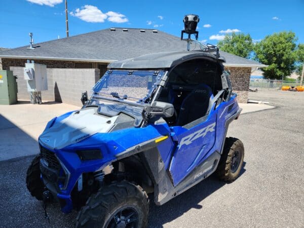
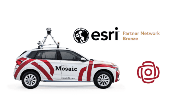
A camera for agriculture inspection and management mounted on ground-based rovers is the perfect marriage of the two previously mentioned solutions. The Mosaic 51 is one option for an agriculture camera system. By providing a stronger, more durable solution to drones and a more versatile solution to near-ground based systems, the Mosaic 51 offers farmers the best camera solution for data collection.
This 360-degree camera consists of 6 12-Megapixel image sensors which can be mounted atop a moving vehicle, most typically a standard car (self-driving cars as well), but also on UGVs (unmanned ground vehicles), such as ground rovers, or other farming equipment which can transverse fields.
The Mosaic 51
- is a more mobile solution to near ground remote sensing systems
- is not hampered by weather, by wind or by heat. With its IP64 rating, the industrial-grade housing unit is sealed and water-resistant, making it possible to operate in heavy winds, rain storms and through extreme heat.
- is not a danger to wildlife such as birds. Since the camera is mounted on a ground-based rover or other farming machine, it only covers ground already in use by the farmer.
- allows for privacy, as the operation of the camera will only take place on the farmers’ land without the concern for crossing boundaries or trespassing on neighboring fields.
- is easy to operate. There is no need to obtain a license or train in order to operate the Mosaic 51.
- is secure. The Mosaic 51 can come equipped with 256-bit encryption out of the box, allowing for full confidentiality and GDPR compliance.
- is not vendor locked, so farms can migrate to the Mosaic 51 without fear that they are bound to a specific software solution.
- offers the highest quality imaging on the market at 12K resolution on each of the 6 sensors
- can operate and collect data over nearly 10 hours, with 7fps 12-bit compressed RAW in full resolution
- can store up to 8TB of data in its USB 3.0 storage
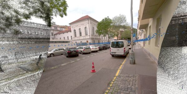
- has 3D scanning capabilities which can allow for collection of soil and field analysis data to streamline planning and planting patterns and to help optimize field irrigation and soil nitrogen levels throughout the crop cycle.
The Mosaic 51 camera is the next step in the development and usage of truly high performing tools which are making improvements in the agricultural industry as well as many other sectors. Paired with software to create prescription maps and treatment plans, take soil and leaf sampling, and generate vegetation index maps, the future of farming is sure to achieve higher efficiency, efficacy and ecological standards.

