
Mosaic 51 is now fully integrated with external GNSS to easily achieve RTK
Prague, Czech Republic, 28th April 2022
Previously, mapping and surveying companies had to choose between high image resolution and high positioning accuracy. Now, they can easily achieve both.
Mosaic announces that its flagship camera, the Mosaic 51, a robust 360° mobile mapping camera, now has extended capabilities, as it is fully integrated with external GNSS to easily achieve RTK. For customers with a high demand for precise position data, the solution can easily provide centimeter-level accuracy, utilizing RTK (Real-Time Kinematic) technology.
It also helps with gathering position with absolute accuracy in challenging conditions like urban canyons, which can pose a huge challenge for standard GNSS positioning systems.
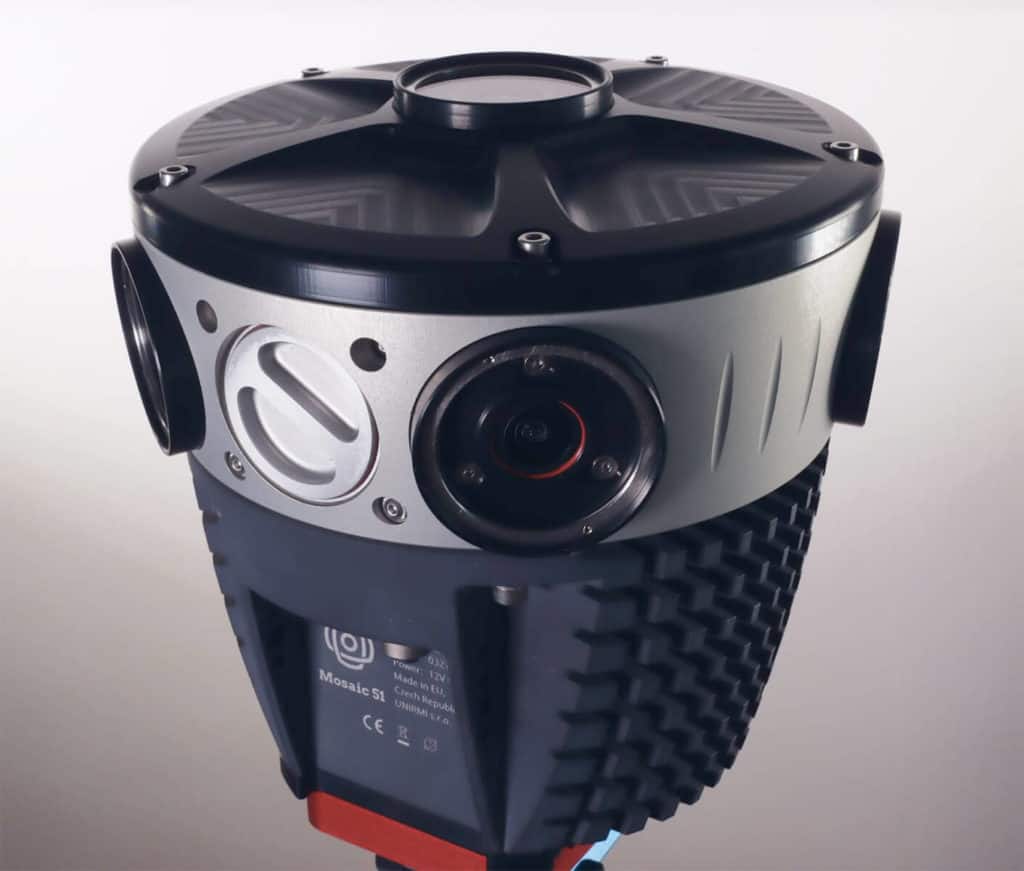
The Mosaic 51 – leading 360° mobile mapping camera
In its 3 years in production, the Mosaic 51 has already gained recognition as the go-to mobile mapping solution for street-level truth with its best-in-class ground-level imagery, thanks to its 75.5MP resolution with 6x12MP image sensors, granting full 360° image capture. It is the highest resolution mobile mapping camera available.
The Mosaic 51 is currently the only single-unit mobile mapping camera on the market, with an embedded computer, so that users do not need a dedicated computer within the vehicle to operate and capture data. This makes it more functional and mobile than traditional mobile mapping systems, which are larger, heavier, and require additional pieces of equipment.
The Mosaic 51 stand-alone unit currently possesses a built-in GNSS receiver with an accuracy of about 1.5 meters. However, capitalizing on the power of RTK, a specialized form of differential GPS, users can achieve 100 times greater accuracy over standard GPS.
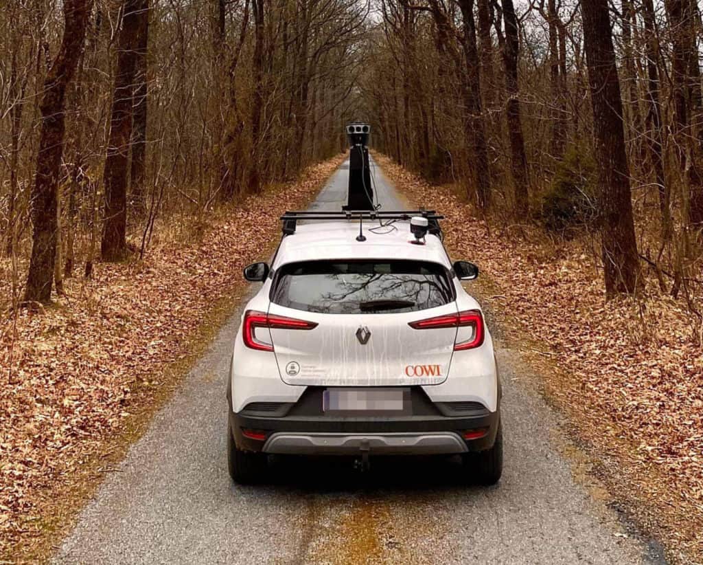
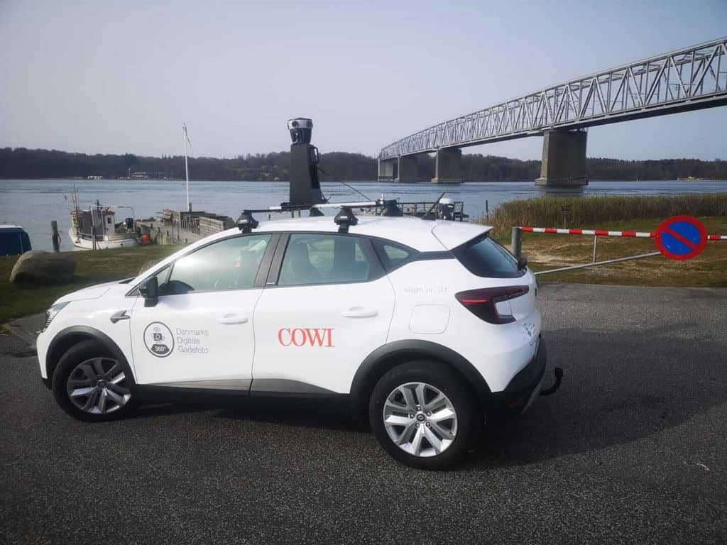
Mosaic 51 integrated external GNSS use cases
This latest update gives Mosaic customers the highest image resolution as well as high position data precision. The Mosaic 51 integration enables RTK for GNSS positioning of the captured image data, which mapping and surveying companies, as well as infrastructure and utility companies, can use later to pair with highly precise geographic coordinates.
The camera came to be from the demand in the mobile mapping and GIS surveying markets for higher image quality. This imagery has a multitude of applications:
- road surveying and maintenance
- infrastructure and cadastral surveying
- CAD/BIM
- GIS surveying
- public safety
- utility and telecom companies
Now the Mosaic team has ensured that, in addition to having the clearest image possible for a mobile mapping device, it also has some of the highest precision with centimeter-level accuracy.
Not only can the camera now capture cracks in the road, but “you can see when the vehicle is changing lanes,” reports Rostislav Lisovy, Co-founder, VP Engineering of Mosaic.

Emlid Reach RS2 – RTK Receiver – external GNSS
The GNSS chosen for the integration is the Emlid Reach RS2, a multi-band RTK GNSS receiver with centimeter precision. This was due to several factors, including functionalities as well as its price point. This makes it more accessible and scalable to more companies.
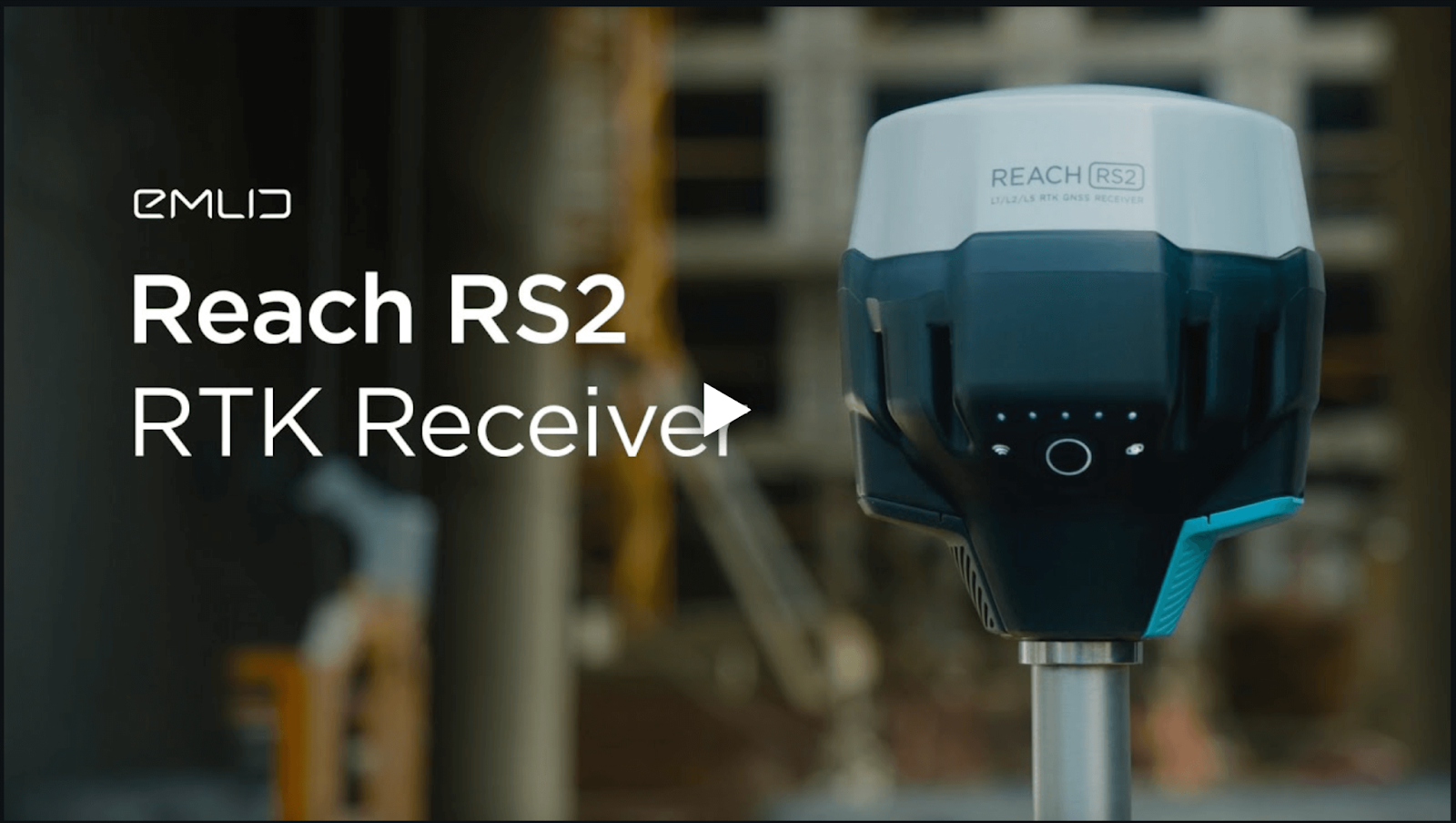
The Emlid Reach RS2:
- gets a fix in seconds
- centimeter-precise results in any place on Earth
- maintains robust performance even in challenging conditions
- achieves centimeter accuracy on distances up to 60 km in RTK, and 100 km in PPK mode
- operates for 22 hours on one charge for maximum robustness
- Greater independence as it doesn’t rely on an internet connection from a phone
The durability of the Reach RS2 complements the robustness of the Mosaic cameras. For example, the M51 is built to operate for a full day and in less-than-ideal weather and road conditions.
The Mosaic integration is being extended to the newly released Mosaic X as well. Both current and future Mosaic customers can now benefit from this integration.
Looking for a 360° mobile mapping camera that produces high-resolution images and also has centimeter-level accuracy? Look no further than the Mosaic 51.
Contact our team today for more details.


