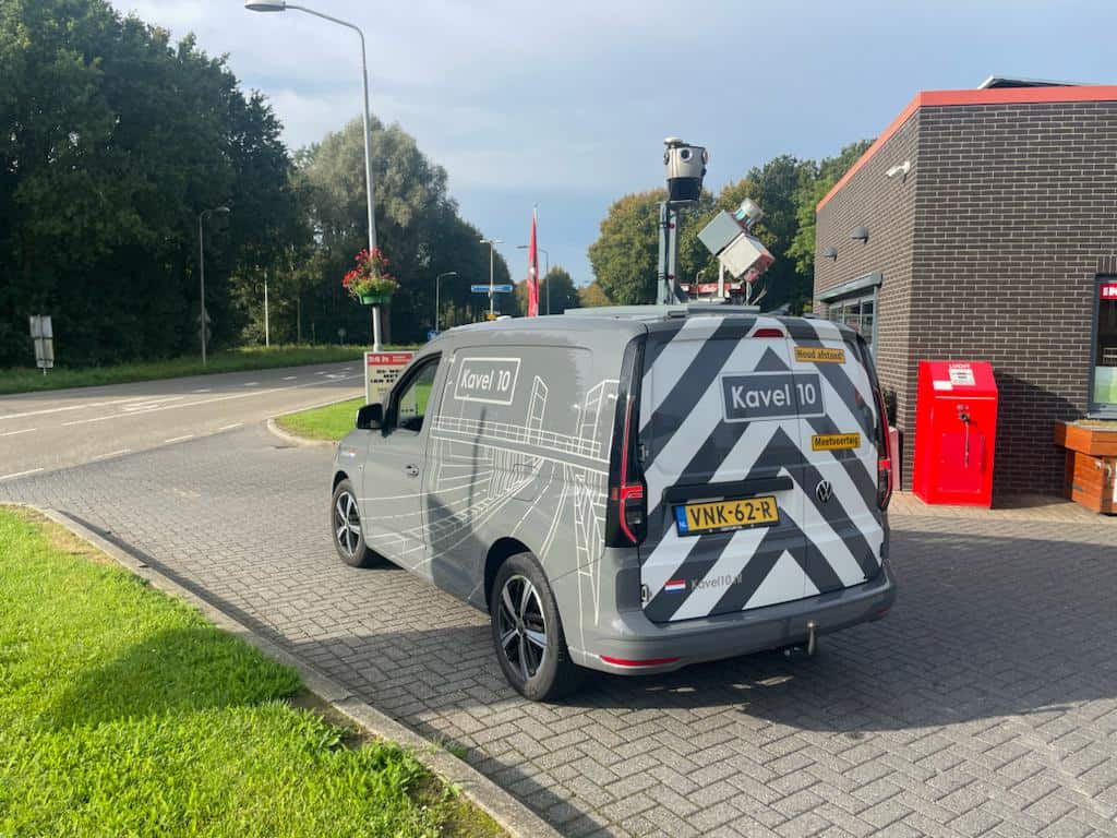
, Kavel10, Mosaic X camera, RIEGL scanner")
The Unparalleled Performance of Mosaic X: A Game-Changer in Efficient Data Collection and Operational Stability.
Introduction
In the intricate realm of engineering, Kavel 10 distinguishes itself through its unwavering pursuit of innovation and excellence. To enhance their data processing capabilities, the firm embarked on a quest for the ideal technological ally. The Mosaic X camera system surfaced as the top choice, revolutionizing Kavel 10’s process to colorize point clouds and establishing new benchmarks in the industry.
Numbers:
- Date of acquisition of Mosaic X camera: May 2023
- Projects done since:
- Around 2-3 smaller engineering jobs/week
- Around 3-4 municipalities per year
- Kilometers: around 6000-7000 km/year
- Savings: 1-2 hours ahead of having to fix the camera.

“I highly recommend the Mosaic X camera for its unbeatable stability and cost-effectiveness. Its robust design ensures zero operational downtime, a critical feature when working on highways. Since we started using it, we haven’t encountered a single failure. Plus, its user-friendly interface is straightforward, even for those without an engineering background, making troubleshooting a breeze.”
Ewoud Van Der Cruyssen, Technical Manager, Kavel 10
Who is Kavel 10
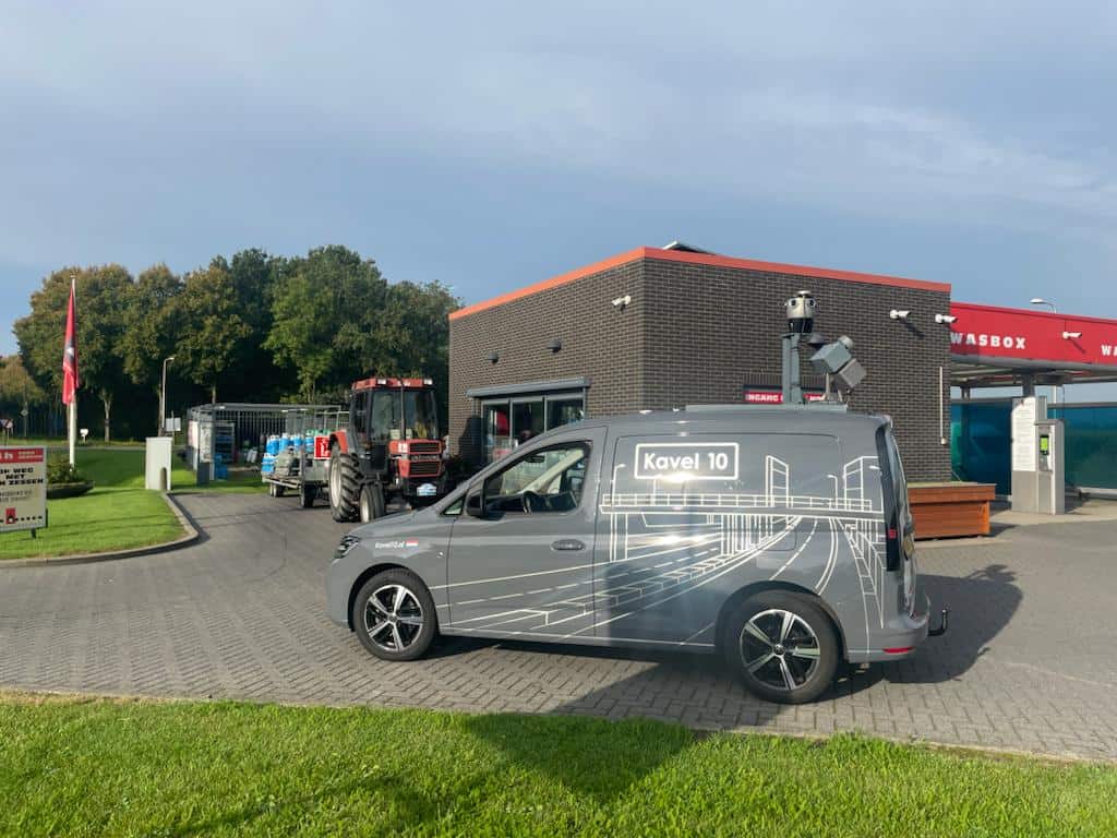
Kavel 10, a prominent surveying company in the north of the Netherlands, has expertise in both aerial surveying and mobile mapping. With a history spanning 6-7 years in the aerial imaging business, Kavel 10 has carved out a niche for itself, especially in projects ranging from significant city initiatives to infrastructure-based engineering assignments. Since May of 2023, they have integrated the Mosaic X camera into their operations, employing it extensively over hundreds of kilometers for various projects. As they continually evolve, the team of approximately 25 members at Kavel 10 is contemplating an expansion in their services, with the potential aim to cover panoramic images for the entire Netherlands.
What was the Challenge
Initially Ewoud from Kavel 10 articulated his decision to transition to the Mosaic X camera system after testing a variety of panoramic cameras over the years, each with their distinct limitations. These included challenges such as low resolutions, the presence of rolling shutters, and intricate user interfaces.
Additionally, before transitioning to the Mosaic X, Kavel 10 grappled with numerous setbacks brought about by their former systems. Despite testing a gamut of cameras, such as the Ladybug 3, Ladybug 5, and the NCTech iStar Pulsar, each posed its own set of challenges. These devices, lamentably, were notorious for their instability, frequently forcing operators into time-consuming shutdowns and restarts. This consistent disruption exacerbated operational impediments. Ewoud’s team had been in search of a more streamlined solution, ideally a compact system that obviated the need for external computers or bulky hard drives. Their quest was finally satiated with the Mosaic X camera’s standalone design, complete with internal storage, addressing the inefficiencies of their past devices.
Learn more about current mobile mapping camera systems here –>
Moreover, introduced as a newer entrant in the market, the Mosaic X camera captivated Kavel 10’s attention with its features like the global shutter, integrated CPU/GPU, and high-resolution imagery. While there was initial skepticism given Mosaic’s recent emergence in the market, the choice to adopt the Mosaic X has been validated by its exceptional stability, ease of operation, and significant reduction in the operational issues witnessed with prior systems, especially the frequent need to stop and restart equipment.
Where the Mosaic X Camera System Stood Out
- Compact & Standalone: Doesn’t require an external computer or external hard drives.
- Internal Storage: Convenient for storing data.
- Web Interface: Eliminates the need for external software to run the camera.
- Stability: No operational interruptions. Stable even during highway operations.
- Reliability: No failures reported since its acquisition in May.
“We were in search of a compact system that could stand on its own, without the need for external computers or hard drives and excessive cabling. With Mosaic, we found just that. Its internal storage and web interface eliminate the need for external software and hardware, making it an ideal solution for us.”
Use of Data and Sensors
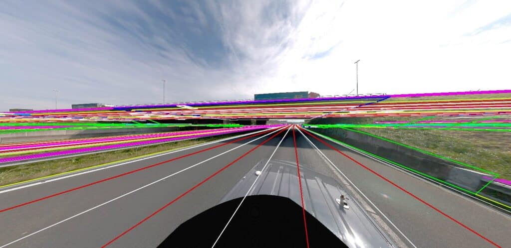
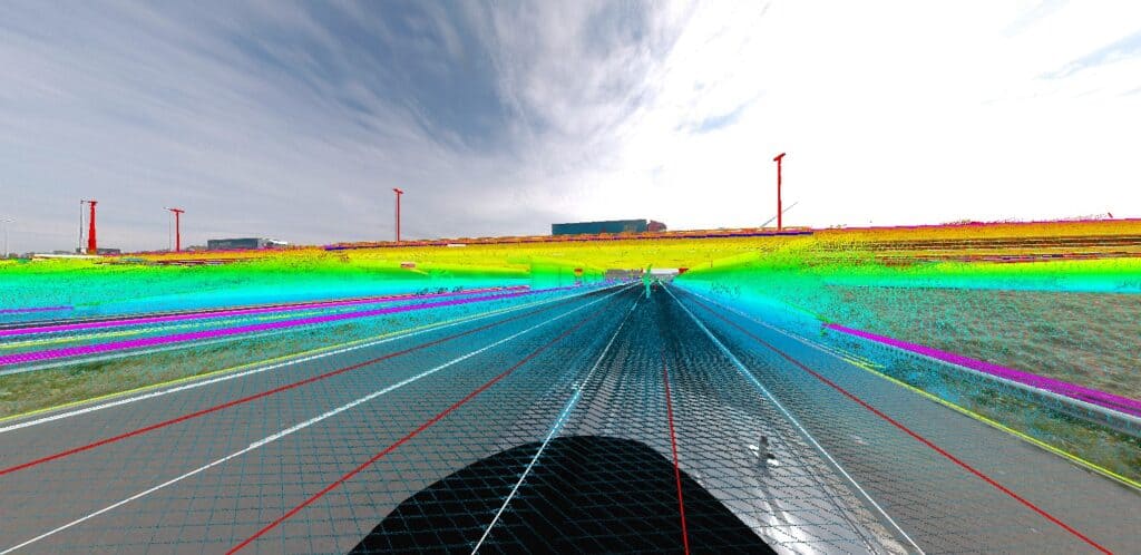
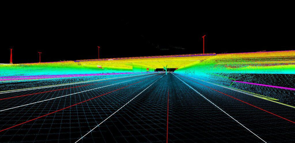
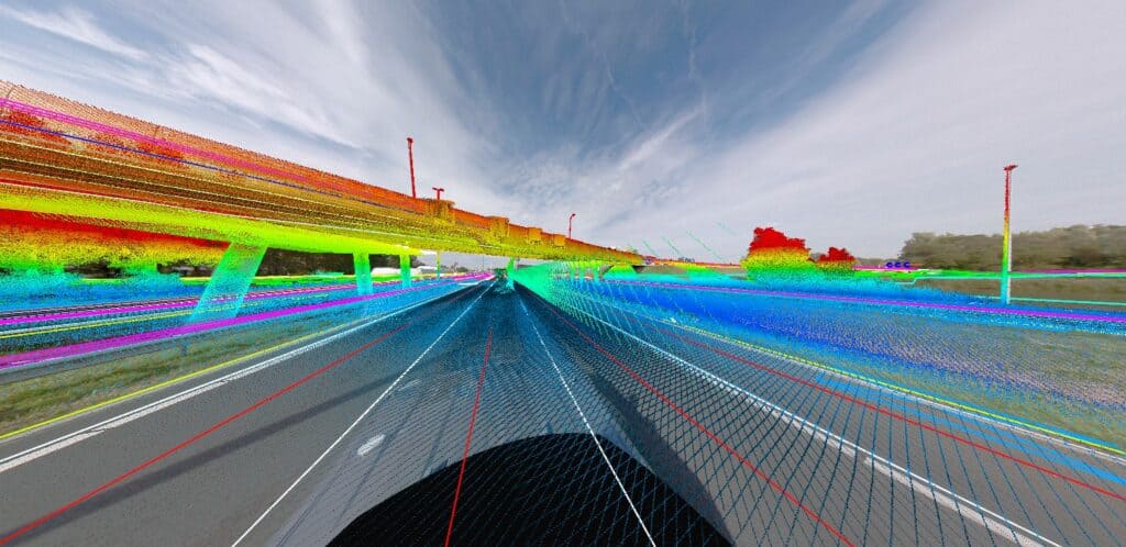
Kavel 10’s endeavors in data and sensors involve an intricate process of overlaying point clouds with images. Their current setup is a 3DLasermapping ROBIN system, distinct from the RIEGL VMX all-in-one system. It includes a 3D laser mapping system procured in 2017, integrating a RIEGL VUX Scanner, IGI FOG IMU, GPS, and other software elements. This setup is custom-built rather than a standard RIEGL configuration.
Learn about other Mosaic customers integrating the Mosaic X camera system with RIEGL LiDAR.
Historically, when it came to software, Kavel 10 relied heavily on Terrasolid for merging point clouds and images and had “Reality Capture” in their arsenal. The latter, however, presented challenges due to its inability to support a fish-eye distortion model, a pivotal feature for Kavel 10. Despite this setback, with the combined expertise of the Mosaic team and Terrasolid professionals, Kavel 10 triumphed over this hurdle, achieving high-precision colorization of their point clouds.
“Mosaic’s support team was especially vital in this scenario. We couldn’t have completed this process without them and really appreciate all of their timely and expert advice throughout the process.”
Since the acquisition of the Mosaic X camera system in May 2023, Kavel 10 has been using the camera extensively to colorize point clouds, with at least two smaller engineering projects per week, in addition to larger tenders.
Engineering Projects with Mosaic X
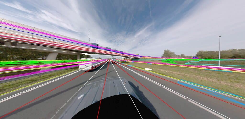
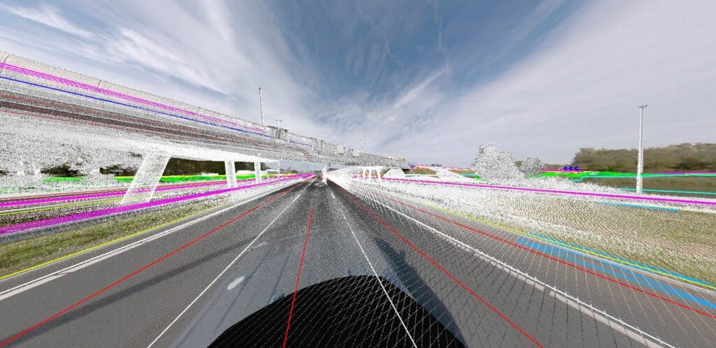
As previously touched upon, Kavel 10 is a leader in data acquisition for engineering, expertly merging aerial and terrestrial measurements. When using the Mosaic X Camera, they capture street-level imagery every 5 meters, valuable in airborne projects and municipal drives. This is useful in engineering as the camera aids in road maintenance and is used alongside a LIDAR-equipped vehicle for road redesign.
They annually collaborate with the City of Venlo near the German border and have contracts with 4-5 other municipalities. Despite stiff competition making some projects less profitable, they actively participate in large infrastructure projects, often around major highways. By combining aerial and mobile data, they document projects’ starting points, known as the “zero situation or as-built” and gather data again upon completion.
Thanks to their varied data sources, from aerial imagery to street LIDAR and GPS data from surveyors, provide comprehensive insights vital for construction. The initial “zero situation” data aids in tasks like asphalt assessment and design, influencing decisions on volume removal. Subsequent data, termed “as-built”, ensures contractual adherence and updates national maps.
From this data, Kavel 10 derives:
- Bare Ground Models: Combining street and aerial LIDAR data for foundational metrics.
- Linework Extraction: They offer precise CAD linework from their diverse data. More can be found at Kavel 10’s Digital Terrain Model page on their website.
- Asphalt Measurements: Insights into slopes and cross sections.
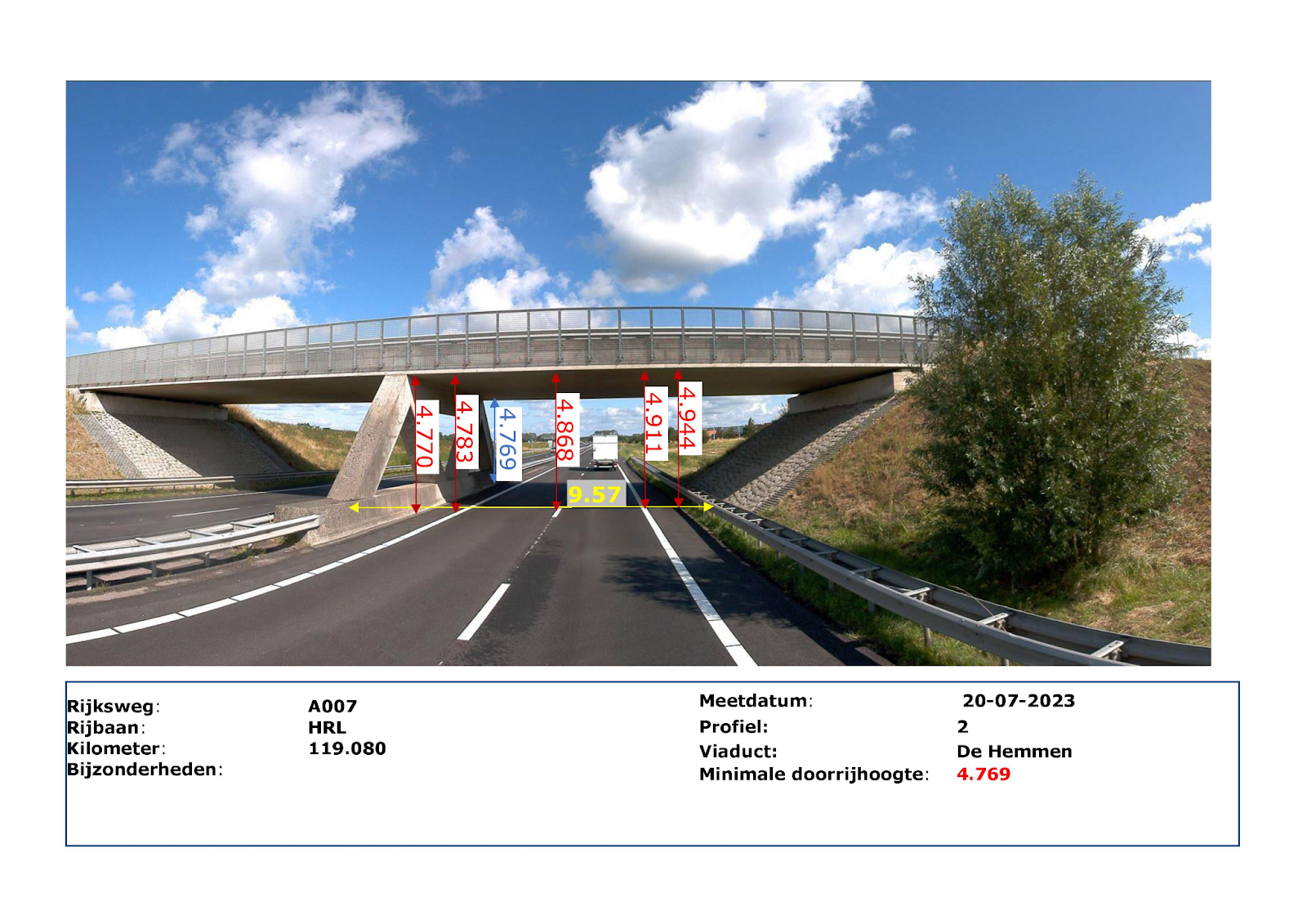
- Clearance Sections: Merging Mosaic imagery, it ensures government compliance.
Why High Resolution Matters
In the Netherlands, road maintenance relies heavily on precise data, especially when calculating the exact amount of asphalt replacement. This task involves intricate operations, such as scraping off specific layers of old asphalt before laying the new.
For these operations, the combination of LiDAR and high-resolution imagery is paramount. Without both, vital information could be lost or undiscovered, leading to errors in such projects, which can result in substantial costs, making the need for precision crucial.
Benefits of Mosaic X Camera
Stability and Reliability
Compared to their previous systems, which had frequent operational interruptions, the Mosaic X camera stands out for its stability. Consequently, these interruptions tended to cause delays of 1-2 hours daily. The robust nature of the Mosaic X has resulted in significant man-hour savings since its adoption in May 2023.
Ease of Use
Kavel 10’s drivers prefer the Mosaic X camera due to its straightforward operation. They find its interface intuitive, reducing the need for extensive troubleshooting. This simplicity ensures the drivers can focus on driving, prioritizing safety while capturing high-quality imagery.
Efficient Support
Mosaic’s customer support has left a positive impression on Kavel 10. They appreciate the quick response times, even outside of regular working hours, and the depth of knowledge the support team provides. This level of support stands out compared to other providers in the market.
Kavel 10’s Journey with the Mosaic X Camera System
“I see the potential for more projects in the future, possibly involving additional cameras.”
In the past several years, Kavel 10 has emerged as a powerhouse in aerial imaging. Noteworthy projects include their partnership with the City of Amsterdam to gather AI-essential lidar and imagery data for environmental detection. Their expertise also spans infrastructure and road maintenance across the Netherlands, with laser data being pivotal in ascertaining asphalt volumes for roads. They have made a name for themselves by capturing much of the Netherlands with oblique aerial imagery.
Boasting a dedicated team of 25 experts, Kavel 10 aims to expand their services, potentially capturing panoramic views of the Netherlands, while also assessing the practicalities of managing a vast vehicular fleet. Their continued growth and diverse projects highlight their market dominance and forward-looking vision.
Conclusion
Kavel 10 carefully chose the Mosaic X camera system. This decision transformed their operations. The system is renowned for its reliable performance, ease of use, and sturdy design. It plays a crucial role in gathering extensive data and enhancing how they colorize point clouds. The partnership with Mosaic exemplifies the blend of industry knowledge and advanced technology. As Kavel 10 further utilizes the camera and deepens its collaboration with Mosaic, the path is evident. Strategic investments focused on the future can elevate engineering firms to new success levels.
Looking for a mobile mapping camera solution that is reliable, robust and can integrate with external LiDAR?
Contact us today and find out more about the line of Mosaic mobile mapping cameras and how to colorize point clouds.


