")
Customer success story: From 6 months down to 10 days with Field Group’s newly devised mobile mapping solution combining Z+F Lidar, GNSS, IMU and our Mosaic X camera.
Field Group is one of Europe’s leading companies in aerial surveying, mapping, and land surveying. They are also the winner of the ‘Triple Crown’ in that they own all 3 models of Mosaic’s 360º mobile mapping cameras. (See more here.)
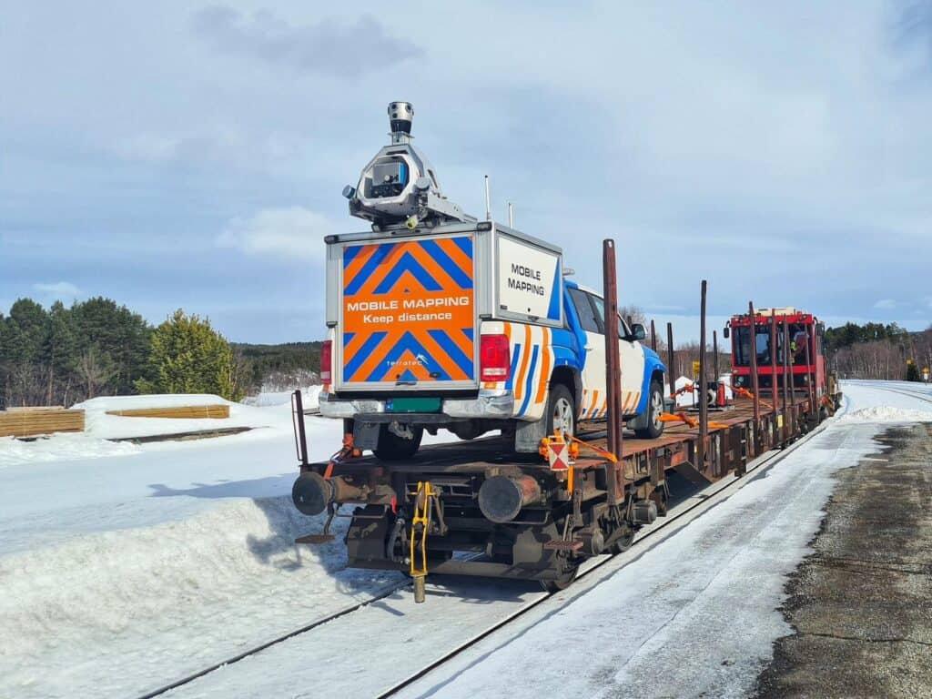
In one of their latest projects, they had to scan all of the non-electrified railways in Norway. They accomplished this by designing and developing their new state-of-the-art MMS combining LiDAR, GNSS, IMU, and a 360º camera.
Rail authorities in Norway need to know the location of the tracks with a horizontal accuracy of 10mm. This data should be measured annually to determine if and by how much the tracks are shifting. Temperature changes or the braking of heavy trains can cause movement on the tracks. Too much movement in the tracks can cause derailments; hence, it is crucial to monitor such movement.
Regular land surveys cannot achieve these results due to the many kilometers of rail tracks to cover. For this project, they needed to survey a total of approximately 1,400 km, both ways. Field Group developed a method that involved mobile mapping and a highly advanced post-processing workflow.
The scanning process
Field scans the tracks with a combination of several sensors. This included a very high-quality LiDAR unit from Zoller+Fröhlich (Z+F) which grants submillimeter accuracy. The generated point cloud is then geo-referenced using a combination of GNSS and IMU devices and post-processed with Field’s in-house built Terrapos software.
Terrapos take advantage of the many permanent GNSS base stations set up by the Norwegian authorities. The surveyors scan all of the tracks twice, after which the point clouds are matched using a very advanced algorithm called ‘Tpmatch’, which has also been developed in-house. Tpmatch utilizes all the available information from the point clouds and navigation sensors to achieve the optimal solution.
From the geo-referenced point cloud, they are able to measure the tracks with an absolute accuracy of about 8-10mm, which is within the specifications of the rail authorities.

“We have done several land survey campaigns to verify the result, and we see that in most cases, we are at about 4-6mm accuracy.”
– Kim Willem van Woensel Kooy, Field Product Manager
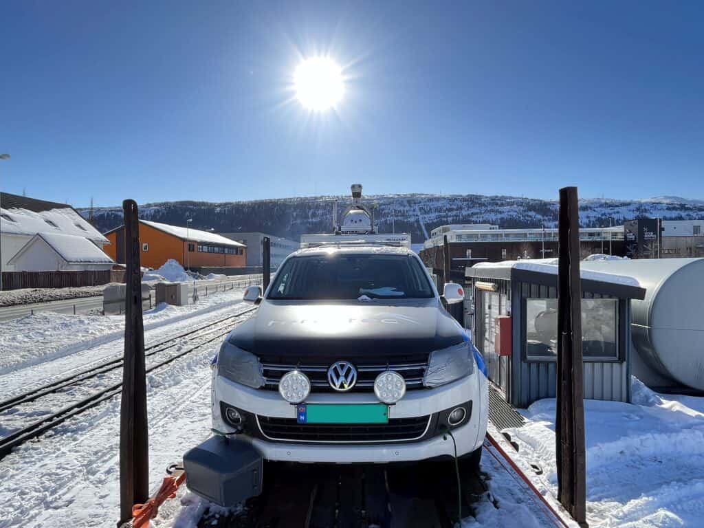
The MMS also includes the Mosaic X camera, one of our 360º mobile mapping cameras. Identifying some objects, such as signs, is easier using images rather than the point cloud. It is typical to colorize the point cloud with images as well. However, as the survey was conducted when the ground was covered in snow, this was not the case for this project. Another advantage of capturing image data is that the images can also be published in Field’s 360 web viewer, called Mapspace, enabling the customer to use the images to view or inspect their infrastructure.
The results
This newly devised mobile mapping rig and the method of data capture reduced the overall time frame of the project from a 6-month-long campaign to only 10 days of data capture and about 4 to 5 weeks of data processing and quality control.
Additionally, by traditional methods, the project would most likely require hiring all available land surveyors in Norway, according to van Woensel Kooy.
“Without this method, the rail authorities would actually not be able to do these kinds of measurements.”
As the project occurred under severe weather conditions, there is always a cause for concern regarding the functionality of the equipment in use.
However, Arkadiusz Szadkowski, VP Software Products, IT & Cyber Security, Field Group reported:

“The Mosaic X is operating very well in harsh Nordic conditions; it operated well in North Norway in the middle of winter. In extreme conditions, it has proven how robust it is and it can cope with tough conditions.”
For more information about Field Group and the services they provide their customers, visit: field.group
For more information about Mosaic and our robust 360º mobile mapping cameras, contact us below.


