
Mosaic Xplor
Unlocking hidden realms.
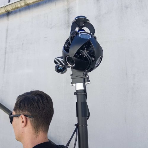
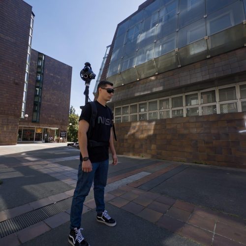
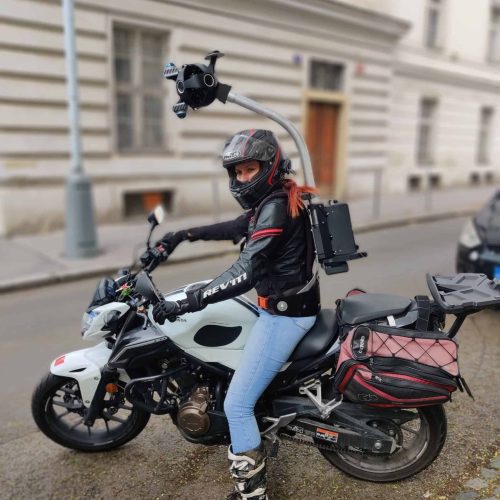
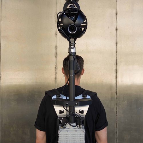
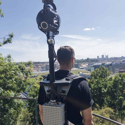
Backpack camera with 360º Mobile Mapping technology reshaping Geospatial, Surveying, and Entertainment.
Are you in the reality capture business and struggling with
Cumbersome Gear
Dragged down by heavy, awkward equipment?
Costly High Technical Demand
Need to train and use highly skilled surveyors for every job?
Setup & Capture Ordeal
Hours lost to complicated collection techniques?
Accuracy Trade-Off
Sacrificing photorealism and portability for unnecessary precision?
Site Restrictions
Facing difficulties with rough, narrow, or wet conditions and other environmental challenges?
Safety Limitations
Frustrated by the inability to survey hard-to-access and potentially dangerous sites due to stairs and ladders?
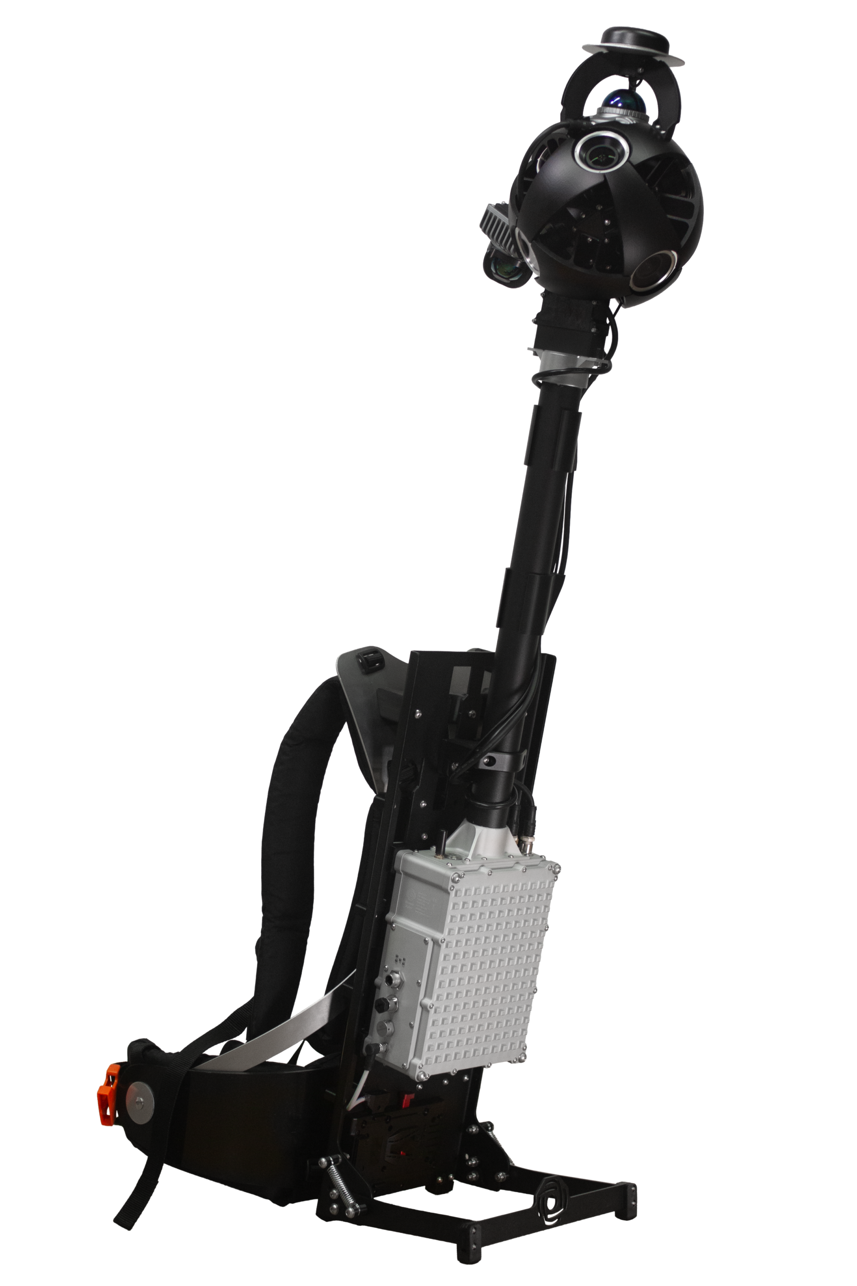
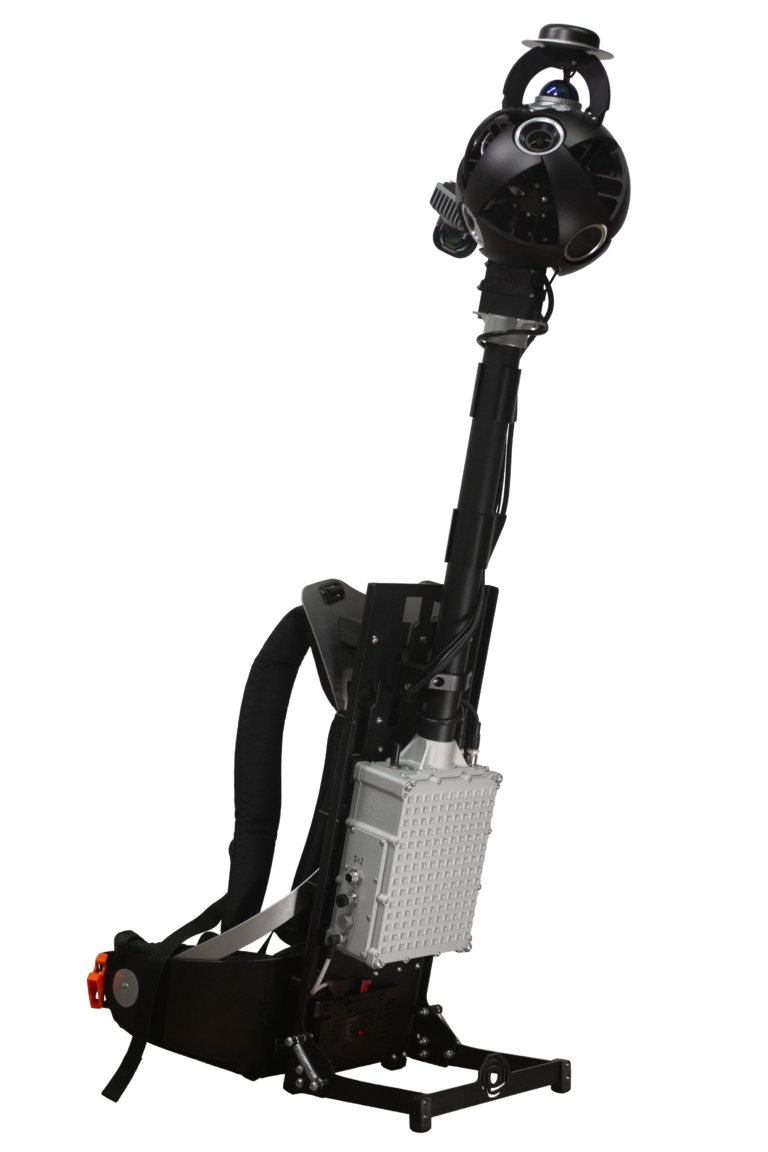
Introducing Xplor
Geospatial and 3D scanning game-changer!
Explore, capture, and analyze challenging-to-reach environments like industrial facilities, factories, pedestrian zones, and more. This European-made backpack camera features:
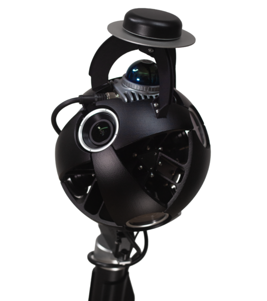
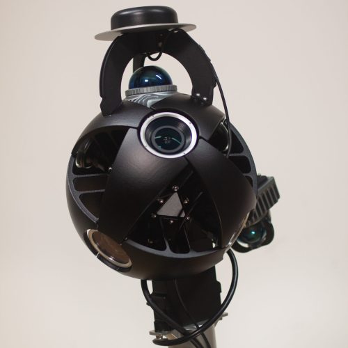
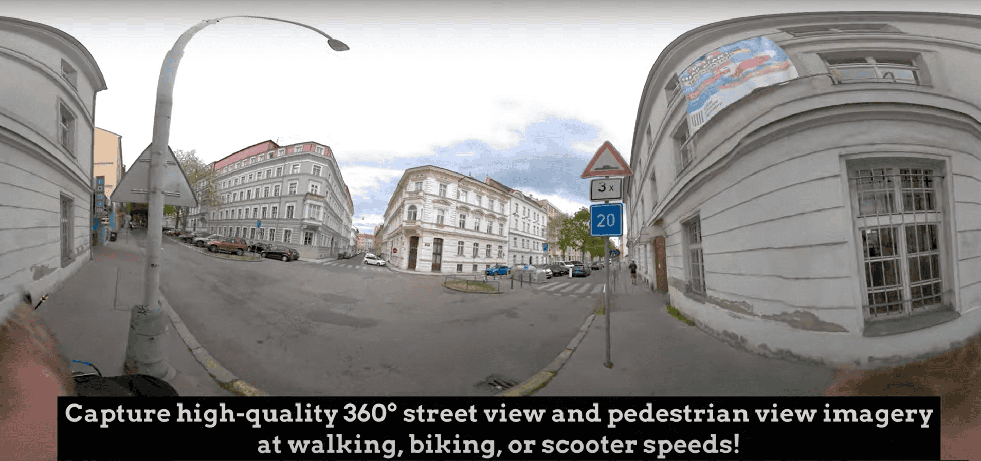
- Revolutionary 13.5K Resolution
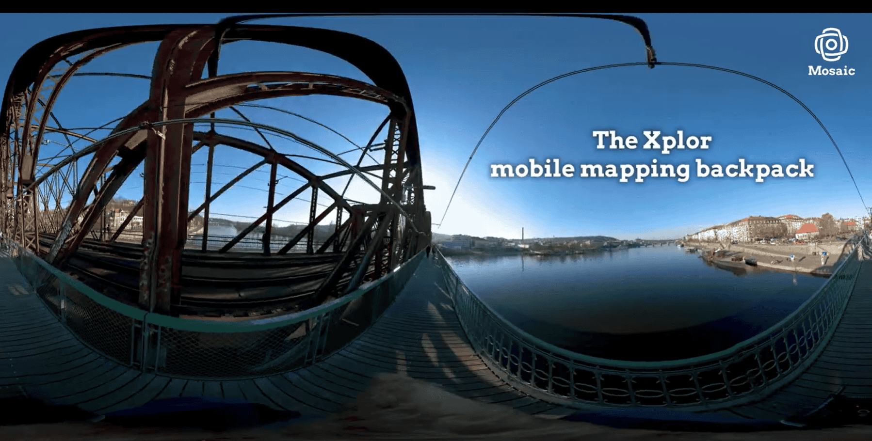
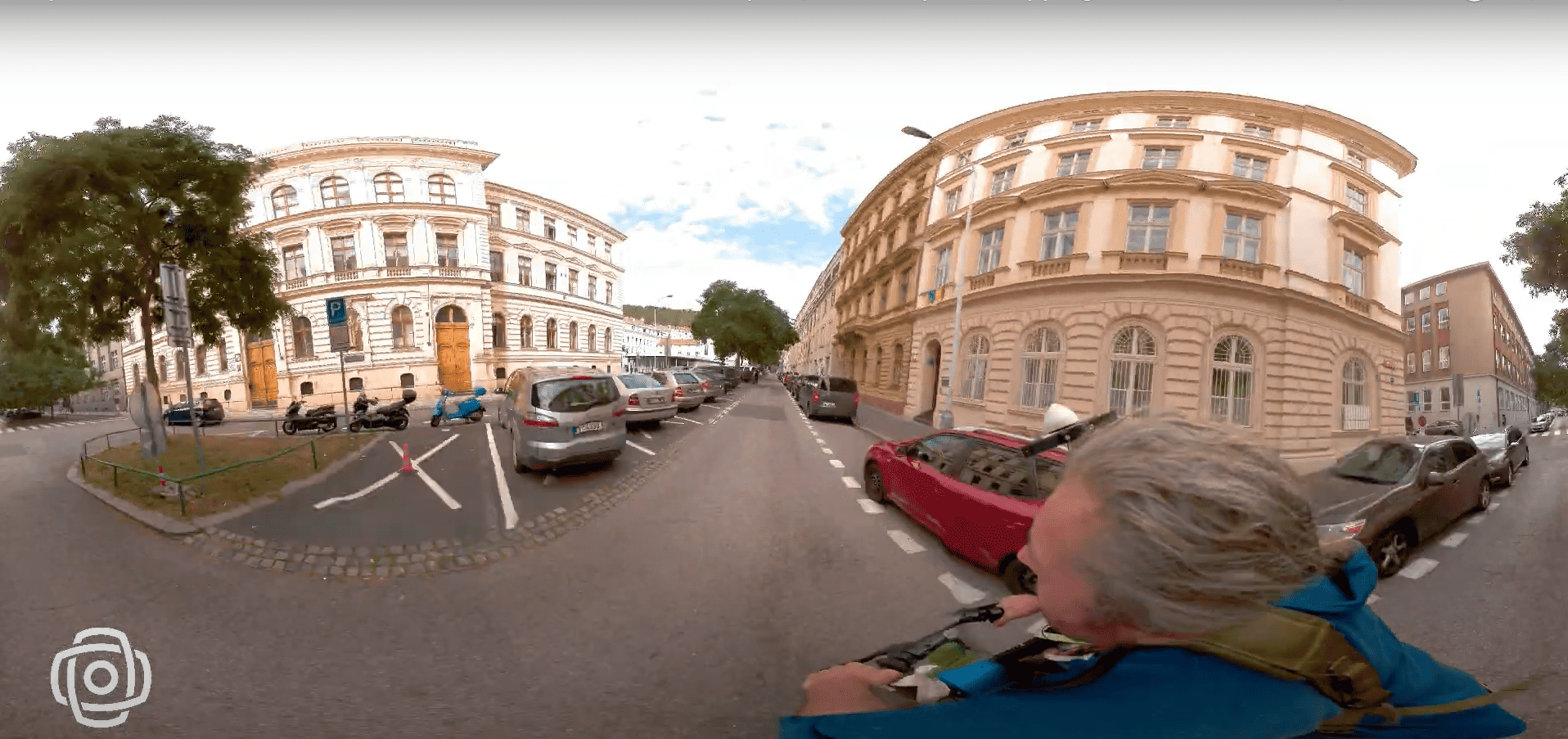
Redefines clarity with a groundbreaking 13.5K resolution for geospatial and 3D scanning. - 360º Spherical Panorama Capture
Panoramic perfection with complete spherical coverage without blind spots! - Cutting-Edge 360º x 120º LiDAR Capture
Lighter and more portable than ever combining image and 3D scanning devices into one backpack. - Versatile Scanning Power
Versatile scanning capabilities to easily survey spaces not accessible by larger vehicles or devices, on the go.
With the Mosaic Xplor, you get:
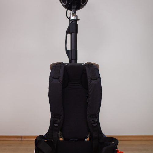
Ultimate Portability and Comfort
Enjoy a lightweight, ergonomic design that ensures hours of comfortable use for extended surveying sessions
Efficient and Intuitive Control
A user-friendly interface anyone can master quickly, combining world-class optics and LiDAR in a single, budget-friendly device
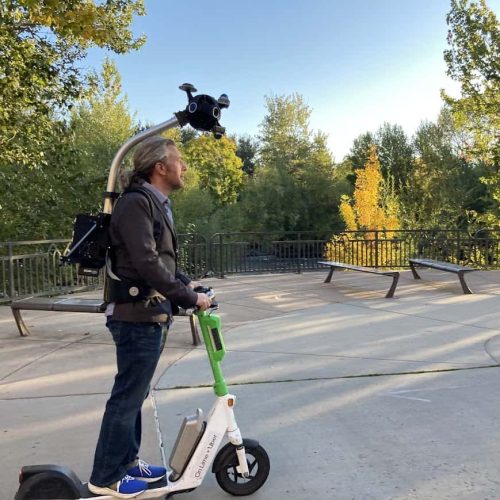
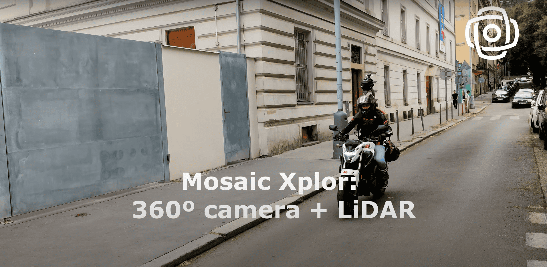
Sped-up Data Capture
Seamlessly collect data while in constant motion, including walking, or on a scooter or biking, without pausing for photos.
Unmatched Detail
Reality captured in unprecedented resolution with high-resolution cameras and LiDAR technology.
Rugged Reliability
Built to withstand the elements, the Xplor is your trustworthy companion in any adventure, across any terrain.
Flexibility & Safety
Securely ascend and descend ladders or stairs with a hands-free device, exploring high-risk scenarios with ease.
See who is benefiting
Industries and professionals transforming their work with our technology
- Architects, Engineers, and Contractors (AEC)
- Visual Effects (VFX) professionals
- Urban mappers and surveyors
- Forest, hiking, and park enthusiasts – ideal for areas inaccessible by vehicles
- Industrial park workers – perfect for navigating ladders, stairs, and other structures
Discover Real Customer Success Stories
There’s no better testament to product quality than real customer experiences. Delve into our case studies to explore the challenges we’ve successfully addressed!

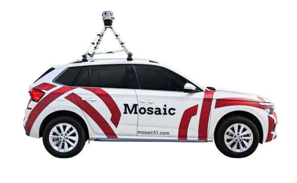
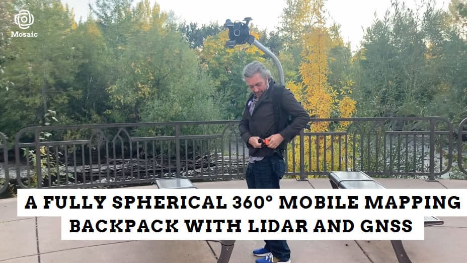
Go anywhere with the Mosaic Xplor Mobile Mapper
Want to See How Mosaic Cameras Are Used in the Field?
Access our case studies pack featuring real-world examples from customers using Mosaic Xplor and other Mosaic 360 cameras across different industries and environments.
What you can look forward to
Geo-referenced 13.5K Resolution Panoramas
The future of panoramic imaging with Mosaic Xplor's ability to produce 13.5K resolution spherical panoramas, for unrivaled visual quality and coverage.
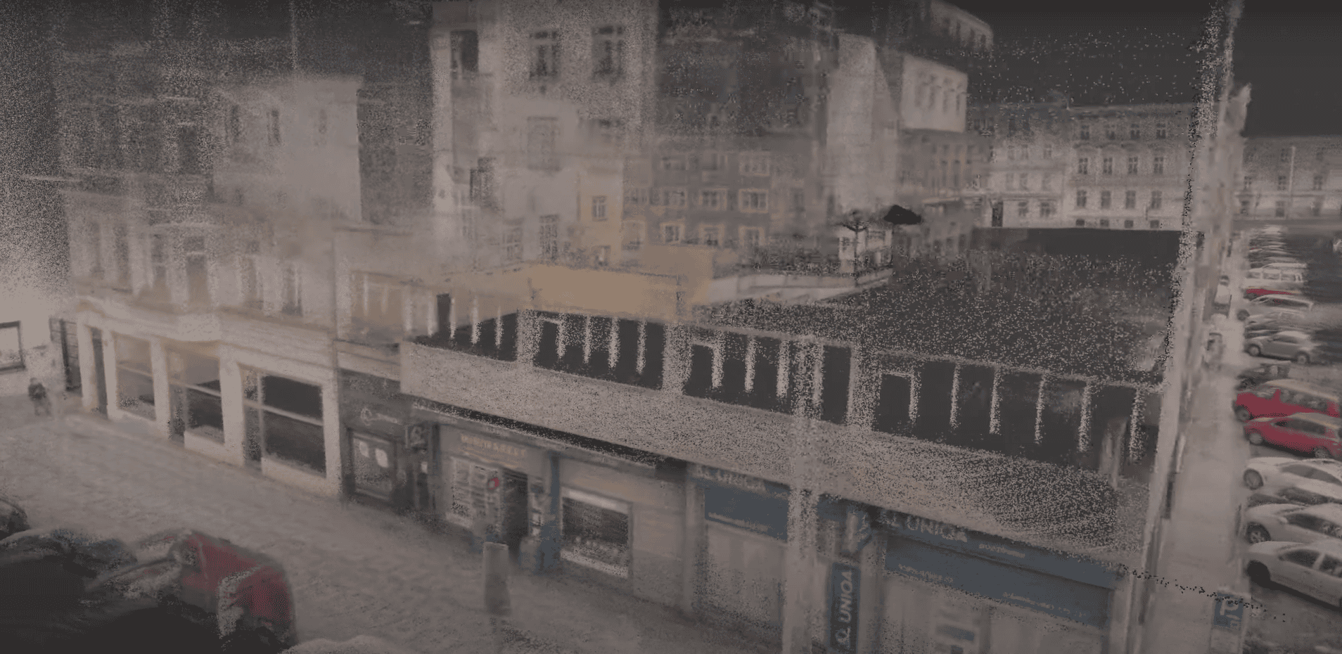
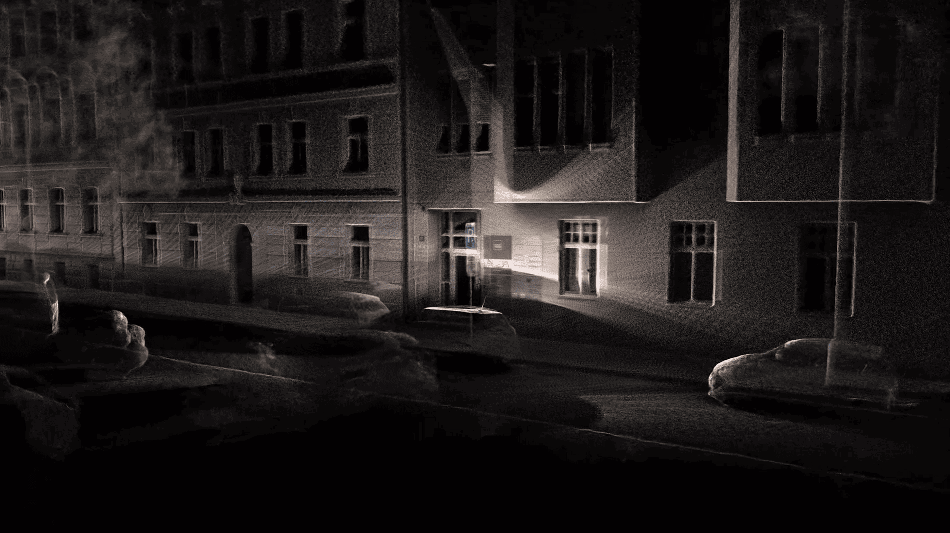
Precise (Colored) Point Clouds
Achieve exceptional accuracy with point clouds boasting 5cm accuracy and 3 cm precision. Our device captures detailed data in both color and depth.
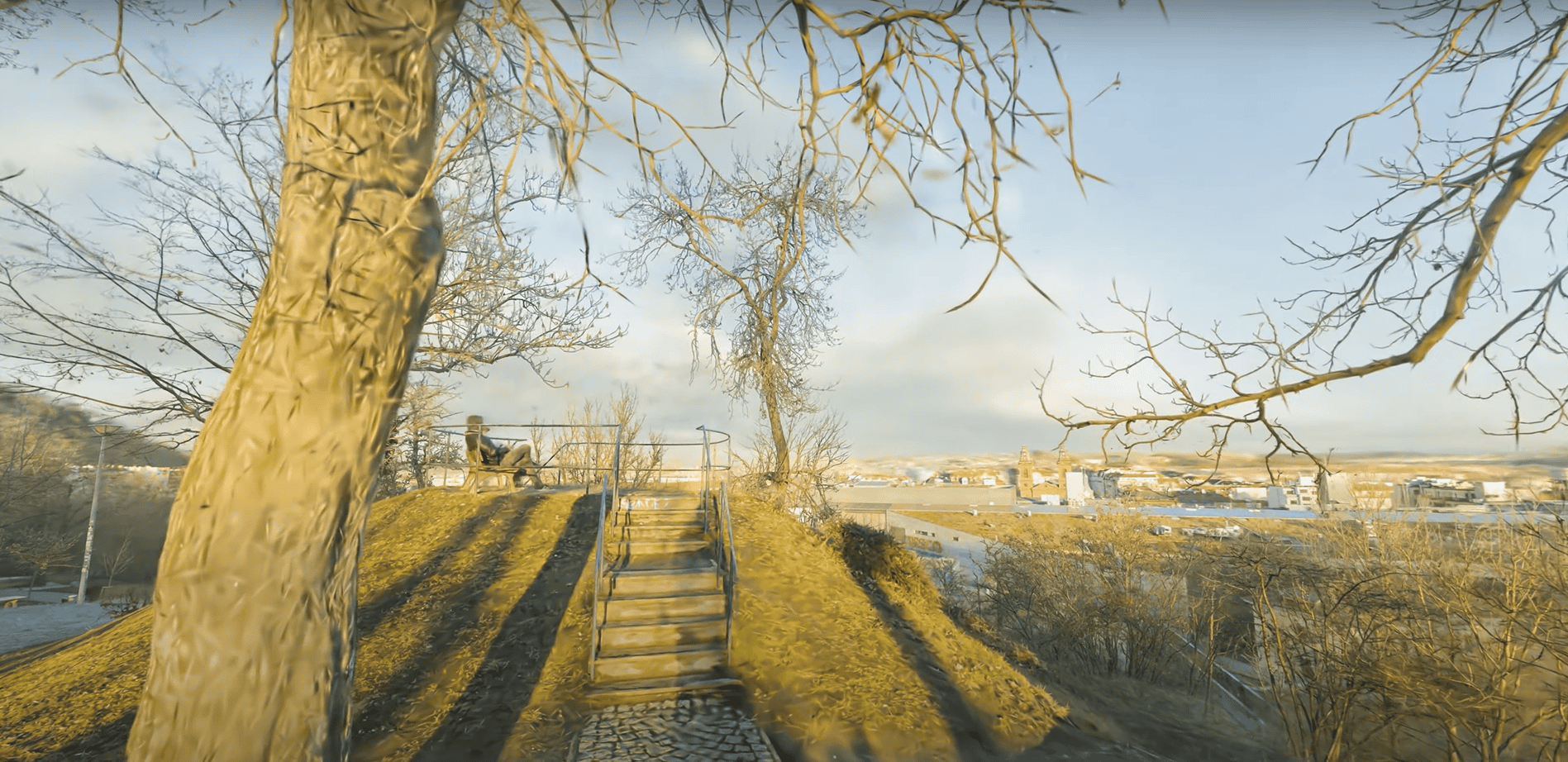
Detailed Textured Mesh Models
Transform your scans into highly detailed textured mesh models, offering a comprehensive view of your surroundings.
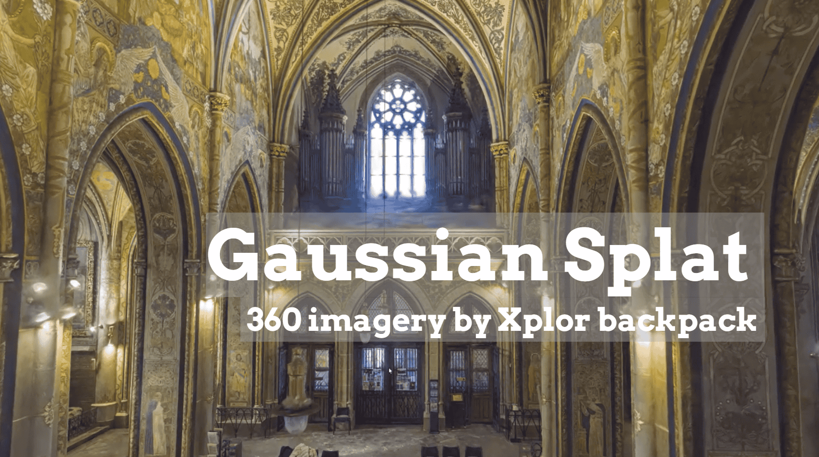
3D Gaussian Splats and NeRFs
Utilize advanced 3D Gaussian splats and NeRFs for comprehensive data analysis, helping you unlock new insights from your scans.
The Mosaic Xplor in Numbers:
Optimal speeds
Capture at up to 25 km/h (15mph). Suitable for foot, bike, scooter, and car within city limits.
Light-weight system
All-in-one,compact unit weighing 8 kg (17lbs), with only 2.5 kg (5lbs) overhead.
Data capture
400,000 points per second via two LiDARs, precise within a 40-meter range.
3D models & 3D reconstructions - see the possibilities
")
")
Data processing optimized
Efficient 3D Model Creation
Mosaic Xplor accelerates 3D model creation with precise image localization, significantly reducing processing time and enhancing photogrammetric efficiency.
Unmatched 3D Detail
With a unique combination of LiDAR and 6 global shutter image sensors, achieve an unprecedented level of detail, comparable to laser profiler systems costing 10x more.
Freedom in Data Integration
Non-vendor locked data enables effortless integration into your preferred software, granting you the flexibility and financial independence to optimize your resources.


