
Did you catch Mosaic at Geo Week 2026?
For the fifth year in a row, Mosaic joined thousands of other geospatial experts at Geo Week 2026, which took place on
For the fifth year in a row, Mosaic joined thousands of other geospatial experts at Geo Week 2026, which took place on

How PLACE and Mosaic are reshaping cadastre, tax systems, and climate resilience across five countries

Mosaic is proud to announce a new partnership with Spatial Data Analytics Inc. for SOLV3D. Data captured with any Mosaic mobile mapping

When UCLA and the University of Hawaii’s research programs need high-resolution 360° imagery of wildfire aftermath, they turn to Mosaic cameras.
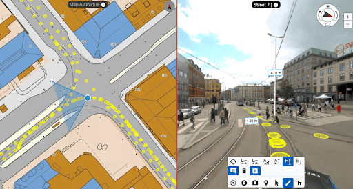
Navigating road and infrastructure surveying doesn’t have to be difficult. Learn how to use open source solutions like Google Street View or

Find all your FAQS about Mosaic here! Asked and Answered.


