
Prague, Czech Republic, and Ankara, Turkiye
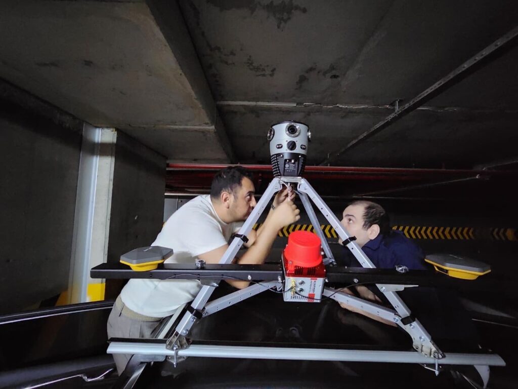
Mosaic is expanding its reach in the Turkish, Central Asian, and Middle Eastern markets through Geolab, a provider of comprehensive geospatial solutions for over a decade. As a Mosaic partner, Geolab is extending its range of geospatial products by offering a modular and scalable solution for growing companies. Mosaic cameras and MLS systems are also built to master the harsh climate conditions often found in these regions, where temperatures regularly exceed 40° C (104° F) in the summer.

Geolab helps public and private sector organizations make accurate, data-driven decisions for infrastructure planning, transportation optimization, urban management, and spatial analysis. Among their suite of services, they:
- Conduct 360° panoramic imaging through mobile mapping to collect points of interest along road networks,
- Integrate 360° imagery with LiDAR data to generate precise point clouds and 3D street and space models that seamlessly integrate into GIS systems,
- Deliver traffic analytics (delay analysis, average speeds, vehicle counts, and estimated arrival times) based on both historical data and real-time information
- Offer utility network solutions for comprehensive management of water and infrastructure assets, and
- Support real-time monitoring, advanced TRACE analysis, editor tracking, branch versioning, and intuitive visualization for smarter operational decisions.
Geolab’s customer base and the broader market also have unique challenges that Mosaic mobile mapping systems are ready to tackle. These include tough terrain, blistering summers, and remote areas with sparse signal, where it may be difficult or time-consuming to get replacement parts or wait for malfunctions.
“Having a 360° camera doesn’t mean anything if it malfunctions when you need it the most. We’re proud to design tough cameras that are built around an industrial frame with sealed connectors and housing. We’ve tested them to IP-67 for water, dust, heat, and vibration. Take your Mosaic camera into deserts, remote areas, and on uneven surfaces without fear of failure.”
-Jeffrey Martin, CEO of Mosaic
With offices in Turkiye, Dubai, and Azerbaijan, Geolab is a regional partner with a wide geographical reach. Their team combines expertise in satellite imagery analysis, GIS-based utility mapping, surveying, and spatial data solutions. They bring over 11 years of professional experience in satellite imagery and GIS-based solutions, supported by team members with up to 15 years of individual expertise.
When we spoke to Yener Turkmenoglu, CEO at Geolab, about the new partnership, he had this to say:
“Partnering with Mosaic enables us to deliver high-resolution 360° mobile mapping solutions that are fast, accurate, and scalable. Their seamless integration capabilities strengthen our technology offering, give us a competitive edge, and open access to new market opportunities. For our customers, this means higher-quality data, faster project delivery, lower operational costs, and more reliable insights for better decision-making.”
About Geolab
GEOLAB Information Technology is a Turkiye-based engineering and technology company specializing in Geographic Information Systems (GIS), transportation analytics, and geospatial data solutions. Founded in 2015, GEOLAB develops data-driven systems that help cities, institutions, and organizations manage infrastructure, mobility, and spatial information more efficiently. The company provides solutions including mobile mapping and field data management, traffic and transportation analytics, infrastructure information systems, geospatial visualization, and satellite imagery services. By transforming complex spatial data into actionable insights, GEOLAB supports smarter decision-making and digital transformation for both public and private sector organizations.
Press Contact:
GEOLAB Information Technology
About Mosaic
Mosaic is a leader in 360-degree camera technology, providing high-resolution, high-speed imagery solutions for a variety of industries, including mapping, surveying, and infrastructure management. Mosaic’s cameras are known for their ease of use, high image quality, and ability to seamlessly integrate into diverse workflows, offering flexibility and precision for any project.
Press Contact:
Lynn Puzzo, Director of Sales and Marketing


