Hurricane season is back in full swing. How is our technology improving emergency response times?
It has been one year since Hurricane Helene made landfall in the southeastern United States. The storm left widespread destruction, particularly in the Big Bend region of Florida and extending into North Carolina. Communities are still facing the long road to recovery.
As another hurricane season is currently underway in the US, the lessons from Hurricane Helene remain urgent reminders of the importance of fast, accurate, and shareable visual data.
Fast response times matter
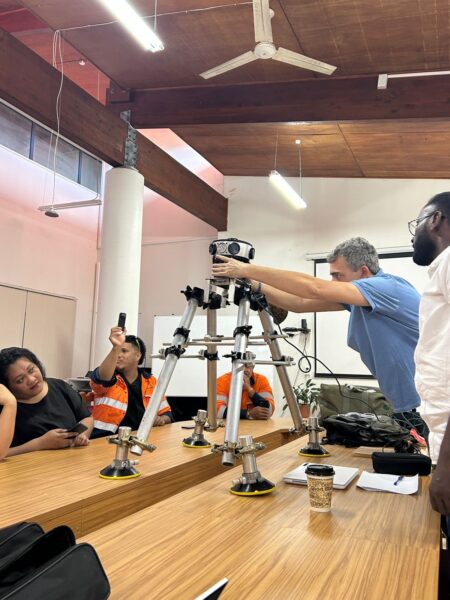
In the days following Hurricane Helene, Site Tour 360 deployed the Mosaic X 360° camera system to document the damage on the ground. Almost immediately after the storm, the camera captured high-resolution, street-level imagery across affected towns. This data provided an almost-instant visual record essential for responders and recovery teams.
A single operator easily captured data with the Mosaic X mobile mapping camera and a standard vehicle. Quickly capturing real-time data meant emergency personnel had the information they needed to perform life-saving tasks when every minute counts.
Data distribution: Helene24
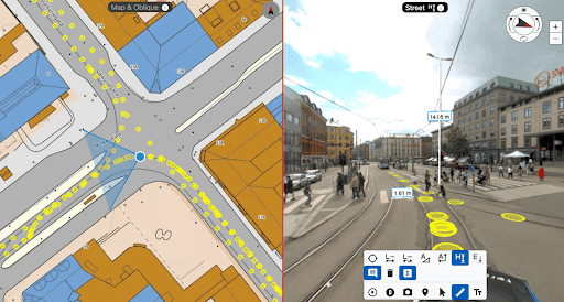
To make this data quickly and widely accessible to emergency responders, Dylan Faraone created helene24.com. This interactive platform allows users to compare Mosaic’s post-storm imagery with pre-disaster Google Street View scenes and an aerial map.
It combines 360Camsters image data (captured with the Mosaic X), historical Google Maps street-view data, and a Mapbox map. As demonstrated in the video below, if you move one element of the program, the other two also react simultaneously.
This simple but powerful tool helped emergency personnel, local governments, and citizens visualize the scale of destruction, a crucial step to prioritizing recovery efforts street by street. It is a model for presenting time-sensitive geospatial data for future storms, especially for those who are not regularly interacting with geospatial data software.
Why speed matters
In disaster response, time is everything. Getting imagery processed and published within hours or days (not weeks!) can make a direct difference in how effectively emergency teams deploy resources.
This can involve immediate human rescue missions and road-clearing strategies, as well as determining whether to declare a state of emergency and send in state and federal government resources.
Insurance companies also rely on fast, high-quality visual documentation. They need live and accurate data to assess claims, validate damages, and accelerate financial relief to affected residents and business owners.
Disaster-proof documentation
Mosaic’s lineup of mobile mapping systems is for exactly these moments. These 360° cameras enable organizations to collect and deliver actionable data almost immediately after events like Hurricane Helene. They are:
- Easy-to-use: Our high-resolution cameras are quick and easy to set up. They fit on any vehicle (or backpack, as is the case with the Xplor), and a single driver can collect data with minimal training.
- Tough: Despite their high resolution, they are incredibly rugged. The Mosaic X, used for Hurricane Helene, is IP67-tested and ready for uneven pavement, dirt roads, and hot and humid conditions.
- Yours: Non-proprietary data formats mean you can use the image processing software you’re already an expert at using. You also own your data, forever. Go back and compare imagery as often and for as long as you need.
When disaster strikes, the faster we can see the full picture, the faster communities can rebuild. Join us on that journey and follow how Mosaic is revolutionizing hurricane disaster response times.