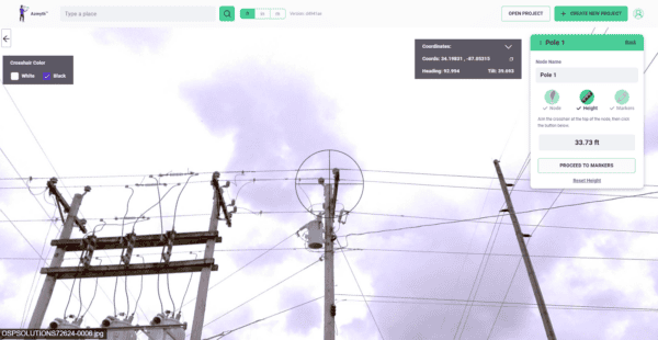
Transforming Utility Pole Inspections with Mosaic X Camera System
Learn how high-resolution 360° imagery, paired with Vulcan’s Azmyth platform, slashes costs by 70% and speeds up project timelines, setting new standards
Learn how high-resolution 360° imagery, paired with Vulcan’s Azmyth platform, slashes costs by 70% and speeds up project timelines, setting new standards

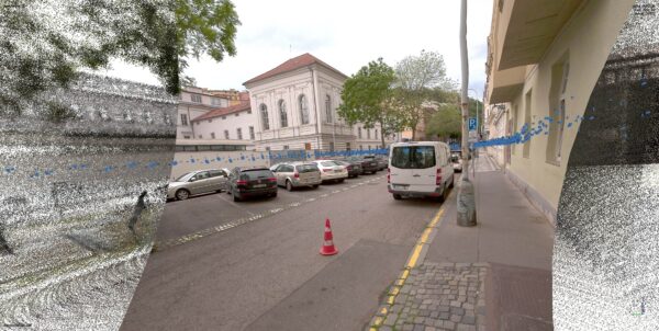
Discover how 360° camera and LiDAR backpack technology overcomes the limits of traditional reality capture devices, providing high-resolution data even in the

HD mapping combined with real-time data is key to improving road safety and enabling autonomous driving. By providing precise, centimeter-level accuracy, these
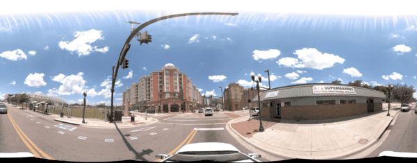
Discover how the Orlando Downtown Development Board used the Mosaic 51 camera to cut data capture from two weeks to three days,
Accurate mobile mapping depends on precise positioning for a good trajectory. This article discusses trajectory creation, LiDAR vs photogrammetry accuracy, and the
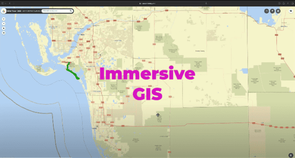
Learn about the cutting-edge applications of 360 imagery in GIS, enabling more precise and efficient project management, disaster response, and environmental monitoring.


