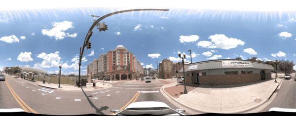
Building a 3D Model of a City: Mapping Orlando with the Mosaic 51
Discover how the Orlando Downtown Development Board used the Mosaic 51 camera to cut data capture from two weeks to three days,
Discover how the Orlando Downtown Development Board used the Mosaic 51 camera to cut data capture from two weeks to three days,
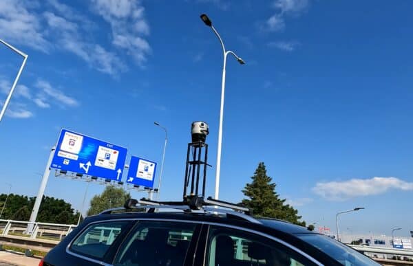
The role of 360° cameras is crucial in creating precise, geo-referenced 3D maps and highly lifelike digital twins. What urban insights with
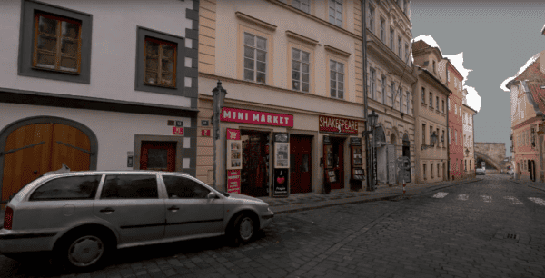
Quick and cost-efficient method of collecting high-quality, photorealistic images of infrastructure, roadside assets, utility and telecommunication assets for inspection purposes.

If you are curious about just how sustainable mobile mapping is and why or how it can contribute to a greener future,


