
Prague-based mobile mapping and geospatial leaders – Mosaic – helped in the pre-production of ‘The Gray Man,’ a 2022 blockbuster
Mosaic’s cutting-edge mobile mapping technology facilitated the VFX studio’s needs

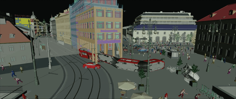
During the pre-production data collection phase of The Gray Man, the 2022 hit starring Ryan Gosling and Chris Evans, VFX studio Scanline reached out to Mosaic for assistance in data capture of the streets of Prague. Mosaic is a leader in 360° hardware and geospatial solutions. Their ability to capture and create large-scale 3D models and reconstructions with their line of 360° mobile mapping cameras caught the eye of Bryan Grill, a visual effects supervisor with Scanline.
Grill is a well-known and respected VFX supervisor. With over 25 years in the industry, he has been nominated for three Academy Awards and one BAFTA award. He is best known for his recent work in “Free Guy” with Ryan Reynolds and several Marvel superhero movies.
VFX meets Geospatial & Mobile Mapping
After seeing the work achieved by Mosaic’s state-of-the-art 360° mobile mapping cameras, Grill reached out to Mosaic CEO Jeffrey Martin. He inquired about the possibility of using this cutting-edge technology to assist in capturing street-level data for The Gray Man.
I had seen some of Jeffrey’s work online and immediately saw the potential for what he and his company is doing with what we are dealing with in the VFX world – mainly the difficulties of capturing large environments and large data sets, easily, quickly and at a reduced cost.
Bryan Grill, visual effects supervisor
The Initial Goal: Quickly Capture Geo & Photos
Grill explains that he was looking for a better and more efficient means of capturing the required data to create a quick representation of the geometry and have photography that lines up with that ‘geo’.
Previously, Grill and Scanline (and presumably other VFX studios) have used a workflow that was labor and time-intensive. When covering such large areas, their usual technique requires LiDAR and photography. This combination creates geometry, which then has to hand-match the pictures. They then add the geometry, which adds considerable time, labor, and costs.
Here’s a shot breakdown:

The Solution: State-of-the-art Data Capture
With Mosaic’s mobile mapping camera rig, the Mosaic team was able to get thorough coverage of large areas much quicker than previously. It also took a relatively short amount of time to capture the scene. This limits the lighting changes in the scene from the sun.
Post Production Solutions
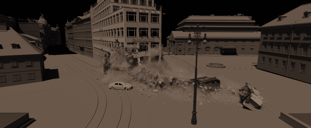
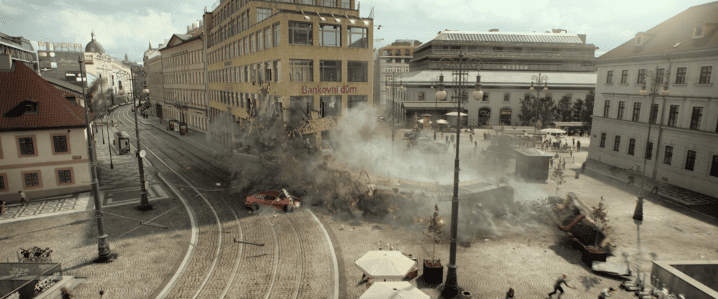
Additionally, following filming, Scanline usually gets the plate shots from the client and creates a 3D track from these. Plate shots (or ‘plates) are images of the background, without any actors or other subjects in view. They then create a composite (or plate composite) in post-production.
Again, this process is very labor-intensive/time-intensive, and with the timeline and budget, Scanline needed a faster, easier, and more cost-effective method.

But due to the 360-degree environment, they were able to line it up to where they wanted it on the first frame and set the keyframe, let the camera go, and adjust the position (tilt, pan) and set another keyframe.
Scanline created over 400 temp comps, along with 2D tracking. This helped the filmmakers design their final edit.

What this means for the future…
…of both VFX and mobile mapping / geospatial data collection.
I do think this will be very useful to many studios very soon, and it will be the next big tech for VFX and gaming…..it opens a lot of possibilities for innovative solutions in VFX (and similar industries) in the very near future.
Grill
With the latest trends of creating Digital Twins, Smart Cities, and Reality Capture, companies like Unreal Engine and the Metaverse are creating large-scale scans. These Megascans are becoming very popular. In order to feed these platforms, a new system of collecting data and processing it is necessary.

Mosaic seems to be on the front line of this new trend and is setting itself up to lead the way with the cameras, computer vision expertise, and team of engineers and software developers.
With the power of Photogrammetry and UE5, and the highest caliber data collected by our mobile mapping cameras, it’s possible to offer the world’s fastest, easiest, and best large-scale 3d asset creation system, including TV/film production, VFX, video games, surveying, BIM, asset inspection, telecommunications, and infrastructure inspection.
Jeffrey Martin, Mosaic CEO


