Mosaic Xplor is set to redefine the landscape of geospatial and 3D scanning with its groundbreaking 360º Mobile Mapping Backpack Camera + LiDAR.
Last week, during the INTERGEO Expo and Conference, Mosaic introduced a new model to its camera lineup. This sleek, compact format is designed for exploring the most inaccessible places while upholding Mosaic’s renowned quality and reliability standards. One visitor called it “a really interesting twist on the market norm.”
This cutting-edge technology empowers users to explore, capture, and analyze challenging-to-reach environments with the highest-resolution laser and photogrammetric scanning. It is unlocking a world of possibilities in geospatial, industry, and entertainment applications.
“Our newest product – the Mosaic Xplor – was well-received at Intergeo last week, with many visitors excited at the opportunity to maintain the high optical quality and image outputs associated with our Mosaic 360 cameras with the added benefits of LiDAR as well as the increased mobility and coverage that will come from being able to truly explore anywhere by foot or bicycle.”
Jeffrey Martin, CEO of Mosaic
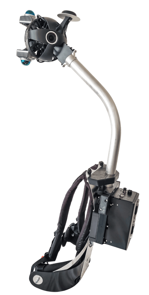
Where the Mosaic Xplor stands out from the competition lies in both the packaging and the outputs.
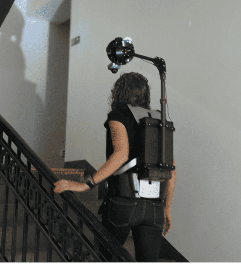
In high-risk scenarios, hands-free functionality translates to maintaining stability while exploring previously inaccessible areas. For example, ascending and descending ladders are now easier with the Xplor. The device also enables fast data capture, allowing users to collect information on the move, whether walking, riding a scooter, or biking, without needing to pause to capture photos.
The mobile mapping backpack camera’s portability and comfort make it ideal for extended surveying sessions, ensuring hours of comfortable use. The expanded vertical field of view (FOV) allows for capturing almost straight-down imagery, leaving no detail unrecorded.
‘The Mosaic Xplor is a really interesting twist on the market norm. Seemingly it’s a high-resolution camera that also uses SLAM LiDAR rather than the other way around. With an increasing demand for high-quality spherical imagery to support and colourise LiDAR point clouds, perhaps the image-first Xplor approach is the way forward’.
Derek Lawrence, Reality Capture Specialist
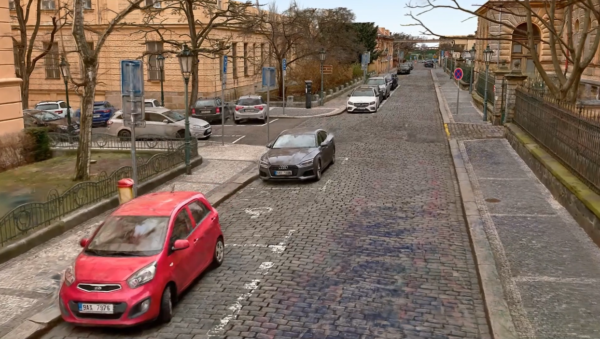
The data capture will be able to generate 13.5K resolution spherical panoramas and precise (colored) point clouds with 5cm accuracy and 3cm precision. Capture detailed data, in both color and depth, for textured mesh models, 3D Gaussian Splats, and Nerfs.
Embark on a data journey with Mosaic Xplor – explore our first colored point cloud:
For more information on the mobile mapping backpack camera and to pre-order, please visit the page.