
Innovative ways companies can use geospatial data from a 360° mobile mapping camera, and how surveying companies can scale data capture and use for multiple customers
The current problem in data collection
One of the biggest problems with collecting street-view imagery and data is the inefficiency of the data collection process.
Oftentimes, it is for one specific project and one specific department or company.
Imagine a city has plans to update a major road in its town.
During the project, pavement and utilities will be torn up and replaced. Current street furniture, such as greenery, sidewalks, or bus stops, will be replaced or updated.
Each of these specific items may require a different company that will need a clear image of the entire environment of the project, but for their own unique reason. So, inevitably, what happens is that each of these companies will independently collect its own data by means of a survey.
This means that some are contracting professional surveying companies to conduct the survey. Others are sending their own personnel out to the field to collect with a multitude of devices.
This is a highly inefficient means of data collection. It is timely and costly, and the different tools used to conduct the surveys produce different levels of quality.
But it doesn’t have to be this way. There is a simple solution.
Data subscription
What if, instead of each end user having to devise their own method and means of collecting and visualizing street-view data for their unique use case, they could all simply find the relevant information in one all-encompassing platform?
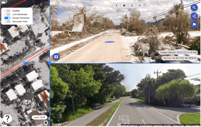
And what if the data were updated on a regular basis so that users could look back in time to compare the changes in the site across the lifetime of the project or further back in history to gain a fuller picture.
i.e., a comprehensive and historical map of the entire town, city, or even country.
The concept is simple. One product, one subscription.
The product – all current and historical mapping data of a given area collected and maintained in an easily viewable platform for any subscriber to access at will. After adding new data, it will update in every subscriber’s system.
As an added feature, there might also be some measurement tools, anonymization, as well as AI asset identification to further enrich the visual data.
What are the benefits to end-users
Reduce time in the field
The majority of sales can be conducted over the phone nowadays. All you need is a sales team, a telephone, and a great pitch.
However, for many companies offering services or products, conducting research beforehand is essential. They need to understand where their customers are and what to offer them.
Let’s pretend you are an advertising agency. You want to know possible advertisement locations (i.e., on the sides of buildings, at bus stops, or in standalone billboards). But it’s a time-consuming process to find all of those locations.
Rather than spending precious hours and days driving the streets looking for these possible locations, imagine only having to drive the roads on an up-to-date online map with clear images of the roadside infrastructure where you could possibly place advertisements.
Offer a better customer experience
Understanding your customer or client from the first interaction is key to a long and fruitful relationship. When a customer, client, or resident calls a company or governmental agency (one of which you will read about in a moment or two) to report an issue, what better way to show those people that you truly understand where they are coming from than by being able to drop down into their neighborhood and discuss the current state of things.
Rather than having to schedule a time in the future to visit the location in question, the customer service rep could access the latest images of the property in question and work through the issue immediately on the phone with the caller or taxpayer.
Finding multiple use cases for the same 360 imagery
The most common and obvious subscribers to such a system would be government-owned institutions and municipalities. Namely, local divisions seeking data to improve infrastructure, road asset management, and general city maintenance.
Public industries such as the police, army, and fire services are also potentially regular subscribers.
However, with such a diverse range of other companies requiring comprehensive data, and with the data already being continuously collected, it makes sense to widen the customer target.
When considering who might benefit from a readily available 360º street view platform, let’s consider:
- Which companies work outside?
- Which companies need images of infrastructure and buildings?
- Which companies need to evaluate the space of a specific area and its surroundings?
Plenty of private companies need this data. They likely already had a solution in place for data collection, but it would have required time and money in resources.
Banks, golf clubs, insurance companies…the list really is endless. Essentially, every sector can make use of this data.
Let’s walk through some of the areas where you can capitalize on data, such as monitoring maintenance or competitor activity.
Electrical car companies
Companies providing electric cars can view the location of charging points, plan where new points should be installed, and whether there is high-current infrastructure nearby.
They could also see the areas where other electric cars are parked, and potentially target advertising in that area for new customers.
Insurance companies
When insurance companies are surveying buildings for quotations, having accurate data on hand saves time for site visits. Damage assessment can also be carried out using historical data as a comparison to present-day damage.
Tax authorities
In a similar vein, tax authorities can gauge the features of buildings from 360° imagery. The number of floors, the number of windows a building has, or whether it has had any improvements can all be checked using street-view imagery data.
Streetlight providers and manufacturers

Something we probably all take for granted are street lights or lamp posts. But they are an integral part of our infrastructure. And there are many players in the field, whether due to ownership of the land or physical parts of the lamp poles. Many times, the local authorities don’t even know how many street lights they have at a given time.
Street light providers can use the imagery to ascertain how many and what types of street lights are within a given boundary, whether lighting is energy-saving, ‘smart-lighting’, LED, or solar-powered. This is very helpful in managing the sustainability of lighting in a given area.
Storage removal companies
Rented storage facilities, affectionately known as ‘warehouse hotels’, deliver storage units to residential areas and collect them once full. They need to gauge where to drop off the unit and determine the access around it. Data can help check roads, parking measures, and accessibility to a resident’s house or garden.
Playground manufacturers
Another way to capitalize on data is to sell it to companies that manufacture and install playgrounds.
Firstly, the surrounding space can be analyzed to determine the best-suited style of playground. For example, if many surrounding buildings feature wood or stone, a more natural-themed park with neutral tones will likely fit. For playgrounds, you can check the installation year and monitor when to repair or repaint parts. Measure the size of the area and identify the surface materials used.

Schools can also make use of this data when considering multiple playground providers, and playground manufacturers have current and historical data to share.
Perimeter security
Saving time on site visits is ideal for companies involved in the upkeep and installation of fencing. Large perimeters such as naval bases, hospital grounds, or parks can be measured easily and accurately from 360° data.
Roadside advertising and promotions
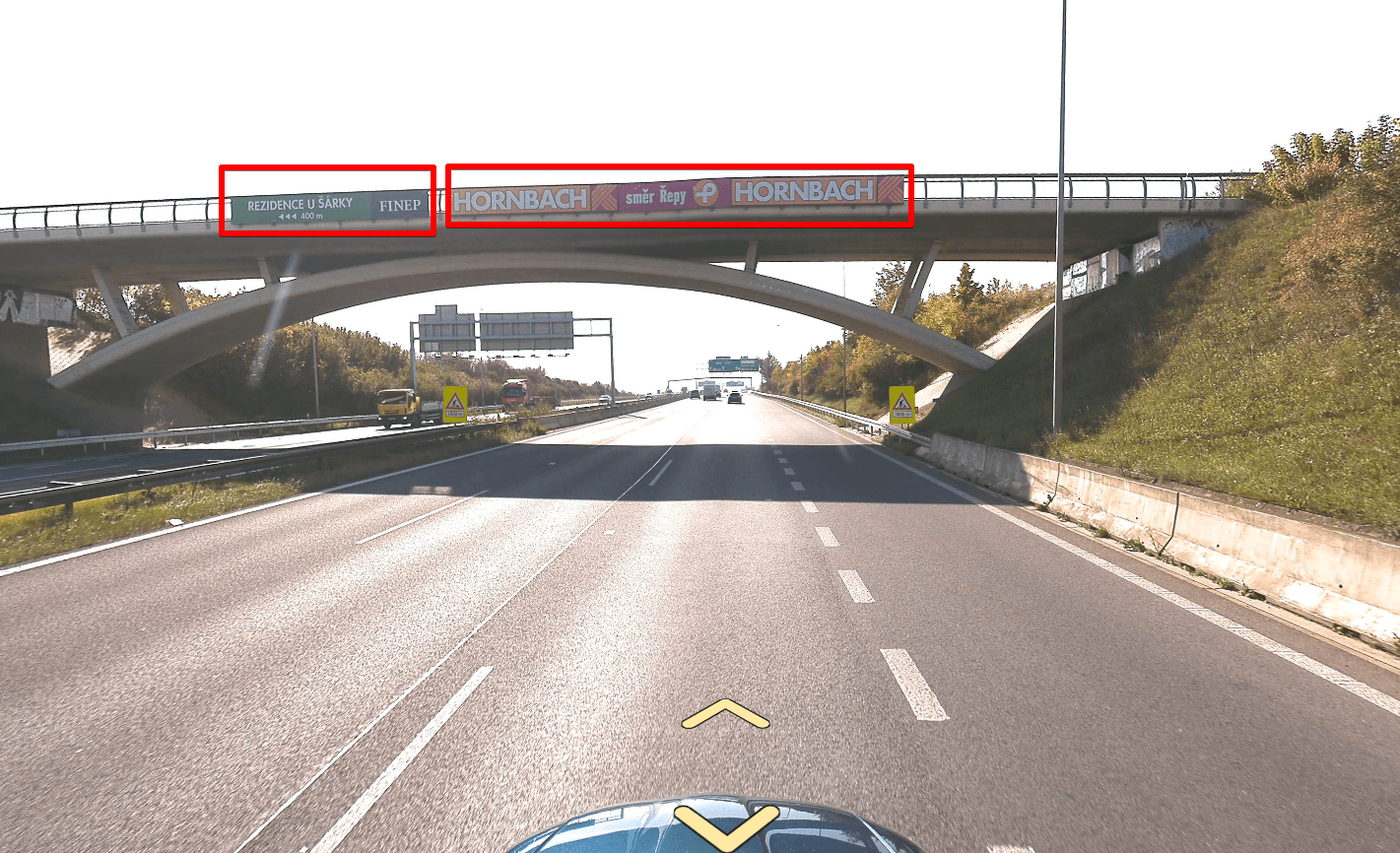
Ideal placements for promoting company names or advertisements can be identified using geospatial data. Manufacturers can examine buildings and locate the placement that will have the best line of sight. You can also measure the areas for scale simply by looking at data, with no site visit required.
Shopping and entertainment centers
There are a huge number of businesses under this umbrella. New planning for shopping centers, golf courses, swimming pools, stadiums, and many other projects can be expedited with geospatial data when contractors are provided with information and imagery promptly.
Outdoor furniture companies
A niche market, perhaps, and not immediately thought of, but companies providing outdoor furniture for cafes and restaurants have great use for this data. They can examine historical imagery of the tables and chairs used, and contact the companies once they estimate they need to be renewed.

For this, current and historical data are required, and here the salesperson can easily discuss the location, their street, and really familiarize themselves with the area before speaking with prospects.
There are a myriad of other ways to capitalize on data sourced from 360° imagery because so many companies can benefit from it.
How is this data captured?
The question on everyone’s lips.
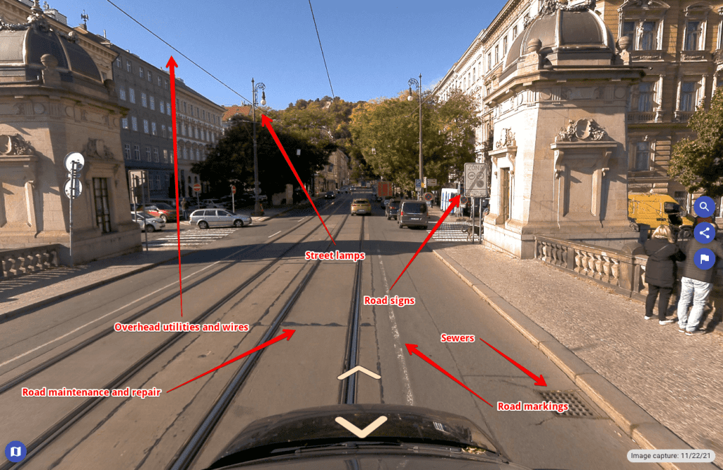
The line of Mosaic 360º mobile mapping camera systems captures impeccable 360° imagery. The 3 different systems designed and built by Mosaic all contain six lenses to photograph and store real life in sharp resolution. High-resolution imagery is integral in the collection of data to ensure the data captured is accurate and of the highest quality for data subscribers.
Waterproof and dust-proof, the Mosaic 51 and Mosaic X systems can withstand exceptionally high and low temperatures without affecting the quality of the imagery. It is entirely compact, too! Only one person needs to set up and operate this standalone system, which easily fits on a standard vehicle’s roof.

The ideal mobile mapping system required for large-scale data collection needs to be the best model possible, not only for accuracy, but also due to the number of subscribed companies relying on the data, and their own customers relying on that data-backed evaluation.
The possibility of state-sourced and shared data
Many private companies collect data for internal company use, but they often do not wish to share this data because they have invested the time and money to source it.
Sharing data with other companies could be a very valuable resource, and useful, for example, to neighboring municipalities, electricity providers, or wastewater companies working on cross-border projects. Often, data is ‘geofenced,’ meaning that it will simply cut out once it crosses into a new municipality.
An open working mentality would provide a faster solution if companies had access to the required data.
Not all companies have the budget to capture data at scale, so a subscription service is an economical business plan that provides companies and organizations of varying sizes with access to the data necessary to them without incurring the typical costs associated with such services.

There have been suggestions that individual states and local governments provide their own data as a resource for the private sector. If municipalities were to invest in an effective 360° camera and capture imagery from around their city, it would be an economic boost for town-wide, regional, or even national efficiency.
Not only that, with only a handful of drivers collecting the data, and with the data digitized and available online, other companies will not need to be on the road, reducing the volume of carbon emissions.
The future
Artificial Intelligence usage is on the rise, and it is flowing into more and more walks of life.
AI is already in use when capturing data, in facial and license plate blurring. How can you further integrate this? What about using machine learning to recognize particular objects for real-time identification?
For example, a farm that has attached cameras to its tractors to check for weeds amidst crops. They would find it very useful to have AI identification that could immediately recognize a weed and spray it with weedkiller right there and then.
There are many ways to capitalize on data from a 360° camera, and possible routes for expanding your client base.
The main question when considering capitalizing on data capture is – what is doable, and what is sellable?
Looking to scale data capture in your community? Contact us below for more details and to see how you start collecting data at scale for your community.


