Does high-quality mobile mapping have to be so cumbersome? Mosaic is rethinking what professional mobile mapping is supposed to cost, weigh, and demand of the people running it.
Prague, Czech Republic —27 August, 2026
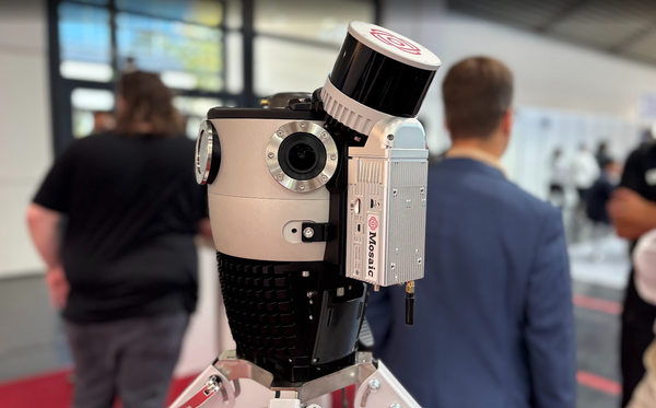
Mosaic, developer of the Mosaic X 360° panoramic camera and the Meridian mobile mapping system, is announcing the launch of Mosaic Meridian 2, the next generation of its fully integrated LiDAR and 360° panoramic imaging mobile mapping system.
For more than two decades, professional mobile mapping has meant the same set of compromises: extraordinary data in exchange for extraordinary cost, bulk, complexity, and crew. Now with the Meridian 2 – there is a new path available to users.
It fits the full capability of a survey-grade mapping system into a manageable size that one person can luggage-check at the airport, set up single-handed, and start collecting data minutes after arriving on site. All at a fraction of the cost of competing systems.
Meridian 2 is built for the crews performing the majority of real-world work – where what teams actually need is professional-grade data they can capture affordably, quickly, and alone.
“For product design and engineering, it’s good to remember that ‘perfect is the enemy of good’. We are building tools that people pay for, both with money and time. While it’s always true that anything can be better (a point cloud can be denser, a photo can be higher resolution, and so on), we need to keep the economic reality in mind of ‘why are we doing this, and to what end?’
Paying close attention to this will allow the stakeholders to have a solution that does only what they need, and not more. This should of course end up being cheaper than the nuclear option of ‘Let’s use the most expensive equipment possible to create the densest possible data’.”
- Jeffrey Martin, Co-Founder and CEO of Mosaic, in With LiDAR, Sometimes Less is More
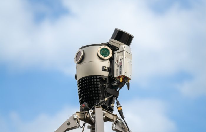
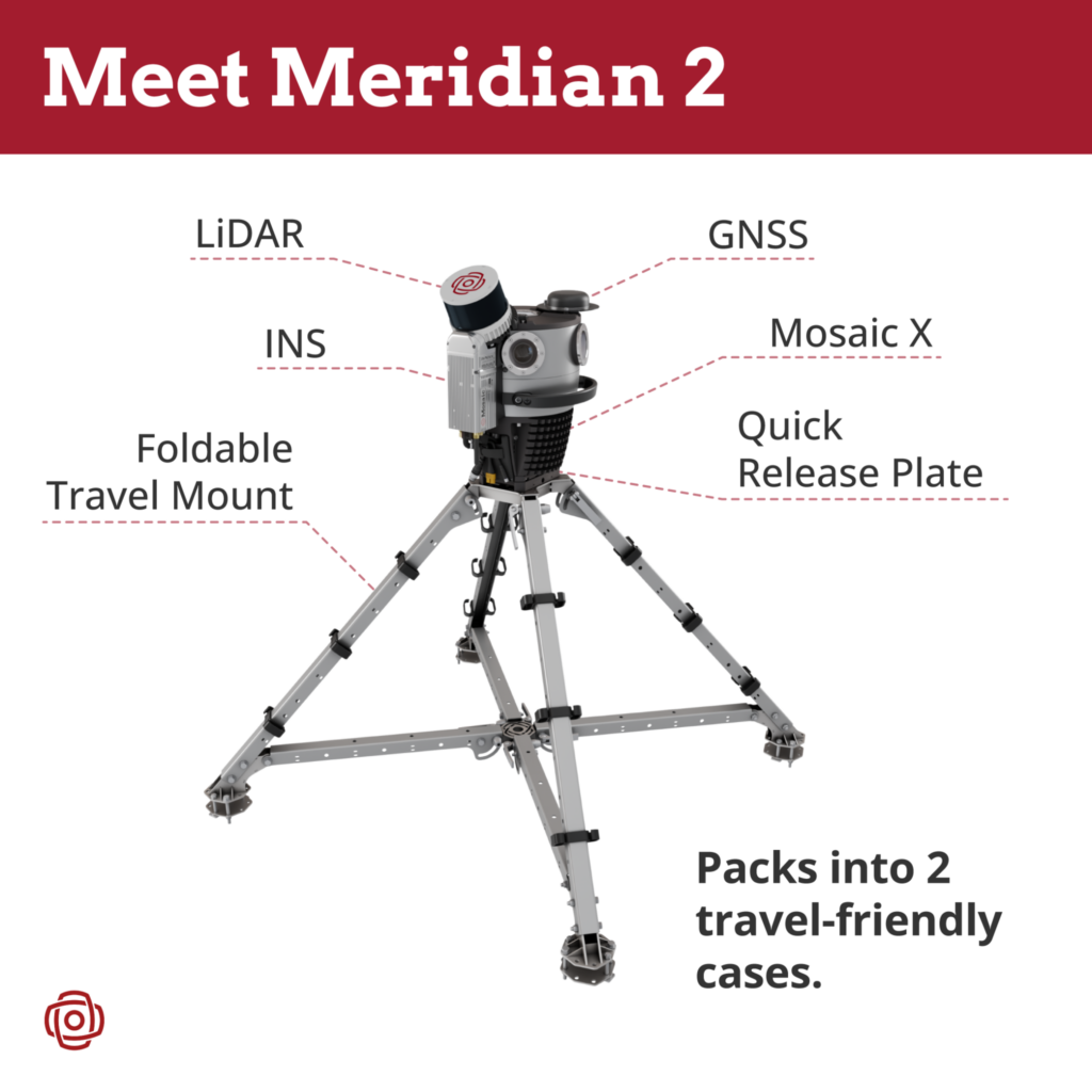
Meridian 2 pairs the Mosaic X – Mosaic’s in-house designed 360° camera, with six global-shutter sensors capturing 91.2 MP equirectangular panoramas – with 32-channel LiDAR and survey-grade GNSS/INS, the same class of sensors mobile mapping teams already rely on.
Rigid calibration, in a compact body
Experience a tighter integration and rigid, built-to-last calibration that you can depend on every time.
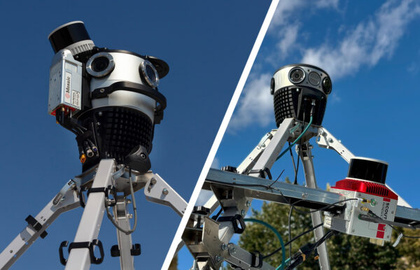
Every sensing element in Meridian 2 – the GNSS antenna, the IMU, the LiDAR, and all six camera sensors – occupies the smallest space physically achievable, with each subsystem still operating at its full performance.
Nothing is compromised to make it all fit. Packed this tightly and locked together as a single rigid body, the system holds its calibration through transport, temperature, and everyday field use. There is no boresight ritual at the start of a job. Meridian 2 has the out-of-the-box performance you can rely on to quickly get on the road and capture data.
The operator mounts the Meridian 2 onto the vehicle once and can trust it on every acquisition thereafter. Minimum size, maximum performance, and calibration built to last, achieved simultaneously — a trail Mosaic is set on blazing.
Elevated LiDAR geometry, engineered to the optimum
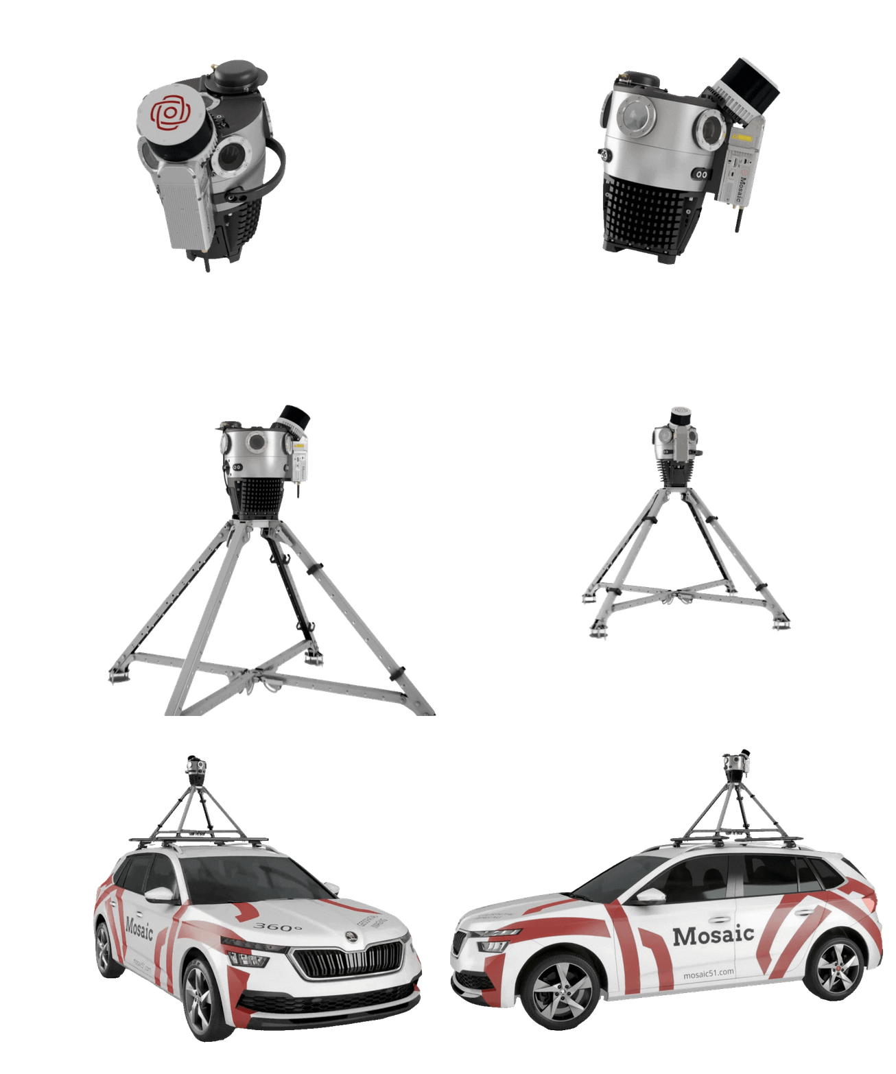
Mounted directly onto the Mosaic X camera and elevated above the roofline, the LiDAR delivers high return intensity and full, unobstructed 360° coverage for clean, reliable capture of building facades and overhead assets. The result is consistent, high-quality data while still having the benefits of a compact and rugged system.
Higher quality data doesn’t have to come with a luxury price tag. The placement and angle of the LiDAR are the result of an extensive program of testing and analysis, working through every trade-off among coverage, return intensity, obstruction, and range until reaching the best balance.
Mobile mapping that fits in checked airplane bags
Airport travel, compact cars, and small teams don’t have to be barriers to your mobile mapping plans. Mobile mapping systems often need to be shipped on a cargo pallet or cannot fit into standard airplane luggage, but the Meridian 2 challenges the status quo.
The Meridian 2 is faster and cheaper to transport than competing mobile mapping systems. There’s no need to ship the system as cargo. It goes where you go, whether it is on a plane or a passenger vehicle.
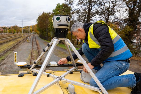
Just like the original Meridian, Meridian 2 mounts and dismounts in under a minute, thanks to the quick-release mount. It can be installed by one person, and the complete system packs into two carry-on cases.
Mobilization, capture, and delivery are now genuinely a one-person operation, a workflow that most still treat as a multi-person production with a mountain of logistics.
“The Meridian 2 has big market potential. It is the only 360° panoramic and LiDAR system you can pack into two small bags. Where it really shines is transportability, asset capture, and ease of use. It is a much cleaner, more user-friendly solution, and that makes it easier for decision-makers to have confidence their team can handle and operate it.”
- Grayson Omans, Founder and former CEO of Phoenix LiDAR
“Meridian 2 means you’re not tied to a traveling by large vehicle or with a large crew. And no pre-collection boresight ritual anymore. One person can carry the whole system in two cases, set it up alone, and start collecting professional-grade data within minutes of arriving on site.”
The high-end systems in this category are excellent instruments, and for the handful of projects that need sub-centimetre absolute accuracy, they’re worth what they cost. We built Meridian 2 for everyone else p the surveyors, utilities, municipalities, and service providers who need professional-grade data at a price that makes commercial sense. We’re only getting started.“
- Jeffrey Martin, Mosaic CEO and Co-founder
Meridian 2’s Availability
Mosaic Meridian 2 is now available to order, with fast shipping.
Existing Meridian owners can upgrade to Meridian 2: the core sensing components are carried forward and reassembled into the new integrated configuration.
Owners of a standalone Mosaic X camera can likewise grow it into a complete Meridian 2 system by sending their camera to Mosaic for integration.
Early Reception
Meridian 2 was previewed at the Topodot User Conference (TUC) in May 2026, drawing a strong response from Topodot, fellow exhibitors, and attendees, and confirming that what Meridian 2 offers is closely aligned with where the market is heading.
See Meridian 2 at Intergeo 2026
Get your chance to see Meridian 2 live at Intergeo 2026, in Munich from September 15th to 17th at the Mosaic booth B5.H019.

About Mosaic
Mosaic designs and builds 360° imaging and mobile mapping hardware from Prague, Czech Republic. Its product line – the Mosaic 51, Mosaic X, Meridian, and Meridian 2 – ships to mapping professionals in more than 50 countries. Mosaic was founded in 2018 to put professional-grade 360° imaging and mobile mapping capability within reach of the surveyors, utilities, municipalities, and service providers who do the everyday work of documenting the world.
Press Contact:
Lynn Puzzo, Director of Sales and Marketing