The Mosaic 51’s reliability helped a Richmond-based geospatial consulting firm to build a scalable, end-to-end pavement condition assessment pipeline.
The universal infrastructure problem
The health of a road network quite literally radiates out into broader society. We’ve all heard the local jokes about crossing state lines and immediately knowing due to the change in the highway’s quality.
Trust in local governments is also directly tied to road conditions, since pavement conditions signal to locals and visitors where the government is investing its resources. Roads are a frequently used, highly visible indicator of a government’s performance, and road maintenance was historically one of the first things tax money was used to fund, even as far back as ancient times.
Poor road conditions lead to, in the best-case scenarios, cars with damaged alignments, damaged suspensions, and popped tires. In the worst cases, a driver losing control of the car due to a neglected pothole can spiral into a deadly collision.
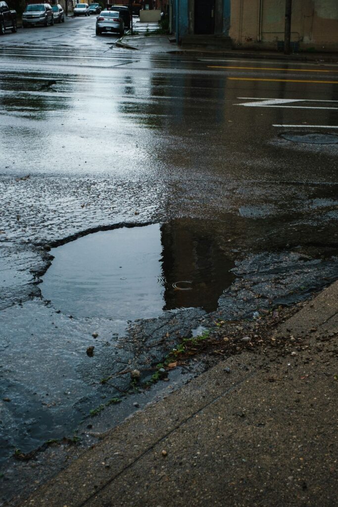
These unmaintained roads cost individual households extra expenses for car repairs, as well as government budgets when a small crack escalates into a massive pothole. The old adage “a stitch in time saves nine,” or that fixing a small problem immediately saves one from expensive emergency repairs, comes to mind.
A major reason for this nationwide road neglect is the emphasis on new road construction and vanity projects over routine maintenance.
According to this Time Magazine article from 1992, Why America Has So Many Potholes:
“The attitude was the faster it crumbles, the faster we’ll get brand-new,” says New York Senator Daniel Patrick Moynihan, a stalwart highway watcher. Moreover, maintenance is unglamorous. “Nobody ever had a ribbon-cutting ceremony for fixing cracks,” notes Moynihan.
While ancient by news story standards, this article’s age shows the eternal nature of this problem for American roadways.
America’s unique road infrastructure challenges
American cars are getting bigger every year, transportation infrastructure is rapidly aging, and some cities are seeing surges in residents as people migrate for work. The lack of investment in sidewalks, biking infrastructure, high-speed rail, or public transportation adds to the overreliance most American cities have on road networks for individual vehicles.
Without the political will to improve alternative transportation options, each individual is forced to move around town in a 2,000-pound vehicle, which adds to the roadway’s deterioration. Moreover, if a 2,000-pound personal vehicle is damaging roadways, imagine what an 18-wheeler does as it moves goods cross-country.
Under these conditions, the old technologies for maintaining roadways cannot keep up with the United States’ rising demand and wear-and-tear on roads. When a local government is responsible for thousands of miles of roadways, it is an impossible task to be everywhere all at once, or to prioritize every road repair with equal resources.
However, technologies like 360° mobile mapping cameras and LiDAR are improving financial outcomes for these departments.
Mobile mapping for American roads
Mobile mapping systems are helping local governments be more omnipresent on their streets, respond faster to service requests, and predict problem areas before they deteriorate.
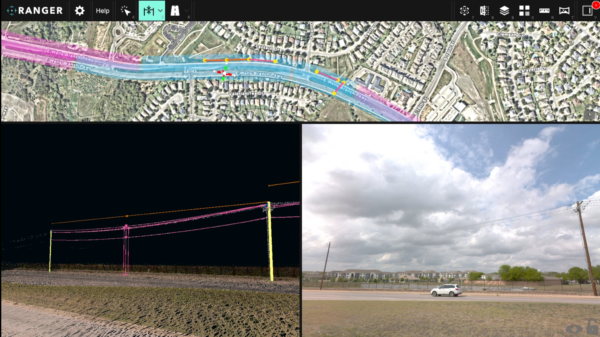
With repeated use over time, mobile mapping helps make the case for major road repairs. When one views the changes in road conditions side-by-side, it is more noticeable than watching a crack slowly become a pothole over several years. It can also build a historical record of road conditions (among other things, such as building facades and utility poles). This is precious information in the aftermath of a disaster, such as a wildfire or hurricane.
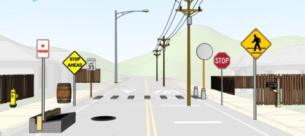
The challenge for local governments compounds when you factor in asset inventory. Many agencies lack a systematic, georeferenced catalog of the ancillary infrastructure tied to their roadways (commonly called “road furniture” -think guardrails, signs, drainage inlets, bus stops, utility poles, and manholes). Condition assessment and maintenance planning become even more difficult to coordinate across departments without a comprehensive record of what exists and its condition.
These are the core problems that Timmons Group’s Geospatial Services team has spent years trying to solve, but thanks to their workflow that includes the Mosaic 51, Mapillary, and ArcGIS, they’ve found a solution.
Timmons Group
Founded in 1953 and headquartered in Richmond, Virginia, Timmons Group is a nationally recognized, multi-disciplined engineering and technology firm. They have appeared on Engineering News-Record’s list of the Top 500 Design Firms for over 30 years.
Timmons Group’s geospatial practice operates across civil engineering, landscape architecture, environmental services, surveying, and geotechnical disciplines, where they provide public and private sector clients alike with GIS-driven solutions that span strategic planning, enterprise system implementation, field data collection, and custom application development.
The pavement assessment division, led by GIS Solutions Architect and Project Manager Brian Kingery (GISP, PMP) and Senior GIS Technical Analyst Andrew Barron (GISP), has conducted projects ranging from individual corridor assessments to countywide surveys.
These projects span distances from 100 to 1,500 miles and are in geographically and climatically diverse environments, including Colorado, Louisiana, and jurisdictions across the Mid-Atlantic.
Hardware limitations and the decision to switch cameras
Timmons Group did not begin its mobile mapping journey with the Mosaic 51. The team’s earlier configuration relied on an NC Tech Pulsar 360° camera; however, they noted that this system presented some operational challenges in the field.
The connectivity via the internal Wi-Fi was unstable, and the hardware did not hold up well under field conditions. The system required careful management to function within normal operating parameters and was even damaged during a project in Colorado, where many of the roads were heavily rutted and unpaved. When hardware has structural issues, the crew has to return to re-collect the data, which can impact project budgets and schedules.
Upgrading to the Mosaic 51
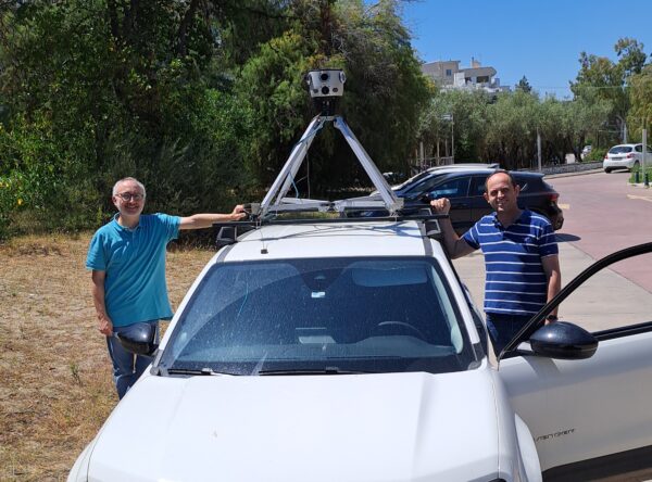
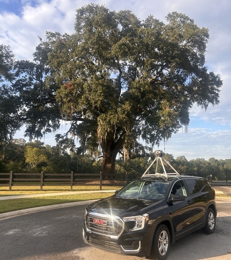
The Mosaic 51 is Mosaic’s flagship mobile mapping camera: a 12.3K resolution, fully weatherproof 360° imaging system. It comes with integrated GNSS and is purpose-built for sustained road-speed data collection. The system is designed to withstand tough conditions like intense road vibration, temperature extremes, dust, and precipitation.
For Timmons Group, the difference was immediately apparent when Cullen Vukmer, GIS Specialist, conducted a major collection campaign in Broussard, Louisiana, during hurricane season. This is when unpredictable and violent afternoon thunderstorms are routine. Other equipment on the truck required active protection from the rain, but the Mosaic 51 didn’t. Vukmer continued driving through deteriorating weather conditions without interrupting collection or risking equipment damage. Image quality remained consistent with only periodic manual cleaning of water droplets.
The camera’s mount system is also operationally efficient. The vehicle-mount remains on the vehicle between deployments; removing and reattaching the camera itself is a quick operation that a single operator can manage. This reduces setup overhead and keeps the crew focused on driving and collection rather than equipment configuration.
The data collection pipeline
Mobile data acquisition
Timmons Group’s mobile collection platform is a custom-equipped vehicle fitted with SSI laser sensors for longitudinal roughness measurement and the Mosaic 51 camera for 360° georeferenced imagery.
The truck follows a pre-planned route derived from GIS-represented roadway segmentation loaded on digital offline-enabled field maps. This ensures complete, systematic coverage of the project area.
The Mosaic 51 captures continuous, high-resolution panoramic imagery, and simultaneously, SSI sensors record International Roughness Index (IRI) values along each segment. This provides a sensor-derived roughness measurement that serves as the quantitative foundation for subsequent pavement condition calculations.
In-house post-processing
All imagery processing is handled in-house, using Mosaic’s post-processing software to stitch the raw fisheye inputs from the Mosaic 51’s lens array into fully equirectangular, georeferenced panoramas.
Once stitched, the imagery is uploaded to Mapillary via the Desktop Uploader, where it becomes accessible to the broader project team through the Mapillary API. Mapillary is an excellent and free tool for imagery that is unclassified and can be accessed by the public as well.
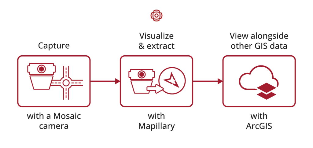
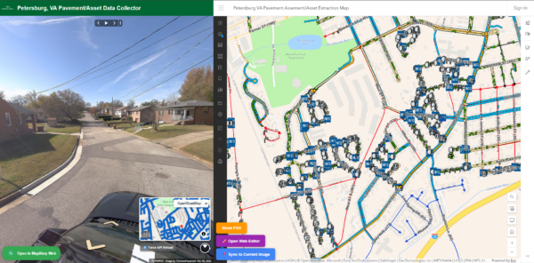
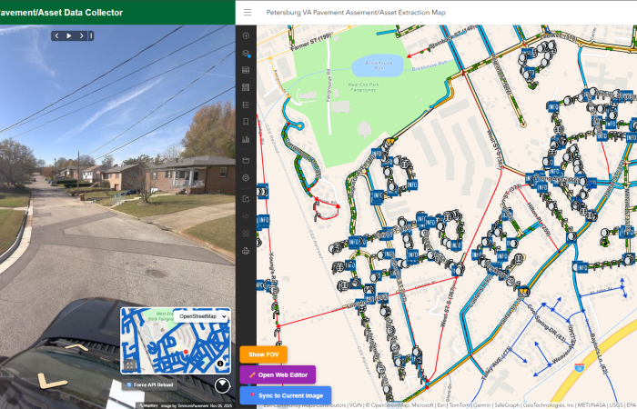
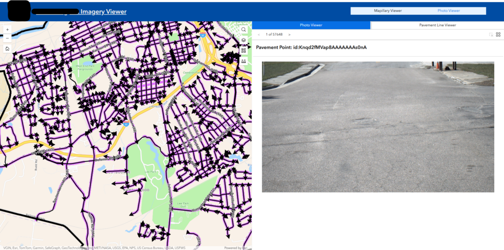
Utilizing the Mapillary API and ArcGIS Online webmaps, Timmons Group has developed a custom web application that analysts can utilize to efficiently view imagery alongside their respective GIS segments to map project-relevant features.
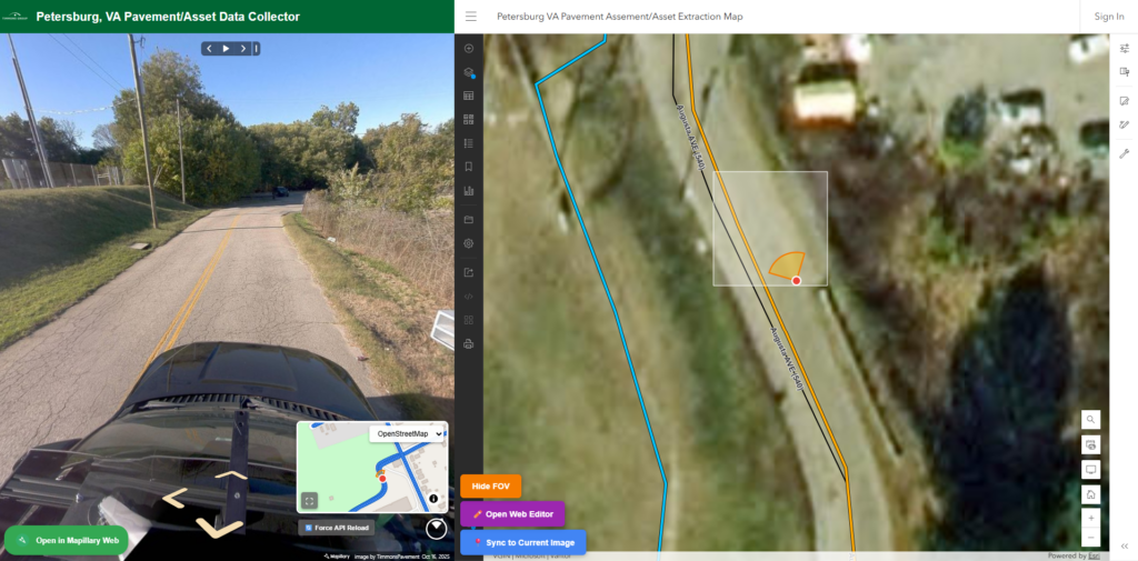
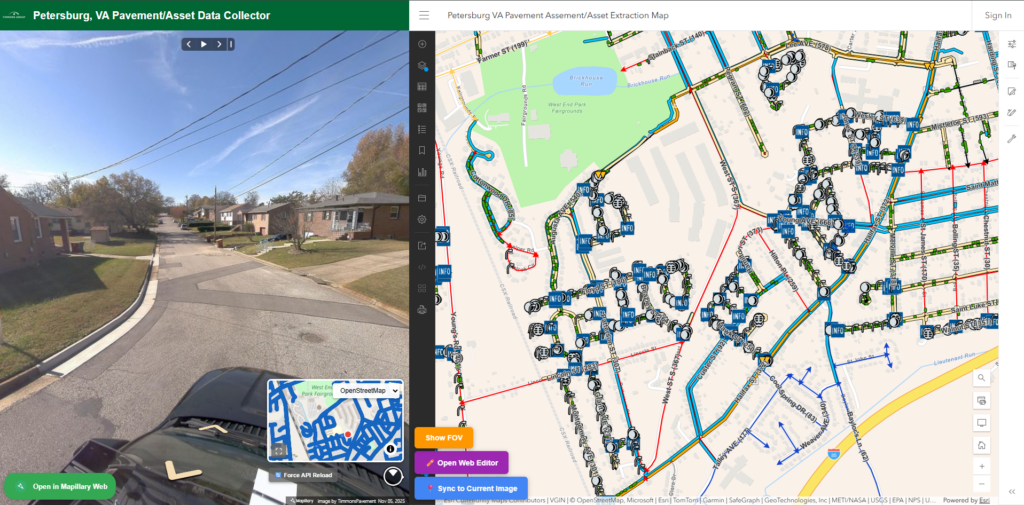
See our step-by-step guides on how to take advantage of Mapillary and Mosaic’s compatibility:
Part 2: Integrating 360 Street View Imagery in ArcGIS: Enhancing Geospatial Visualizations with Mapillary
Pavement distress digitization and Pavement Condition Index (PCI) scoring
With georeferenced imagery accessible through the team’s internal GIS/Mapillary web application mentioned above, Timmons editors systematically review the road network segment by segment for road distress.
Each distress they find in the imagery is logged as a georeferenced point feature with an attribute relating to the type of distress, which is drawn from a taxonomy of approximately 40 categories.
They also include a classification about the damage’s severity and extent, whether it is measured in linear feet (for cracks) or square footage (for surface deformation and potholes).
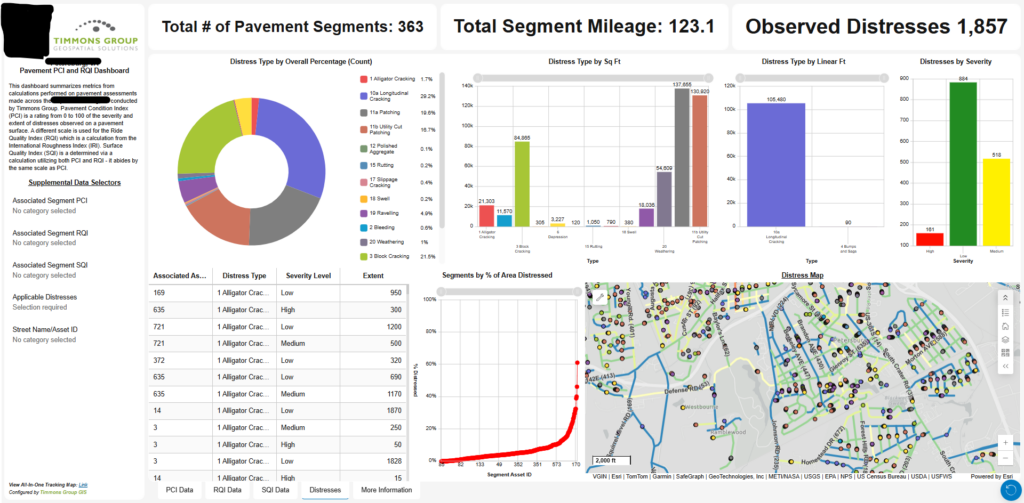
IRI values (from the SSI sensors) and the combination of distress severity, extent, and type attribution (from the visual review) are then fed into Paver. Paver is a specialized pavement management software that calculates the Pavement Condition Index (PCI) scores for each assessed segment in accordance with established ASTM D6433 methodology. Derivative metrics including the Ride Quality Index (RQI) and Surface Quality Index (SQI) are also computed and attributed to the road network feature class.
For select projects, clients require feature identification along their assessed roadways for signs, lane striping, curbs, manholes, and other assets. Utilizing the custom web application, manual asset extraction can be achieved in a similar manner as the distress features.
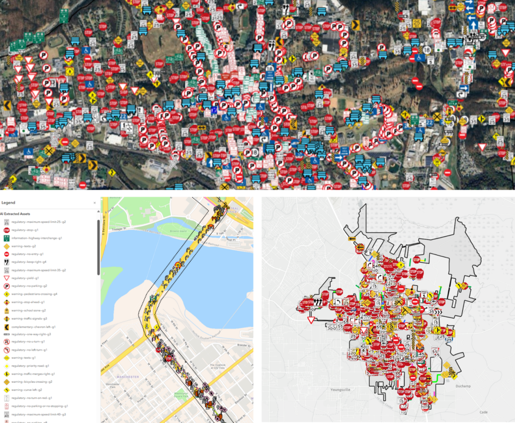
The manual approach is supplemented or substituted by an automated approach: a Python script queries Mapillary’s computer vision-derived object detection API within a predefined project bounding box, returning a JSON file of detected asset types. These asset types are typically traffic signs, traffic signals, utility poles, manholes, and more.
The JSON output is converted to a feature class, clipped to the project boundary, symbolized in accordance with Mapillary’s standard schema, and published as a feature service alongside the pavement data.
Client deliverables: the pavement viewer experience
The ArcGIS Online application suite
Final deliverables are packaged as a suite of ArcGIS Online applications tailored to each client’s technical sophistication, data volume, and analytical priorities.
The core product is the Pavement Viewer Experience. This is an ArcGIS Experience Builder application comprising multiple pages that bring together GIS segmentation data, pavement metrics, asset inventories, and imagery into a single navigable interface.
The first page presents road segments symbolized by PCI score category. These range from “Serious” to “Very Good” and are displayed alongside georeferenced distress points and extracted assets. This view uses non-360° pavement-focused imagery to provide a detailed visual record of assessed surfaces.
The second page delivers full Mapillary 360° panoramic imagery via the Oriented Imagery Widget, shown below. This allows users to step through georeferenced street-level scenes tied directly to the GIS segmentation layer below.
Tabbed dashboards display PCI, RQI, and SQI values with interactive filter controls where users can isolate segments by metric threshold (e.g., show only “Poor”-rated PCI segments) or navigate directly to a specific street by asset ID or name. All filters cascade across tabs, so selecting a segment in the PCI view automatically updates the RQI and SQI views for that same segment. Aggregate statistics, such as total mileage assessed, segment count, and asset counts by type, provide network-level situational awareness at a glance.
These tools are designed to be operable without GIS expertise. Timmons Group’s end users most often are city planners, public works directors, and transportation engineers. These are professionals with domain expertise in pavement management and infrastructure finance, but without necessarily deep GIS training. The Pavement Viewer Experience puts comprehensive, analytically rich spatial data into the hands of decision-makers who can act on it immediately.
Time-based documentation and pre/post assessment of road damage
For many private-sector clients, Timmons Group conducts coordinated pre-construction and post-construction pavement assessments on ingress and egress routes. These are usually solar and wind energy developers whose construction logistics require routing large, heavy equipment over publicly maintained roads.
The before-capture imagery and PCI scores establish a legally defensible baseline; then the post-construction reassessment quantifies degradation attributable to the heavy transport loads. This time-based documentation supports damage compensation or road repair agreements between the developer and the municipality.
Outcomes: smarter infrastructure investment
Bringing non-experts into the light
Perhaps the biggest challenge for any government-funded repair projects is demonstrating the project’s severity to the many non-expert stakeholders involved. While a pavement expert might know exactly what is being said without a picture, someone from the local government who doesn’t work in the industry may have trouble understanding how to lay out the budget’s priorities.
Mobile mapping imagery takes that non-expert stakeholder out of the abstract and into reality. Being told by an expert that a section of road has a “poor PCI score” and is in severe need of repairs can get lost or ignored, but when they are shown imagery of the damaged roads, the problem becomes much easier to understand.
Getting ahead of complaints and building a historical record
The practical impact of Timmons Group’s workflow is a dramatic improvement in the situational awareness of infrastructure managers who previously had little to no current data on their roadway networks.
Where a city engineer may have previously relied on complaint-driven or walk-through inspections to inform a multi-million-dollar annual pavement maintenance budget, the Timmons deliverable provides a GIS-attributed, network-wide inventory.
A jurisdiction managing an annual pavement budget can immediately identify which of its segments are performing well versus which segments have deteriorated over time. They can also check the historical record to see which roads are crumbling and at what rate.
Instead of playing whack-a-mole by addressing citizen complaints one-by-one, they can make long-term plans that save money and keep roadways in safe conditions.
Prioritizing the right treatment at the right segment at the right time extends pavement life and dramatically improves return on infrastructure investment.
Mosaic 51: a camera built for any environment
The Mosaic 51 specifically contributes operational durability, beyond high-resolution imagery, and deployment simplicity.
The Timmons team operates across the American continent in conditions that range from high-altitude unpaved roads in the Colorado Rockies to low-elevation subtropical highways in Louisiana. These environments represent the kinds of extremes in temperature, humidity, and road surface quality you’ll find in the US. The transition away from the NC Tech Pulsar to the Mosaic 51 provides the reliability the Timmons team needs to plan, bid, and execute projects across the continental US with confidence.
The future of American pavement management
America’s overreliance on roadways to transport people and goods won’t be solved overnight, but thanks to mobile mapping technology, the processes we use to monitor and repair these roads are getting much faster.
Interested in how the Mosaic 51 can revolutionize your own mobile mapping and asset management workflows? Explore the Mosaic 51 or contact the Mosaic team to discuss your project’s requirements.