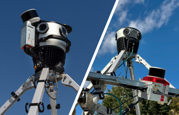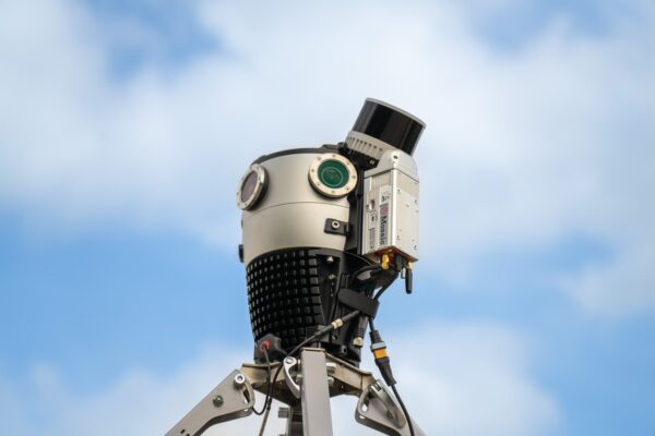

Mosaic’s streamlined mobile mapping systems let a single operator capture LiDAR and 360° imagery anywhere, without waiting on a bigger crew.
Geospatial teams of every size have felt the squeeze of limited resources. This could be a shrinking budget, a wave of retiring experts, or a seemingly impossible deadline.
The answer to more on-time work has historically been more people. This could mean sending a bigger field crew yourself or outsourcing more work to sub-contractors.
However, in many industries, throwing more people at a problem is becoming much harder to do. Some countries, such as Japan, are facing severe labor shortages across the board. In the US, the government-initiated Broadband Equity, Access, and Deployment (BEAD) program is running simultaneously across all 50 states, causing skilled labor shortages in specific fields.
Mosaic designs 360° camera systems for exactly these kinds of scenarios: lean, on-the-go teams that need mobile mapping solutions which don’t require an entire field team every time.
Why leaner mobile mapping teams are becoming the norm
Businesses are always balancing limited resources, which are usually skilled labor, financial costs, and time. It often feels like a “2 out of 3” situation, where you can have two of these resources, but it will cost you the third one, so choose wisely.
While these resources are heavily intertwined, they each come with specific challenges unique to geospatial data capture.
Skilled labor
The cost of high-quality labor includes both the financial cost and the time associated with onboarding and training. It can be a big hindrance to a company’s estimated project pricing and deadlines, especially when a new or larger contract comes along.
For example, in our case study with Fotopo in Greece, a big problem for them was finding and training skilled workers across the country for data collection. They were using both in-house and sub-contracted work, but often had to recapture data.
After implementing the Mosaic X, Fotopo was able to collect consistent, high-quality data from a smaller, better-trained crew and also double its project speed.
Mosaic X allowed on-the-ground technicians to capture 360° imagery in a single pass and take that data back to the office for interpretation. Not having to re-capture missed utility poles or entire streets saved field labor costs, and helped keep the most specialized technical employees in the office, which is the most efficient way to stay on track.
The competition for skilled field staff, both in-house and sub-contracted, makes every additional body on a survey crew a harder commodity to come by. It also puts a premium on tools that let the existing and knowledgeable staff cover more ground.
Financial costs
Dispatching a multi-person crew to walk a route pole by pole, or to capture assets one at a time, adds up quickly – not only in labor hours, but in vehicle and gas costs and scheduling overhead too. Not to mention the permits and headaches from closing or narrowing major traffic corridors.
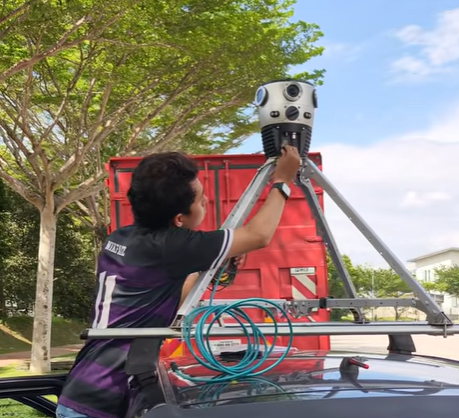
When a single operator can capture an entire corridor from behind the wheel in one pass, that overhead mostly disappears, and the project timeline compresses along with it.
Time
While it is very common for construction and asset management projects to go over-schedule, it is not ideal. Time buffers are often built into projects, and with so many moving parts from different subcontractors and government agencies, some deliverables are bound to be late.
However, for some projects, time is the one resource you can’t buy back. In industries like natural disaster management, first responders, researchers, and insurance companies are working against physical evidence that doesn’t wait around. Evidence starts to disappear almost instantly as the weather conditions change, debris is cleared, or demolition starts.
In the case of Texas A&M, researchers were able to use 360° imagery captured right after Hurricane Milton to train AI models to categorize storm damage. This kind of time-sensitive data is important, but very difficult to capture at the right moment after a natural disaster.
“In this study, Mosaic data plays a critical role by providing high-quality pre-disaster and post-disaster street-view imagery.
While street-view imagery itself is not scarce, datasets that are consistent in format, high in visual quality, temporally aligned, and disaster-related remain extremely limited. The value of the data lies not merely in availability, but in its reliability, consistency, and suitability for longitudinal analysis.”
-Yifan Yang, PhD student with Texas A&M University’s Department of Geography
Waiting to assemble and deploy a full field team can mean missing that key window entirely, and losing evidence that can never be recaptured.
How does one person replace an entire field crew?
The traditional model for asset capture (whether that means utility poles, road corridors, or disaster-affected buildings) sends technicians out to examine and document assets one at a time. Every missed measurement or forgotten angle means a return trip. This adds costs and delays to projects.
However, when you’re able to capture high-resolution 360° imagery (and/or a dense LiDAR point cloud) in a single pass, most of what a technician would normally need to check on site is already sitting in the office, ready for review.
That reduces, and in many cases entirely eliminates, the need to send someone back to the field for something missed the first time.
When every hour counts: disaster response and insurance claims
Sending a small, quick team is especially important when the data you are capturing is temporal, or will only be available for a limited time. For the disaster response and insurance industries, evidence from natural disasters needs to be documented quickly.
Below are three case studies in which time was of the essence for data capture.
The 2023 Lahaina and 2025 Los Angeles wildfires
After the 2023 Lahaina, Hawaii, wildfire, the National Disaster Preparedness Training Center at the University of Hawaii worked with Site Tour 360 to capture high-resolution imagery of the burn area. They made the imagery available to FEMA and local authorities through Esri ArcGIS within 24 hours of data collection.
A similar small-team capture happened again after the 2025 Los Angeles wildfires, when both UCLA and the NDPTC used Mosaic systems to document the Eaton and Palisades fire areas while conditions on the ground were still fresh.
Read the full case study here: Documenting Lahaina and LA’s Wildfire Damage with Street-Level Imagery
Insurance
Insurance companies operate under similar pressure from a different angle. In our case study of McKenzie Intelligence Services, read about how faster access to reliable post-disaster imagery means faster claims processing for policyholders who are often displaced and waiting on a decision about their homes or businesses.
A compact mobile capture team that can be on site within days of an event shortens that entire chain of events from disaster to financial resolution.
When small teams have a large coverage area: utilities and FTTX projects
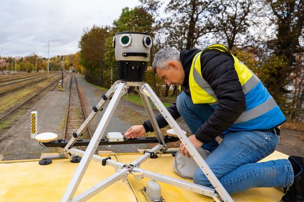
Smaller, more agile teams can cover more ground when given the right tools. These case studies below share the same underlying pattern: A single vehicle-mounted system, operated by one or two people, replaced what would traditionally have required a much larger field presence. All without sacrificing the accuracy that engineering teams depend on downstream.
Utilities and telecoms
Vulcan Line Tools builds hardware and software for electric utilities and telecom companies. They switched from a lower-quality camera to the Mosaic X to survey a 5,000-pole city for a fiber deployment project.
“Our services are now able to be completed faster and with higher-quality data. For our customers, this means getting a 5,000-pole city for around $30,000 when before it would’ve been well over $100,000. And it’s being done in weeks rather than months.”
–Zac Young, founder of Vulcan Line Tools
Read the entire case study here: Transforming Utility Pole Inspections with Mosaic X Camera System
City-scale asset management
The City of Ottawa is creating a comprehensive asset management system and digital inventory of Ottawa’s traffic infrastructure, which includes street furniture, such as signs, street lights, traffic signals, and pavement markings. For a capital city of more than one million people, this is a large endeavor.
Read this article from CTV News: Have you seen a City of Ottawa SUV driving around the city with a camera on it?
FTTX projects
Midwest Energy and Communications took a similar approach for its own fiber-to-the-home expansion. They collected more than 500 miles of imagery across grant-funded project areas. Much of it was in rural regions where Google Street View coverage was too sparse or outdated to support network planning.
“The clarity and detail that the Mosaic camera brings to our data collection process have been a game-changer. We’re not just seeing our community with greater clarity, but we’re also able to make decisions with confidence, knowing that we have the most accurate and up-to-date information at our fingertips.”
-Nick Bogen, GIS Developer at Midwest
Read the entire case study here: Midwest Energy & Communications’ Innovative Approach to Utility Mapping with the Mosaic X Camera
Is it time to upgrade your surveying equipment?
Mosaic designs mobile mapping and surveying equipment designed specifically for smaller teams in all industries that need to get a lot done with limited resources. That includes:
- Departments of transportation managing large road or rail networks with limited survey staff
- Utility and telecom companies conducting make-ready surveys for fiber and broadband
- Disaster response agencies and researchers documenting conditions before they change
- Insurance companies and adjusters who need fast, reliable post-event imagery
- Small survey and mapping firms competing for larger contracts without a large payroll
If any of these sound like you, check out our extensive list of case studies that span many countries, industries, and budgets.
Conclusion
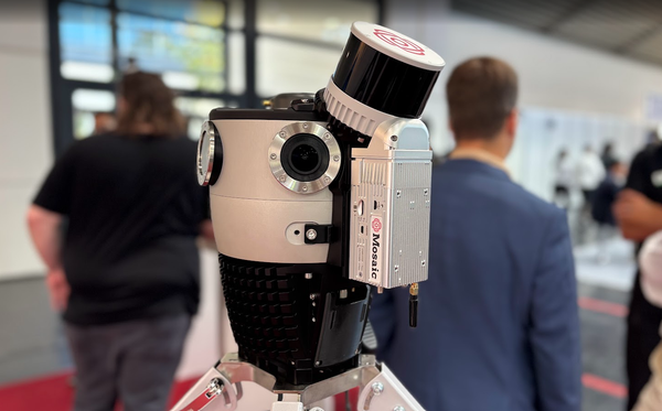
Bigger crews used to be the only way to cover more ground, but Mosaic is shaking up the mobile mapping industry. Now you can take one operator, one vehicle, and a mobile mapping system small enough to check onto a flight to capture the same engineering-grade data that once required a much larger team.
Ready to see what a smaller team with the right equipment can capture? Contact Mosaic to figure out which of our systems is right for your projects and deliverables.