Geospatial professionals with serious data requirements tend to outgrow their prosumer and consumer systems. Here is what a purpose-built MMS offers that they never will.
You bought your prosumer camera because it made sense at the time: it was affordable, compact, and easy to use. For early-stage route planning, a quick site walkthrough, or building your case for a larger investment, it made your job a lot easier.
Then the projects got bigger, with more demanding deliverables, like a client needing imagery that was precise enough to extract pole attachment heights, or an audit requiring georeferenced as-built documentation.
Gradually, the camera that was good enough to get you started is now holding you back.
While prosumer 360° cameras, such as Insta360, GoPro, and Ricoh Theta, are well-made, it is very common for surveying and infrastructure management companies to outgrow them. These cameras are designed to bridge the space between consumer and professional, but if you’ve been around long enough, you already know the difference between a tool that works “well enough” and a tool that is built specifically for your job.
This article walks through exactly where that gap is, what the data says, and what a professional-grade mobile mapping system (MMS) offers when it’s time to take that next step with your business.
Prosumer vs. professional: a side-by-side comparison
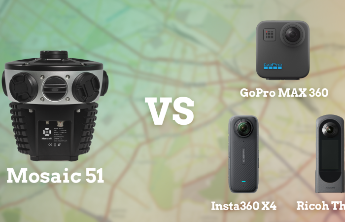
The table below compares three widely used prosumer 360° cameras against the Mosaic 51. Resolution, positioning, durability, and data portability are the most important specs for professional surveying and mobile mapping.
| Spec | Insta360 X4 | GoPro Max | Ricoh Theta X | Mosaic 51 |
|---|---|---|---|---|
| Max Resolution | 8K (72 MP) | 5.6K (17 MP) | 11K (60 MP) | 12.3K (72+ MP effective) |
| Shutter Type | Rolling shutter | Rolling shutter | Rolling shutter | Rolling shutter |
| IP/Weather Rating | IPX8 | IPX8 | IPX8 (when using underwater case) | IP67 |
| GNSS Integration | Consumer GPS (app) | Consumer GPS (app) | Consumer GPS (app) | Built-in GNSS/INS, ext. antenna support |
| Data Ownership | Proprietary ecosystem / cloud-dependent | Proprietary ecosystem / cloud-dependent | Produces standard imagery formats | Produces open formats with 20+ software integrations |
| Marketed use | Social media, VR, real estate walkthroughs | Action video, casual 360° | Real estate, light commercial | Infrastructure survey, mobile mapping, asset management |
| Price (USD) | ~$500 | ~$400 | ~$900 | Contact for pricing |
What does “survey-grade” actually mean? And do you need it?
“Survey-grade” gets thrown around loosely in 360° camera marketing, so it is worth being precise about what the term actually requires.
By accepted industry standards, survey-grade means a repeatable accuracy of 1–3 cm horizontally and 2–5 cm vertically, achieved through tools like RTK GPS, Total Stations, or LiDAR.
Three things define survey-grade:
- Precision: measurements fall within that 1–3 cm window of true ground position, not just relative accuracy between features in the same dataset.
- Independent validation: the data is checked against known, fixed benchmarks (ground control points, or GCPs), not simply trusted because of the equipment used to collect it.
- Legal defensibility: because of that validated precision, the data holds up for determining property boundaries and construction staking.
Mapping-grade, survey-grade, and where 360° mobile mapping fits
No mobile mapping system – prosumer or professional – reaches survey-grade accuracy on the strength of its cameras alone. It requires add-ons that your typical prosumer cameras cannot accommodate.
“Mapping-grade” is the middle tier between consumer/prosumer cameras and survey-grade mobile mapping systems. Mapping-grade cameras, like Mosaic’s lineup, are a huge quality improvement over consumer/prosumer cameras, even when used without survey-grade technology.
The benefit of Mosaic’s lineup of cameras is that they can be used with or without survey-grade add-ons. The cameras adjust to your project’s needs.
Two things determine how close a system can get to survey-grade:
Georeferencing: every frame needs to be tied to a precise real-world coordinate. This is typically through a GNSS/INS system with IMU integration that holds accuracy even in GPS-challenged environments, such as under tree canopy, in urban canyons, or through tunnels.
Mosaic’s cameras ship with a built-in GNSS receiver accurate to roughly ±1.5 m. To bridge the gap from mapping-grade to surveying-grade, Mosaic integrates seamlessly with external multi-band RTK GNSS receivers (such as the Emlid Reach RS2, RS2+, or RS3). These deliver centimeter-level accuracy in RTK mode up to 60 km from a base station, or in PPK mode up to 100 km. Now, you’re squarely in survey-grade territory.
Getting there in practice still requires the same independent check-shot validation any survey-grade workflow needs, regardless of which camera captured the imagery.
Known, consistent camera geometry: photogrammetry, 3D reconstruction, and feature extraction all depend on knowing exactly where each lens sits, how it’s oriented, and how the lenses relate to one another.
Mosaic’s fixed, individually calibrated lens configuration (with the calibration file provided to each customer) keeps that geometry stable across every capture.
Prosumer cameras, with consumer-grade mounts and variable stitching algorithms, introduce geometric uncertainty that compounds through every downstream step. That’s a large part of why prosumer cameras cannot be integrated into survey-grade workflows, even with a better GPS bolted on. The lens geometry itself becomes the weak link.
The importance of data ownership
Clear data ownership and control separates the amateurs from professionals.
Ambiguous licensing and requiring proprietary software create barriers that can derail a project’s timeline. It also puts your business model at the mercy of external companies that could sell your data, go bankrupt, or make licensing changes without your consent.
Imagery from Mosaic cameras is produced in non-proprietary formats and is entirely under your control. This separates it from the prosumer market, which tends to require proprietary software.
Looking for more on upgrading from your prosumer camera?
Read our case study from Fly North: Integrating Street View Mapping with Drone Surveying
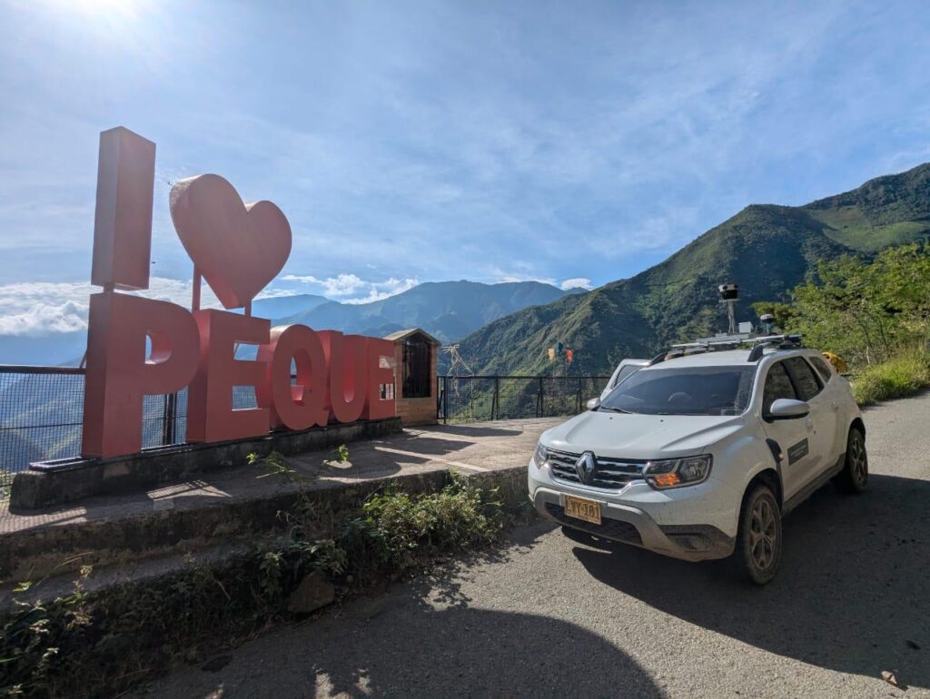
“After experimenting with the Insta360 Pro 2 and investigating the Ladybug5, Fly North purchased the Mosaic 51 camera system to complement their drone aerial mapping services. It improved the accuracy and resolution of their cadastral projects while staying within the budget constraints of their Colombian clients.”
Working with a prosumer 360° camera
Prosumer 360° cameras are primarily intended for content creation on social media or virtual tours for real estate listings. While they have their uses for some light surveying work, they often fall short if you try to push them beyond the basics.
For starters, prosumer cameras are not calibrated to survey-grade standards. They don’t carry industrial-rated enclosures, and aren’t durable to extreme heat or unpaved roads. If the camera is equipped with GNSS receivers, they are usually only designed for consumer-level accuracy. They also almost universally route the data through proprietary ecosystems that limit how you can process, store, and share your imagery.
Most prosumer cameras also use micro SSD cards that reach data storage capacity quickly and can get lost easily. The Mosaic 51, however, uses a 1- 2 TB SSD that holds a full day’s worth of data capture and makes data storage and transfer much easier.
Where the gaps start to show
Lower imagery resolution than needed
In surveying, anything more complex than basic documentation will need a higher resolution than a prosumer camera can provide. Tasks like reading utility pole labels, confirming street addresses, or verifying road markings’ conditions require high-quality imagery that can withstand being zoomed in beyond what most prosumer cameras can handle.
The three most comparable prosumer cameras (featured above in the table) only offer resolutions ranging from 5.6K to 11 K.
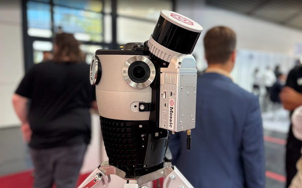
For comparison, the Mosaic 51 produces 12.3K equirectangular output from six 12.35 MP sensors. That resolution, combined with the fixed geometry of the overlapping lenses, is what enables AI and machine learning models to extract features reliably, and what gives offsite engineers enough detail to make decisions remotely without returning to the field.
If you need to crank the resolution even higher, the Mosaic X features 13.5K equirectangular output from six 12.32 MP sensors.
Mosaic cameras also have larger pixels than most prosumer cameras, with GSD (ground sample distance) of 5.5mm (Mosaic 51) and 4.6mm (Mosaic X) at 10 meters.
Field durability and reliability
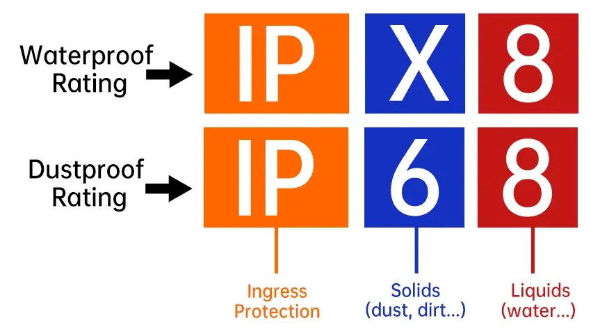
Prosumer cameras are engineered to a price point and a use case of about IPX8, which does not include sustained operation in salt air, desert heat, or on dusty and bumpy unpaved roads. Many surveying locations require a camera that can withstand these kinds of harsher environments.
For example, when PLACE, a global non-profit mapping organization, needed to capture every road in Funafuti, Tuvalu, they were operating in an extreme environment: tropical humidity, salt air, rough roads, and intense heat. They were also capturing data in a remote location in the middle of the Pacific Ocean, so their camera needed to be reliable.
They chose the Mosaic 51 specifically because it is built around an industrial frame with sealed connectors and housing, tested to IP-67 for water, dust, heat, and vibration.
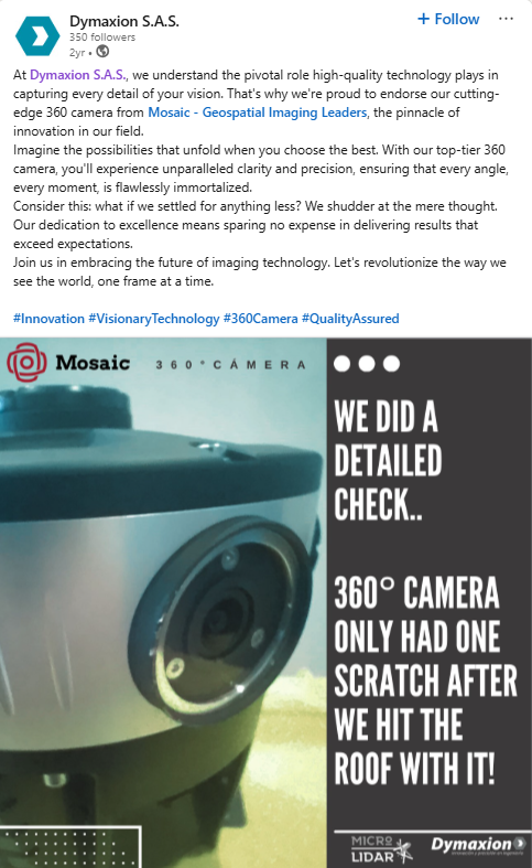
In this real-life case study of Mosaic 51’s durability, Dymaxion hit the roof of a parking garage with the Mosaic 51, and it sustained only scratches. Read the entire story here.
Vendor lock-in and data ownership
This is the issue that experienced professionals often cite first, but it is the one least visible until further down the road: most prosumer 360° camera systems require proprietary software for processing, stitching, or uploading imagery.
Some prosumer camera companies route data through closed cloud platforms, and others produce output formats that are not natively compatible with the software infrastructure your company relies on.
Relying on a prosumer camera with proprietary red tape adds unnecessary risk to your business. Vendors can change their licensing terms, discontinue a software, or raise their platform fees. From the client side, they may want the data in a specific format that you can’t deliver.
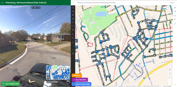
Mosaic cameras are built with flexibility and data control in mind. The imagery you capture with Mosaic is compatible with over 20 software programs, including ArcGIS, QGIS, Mapillary, Mapersive, and a wide range of photogrammetry and point cloud platforms. The data is yours, in standard formats, processable in whatever tools your organization uses.
What to look for when you are ready to upgrade
The right mobile mapping system depends on your specific use case, but several criteria apply broadly to professional surveying and infrastructure work.
Resolution relative to your deliverables
Define the smallest feature you need to identify reliably from captured imagery. If that feature is a street address, a pole class stamp, or a lane marking condition, you need at minimum 12K equirectangular output.
IP rating relative to your operating environment
If you operate in rain, high humidity, dusty conditions, or on unpaved roads, a high IP rating is needed to keep the camera on the vehicle and your surveying on schedule.
Software ecosystem compatibility
Before purchasing any system, confirm that its output formats are natively compatible with the GIS, photogrammetry, and asset management platforms your organization already uses. Verify that imagery can be exported without requiring a proprietary license, and that it can be ingested by AI or machine learning pipelines without custom preprocessing.
GNSS and IMU integration
For any project where spatial accuracy matters, the camera system needs a built-in or tightly integrated GNSS/INS solution. Consumer GPS, which relies on the same chip as a smartphone, is adequate for navigation, but not for survey-grade positioning or for generating data that will be used in pole loading analysis, boundary verification, or federal compliance documentation.
Mosaic systems have proven integrations with external GNSS devices, such as the EMLID Reach line (specifically the RS2, RS2+, and RS3) and XVN (Xsens Vision Navigator).
Single-operator capability
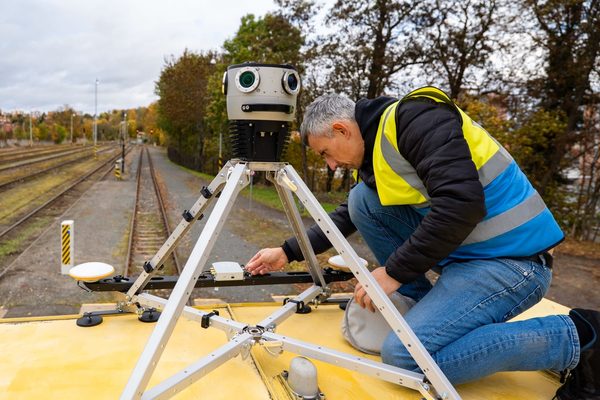
A system that requires a two-person crew or an in-vehicle workstation adds cost to every data collection day. Mosaic mobile mapping systems are designed for single-operator deployment from a standard vehicle. The built-in computer, onboard storage of 1 to 2 TB, and self-contained power mean a single person can mount the camera, drive the route, and return with a complete dataset.
LiDAR integration, if your use case demands it
Not every mobile mapping project requires LiDAR. For route documentation, cadastral surveys, as-built imagery, and visual inspection workflows, high-resolution 360° imagery alone is sufficient.
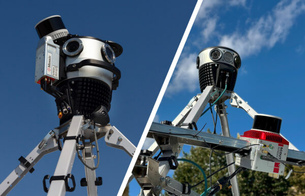
For pole loading analysis, BIM corridor documentation, or engineering-grade point clouds, a combined camera and LiDAR system, such as the Mosaic Meridian or Meridian Lite, provides both data streams in a single vehicle pass, without requiring two separate capture runs.
Frequently asked questions
What is the difference between a prosumer 360° camera and a professional mobile mapping system?
A prosumer 360° camera, such as the Insta360 X4 or GoPro Max, is designed for social media content creation and light commercial use, like virtual tours. It uses rolling shutter sensors, consumer-grade GNSS, and typically requires proprietary software for processing. A professional mobile mapping system, like the Mosaic 51, uses global-shutter, high-resolution sensors with known calibration geometry, integrates survey-grade GNSS and IMU positioning, operates in industrial field conditions, and produces output in open formats compatible with GIS and engineering workflows.
Can I use an Insta360 or GoPro for infrastructure surveying?
For early-stage planning, simple site walkthroughs, and internal visual records with low accuracy requirements, a prosumer camera can definitely work. However, they can fall short if the project requires survey-grade georeferencing, engineering-grade feature extraction, AI or machine learning pipelines, federal compliance documentation, or operation in harsh field environments. At that level of requirement, the resolution, positioning, durability, and data portability limitations of consumer hardware become operational bottlenecks.
What resolution do I need for survey-grade street-level imagery?
The minimum effective resolution for reading small features, such as utility pole class labels, street address numbers, or lane marking conditions, from vehicle-mounted 360° imagery is typically in the range of 12K equirectangular output with global-shutter sensors. For AI and machine learning workflows, format consistency and calibration stability matter as much as raw resolution.
Is Mosaic imagery compatible with GIS and photogrammetry software?
Yes. Mosaic imagery is proven compatible with over 20 software programs, including ArcGIS, QGIS, Mapillary, Mapersive, ArcGIS Reality, and a range of photogrammetry and point cloud platforms. The imagery is delivered in standard formats and does not require proprietary processing software. Mosaic cameras also integrate with external GNSS/INS systems and LiDAR, and their output is compatible with feature extraction platforms such as New Compass Ranger and Pathfinder.
Ready to upgrade your prosumer 360° camera?
Prosumer 360° cameras have their place; however, there is a ceiling on what hardware on this level can do, and it shows up in specific and predictable ways.
The upgrade to a purpose-built MMS from Mosaic is not a luxury purchase if your company has proven its concept with a prosumer camera. It just becomes necessary when your equipment catches up to your expertise and your clients’ quality demands.
If your current 360° camera is becoming the bottleneck on your projects, contact the Mosaic team to discuss which system fits your use case.