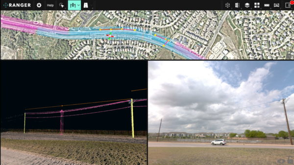
How two configurations of the same professional platform serve different projects, and how to tell which one is for you.
There is a question we get asked a lot about our mobile laser scanning (MLS) systems, and it is almost always phrased the same way:
Which system is better?
But this is a flawed approach. We would rather answer a more useful question:
Which system is right for the work I am being paid to deliver?
Mosaic Meridian 2 and Mosaic Meridian Lite are not the “good version” and the “cheap version” of the same thing. They are two configurations of the same professional platform, built on the same survey-grade foundation and tuned for two different kinds of projects.
If you choose the MLS system based on the deliverables, then both are excellent. But if you choose based on the price tag alone, you will either overspend on capabilities you never bill clients for, or come up short on a contract that needs them.
Here is how to tell the Meridian 2 and Meridian Lite apart.
Let’s start with the similarities
This is the part that surprises people, so it is worth being blunt about it.
Both systems use the same LiDAR and the same GNSS/INS navigation core.
That means the same 32-channel sensor, the same point rate, the same 1 – 2.5 cm precision, the same intrinsic ranging accuracy, the same RTK and PPK support, and the same georeferencing performance.
With our Meridian lineup, there is no “survey-grade” version and “nearly survey-grade” versions, as the measurement foundation is identical for both units.
Both are also genuinely single-operator systems. One person, with one vehicle, driving one pass. The imagery and LiDAR are captured, calibrated, and delivered together.
So if your decision hinges on point cloud accuracy or positioning accuracy, we can save you some time: that requirement does not distinguish these two systems. Look at the rest of the list instead.
Where these MLS systems differ
Four things set the Meridian 2 and Meridian Lite apart. All four are about how the shared sensors come together, not about the sensors themselves.
1. The camera
The camera is the biggest single difference, and the one most likely to decide your choice.
Meridian 2 carries the Mosaic X: a global-shutter camera producing 91.2 MP equirectangular panoramas at 360° × 139° field of view.
Meridian Lite carries the Mosaic 51: a rolling-shutter camera producing approximately 75 MP panoramas with the same 360° × 139° field of view.
Both are high-resolution 360° cameras that produce imagery for professional teams to use in their everyday workflows. However, the distinction between these two is what happens when the vehicle moves fast and when the imagery has to do more than just illustrate.
A global shutter captures the whole frame in one instant, while a rolling shutter reads the frame progressively. At city speeds, this distinction between lenses rarely matters.
The type of camera you use matters a great deal when you:
- Travel at highway speeds,
- Capture on a highway or railroad corridor job,
- Need to zoom in on a crack in a bridge soffit, or
- Colorize a point cloud from that same frame.
2. Where the LiDAR sits
Both MLS systems use the same sensor, but it is in a different position. This small change matters a lot more than most people expect.
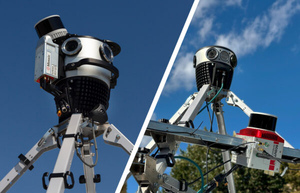
On Meridian 2, the LiDAR is mounted higher and at a revised angle, directly above the camera. Through testing and refinement, we found this delivers stronger intensity returns, removes interference from the vehicle roof, and produces noticeably cleaner data on building facades and overhead assets.
See the Meridian 2’s configuration below:
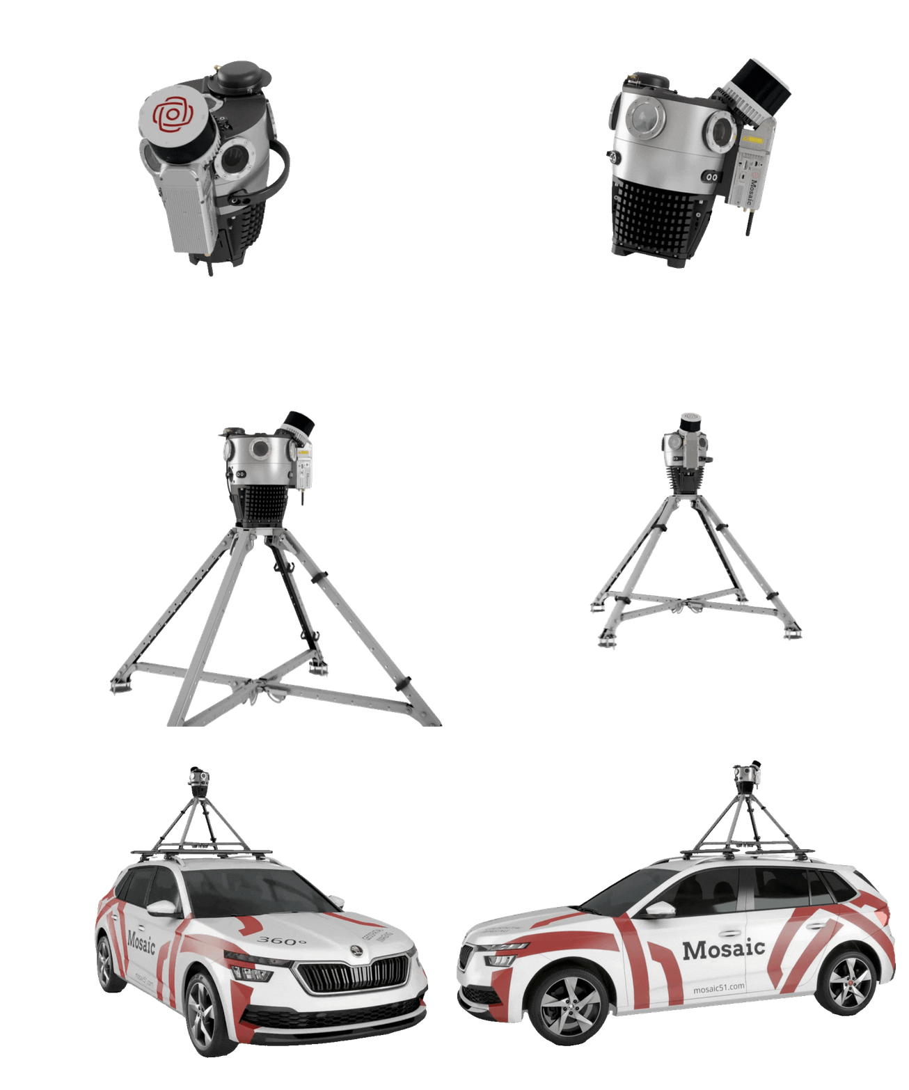
None of that makes it a better sensor, per se. It is the same sensor with a better line of sight. This gives it a more favorable incidence angle on the targets that are hardest to catch: upper facades, building tops, overhead infrastructure, and distant objects. Points land where you need them, and more of the environment is seen consistently.
If your work is at street level (like roadside assets, signage, curbs, road furniture, and other city inventory items), this advantage is largely theoretical for you. If your work looks upward, it is worth real money.
3. Calibration and integration
Because the Meridian 2 LiDAR is fixed directly to the camera, the two sensors move as a single rigid unit. Calibration is more accurate, more stable, and effectively permanent. There is no drift between sessions and no need for re-calibration between jobs.
This saves you field time before a job, office time after it, and removes that quiet background uncertainty about whether today’s data matches last month’s.
On a program with repeat mobilizations, removing that step removes a recurring line item.
4. Deployment and transport
Meridian 2 uses a quick-release mounting system in place of a multi-bolt installation, and the wing bracket is gone entirely. The result is one of the most compact professional mobile mapping systems available.
The whole thing packs into two manageable carry cases that fit into checked luggage on flights. Mount it and start capturing data in minutes.
Meridian Lite keeps deployment simple and streamlined in its own right: one operator, no unnecessary complexity, straightforward setup. It was never designed to be a heavy system.
Both are practical in the field. Meridian 2 is optimized for teams who mobilize often and for whom setup time is genuinely expensive.
Meridian 2: the maximum-capability configuration
Built for: high-speed, image-critical and coverage-critical work.
Meridian 2 is the right call when your imagery has to survive highway speeds, when your point cloud needs to reach upwards, and when a single capture has to keep paying for itself long after the crew has gone home.
Typical projects include:
- Highway and long-corridor mapping
- Infrastructure inspection and condition documentation
- Facades, building tops and overhead assets
- Utility, transport, and road-authority workflows
- High-quality RGB-colored point clouds
- Datasets intended for repeated reuse across multiple deliverables
You are probably a Meridian 2 customer if:
- Clean imagery at highway speed is non-negotiable
- Your imagery has to support inspection, not just provide context
- Upper facades or overhead assets have to be visible in the data
- RGB colorization is part of what you contractually deliver
- One capture needs to serve several future uses
- Mobilization time is a real cost for your crew
One more thing worth saying plainly, because it comes up in every serious evaluation:
Meridian 2 is the premium configuration within the Mosaic range, but that is a within-range statement. Measured across system cost, software, maintenance and single-operator deployment, it delivers significantly lower total cost of ownership than enterprise-class alternatives (think the kind of rig that needs a two-person crew and a dedicated processing pipeline).
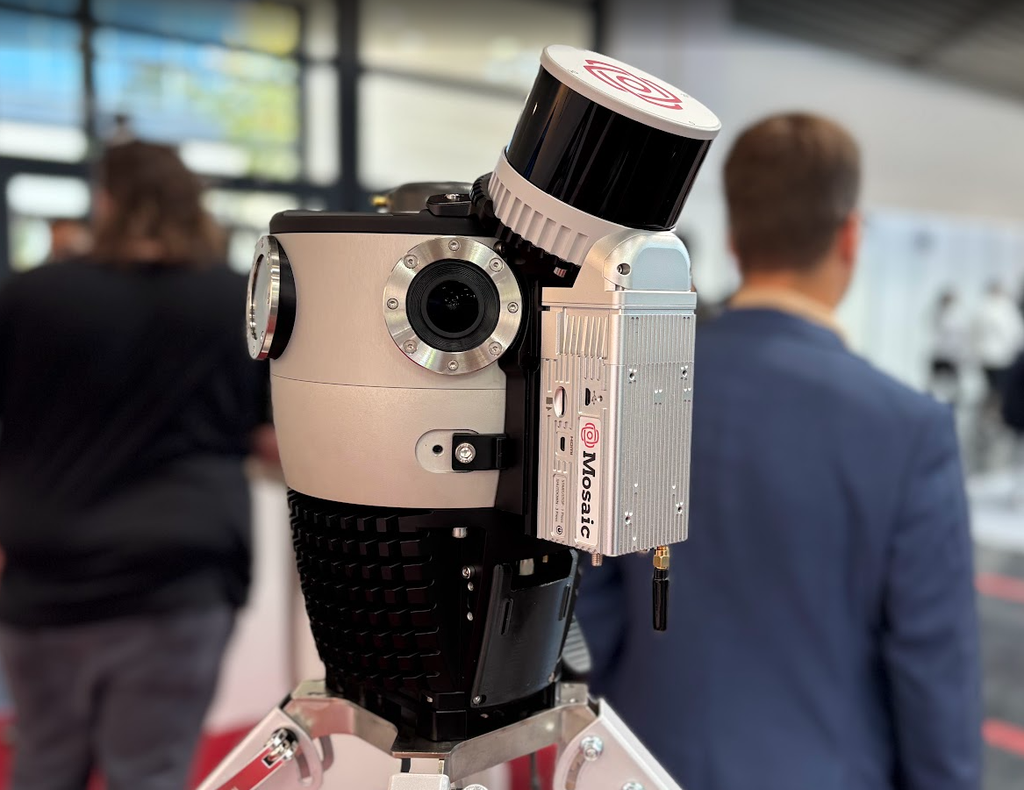
Meridian Lite: the right-sized configuration
Built for: efficient, repeatable, city-scale mapping.
Meridian Lite exists because a very large amount of valuable mapping work does not need highway-speed imaging or facade-level inspection detail, and paying for those things anyway is often a waste.
It brings the same professional LiDAR and navigation foundation into a configuration tuned for volume, speed of turnaround, and accessibility.
Typical projects include:
- City-scale GIS database creation
- Roadside and municipal asset inventory
- Smart-city and public-space documentation
- Repeated network- or city-refreshing programs
- Street-view and visual-reference datasets
- Fast-turnaround, budget-conscious professional mapping
You are probably a Meridian Lite customer if:
- You need professional LiDAR but cannot justify an enterprise-level stack
- You mainly collect at city speeds
- Processing and delivery speed matter more than maximum image specification
- Your panoramas are for documentation and asset interpretation
- You want to scale a fleet, or repeat the same survey regularly
- ROI is the number your business case turns on
There is a real workflow advantage hiding in here that is easy to miss. Because the LiDAR core is identical, the difference in data volume between the two systems is almost entirely the image stream.
A lighter image stream means faster transfer, faster post-processing, and faster delivery. On a program where you are re-capturing the same network four times a year, that compounds into something significant.
Side-by-side comparison
| Meridian 2 | Meridian Lite | |
| LiDAR | 32-channel, 1–2.5 cm precision | Same shared LiDAR core |
| Point rate & accuracy | Identical | Identical |
| GNSS/INS | Survey-grade, RTK + PPK | Same navigation core |
| Camera | Mosaic X | Mosaic 51 |
| Panoramic imagery | 91.2 MP / 13.5K | Approx. 75 MP / 12.3K |
| Shutter | Global | Rolling |
| LiDAR position | Higher, directly above the camera | Standard system position |
| Coverage strength | Facades, building tops, overhead and distant assets | Professional standard coverage for city-scale work |
| Image data weight | Richer image asset | Lighter, faster to handle |
| Deployment | Quick-release mount, two carry cases | Simple, streamlined, three carry cases |
| Best fit | High-speed, image-critical, coverage-critical, reusable-dataset projects | City-scale GIS, asset inventory, repeat surveys, fast turnaround |
Six questions to decide which system is right for you
If you are still weighing your options between the two, these are the questions we would ask you on a call.
- What is the contracted deliverable? Panoramas, uncolored point clouds, RGB-colored point clouds, GIS assets, inspection records, or a reusable digital record of the network?
- How fast will the vehicle actually be moving? City speed, or highway and long-corridor production speed where motion performance becomes critical?
- How will the imagery be used? Visual context only — or a high-value source for inspection, colorization and interpretation?
- Which targets matter most? Ground-level roadside assets, or facades, overhead infrastructure and elevated objects where mounting geometry earns its keep?
- Where is your cost bottleneck? Field time, processing time, storage, staffing, repeat visits — or the risk of missing information and having to go back?
- What creates your margin? Maximum deliverable quality and reusability, or high-volume capture and fast turnaround?
If your answers cluster around image quality, speed, coverage and reusability, Meridian 2 is your system.
If they cluster around city-scale throughput, fast image handling and return on investment, Meridian Lite is your system — with exactly the same LiDAR and navigation quality underneath.
What both systems give you regardless
Whichever configuration fits, some things do not change.
Non-proprietary outputs. LAS, LAZ and CSV point clouds plus stitched, geo-referenced imagery — built to drop into the workflow you already have, not to lock you into ours.
Single-operator capture. Calibrated 360° imagery and LiDAR in one pass, by one person.
Professional-grade data. Both systems are professional integrated mobile mapping platforms. Neither is an entry-level compromise.
TL;DR: Same professional LiDAR core. Different camera, geometry, workflow, and customer fit.
Meridian 2 is the maximum-capability configuration for image-critical and coverage-critical work.
Meridian Lite is the right-sized configuration for efficient city-scale mapping.
The better system is the one matched to what you have to deliver.
Want to see the data before you decide?
We have sample point clouds and 360° panoramas from real acquisitions for both configurations, and we are happy to walk through which one fits your project.
Get in touch with us, bring your deliverable spec, and we will give you a straight answer on which MLS system is the best for you.