
ARX Tecnologia, Mosaic’s Brazilian partner, originally published this article in October 2026 on their blog and LinkedIn in Portuguese.
In mobile mapping, image quality is essential to ensure reliable data. In many projects, the objective goes beyond simply recording georeferenced images: it is necessary to identify street names, house numbers, sidewalk conditions, trees, and pavement characteristics, such as the state of the asphalt.
Even when these elements are some distance from the camera, the images must offer sufficient sharpness and definition for analysis. Low-quality recordings can hinder the interpretation of information, compromise project results, and in more serious cases, require new data collection. Therefore, having a high-performance camera is an important factor in obtaining reliable images and making better use of the data collected in the field.
In addition to image quality, the equipment’s resistance to environmental conditions is an important factor in mobile mapping. During field operations, the camera is exposed to sunlight, wind, and dust, conditions that are part of the data collection routine and should not compromise its operation, calibration, or the quality of the recorded data. Therefore, it is essential to have equipment prepared to operate in outdoor environments, maintaining the reliability of the captures even in the face of variations encountered along the route.
Another fundamental aspect is the consistency of performance throughout the entire operation. On a typical data collection day, which can last about seven hours , the camera needs to maintain a uniform quality standard, without performance losses due to overheating or prolonged use. Operational stability contributes to ensuring that the images recorded at the beginning and end of the journey are of adequate quality for subsequent analysis. Therefore, the reliability of the equipment throughout the entire journey is as important as its ability to produce high-quality images.
The technology behind Mosaic 51
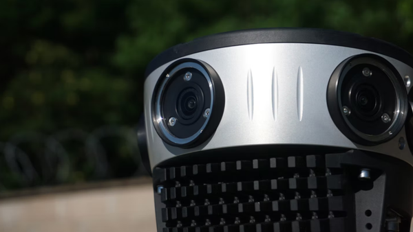
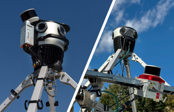
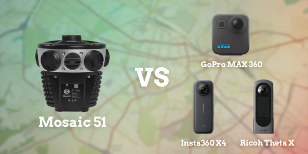
The Mosaic 51 brings together features developed to meet the demands of mobile mapping, combining high resolution, 360° panoramic capture, and a design engineered for field operations. Equipped with six 12.35-megapixel sensors, the camera produces panoramic images with a resolution of 75.5 megapixels, allowing for highly detailed recording of the environment around the vehicle. Its optical design aims to maintain sharpness in different areas of the image, contributing to the identification of urban and infrastructure elements.
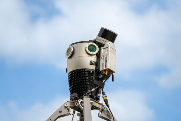
One of the main distinguishing features of the Mosaic 51 is its durability. The structure was developed to withstand the conditions encountered during outdoor data collection, with IP67 sealing against dust and water ingress, protected lenses, and industrial connectors resistant to environmental exposure. These features help preserve the equipment during continuous use in the field, including on routes with varying pavement conditions.
Thermal management also deserves mention. The camera features a structure designed to passively dissipate heat, using thermal dissipation elements integrated into its body. This solution contributes to controlling the internal temperature during operation. The manufacturer specifies an operating temperature range of 0 °C to 45 °C, an important characteristic for planning data collection in outdoor environments.
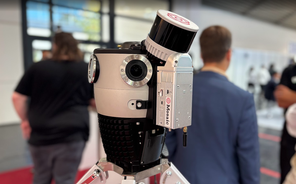
Another important feature is the 1 TB internal SSD storage, which allows data to be recorded directly on the device, without depending on a dedicated onboard computer. The removable and replaceable storage facilitates data management between operations. Furthermore, the Mosaic 51 allows integration with external sensors such as GNSS, IMU, and LiDAR, offering flexibility for different mobile mapping configurations.
With this combination of resolution, integration features, and rugged construction, the Mosaic 51 was designed to meet the demands of professional operations, where image quality must go hand in hand with equipment reliability.
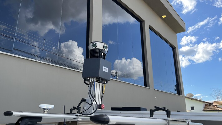
Mosaic 51 integrated into the ARX 672 system
The quality of the Mosaic 51 becomes even more significant when we consider its integration with the ARX 672 mobile mapping system, developed by ARX Tecnologia to meet the demands of data collection in urban areas, highways, and various field environments.
The system combines high-resolution panoramic capture with positioning and orientation technologies, allowing images to be associated with vehicle trajectory information. This integration enables the creation of a georeferenced database that can be used in multi-purpose technical cadastral projects, urban asset inventories, infrastructure analysis, and other geospatial applications.
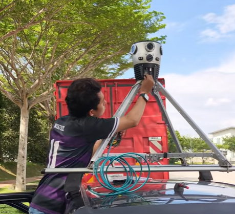
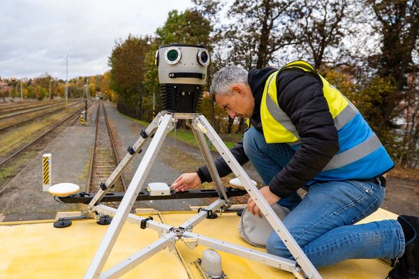
In addition to its capture quality, the ARX 672 was designed to simplify operational routines, with practical mounting, offline navigation capabilities, and integration with processing tools. In this way, Mosaic 51 technology is part of a solution that seeks to combine image quality, productivity, and efficiency in mobile mapping operations.
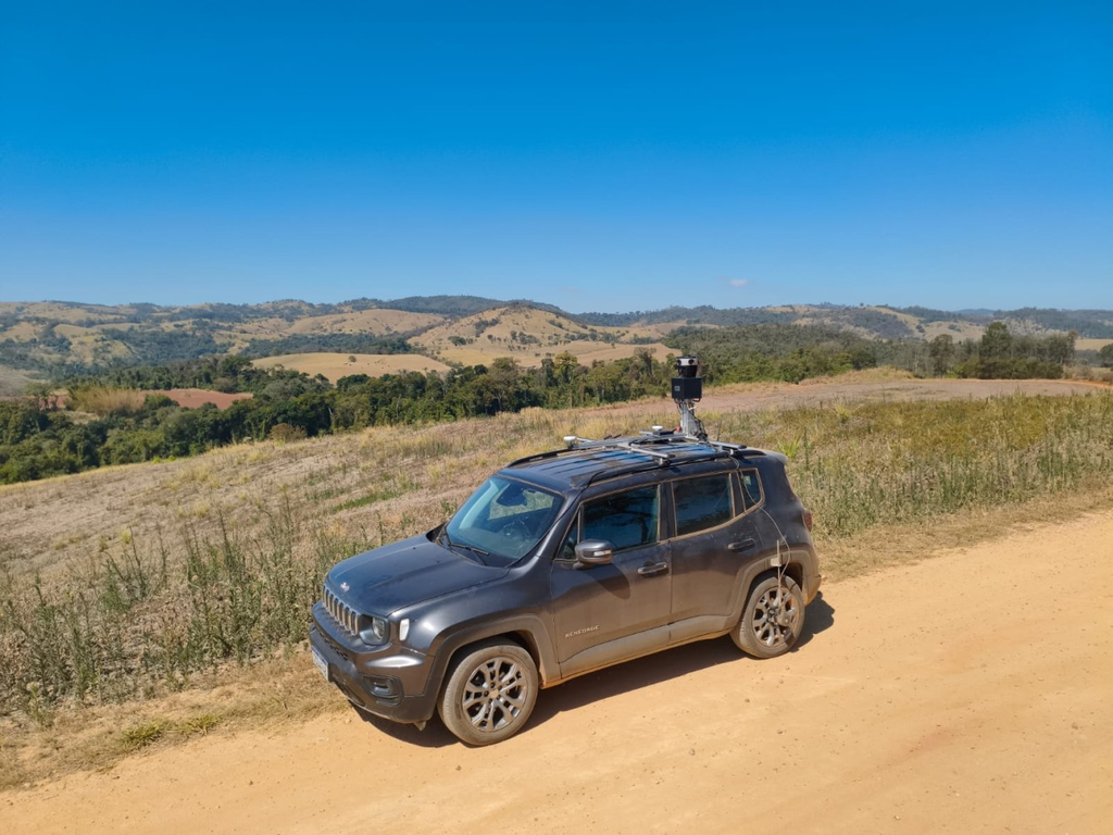
Among the main features and differentiators of the ARX 672, the following stand out:
- High-resolution panoramic camera: Equipped with the Mosaic 51, the system captures 360° panoramic images at 75.5 megapixels, allowing you to view details of urban elements and infrastructure.
- Integrated georeferencing: Combines GNSS, IMU, and DMI to record positioning, orientation, and displacement information during data collection.
- Operation by a single professional: The system configuration lets a single operator carry out collection activities, simplifying the field routine.
- Offline navigation: Offers navigation features with interactive maps that allow you to guide collection even in locations without an internet connection.
- 1 TB internal storage: The Mosaic 51 features an integrated SSD for recording operational data, facilitating the management of large volumes of images.
- Practical assembly: Its structure was developed to facilitate installation in the vehicle and reduce preparation time before collection begins.
- Agile data processing: The workflow allows for processing images and trajectory information on the same day, according to operational and processing conditions.
- Integration with ARX GEO 360: The collected images can be used in ARX software for photogrammetric measurements, multi-purpose technical registration, asset inventory, and identification of urban elements using artificial intelligence capabilities.
The quality of a mobile mapping system begins with its ability to record reliable images and preserve data consistency throughout the entire operation. With high resolution, rugged construction, and features developed to meet the demands of field data collection, the Mosaic 51 plays a fundamental role in the ARX 672 system. Its integration with positioning and orientation technologies allows the captured images to be transformed into georeferenced information that supports various applications, from technical cadastral surveys to urban infrastructure mapping.
By combining Mosaic 51 technology with the operational capabilities of the ARX 672, ARX Tecnologia aims to offer a solution that unites image quality, reliability, and efficiency. After all, having well-defined images and consistent data is an essential step in developing mobile mapping projects with greater safety and precision.