
Mapping entire cities has never been easier. In this case study, see how to get live updates from drivers, work accurately without LiDAR, and build future-proof city plans.
Many day-to-day decisions for city planners start with asking “what does the street actually look like right now?”
For one city in Finland, the existing street-level imagery on file was old, inconsistent in quality, and no longer matched the pace of development. This was getting in the way of city planners making timely, accurate decisions for road work and street furniture upgrades.
This city has a university, and a robust tourism economy in both the summer and winter seasons for a variety of sports. And while it is on the smaller side, its population is gradually increasing. In order to keep up with the necessary changes and upgrades to accommodate growth, the city government needed updated street view imagery.
However, refreshing an entire city’s visual record takes a team of experts. For this project, it called for three companies working together:
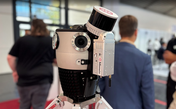
- Mosaic supplying the 360° camera hardware,
- Terra Visus managing the large-scale data capture, and
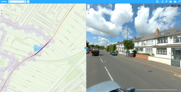
- Autori running the software behind the operation.
Together, they set out to recapture 525 kilometers (326 miles) of streets in high-resolution 360° imagery for a project that would impact multiple government departments.
What follows is a look at how that partnership worked in practice. We will discuss why the city chose imagery over imagery+LiDAR, how the hardware and software were selected, and what the data capture process entailed.
This case study is in conjunction with a webinar between:
- Lynn Puzzo, Director of Sales and Marketing at Mosaic,
- Andrew Baddeley, COO of Terra Visus, and
- Ari Immonen, Director of Business Development at Autori.
You can watch the whole webinar on our YouTube Channel, or below:
“I like the integration between the software solution, Autori, and, as I’ve made quite public a number of times, the reliability of the Mosaic hardware.
I think it’s a very good combination, because it’s very difficult for one company to do everything.
The best thing is for each company to do what it’s good at and to form these partnerships where required. As a result, you get the outcome that we managed to achieve over in Finland.”
–Andrew Baddeley, COO of Terra Visus
Goal: reduce field visits to save time and money
Visual data is at the core of many decisions across city planning, engineering, permitting, and road maintenance departments. Examples include a permitting officer confirming sidewalk width to place new trash cans, an engineer checking road sign placement, or a maintenance planner assessing the scale of an upcoming repaving job.
Without current imagery on file, that means manually sending a person into the field, even for small questions that could have been answered from a desk in minutes with a photo.
The lost time and money add up quickly when you multiply manual field visits across multiple city management departments for every project. An updated, searchable library of 360° street imagery can turn a field visit into a few clicks.
This need for efficiency led the city government to invest in updated street-level imagery.
Why use imagery instead of LiDAR?
Given the scale of the project, it would have been reasonable to expect a combined imagery-and-LiDAR approach. Instead, the city government specifically requested an imagery-only solution, for two practical reasons.
First, city planners did not yet have the systems or internal workflows in place to store, manage, and make regular use of LiDAR point cloud data. Point clouds are great tools, but they require dedicated software and trained staff to deliver ongoing value. LiDAR data is only as good as the client’s ability and desire to use it, and at this stage, it would have been overkill for this city’s needs.
Second, the staff was already comfortable navigating with Google Street View-style tools. A 360° imagery library matched their existing workflow and required essentially no retraining. Mosaic’s non-vendor-locked imagery made it easy to incorporate imagery into programs they already knew.
“The higher the resolution of the imagery, the less LiDAR is an absolute requirement, because you can achieve a lot with just imagery when it’s got a conformal projection and accurate positioning.”
–Andrew Baddeley
Incorporating LiDAR later on
Choosing imagery over imagery+LiDAR for this phase of their projects does not mean they cannot incorporate point cloud data later. An imagery-only dataset can support more advanced applications down the line without a second data capture project.
High-resolution and well-positioned imagery is the foundational input for emerging 3D reconstruction methods, such as Gaussian Splats and AI-based asset detection.
Building the right toolkit of hardware and software
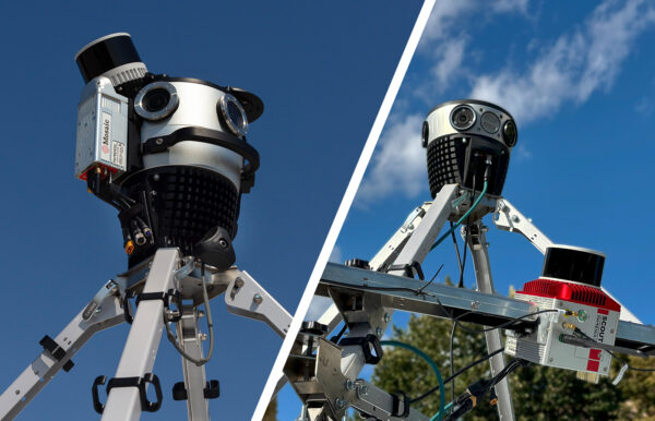
A project of this scale depends on hardware that performs consistently over hundreds of kilometers, paired with software that can manage the logistics of a multi-day, multi-crew capture.
Hardware: why the Mosaic X fit the tender requirements
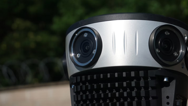
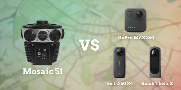
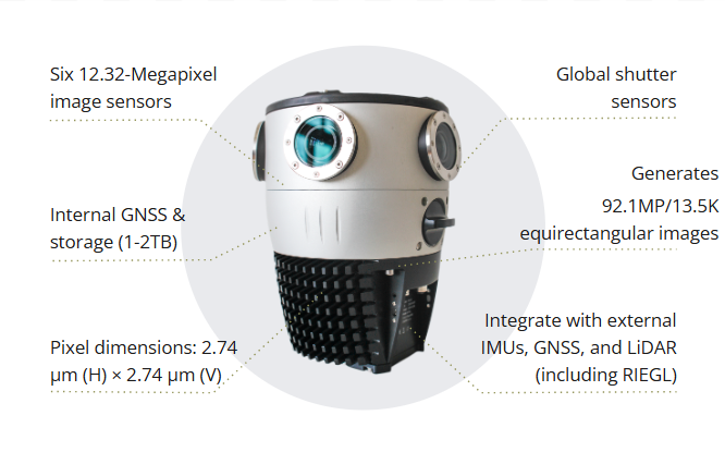
The city’s tender specifications called for a high-resolution threshold that ruled out most consumer and prosumer-grade options. The Mosaic X delivers 91.2 MP equirectangular resolution across 13.5K panoramas, comfortably meeting that bar.
Just as important was the camera’s global shutter design. A global shutter captures an entire image at once, rather than scanning it line by line, avoiding the distortion rolling-shutter sensors can introduce at driving speed.
“The global shuttering was very much needed, because this data will be processed in the future for many different needs. So the Mosaic X was the obvious choice.”
–Ari Immonen, Director of Business Development at Autori
“It’s what you can do with the image that becomes important, not just the image itself. Particularly with the resolution and the accurate positioning that you can achieve with the Mosaic X.”
-Andrew Baddeley
Software: Autori Vista makes fleet-scale capture manageable
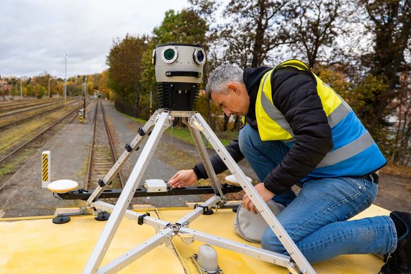
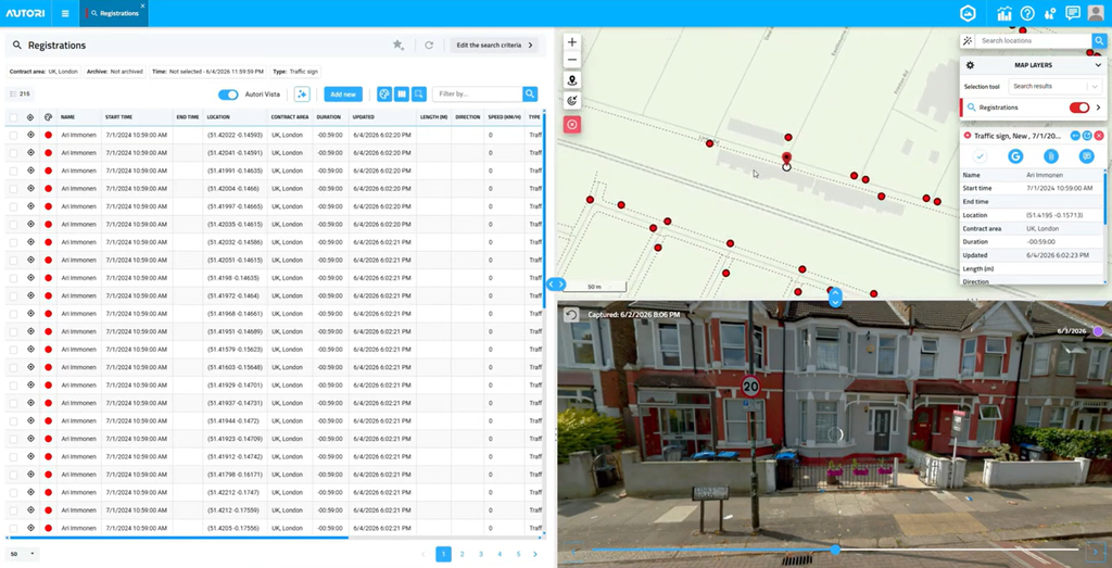
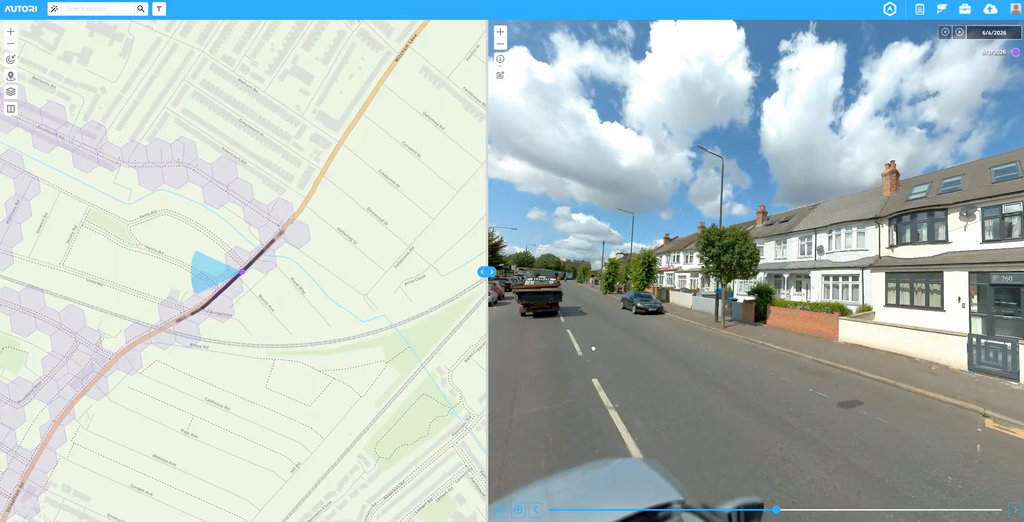
On the software side, Autori provided the platform to plan and supervise the data capture. With Autori Vista, a project manager can build route plans on a map, distribute them to drivers, and track progress in real time as drivers complete each route.
This level of oversight matters when a project spans hundreds of kilometers and requires multiple days in the field, because it gives the office a live picture of what has been captured and what remains unmapped.
Autori Vista also gave field crews a way to log problems as they happened. A blocked road, an active construction zone, or a safety hazard could be tagged with a photo and its location and sent back to the office immediately.
Once the drivers captured the imagery, it was uploaded through Autori Vista in the background. This way, the project team could review completed sections without waiting for crews to return and manually transfer files. As Ari put it,
“What really matters is the quality control: how fast you are able to check what you captured during that day and be prepared for the next day… That is extremely important, particularly in large-scale projects. If you’re not doing that, you lose time, and in the worst case you need to come back and do it again.”
The data capture process
Field conditions rarely match our predictions exactly, but with robust systems in place, we can mitigate risk and run a successful data capture session.
Behind Terra Visus’ project management success was Mosaic’s consistently reliable hardware and Autori’s software that streamlines the driving process.
Narrow roads in older cities
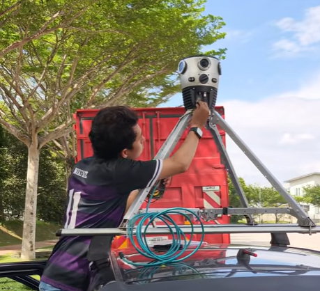
Mapping older cities comes with its own challenges, as most are not built on a grid system. The narrow, winding, one-way roads of many European cities often require reversing and backtracking to capture every route completely. This highlights the value of pre-planning the route on Autori Vista.
Drivers in medieval cities also face many obstacles, pedestrians, and signs to navigate. This is completely different from long, monotone stretches of highway and railroad corridors or the simple grid systems of newer cities (especially in North America).
When asked about the logistics of such a data capture project, Ari said:
“[Mosaic X’s] reliability is actually a big thing. Data capturing is not just the driving. You need to do the navigation, planning, and following the traffic, all while being very careful. So if you start struggling with the camera, that’s additional stress for you, and that is not good at all.”
Obstacle reporting in large-scale projects
The Autori Vista software lets drivers add real-time comments in their system about closed roads (due to construction, a car accident, safety issues, etc.) and other obstacles to data capture, so project leads in the office can know immediately and pivot their plans.
Features like this replace old-school note-taking. With the press of a single button, drivers can make a report of safety issues, which marks the time and location and takes extra photos of the incident for a later investigation, if needed. As Andrew put it,
“[Autori Vista] was a good way of monitoring where the drivers have been, what they weren’t able to capture, and why they weren’t able to capture it… And because you get live monitoring… You’re getting reports constantly. From a management process, particularly at scale, it’s a very, very good system to use, rather than drivers collecting and uploading tracks at the end of the day, where you’ve got 24-hour delays.”
It also makes it easier to report how many safety issues were in a particular project or on a route, as many clients request this metric.
A mobile mapping system you can trust
For large-scale data capture projects, you can’t run the risk of finicky and sensitive hardware. The Mosaic X is IP-67-tested and gets the job done in a wide variety of environmental conditions.
“I’ve been using your hardware for a while and… I was just on a project a couple of weeks ago where I kept the screens on, showing the feed from the camera and the feed from these other systems.
And to be honest, I kind of didn’t need to bother because I knew that once I turned it on, until I turned it off, it was just going to work all the way through. And it was a great pleasure to have that satisfaction.”
-Andrew Baddeley
Turning 1.7 terabytes of raw data into usable information
The project generated 1.7 terabytes of raw 360° imagery, with each set of 6 images captured at two-meter intervals across 525 kilometers. While that much data sounds impressive, it is only as good as it is usable. This means running regular quality checks and ensuring the data matches the vertical positioning systems the government uses for surveying.
Why daily quality control isn’t optional at this scale
With an entire city’s worth of street-level imagery, checking data quality only at the end of the project isn’t realistic. Daily quality checks and backups were built into the workflow specifically to prevent losing time and money on recapturing huge sections of the city.
Matching GPS positioning to Finland’s local geoid model
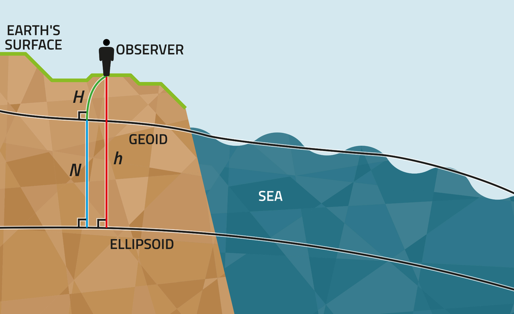
The tender also required vertical positioning accuracy. GPS RTK data provides height relative to a mathematical reference ellipsoid, which does not match the elevation values used in local mapping and engineering systems.
To meet the project’s specifications, that RTK data had to be converted using Finland’s national geoid model, which the National Land Survey of Finland maintains as the standard reference for translating satellite-based heights into locally meaningful elevation data.
Getting this conversion right was essential for the camera height and positioning data to hold up to engineering-grade quality standards.
What this project signals for the future of urban mobile mapping
This project worked because three companies focused on what each does best. Mosaic supplied hardware built to perform reliably over hundreds of kilometers and multiple days of varied field conditions. Terra Visus managed the scope and licensing of the data capture. Autori’s software handled the logistics of turning a capture plan into a coordinated, trackable field operation.
No single company needed to be an expert in all three areas, and the result reflects that division of labor. A hardware provider trying to build fleet management software from scratch, or a software company trying to manufacture its own camera hardware, would have added risk and delay to a project that already had a tight timeline.
Looking ahead, 360° imagery like this is increasingly compatible with the broader software ecosystem that local governments already use for planning and asset management. It also serves as the raw material for newer applications, from Gaussian Splats to AI-driven feature detection, meaning a single capture project can keep paying off well after the cameras have moved on to the next city.
For municipalities weighing their own imagery refresh, this project offers a practical lesson: plan for the field conditions you can’t predict, choose hardware and software that match your actual workflow rather than the most advanced option on paper, and treat quality control as part of the schedule, not an afterthought.
Frequently asked questions
What is 360° street-level imagery used for in municipal government?
Cities use 360° street-level imagery to support city planning, engineering reviews, permit approvals, and road maintenance. It gives staff a way to check current street and property conditions without a field visit for every question. Emergency services can also use the same imagery to review access points and terrain before responding to a call.
Why choose camera-only capture instead of LiDAR?
One may choose an imagery-only approach when they do not yet have the hardware and software systems, data storage space, or trained staff needed to manage LiDAR point cloud data on an ongoing basis. High-resolution imagery can still support LiDAR-style applications like 3D modeling later, without requiring a second capture project.
How is positioning accuracy maintained across a large-scale mobile mapping project?
Large-scale mobile mapping projects typically rely on GPS RTK positioning, which is then converted using a region’s local geoid model to produce elevation data that matches local mapping and engineering standards, rather than relying on raw satellite-based height values.
Who uses street-level imagery (besides city planners)?
Beyond city planning departments, street-level imagery is important for engineering teams, permitting offices, emergency services, and road maintenance crews.