ARX Tecnologia, Mosaic’s Brazilian partner, originally published this article in May 2025.

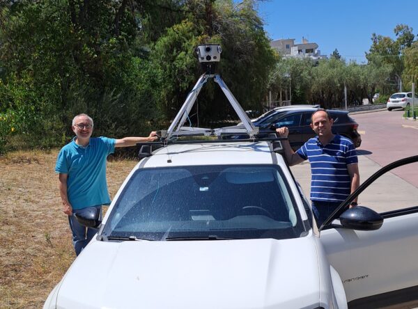
See the comparison between the Mosaic51 and Ladybug5+ cameras used in ARX672 and ARX630 systems, respectively.
Introduction
360º mobile mapping technology has transformed how cities, highways, and public assets are recorded, inventoried, and monitored. Since 2020, ARX Tecnologia has led this movement in Brazil, offering the national market complete high-definition georeferenced capture solutions.
This article presents a technical and operational comparison between the two generations of ARX mobile mapping systems: the ARX630, based on the Ladybug5+ camera, and the current ARX672, equipped with the powerful Mosaic 51 camera. More than just a change of components, this evolution represents a leap in quality, productivity, and new possibilities for urban, road, and infrastructure cadastre projects.
ARX630: The Solution that Democratized Mobile Mapping in Brazil
Launched in 2020, the ARX630 was the first mobile mapping system marketed by ARX Tecnologia. Designed to serve municipalities, dealerships, and engineering companies, the ARX630 marked a new phase in the national market by offering a solution with an excellent cost-benefit ratio, breaking with the traditional model of services provided only with expensive imported systems.
The ARX630 integrated:
- The 30MP Ladybug5+ camera, providing good quality panoramic images for urban inventories;
- Dual GNSS system with post-processing (PPK) support, ensuring centimeter accuracy;
- IMU (Inertial Unit) and DMI (Wheel Odometer), allowing accurate trajectory reconstruction even in environments with low GNSS signal quality; and
- Integration with ARX GEO 360º: Allows dynamic navigation, precise measurements directly from panoramic images, and efficient extraction of valuable information from collected images.
During the years it was in operation, the ARX630 was used in dozens of cadastral update projects, public lighting inventory, road sign monitoring, and highway inspection. Its performance enabled many city governments (through service providers) to access technologies previously restricted to capital cities or large corporations.
However, with the increase in demand for a higher level of detail and better visual quality, especially in projects that required the identification of small elements such as building numbers, traffic signs, and identification on the power distribution network, ARX began developing a new generation of the mobile mapping system.
ARX672: The New Benchmark in Quality and Productivity
Launched in 2024, the ARX672 brought the most modern mobile mapping technology to the national market. The big difference is the adoption of the Mosaic 51 camera, which offers:
- 75.5MP total resolution, more than double the previous generation;
- Captures in 12.3K, providing much sharper and more detailed images;
- 1TB SSD internal storage, allowing long collection days without interruptions;
- Integration with GNSS with real-time RTK support, plus IMU and DMI integration; and
- IP64 protection, ensuring robustness in urban and road operations.
This evolution has allowed the ARX672 to significantly increase the level of detail and productivity of mapping collections, making it possible to:
- Identify smaller and denser elements, such as labels on posts, building number plates, and details on facades; and
- Improve the reading of elements at a distance, with greater clarity across the entire scene.

In addition, the ARX672 maintains full compatibility with the ARX GEO 360º, allowing customers who have already used the ARX630 to make the transition naturally. Your team can still take advantage of measuring directly in the 360º panorama, and you can still use the systems in which your team is trained.
Technical and Operational Comparison
| Feature | ARX630 (Ladybug5+) | ARX672 (Mosaic 51) |
| Full Resolution | 30 MP | 75.5 MP |
| Image Quality | Good for general inventories | Excellent, with rich details |
| Internal Storage | Does not have | 1TB |
| GNSS and IMU | PPK with dual GNSS + IMU + DMI | PPK/RTK + IMU + DMI |
| IP Protection | IP65 | Tested to IP67 |
| Integration with ARX GEO 360 | Yes | Yes |
| Main Applications | Urban registration, signage, highways, railways | Urban registration, signage, highways, railways |
| Productivity (km/day) | High | Very High |
| Level of Detail Captured | Average | High |

Benefits Observed in Real Projects
With the adoption of the ARX672, projects that previously had limitations in reading details now have much sharper and more detailed images, thanks to the leap in resolution now that we’ve switched to the Mosaic 51. This allowed elements such as building numbers, traffic signs, street furniture, and even small details on facades to be captured clearly, without the need to change the methodology or collection speed.
Furthermore, the increased resolution has opened up the possibility of applying artificial intelligence resources to image processing. With ARX AI, it is possible to automatically detect objects such as posts, signs, manholes, and other urban assets, making the inventory process even more agile and standardized.
Projects already executed with the ARX672 have highlighted clear benefits, such as:
- Reduction in office analysis time, due to the superior quality of the images;
- Improved identification of small and detailed elements;
- Reduced need for field visits, increasing project efficiency;
- Automating urban asset identification with ARX IA, accelerating inventory; and
- Direct integration with GIS platforms such as ARX GEO 360, ArcGIS, and QGIS.
In short, the evolution to the ARX672 represents a direct gain in the quality of the data delivered, without changing the way teams are already used to working in the field. This makes the transition simple and the results even more complete.
Conclusion
The transition from the ARX630 to the ARX672 represents more than a technological upgrade: it is a new level of quality and efficiency for mobile mapping projects in Brazil and Latin America.
While the ARX630 was essential to democratize access to technology, the ARX672 positions ARX Tecnologia at the forefront of national geotechnology, offering a solution that meets the highest standards of quality, precision, and productivity.
For those interested in learning more about the ARX672, reach out to ARX Tecnologia. For those interested in the line of Mosaic camera system, contact us below.
Discover how these solutions can take your projects to the next level, offering more precision, agility, and value to the market.
About ARX Tecnologia
ARX Tecnologia, based in São Paulo, Brazil, leads in providing cutting-edge geospatial solutions. With a focus on mobile mapping and surveying technologies, ARX is pioneering new methodologies in the geospatial sector. They are a proud partner of Mosaic for the Brazilian market.
About Mosaic
Mosaic builds rugged, professional-grade 360º cameras for use in mobile mapping, infrastructure inspection, and geospatial documentation. Trusted by customers worldwide, Mosaic helps users document environments in HD, bringing clarity to complex urban and industrial environments.
Contact:
Lynn Puzzo, Director of Sales & Marketing