
Your guide to navigating your road and infrastructure surveying options – from Google Street View to DIY solutions with Mosaic.
Imagine you’re planning a big road trip. Before you even hit the gas, you’d probably check the map, look at the road conditions, and maybe even peek at some photos of your route. Road and infrastructure projects are no different. Before any new construction, repair, or maintenance, you need a clear picture of what’s actually out there. That’s where surveying comes in.
But here’s the catch: there’s no single “right” way to collect road and infrastructure data. From free online tools to hiring professional surveyors, each option comes with its own trade-offs. And if you’re a municipality or transportation authority, the choice can feel a little overwhelming, especially if surveying isn’t your day-to-day job.
That’s why we’ve put together this guide. We’ll walk through the most common methods for collecting street-level imagery and survey data, breaking down the pros and cons in plain language. By the end, you’ll have a much clearer sense of which path makes the most sense for your needs.
Spoiler alert: there’s a strong case for collecting the data yourself (and yes, Mosaic makes that easier than you might think) – but let’s start by looking at all the options on the table.
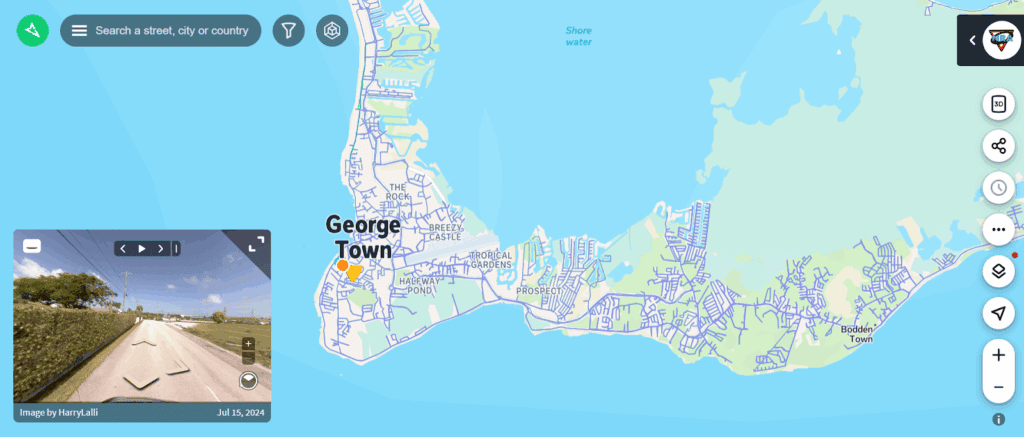
1. Using Mapillary and Google Street View (open source data)
If you’ve ever zoomed around a neighborhood on Google Street View, you already know how useful these platforms can be for getting a quick sense of the road ahead. Tools like Google Street View (GSV) and Mapillary (an open-source, crowdsourced alternative) put a massive library of street-level imagery at your fingertips. Even better, these tools are often free.
Pros
- Widely accessible and easy to use. If you’ve got an internet connection, you’ve got access.
- Huge existing database. Google Street View covers much of the world, and Mapillary is growing daily thanks to community uploads. It also shows historical data.
- Cost-effective for initial assessments. Perfect for an early-stage “desk study” before committing resources to on-the-ground work.
Cons
- Outdated imagery. The biggest drawback is freshness. Google might only update some rural areas every 5–10 years. For example, large stretches of Eastern Europe, rural Canada, and parts of Africa often rely on imagery that’s badly out of date. Even in the U.S., some small towns haven’t been updated in nearly a decade.
- Limited detail. Google captures images every 10–15 meters. That means small but important things, such as a new crosswalk, pothole, signage change, or subtle curb detail, can be completely missed.
- Resolution & quality vary. Google optimizes imagery for viewing, not for engineering-grade analysis. That means the crisp detail you’d need for infrastructure surveys just isn’t there.
- Lack of control. You don’t get to decide when or how imagery is captured. If a tree was blocking a sign when the car drove past, that’s the image you’re stuck with.
- Mapillary’s open-source challenge. Since anyone can upload images from any type of camera (from dashcams to smartphones), quality is all over the map. Coverage is also uneven. Cities may be rich in imagery, but rural roads may be spotty. And unlike 360° cameras, most uploads are single-camera shots, so you don’t get a complete, immersive view of the road environment.
In short, Google Street View and Mapillary are great for quick checks or early planning, but they’re not reliable if you need up-to-date, detailed, survey-grade data.
2. Utilizing Other Open Source Platforms
Google Street View and Mapillary might be the big names, but they’re not the only free or low-cost options out there. Depending on your region and needs, you might come across other open-source or government-supported platforms.
Examples of other platforms
- OpenStreetCam (now part of KartaView): Similar to Mapillary, community members upload dashcam or smartphone imagery. Coverage is patchy, but it’s growing.
- Government open-data portals: Some cities or regions release their own roadway imagery or LiDAR data for free. Think of New York City’s Open Data portal or the UK’s Ordnance Survey as examples.
- OpenAerialMap and Sentinel Hub: While not street-level, these provide satellite and aerial imagery. They’re useful for context but not for detailed infrastructure surveys.
- Local GIS consortia or university projects: Sometimes academic institutions or regional GIS groups publish crowdsourced imagery or road condition data.
Pros
- Free or low-cost. Hard to beat the price when budgets are tight.
- Community-driven. With contributors constantly adding content, these platforms can grow and evolve quickly.
- Flexible for tech-savvy users. If you’ve got a GIS team in-house, you can sometimes mash up data layers to get interesting insights.
Cons
- Inconsistent data quality. One street may be crystal clear, while the next looks like it was shot with a flip phone in 2010.
- Limited coverage. Big cities tend to be better represented, but once you head into rural areas, the map often fades to gray.
- Requires technical know-how. Many of these platforms aren’t plug-and-play. To get value, you’ll need staff who understand GIS tools and how to process raw data.
In other words, these platforms can be useful for exploration and background context, but they rarely provide the consistency and reliability municipalities and transportation authorities need for decision-making.
3. Buying Data from Providers
Another path some municipalities and organizations take is to purchase data directly from providers who specialize in collecting and selling street-level or infrastructure imagery. These companies typically operate fleets of survey vehicles, planes, or drones, and then package the data for resale.
Pros
- Professional quality. Since these providers often utilize high-end sensors and specialized equipment, the imagery is typically of much higher resolution than open-source options.
- Time savings. Instead of sending your own team into the field, you can have ready-made data delivered to you.
- Custom packages. Some providers offer tailored datasets, so you can purchase just the segments or types of data you need.
Cons
- Expensive. The price tag for access to these datasets can be steep, especially if you need large geographic areas.
- Delays in delivery. Providers may need weeks (or months) to process and deliver the data you’ve purchased – not ideal if you’re on a tight timeline.
- Limited coverage. Many providers don’t have universal coverage. You might get complete data for downtown, but the rural roads on the outskirts of your municipality may be missing entirely.
- Not truly yours. Even after purchase, you may face restrictions on how you can use the data. Licensing terms often prevent full ownership or redistribution.
- Mismatch with your needs. Providers collect data on their schedule, not yours. If the data they’ve captured doesn’t line up with the roads or infrastructure you need, you’re stuck with an incomplete picture.
The big picture: Buying data can be convenient for quick access to professional-grade imagery, but it’s often costly, slow, and doesn’t always give you exactly what you need.
4. Hiring a Surveyor
If accuracy is your top priority and you want someone else to handle all the heavy lifting, hiring a professional surveyor is a traditional route. Licensed surveyors bring expertise, experience, and specialized equipment to the table.
Pros
- Professional expertise. Surveyors are trained to capture accurate, reliable data and interpret it correctly.
- Comprehensive reports. They don’t just take pictures – they provide detailed documentation and insights tailored to your project’s needs.
- High-quality, reliable data. You can trust that what you’re getting is precise and meets regulatory or engineering standards.
Cons
- High cost. Hiring professionals is rarely cheap, especially for large-scale projects or frequent surveys.
- Scheduling constraints. Surveyors often have packed calendars. You may need to wait weeks or months for them to be available.
- Dependence on external parties. Any updates, changes, or re-surveys require coordinating with the surveyor again – you’re not in complete control.
- Licensing restrictions. Even though the data is collected for your project, you often don’t fully own it. You may need to pay additional licensing fees for certain uses.
To summarize, hiring a surveyor guarantees accuracy, but at a higher price and with less flexibility. If you need frequent updates or complete control over your data, this option can quickly feel restrictive.
5. Collecting Data Themselves
For municipalities and transportation authorities who want full control, collecting data themselves can be a game-changer. With the right tools, this approach lets you capture exactly what you need, when you need it – and keeps the data in your hands.
Pros
- Complete control. You decide which roads, intersections, or infrastructure features to survey, and how often to update the data.
- Full ownership. The data is yours – no licensing restrictions or delays from external providers.
- Cost-effective over time. While there’s an upfront investment in equipment, training, and setup, it often pays off quickly compared to repeatedly buying data or hiring surveyors.
- Customizable data collection. Capture the level of detail you actually need, from general road conditions to high-resolution 360° imagery.
Cons
- Initial investment. You’ll need to purchase equipment and spend some time learning the system.
- Time and effort. Collecting, processing, and managing data requires staff time.
- Learning curve. Even with easy-to-use systems, there’s a short ramp-up period for getting comfortable with the software and workflow.
Enter Mosaic.
This is where Mosaic really changes the game. Our mobile mapping camera systems are designed to be simple, intuitive, and fast. Anyone in your office who can drive can become a data collector – no specialized degrees or extensive training required. Our single-operator system lets you capture high-resolution, 360° street-level imagery in your own time, on your own schedule.

Whether you’re surveying a small neighborhood or an entire city, Mosaic puts the power back in your hands. You get exactly the data you need, when you need it, and in a format that’s ready to use for planning, maintenance, or reporting.
Self-collection with Mosaic combines flexibility, control, and quality. It is a compelling alternative to relying on outdated maps, expensive data purchases, or third-party surveyors.
6. Other Options
Beyond the main methods we’ve covered, there are a few additional ways to collect road and infrastructure data. These are less conventional for everyday municipal use but can complement other approaches.
Examples
- Drones (UAVs). Great for capturing aerial views, bridges, or hard-to-reach areas. They provide high-resolution imagery and 3D mapping, but typically require trained operators and compliance with flight regulations.
- Satellites. Useful for broad context and planning over large areas. Satellite imagery is constantly improving in resolution, but it usually can’t provide the street-level detail needed for detailed infrastructure surveys.
- Hybrid approaches. Some organizations combine multiple methods – for example, drone data for bridges, Mapillary for minor streets, and Mosaic for high-resolution street-level coverage to create a complete picture.
Pros
- Flexible and versatile. Each method has its strengths, and mixing methods can cover gaps in coverage or resolution.
- Innovative technology. These tools can provide perspectives that traditional surveying or ground-level imaging can’t.
Cons
- Cost and complexity. Drones and hybrid solutions often require extra investment in equipment, training, or software.
- Regulatory considerations. Drone operations, in particular, involve flight permits and safety rules.
- Data integration challenges. Combining data from multiple sources can require significant technical know-how to make it usable.
The big picture: While drones, satellites, and hybrid methods can be valuable in certain scenarios, they usually work best as complementary tools rather than standalone solutions. For consistent, high-resolution, street-level surveying, a system like Mosaic is often the most practical choice.
Conclusion
Surveying roads and infrastructure doesn’t have to feel like navigating a maze blindfolded. As we’ve walked through, there are a variety of options. Use free platforms like Google Street View and Mapillary, buy professional datasets, hire surveyors, or even use drones and satellites. Each comes with its own mix of pros and cons:
- Open-source platforms: Cheap and accessible, but coverage and quality can be inconsistent.
- Buying data: Professional-grade, but costly and sometimes delayed or incomplete.
- Hiring surveyors: Highly accurate, but expensive and less flexible.
- Self-collection: Complete control and ownership, customizable, and potentially very cost-effective.
For municipalities and transportation authorities who want flexibility, accuracy, and independence, collecting your own data is often the smartest path forward. And with Mosaic51 cameras, that path becomes simple, intuitive, and achievable for anyone who can drive. You get high-resolution 360° street-level imagery, full control over your survey schedule, and a system that scales with your needs.
Ready to see how Mosaic can simplify and enhance your surveying process?
Request a demo and see our mobile mapping camera in action.
Send your request and details below in the contact form to learn more details, case studies, and resources.
Take control of your roads, your data, and your schedule. With Mosaic, mapping your infrastructure has never been easier.


