
Virtual Space is meeting the unique needs of the Cayman Islands with street view imagery that tackles the impact of tourism, traffic, and hurricanes.
The digital diary of the Cayman Islands
Tropical islands have unique challenges. They are often isolated with limited infrastructure, their economies are disproportionately tourism-based, and they have crazy weather patterns that bring both amazing sunshine and devastating storms. For the Cayman Islands, Virtual Space’s street view mapping is easing the challenges of many industries.
Virtual Space is the main provider of high-quality street view imagery across the Cayman Islands. They digitally document infrastructure conditions for both the public sector and private entities. If you’ve seen street view imagery of the Cayman Islands, especially on Mapillary or Google Maps, odds are it’s from Virtual Space!
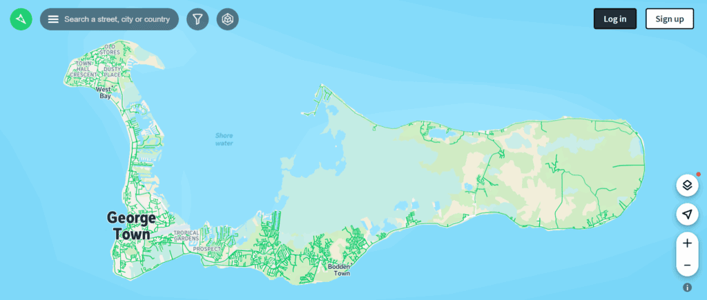
While working closely with the Cayman Islands’ National Roads Authority (NRA), Virtual Space is meeting a wide range of the country’s needs: urban visualization for the tourism sector, accident prediction mapping, drone surveying, historical record-keeping, and disaster readiness.
Today, we got the chance to chat with Harry Lalli, president of Virtual Space, about the Mosaic 51’s positive impact on the company’s many ventures.
Why the Mosaic 51?
Before adopting the Mosaic 51, Virtual Space relied on NC Tech cameras. These early devices served their purpose at the time, especially around 2017–2019, when the company began mapping tourism-related routes. However, two main issues emerged.
- First, the camera’s image quality began to lag behind newer market standards.
- Second, the supporting software ecosystem around NC Tech shifted toward a restrictive, high-cost model. What was once a simple, effective tool for uploading to Google Street View became financially unsustainable.
Virtual Space needed a modern, flexible solution that could deliver exceptional image quality, integrate with current workflows, and support future expansion into more complex geospatial tasks.
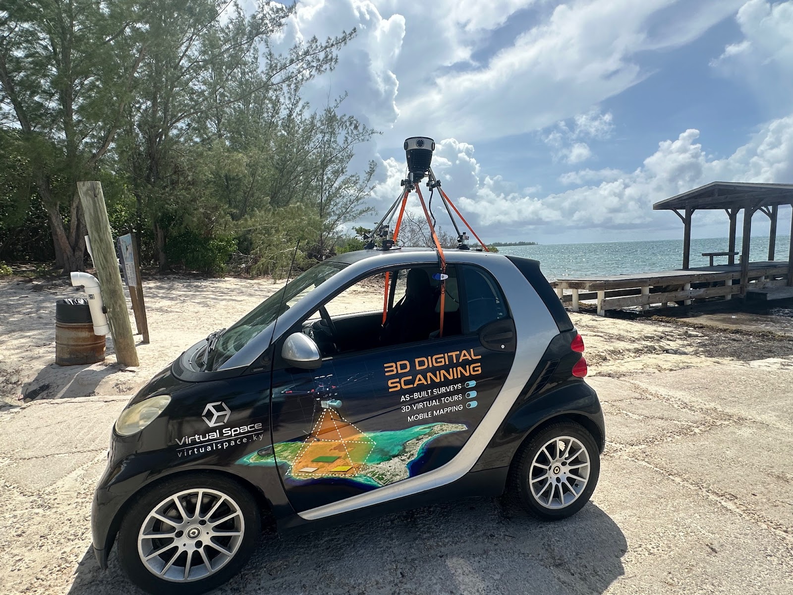
After speaking with trusted industry contacts who pointed Lalli towards Mosaic, the choice was easy! Former NC Tech engineers vouched for the Mosaic 51, citing its rugged build, excellent image fidelity, and straightforward ecosystem. With confidence in the recommendation, Virtual Space acquired the camera in 2024 and began integrating it into its operations.
According to Lalli, the results were immediate: the Mosaic camera outperformed their prior hardware in image clarity and reliability. This leap forward allowed the National Roads Authority to request full street view coverage of Grand Cayman, expanding beyond the limited zones they had previously captured.
Key applications of the Mosaic 51 in the Cayman Islands
Virtual Space now uses the Mosaic 51 across a wide array of public and commercial initiatives in the Cayman Islands:
- Tourism: Google Maps street view imagery captured on the Mosaic 51 eliminates misinformation and increases transparency for rental property listings. This directly improves the Cayman Islands’ tourism-based economy and reduces bad publicity from visitors.
- Road Safety: By partnering with safety analysts through the International Road Assessment Programme (iRAP), they are mapping high-risk roadways with 360° imagery. The overall goal is to restructure dangerous roadways to fit modern safety standards.
- Historic Records: Tracking urban growth and changes in infrastructure is important for pitching new developments to investors and determining zoning codes.
- Disaster Readiness: For tropical regions, capturing “before” imagery is vital to speedy and accurate post-disaster assessments for insurance purposes.
Tourism and real estate transparency on Google Maps
The Cayman Islands are a popular tourism destination, but relatively little imagery of the country was documented on Google Maps before Virtual Space filled the gap in the market. This resulted in many misleading apartment and hotel listings, where owners advertised properties as close to the beach, but were in fact located far inland in other neighborhoods.
Vacationers felt scammed and even unsafe, which led to numerous complaints to the Cayman Islands’ Department of Tourism from unhappy visitors. For a country whose major economic activity is tourism, this posed a serious threat to the economic health of the country and its reputation abroad.
The Cayman Islands needed to ensure that visitors to the islands would have a positive report to give their friends when they returned from vacation. They also wanted to show potential guests that their country was a safe and reliable destination in the Caribbean.
Improving the Cayman Islands’ image (literally!) on Google Maps was the obvious choice of action. It is an internationally recognized and crowd-sourced platform that vacationers often use to research their next destination.
After Virtual Space mapped the entirety of Grand Cayman and made the imagery publicly available on Google Maps, the Department of Tourism reported a notable decline in complaints.
“By capturing street view imagery of tourist zones and residential areas, we created a verifiable visual record. This allowed potential visitors to “walk” the streets virtually and see the true context of the accommodations. They felt safer and more confident when booking their vacation rentals.”
– Harry Lalli, President of Virtual Space
Travelers, especially women and families focused on safety, can now use Google Maps’ street view imagery on the Cayman Islands just like they would in larger, well-documented destinations. They can accurately assess the neighborhood, street conditions, and proximity to landmarks like Seven Mile Beach.
Mapping the country helped rebuild trust in local property listings and elevated the Cayman Islands’ reputation as a transparent travel destination.
Road safety and risk mapping
As the population and lifestyle of a city change, so do its infrastructure needs. More drivers with larger vehicles are using the same roads originally designed for a much smaller population. Many pedestrians are not locals to the Cayman Islands and need clear signage and road markings on how to interact with crosswalks.
Weather is also a major consideration for road safety. Tropical storms, hurricanes, harsh sunlight, heat, and humidity are all incredibly taxing on transportation infrastructure. Roads and road markings wear out much sooner under the sun’s intense rays than in milder climates.
On Grand Cayman, many major roads and intersections have outlived their original design and need lifesaving upgrades. To support predictive analytics and urban safety assessments, the National Roads Authority needed updated street view imagery of major roads, roundabouts, and interchanges.
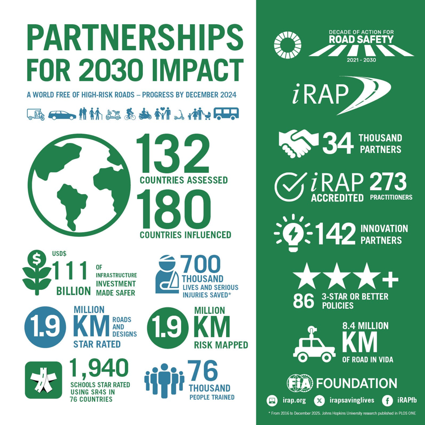
Virtual Space partnered with the NRA for the International Road Assessment Programme (iRAP), a part of the UN’s Sustainable Development Goals. Their goal is to adopt the 12 Global Road Safety Performance Targets, which include achieving high technical standards for roads that take driver and pedestrian safety into consideration.
Virtual Space captured 360° images of all primary traffic corridors on Grand Cayman with the Mosaic 51. They then shared these images with accident-prediction specialists. The high-quality visuals help experts analyze road angles, signage visibility, and obstruction placement. All of these factors influence the likelihood of a crash.
Sharing road safety data among partners
One of the best features of the Mosaic 51 is its open-format data. It is easily shared between departments and companies, each with its own software. In this case, Virtual Space, the National Roads Authority, and other partners with iRAP can access the imagery on the software platforms that fit their particular role in the project.
Thanks to the Mosaic 51, the government received reports with high-resolution visual documentation to support infrastructure improvements. This proactive data collection approach allows for earlier intervention and targeted safety upgrades, reducing the chances of accidents at high-risk intersections.
Historical records of urban growth
The Cayman Islands currently has no comprehensive visual history of its urban development. The earliest street-level datasets are from 2019, and since then, several areas have experienced major changes. New high-rise buildings and infrastructure expansion are among the greatest changes that have occurred.
By recapturing street view imagery with the Mosaic 51 mobile mapping system in 2024, Virtual Space was able to show “before and after” views of neighborhoods over a five-year period. The plan is to periodically re-map the area in the upcoming years to track changes in growth.
The consistency in the Mosaic 51’s camera quality and georeferencing of images allowed for accurate comparisons over time. The imagery is now used for long-term urban planning and environmental change tracking.
Municipalities can analyze how the areas are evolving and respond appropriately. This includes possible rezoning, identifying land-use trends, and ensuring policy decisions align with real-world development. It also helps create a visual archive for future generations or legal verification.
Disaster Response and Post-Storm Assessment
Like other tropical regions, the Caribbean is vulnerable to hurricanes and flooding. After a disaster, insurers and government agencies must quickly assess damage, but pre-event data is often incomplete or missing in Caribbean nations.
Virtual Space captures baseline imagery of major roadways and assets with the Mosaic 51. In the event of a disaster, they can remount the camera, re-drive the same routes, and upload new imagery into 360Camsters.
By comparing pre- and post-disaster imagery, insurers and public officials can quickly identify damage, process claims, and prioritize recovery efforts. This approach mirrors successful models in Florida with Site Tour 360. It positions Virtual Space as a future-ready provider in the Caribbean insurance market.
Next steps
Virtual Space has ambitious goals for the next few years with the Mosaic 51. Their plans include:
- Annually re-capturing street view data for all three Cayman Islands to preserve historical changes.
- Integrating aerial drone data with ground-level imagery to support richer 3D reconstructions.
- Expanding their post-disaster assessment services, leveraging pre-event data to identify damage and support insurance claims.
Virtual Space and Mosaic 51 are proving that mobile mapping technology can do more than capture images. It enables transparency, improves public safety, and supports long-term urban development. From property listings to post-disaster analysis, the applications are varied but unified by one goal: better decisions through better visuals.
If your projects need that competitive advantage, contact our team today to learn more about Mosaic’s full line of products.


