
Why Google Maps doesn’t work for business, and why a B2B street view platform is needed
Let’s explore why businesses are shifting to private street view platforms and uncover:
- Downsides of Google Street View for B2B
- Benefits of Private Street View for Businesses
- Valuable insights from a Former Google Maps Engineer
- Street View Imagery Applications and Mosaic Imaging Solutions
Introduction
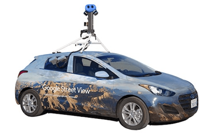
Geospatial data has become a valuable asset to businesses seeking innovative solutions to gain a competitive edge. One such application is the use of street view imagery for corporate needs. While Google Street View (GSV) might be the go-to for individuals exploring a new city or planning a route, it falls short as a B2B solution.
Google Maps has become an integral part of our daily lives, offering a convenient way to navigate through cities, explore new places, and plan our journeys. However, when it comes to businesses seeking a more tailored solution for their geospatial needs, relying solely on Google Maps may not be the most effective approach. When customers search for businesses, they often rely on reviews and take a visual tour of the exterior and interior spaces provided on Google Maps. While reviews offer informative insights, taking control of the imagery allows businesses to shape the viewer’s perception and, ideally, persuade potential customers to visit.
In this article, let’s explore the reasons why Google Maps falls short as a Business-to-Business (B2B) solution and explore the necessity for a private Google Street View platform.
The Limitations of Google Street View
Geospatial data has emerged as a valuable asset for businesses increasingly relying on technology for innovation and strategic decision-making. Google Street View, a widely known tool for exploring the world at ground level, has become a staple for many individuals navigating unfamiliar territories. However, when it comes to addressing the intricate needs of businesses, Google Street View reveals a series of shortcomings that hinder its effectiveness in a B2B context.
Let’s discuss each.
1. Inaccessible Data for AI/ML
One major drawback of Google Street View for businesses is the inaccessibility of its data for running artificial intelligence (AI) and machine learning (ML) algorithms. Google actively prevents scraping of their data, limiting the potential for businesses to leverage advanced technologies for analytics and decision-making.
2. Sparse Image Capture
Google’s image capture intervals of approximately every 11 meters create a fragmented view of locations. This limitation reduces the opportunities for a comprehensive street view, hindering businesses that require detailed and accurate visual data.
3. Messy Data and Slow Support
Even if businesses decide to capture and upload their own imagery, Google Street View can be challenging to navigate. Support is slow, and the platform can be a bit of a mess, discouraging businesses from utilizing it effectively for their specific needs.
4. Incomplete and Outdated Data
Certain areas and countries experience significant gaps in data, lasting for months. Moreover, navigating between panoramic views can be problematic, and the policies of Google sometimes involve the removal of historical data. The infrequent updates (ranging from 1 to 9 years) further compromise the freshness of the data.
5. Limited Coverage
Google Street View predominantly covers cities, main highways, and urban areas. Even in developed countries, it often falls short, covering only 60-70% of roads. Rapid development in cities and countries outpaces the infrequent updates, leaving businesses without accurate and timely data for decision-making.
6. Lack of Control and Public Data
The public nature of Google Street View data means that businesses have no control over their information once uploaded. This lack of control can be a significant concern for companies aiming to maintain a competitive advantage and keep their data proprietary.
7. Difficulties in Uploading
Obtaining an account and the ability to upload to Google Street View can be a cumbersome process. Many businesses find it challenging to navigate these hurdles, making it an additional service rather than a seamless solution.
8. Uncertainty about Future Updates
Not knowing when the next update is coming creates uncertainty for businesses relying on Google Street View. This lack of predictability can be a hindrance for industries that demand real-time, accurate data.
The Private Street View Advantage
While Google Street View has been a staple for many in exploring the world visually, its limitations in a business-to-business (B2B) context have become apparent. The need for a more tailored solution has given rise to the concept of a private street view platform, offering businesses a set of advantages that address the shortcomings of public alternatives.
1. Hosted Forever
A specifically-built B2B street view platform offers businesses the advantage of hosting their data privately and indefinitely. This ensures that businesses have access to their geospatial data whenever they need it.
2. Up-to-Date and Fresh Data
Unlike the sporadic updates of Google Street View, a private solution allows businesses to capture data at the frequency of their needs. This ensures that the information is always current and relevant.
3. Not Shared with Competition
One of the critical advantages of a private street view is the exclusivity of the data. Businesses can maintain a competitive edge by avoiding the pitfalls of sharing their valuable information on a public platform like Google Street View.
4. Capture at the Frequency You Need
Businesses have diverse needs for geospatial data, and a private street view solution allows them to capture data precisely when required. This flexibility is crucial for industries with dynamic and rapidly changing environments.
Insights from a Former Google Maps Engineer
A conversation with a former Google Maps engineer reveals that businesses are keen to utilize street view data for various applications, such as using AI to find assets or analyzing demographic data. However, Google’s reluctance to share this data is attributed to its perceived value and competitive advantage over other tech giants.
The conversation:
“Businesses WANT to use it but are not allowed to,” the engineer states, emphasizing a common sentiment among enterprises eager to capitalize on the vast repository of information embedded in Google’s street view. The discussion delves into specific use cases, including the desire to employ AI algorithms for tasks as intricate as locating every tree in an area or analyzing the composition of cars in neighborhoods to extract valuable demographic insights.
“Find all of the trees,” and “Analyze the cars in neighborhoods to find demographic data,” the engineer cites as examples, reflecting the ambitious aspirations of businesses seeking to harness the power of AI and location-based data.
However, a critical roadblock emerges—Google’s reluctance to share this treasure trove of data. The engineer sheds light on the company’s perspective, explaining that Google considers this data “Too valuable,” akin to a strategic tax. This perceived value serves as a competitive advantage over industry peers, including tech giants like Apple, Amazon, and Mapillary.
“It’s a competitive advantage over Apple, Amazon, Mapillary, etc.,” the engineer asserts, underlining the pivotal role street view data plays in maintaining Google’s dominance in the realm of mapping and location-based services.
This highlights the desire among businesses to use street view data for various purposes like AI-based asset location and demographic analysis. However, Google’s hesitation to share this valuable data is attributed to its strategic importance and competitive edge over other tech giants like Apple, Amazon, and Mapillary. The reluctance stems from the perception that the data is too valuable and serves as a crucial advantage in the competitive landscape. This reveals the intricate balance between meeting business demands and safeguarding proprietary assets in the realm of location-based data services.
Exploring Street View Imagery Applications
Companies and municipalities are increasingly turning to street view imagery to enhance their operations. One notable competitor in this space is Cyclomedia, whose applications provide valuable insights into the versatile uses of this technology. Here, we delve into some ways organizations are leveraging street view imagery, drawing a comparison between our competitor and a satisfied customer who has embraced this innovative approach.
Applications of Street View Imagery: A Competitor’s Perspective
Cyclomedia has proven to be one of the more widely known street view data capture companies. They have demonstrated the multifaceted applications of street view imagery, particularly in the realm of property assessment and information updates. Notably, Cyclomedia’s involvement in a tender in Kansas showcases how their technology facilitates the update of property information. The comprehensive imagery captured by their cars contributes to the overall process of determining fair and equitable property assessments. This is evident in the well-marked Cyclomedia cars employed by Kenton County PVA, as highlighted in a news article link. Here, the technology aids in efficiently locating new construction and other property changes.

The significance of competitors like Cyclomedia in providing tailored street view imagery solutions cannot be overstated. Businesses and municipalities benefit from expedited processes, enhanced efficiency, and accurate data, showcasing the real-world applications and advantages of advanced street-level photography in contemporary geospatial technology. This ongoing trend underscores the evolving landscape where businesses seek alternatives to traditional platforms like Google Street View to meet their unique and dynamic needs.
However, it is important to note one of the downsides of relying on Cyclomedia for street view data. Unlike some alternatives, Cyclomedia retains ownership of the data, meaning that end users do not own the data and must pay to access it. This limitation implies that while Cyclomedia offers an ‘all-in-one’ solution for those in need of street view data, it falls short as a ‘forever’ solution, as users do not possess perpetual ownership of the acquired data.
Despite this drawback, the significance of service providers such as Cyclomedia in providing tailored street view imagery solutions is not to be dismissed. The advantages of expedited processes, enhanced efficiency, and accurate data contribute to the growing trend where businesses and municipalities seek alternatives to traditional platforms like Google Street View to address their unique and dynamic needs.
Customer Success Story: Utilizing Street View for Mapping Enhancement
SiteTour 360 showcased the practical implementation of street view imagery. The customer utilizes the technology to address mapping needs, showcasing the adaptability of this solution across various industries.

Benefits of Street View Imagery Utilization
Expedite the Assessment Process
Street view imagery accelerates the determination of fair and equitable property assessments, streamlining the overall assessment process.
Enhance Efficiency in Property Valuation
The technology significantly improves the efficiency of property valuation procedures, providing a more accurate and up-to-date representation of the assessed areas.
Locate New Construction and Property Changes
Street view imagery proves invaluable in identifying and locating new construction projects and other changes to properties, aiding in comprehensive property management.
In summary, the comparative exploration of our competitor’s applications and a satisfied customer’s success story underscores the impactful uses of street view imagery. The technology’s ability to expedite assessments, enhance efficiency in property valuation, and assist in identifying property changes positions it as a transformative solution for organizations seeking innovative geospatial solutions.
Who Benefits from a Private B2B Google Street View?
Telecommunication Companies
- Infrastructure Planning: Privately collected street view data aid telecommunication companies in planning and maintaining their network infrastructure, ensuring optimal coverage and connectivity.
- Competitive Advantage: Exclusivity of data in private platforms helps telecommunication companies maintain a competitive edge by avoiding sharing critical information on public platforms.
Urban Planning Departments
- City Development: Private street view solutions assist urban planning departments in obtaining detailed and accurate visual data for city development projects.
- Customized Data Capture: Capture data precisely when required, providing urban planners with the flexibility needed for dynamic and rapidly changing urban environments.
Utility Companies
- Enhanced Asset Management: Privately collected B2B street view data and the platforms which display the data allow utility companies to utilize AI and ML algorithms for efficient asset location and management, overcoming Google Street View’s limitations in data accessibility.
- Infrastructure Planning: Detailed and accurate visual data from private platforms aids in planning and maintaining utility infrastructure, ensuring optimal operations.
Road Authorities and Engineering Firms
- Comprehensive Street Planning: Private street view solutions enable road authorities and engineering firms to capture data at the frequency they need, facilitating comprehensive street planning and design.
- Real-time Data: Up-to-date and fresh data uploaded to private platforms is crucial for timely decision-making in road construction and maintenance projects.
Municipalities and Tax Authorities
- Property Assessment: Private street view imagery accelerates property assessment processes for municipalities, providing an accurate and up-to-date representation of assessed areas.
- Efficient Property Valuation: Enhances efficiency in property valuation procedures, aiding tax authorities in determining fair and equitable property assessments.
Financial Institutions and Insurance Companies
- Risk Assessment: Private street view data allows financial institutions and insurance companies to assess risk factors by identifying and locating new construction projects and changes to properties.
- Data Exclusivity: The exclusivity of data in private platforms provides an edge in risk assessment and underwriting, ensuring that proprietary information is not shared with competitors.
Logistics and Transportation Companies
- Optimized Route Planning: Private street view platforms offer logistics and transportation companies the ability to optimize route planning based on real-time, accurate data.
- Asset Tracking: Utilizing AI algorithms for asset location becomes feasible with private platforms, enhancing efficiency in logistics operations.
Public Safety and Emergency Services
- Response Planning: Private B2B street view data aids security and emergency services in response planning by providing detailed information about locations and access points.
- Customized Data Access: Control over data in private platforms ensures that sensitive information is not publicly accessible, crucial for security and emergency response applications.
In conclusion, a private B2B Google Street View offers a range of benefits to various industries, addressing the limitations of public alternatives and providing tailored solutions for specific organizational needs. The ability to capture, manage, and utilize geospatial data in a controlled and exclusive environment empowers businesses across sectors to thrive in the ever-evolving landscape of geospatial technology.
Breaking Free from Limitations: The Mosaic Imaging Solutions Advantage Over Google Street View
While Google Street View has become an integral tool for various applications, it is essential to acknowledge its limitations. Despite its widespread use and numerous advantages, a couple of drawbacks hinder its universal applicability.
For both private and public organizations requiring recent, high-resolution street-level imagery with confidence, relying solely on Google Street View may not suffice. Recognizing this need for alternative solutions, Mosaic Imaging Solution emerges as a game-changer.
Addressing the shortcomings of Google Street View, Mosaic camera systems utilize advanced camera systems capable of capturing 12-22K image data during the time it takes to drive by the assets in question. This not only ensures a more accurate representation of the environment but also provides up-to-date maps in high-quality resolution.
In comparison to Google Street View, Mosaic Imaging Solution becomes an indispensable alternative for businesses, offering tailored street-level imagery that aligns with specific organizational requirements. For those keen on exploring other options for similar applications, an informative article on surveying and mapping cameras, capturing data akin to Google Street View, is available for reference.
Conclusion
While Google Street View serves individuals well in navigation and exploration, it falls short as a B2B solution due to its limitations in accessibility, data quality, and control. The emergence of a private street view platform, such as the Mosaic Imaging Solution, offers businesses the opportunity to harness the power of geospatial data tailored to their specific needs, without compromising on control and exclusivity. The future of street view for businesses lies in private, up-to-date, and customizable solutions that empower industries to thrive in the ever-evolving landscape of geospatial technology.
Discover the innovative Mosaic Camera Systems on our page, where sophisticated and robust products are showcased. Detailed specifications and features of each model are listed, empowering governments and companies to collect data efficiently and enhance their mapping capabilities.
Contact our team today to learn more.


