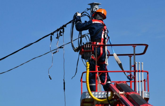
If you have recently received BEAD funding and are preparing for aerial fiber deployment, the most consequential decision you will make before breaking ground is how you conduct your make-ready survey.
This article is Part 2 of our series on the Broadband Equity, Access, and Deployment (BEAD) program. Read Part 1 here.
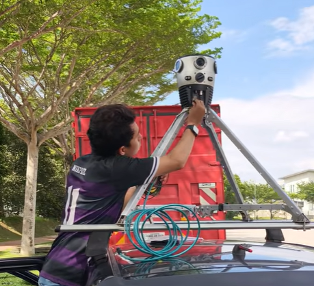
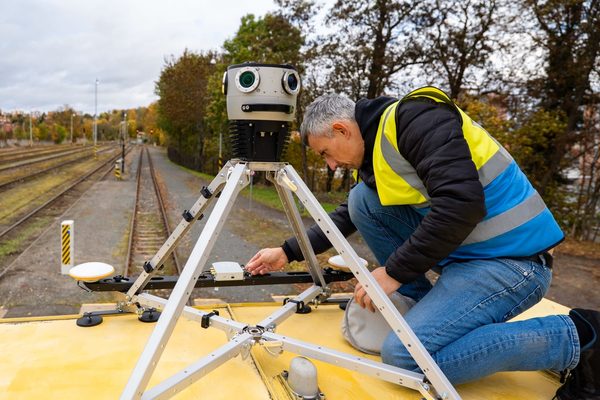
The traditional approach to conducting a make-ready survey is to send field crews, pole by pole, along every proposed route. However, this method is being quickly replaced by vehicle-mounted high-resolution 360° cameras paired with (or without) LiDAR. This change can improve your timeline, cost estimates, and your ability to meet FCC-mandated timelines before they expire.
This article explains the traditional make-ready process, where it breaks down under the pressure of large-scale BEAD deployments, and how mobile mapping is compressing the pre-construction phase without sacrificing the engineering accuracy required of pole attachment operations. It also highlights three real-world case studies where mobile mapping systems have saved companies time and money with FTTX projects in both the US and the UK.
Two approaches, one system family
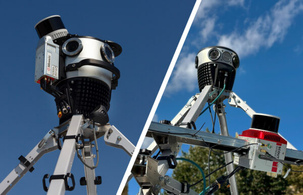
There are two distinct tiers of Mosaic mobile mapping system for make-ready work.
Tier 1 is a camera-only system: a vehicle-mounted high-resolution 360° camera that captures imagery for remote visual inspection, route planning, and manual measurement workflows.
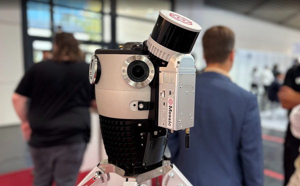
Tier 2 is the Mosaic Meridian: a combined camera + LiDAR system that adds a dense point cloud to the imagery, enabling automated data extraction and engineering-grade deliverables.
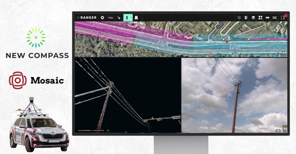
For teams who need to go from captured data to structured engineering deliverables, New Compass’ Ranger platform works directly with Meridian’s combined imagery and point cloud.
Make-ready and your deployment timeline
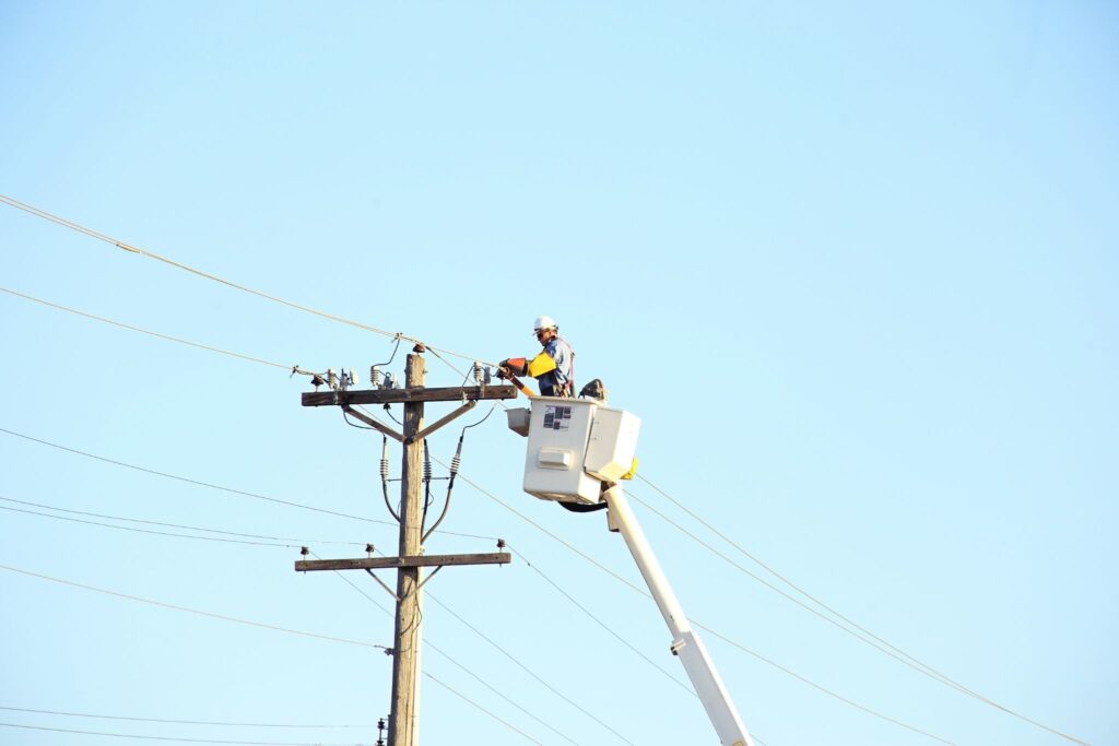
Make-ready is the process of preparing existing utility poles for a new fiber attachment. Utility poles have limited real estate, weight limits, and are exposed to the elements, so it is important to make sure every single pole along a route is capable of attaching new fiber before rollout starts.
Before an internet service provider (ISP) can begin installation, it must submit pole attachment applications to the pole owner, which is typically an investor-owned electric utility, a telephone company, a rural electric cooperative, or a municipal authority. The ISP then waits for the owner to assess whether each pole can physically and structurally accommodate the new attachments.
Make-ready costs themselves are substantial, as they include:
- specialized labor to rearrange existing attachments,
- pole replacements where structural capacity is insufficient or the pole has weathered,
- tree trimming in some cases, and
- ancillary remediation required to create clearance for the new cable.
Per-pole costs for make-ready and pole replacement can range from a few hundred to several thousand dollars, depending on the route’s complexity and the condition of existing infrastructure. Finding innovative ways to reduce costs and improve efficiency at-scale is important for keeping projects within budget and on time, especially considering that most utility pole projects are managed with limited government funds.
Real-world case study: Vulcan Line Tools
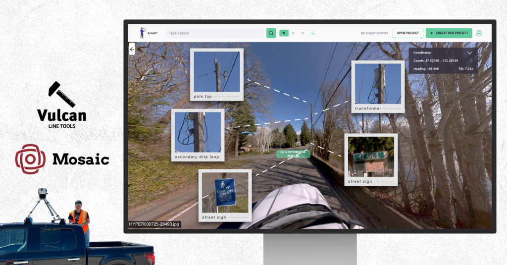
Vulcan Line Tools, which specializes in hardware, software, and services for electric utilities and telecom companies, uses the Mosaic X mobile mapping camera system to streamline the planning and engineering for Fiber-to-the-Home (FTTH/FTTX) projects. Thanks to mobile mapping, they reduced their surveying costs for a 5,000-pole city from over $100,000 to around $30,000, and the time frame from months to weeks.
The entire Vulcan Line Tools case study can be found here.
Where the traditional walkout fails at scale
The conventional make-ready survey, or the “walkout,” involves sending a trained field crew along a proposed route, stopping at each pole, and manually recording a defined set of data. There’s a lot of data that needs to be captured during these walkouts, including:
- pole height and class,
- pole lean measurements,
- ground-line circumference,
- guy and anchor configuration,
- existing attachment heights and ownership,
- mid-span distances, and
- visible structural deficiencies.
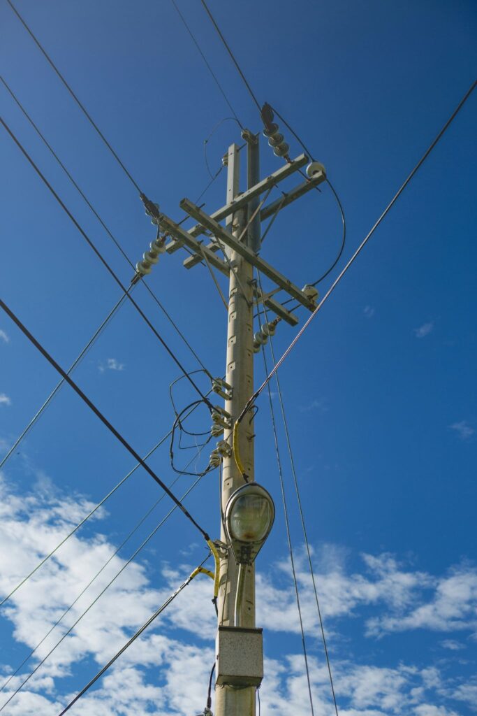
This data feeds directly into pole loading analysis (PLA) as engineering calculations that determine whether an existing pole can carry the additional load of a new fiber cable without failing under wind, ice, or combined loading conditions. Each cable must also be a certain distance from other cables on the pole for safety reasons in case of high winds or thermal expansion (which can cause telephone wires to sag in hot weather).
If a pole fails the loading analysis, make-ready may require replacing it with a taller or heavier-class pole, rearranging existing attachments to create required clearance, or, in some cases, relocating the route entirely.
The traditional walkout model worked when utility projects covered only small areas and when we couldn’t reliably inspect poles any other way. But now, we have 360° camera and LiDAR technology that can scale up the preparation process in ways that save time, money, and stress.
Real-world case study: Midwest Energy & Communications
Midwest Energy & Communications (MEC) integrated the Mosaic X camera for their own Fiber internet (FTTH/FTTX) expansion in the US where they collected over 500 miles of imagery initially for grant-funded areas in their fiber sector. They needed accurate, up-to-date data for planning their FTTH network, especially in rural areas where Google Street View lacked coverage. They integrated the imagery into their enterprise ESRI environment using the Oriented Imagery Catalog to manually review and design their network layout.
Read the entire Midwest Energy & Communications case study here.
At the scale that companies are expected to perform now, the walkout’s structural limitations are becoming harder to justify. Consider the following: speed, consistency, safety, and scalability.
Speed
A field crew conducting a manual walkout can typically survey a few dozen poles per day, depending on terrain, access, weather, and the complexity of existing attachments. With a Mosaic mobile mapping system affixed atop a vehicle, entire neighborhoods can be captured with a single pass, with the data then sent to the appropriate experts for inspection.
For example, the UK’s Catsurveys Ltd. used a Mosaic 51 camera system to shorten new self-dig lengths by up to 71%, decrease self-dig costs by 66%, connect up to 16% more homes, reduce connections by up to 25% using Physical Infrastructure Access (PIA) underground, and increase connected properties by up to 500% using PIA overhead. Read the entire case study here.
Consistency
Manual data collection is subject to human variation and error. Different technicians may measure and document the same pole differently. Errors in span lengths, attachment heights, or pole class introduce downstream work to all other steps in the process. When the same job is done with a mobile mapping system, consistent imagery and LiDAR unaffected by human bias create a firm foundation for data analysis.
Furthermore, software partners are leveraging this consistency to deliver high-precision engineering data. Vulcan Line Tools’ Azmyth platform (featured in detail below), for instance, extracts measurements like attachment heights with a confirmed accuracy within 2.5 inches for power pole and fiber planning when used with the Emlid Reach RS3.
For teams using a combined camera + LiDAR system like the Mosaic Meridian, this consistency extends into the point cloud geometry itself. Extraction platforms like New Compass Ranger can derive attachment heights, midspan clearances, and span distances directly from the LiDAR data. This reduces manual measurements and allows extractors to move quickly through large scale projects with short timelines.
Safety
Conducting a walkout along rural routes, which are often on the shoulder of high-speed roadways, through private agricultural land, or in areas with limited cellular coverage, exposes field crews to a genuine safety risk on an ongoing basis throughout data collection. Mosaic’s 360° cameras operate at highway speeds and maintain capture even if the GPS signal is lost, making them the safest and most efficient tool for rural data capture.
Scalability
Qualified outside plant (OSP) survey technicians are in short supply nationwide, especially with the rollout of the BEAD program. This has placed simultaneous demand on the same labor pool across all 50 states, which is compressing contractor availability. By switching from a traditional walkout to utilizing a 360° camera, data from the same cable corridor can be captured by a single operator in a vehicle, which can then be sent to experts in the office in a fraction of the time. This helps keep major projects on track and within budget.
The BEAD compliance case for mobile mapping
Beyond engineering efficiency, 360° image capture addresses several specific BEAD compliance requirements that manual survey methods handle inconsistently.
As-built documentation
NTIA and state broadband offices require subgrantees to verify that funded construction was completed as proposed. A georeferenced, timestamped 360° imagery record is defensible for as-built documentation and is suitable for federal reporting and any future audit or review.
Non-duplication verification
BEAD prohibits overbuilding existing networks that already meet program service standards. Accurate route documentation supports both the initial challenge process of establishing which infrastructure exists and its location, as well as ongoing compliance monitoring during construction.
FCC timeline compliance
New rules for the FCC’s broadband installation timeline took effect this month. For “Large Orders” of up to 6,000 utility poles (or 10% of a state’s poles), utilities have 90 days from a complete application to perform the survey phase. An application is only complete when it provides the utility with the information necessary to begin surveying the affected poles. The speed and scalability of mobile mapping enable companies to submit complete, engineering-ready applications from the start and avoid timeline extensions and delays.
Vulcan Line Tools’ Azmyth platform in action
The consistent and non-proprietary imagery produced by Mosaic cameras fit seamlessly into the asset detection and management platforms specific to each industry. Take Vulcan Line Tools’ Azmyth software platform for example, which uses high-resolution imagery for remote measurements (attachment heights, clearances) with a consistent margin of error of 2.5 inches.
For make-ready assessments, they use a proprietary “Red, Yellow, Green” map classification to quickly assess each pole’s attachment feasibility, flagging poles that require expensive power make-ready (Red) or minor communication make-ready (Yellow) before construction begins.
When the data needs to do more: adding LiDAR to the workflow
Sometimes, a camera pass alone is not sufficient for a telecoms project’s engineering requirements. For example, under the FCC’s 90-day survey window for large orders, submitting complete, measurement-ready BEAD applications from the start is critical. This is where a workflow that features 360° imagery alongside LiDAR can come in handy.
The Meridian and New Compass workflow follows these steps:
Collection
The Mosaic Meridian captures simultaneous high-resolution 360° imagery and a dense LiDAR point cloud in a single vehicle pass, at highway speed, requiring only one operator.
Extraction
New Compass Ranger is a cloud-native platform that requires no specialized local hardware or local data downloads. It equips extractors with a suite of automated and semi-automated tools to capture the entire aerial telecom network, including utility poles, pole attachments, spans, midspans, and anchors. Automated geometry measurements and asset linkages are built in, delivering deeper network insights with less manual effort.
Delivery
Pathfinder‘s built-in browser viewer lets users review extracted assets alongside the source imagery and point cloud—taking virtual tours, inspecting attribute tables, measuring within the point cloud, and sharing insights with their team. Engineers can validate poles from their desks, eliminating extra field visits.
Mobile mapping: a consistent and unbiased foundation
Mobile mapping systems, whether they’re mounted on vehicles, drones, or backpacks, – imagery only or imagery plus LiDAR – can capture the georeferenced points you need for your utility project. These systems produce a spatially accurate, immersive record of every pole, span, and right-of-way condition along a proposed fiber route in a single pass (and in Mosaic’s case, with a single operator in the vehicle).
From the resulting point cloud and 360° imagery, engineering teams can examine the poles and the surrounding area without returning to the field. The data required for pole attachment applications and loading analysis are right at their fingertips in the office. This data is also consistent and neutral, unlike a manual survey.
360° imagery enables remote visual inspection, such as identifying attachment types, reading visible pole conditions, and reviewing span configurations. Meanwhile, LiDAR adds the geometric depth needed for measurements such as precise attachment heights, midspan clearances, pole lean angles, and span distances. These are derivable directly from the point cloud, which makes them faster to produce at scale and less dependent on an analyst’s interpretation. This is what enables extraction tools like New Compass Ranger to automate the production of structured deliverables from the raw data.
Remote extraction compresses what would be a weeks-long field effort into a much more efficient data-processing workflow. It also produces a consistent, auditable, georeferenced record that supports every downstream phase of the project: make-ready engineering, permitting documentation, construction staking, and post-construction verification.
FAQs about make-ready and mobile mapping
What is make-ready work in broadband deployment?
Make-ready is the process of preparing a utility pole for a new fiber attachment. It includes the survey, engineering analysis, and physical remediation work necessary to install the cables.
Why is the make-ready process such a major bottleneck for BEAD projects?
The make-ready process is the primary pre-construction bottleneck for aerial fiber deployments because it involves multiple independent parties, such as the pole owner, existing attachers, the new attacher, and engineering contractors, each with their own timelines and legal obligations.
What is a pole attachment walkout?
A pole attachment walkout is a manual field survey in which trained technicians walk a proposed aerial fiber route and record data at each utility pole. Data such as height, class, lean, existing attachment heights, span distances, structural condition, and guy wire configuration. With this information, one can prepare pole attachment applications and to conduct the pole loading analysis required to determine if that pole is suitable for more fiber.
How is mobile mapping and LiDAR used in broadband surveys?
In broadband survey applications, vehicle-mounted mobile mapping systems are driven along proposed fiber routes to capture point cloud data on poles and the environment in a single pass. When combined with 360° imagery, the resulting dataset enables remote extraction of pole heights, attachment heights, span distances, and clearance measurements that would otherwise require manual field collection at each individual pole.
Can mobile mapping fully replace a traditional walkout for make-ready?
Not entirely, but it substantially reduces the volume of manual field work required. Mobile mapping can capture corridor-level data needed to prepare pole attachment applications and conduct preliminary pole-loading screenings. The most efficient workflow for BEAD-scale deployments is a hybrid approach: a mobile mapping pass, followed by targeted field verification. This concentrates field labor where it delivers the highest engineering value.
What deliverables should a broadband survey with mobile mapping produce?
A mobile mapping survey for a broadband make-ready project should produce, at a minimum, georeferenced point cloud data for the full route corridor, co-registered 360° imagery that enables remote pole inspection, and extracted pole attributes, such as the location coordinates, height, existing attachment heights, and span distances.
How does mobile mapping support BEAD compliance documentation?
BEAD subgrantees are required to document that funded infrastructure was built as proposed and that no existing network meeting BEAD service standards was overbuilt. Georeferenced 360° imagery captured along the route before and after construction provides a timestamped, auditable visual record that satisfies both requirements.
Next steps
For BEAD subgrantees preparing to move forward with construction in 2026, the make-ready survey is a crucial step where every minute counts. Every week saved in pre-construction data collection is a week recovered for construction and activation. There are two possible paths for streamlining this data-collection process: camera-only (with corresponding software for desktop remote surveying) or a full mobile lidar scanning system such as the Meridian with a tool to analyze and visualize such as Ranger by New Compass.
Camera-only approach
With the camera-only path, Mosaic’s 360° mobile mapping systems are purpose-built for this workflow. They capture georeferenced, high-resolution imagery that turns a single drive pass into a complete pre-construction dataset that can then be organized into structured deliverables. This can look several different ways, but essentially, with just a 360° camera, a team can capture the imagery, then use a viewer to see everything on the office computers, with no special software required.
Using the camera-only method is a good entry point for teams who need imagery-based remote inspection. Mosaic customers like Midwest Energy & Communications and Catsurveys have successfully used this approach for large-scale FTTH planning and route surveying.
Camera + LiDAR approach
If you want to take it a step further, software programs like New Compass’ Ranger and Pathfinder, which pair seamlessly with Mosaic Meridian imagery and LiDAR data, can perform full-spectrum 3D geospatial data extraction. The full workflow is as follows: capture with the Meridian, extract in Ranger, and deliver through Pathfinder. This is the path for projects requiring pole loading analysis inputs, NESC clearance verification, or as-built documentation for federal audit, all in partnership with New Compass, whose Ranger and Pathfinder platforms are purpose-built for this workflow.
Reach out to us today for more information on how this workflow can optimize every dollar of BEAD funding.