
Check out some highlights of 2 interviews with Mosaic’s CEO Jeffrey Martin – on the ‘red carpet’ at Geo Week & in Geospatial World Magazine
Mosaic CEO’s interview at Geo Week in Denver
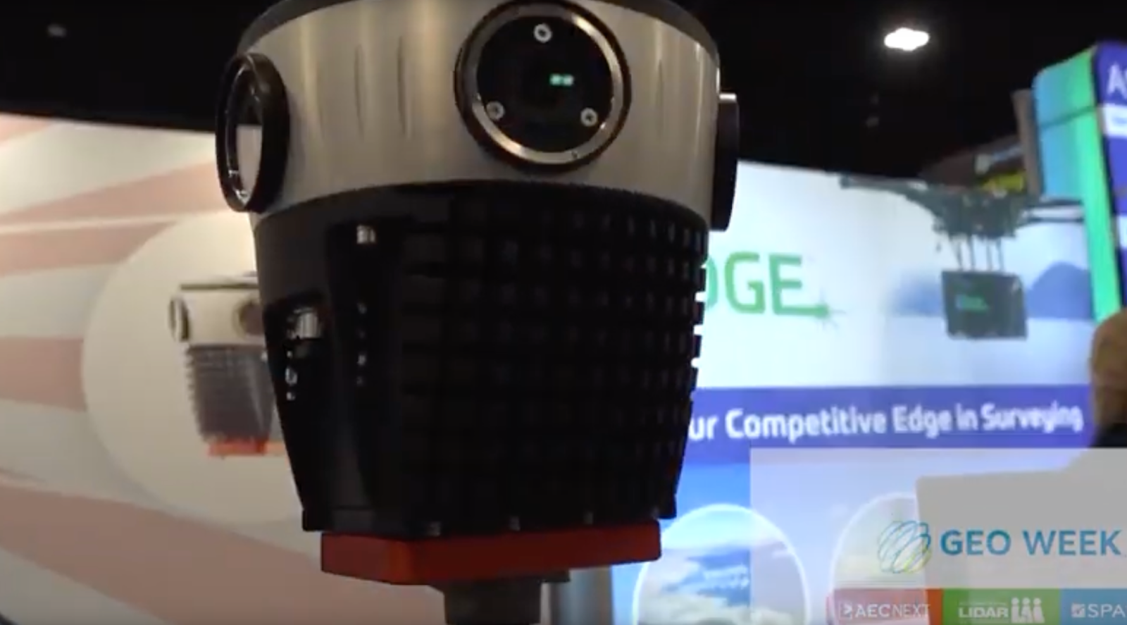
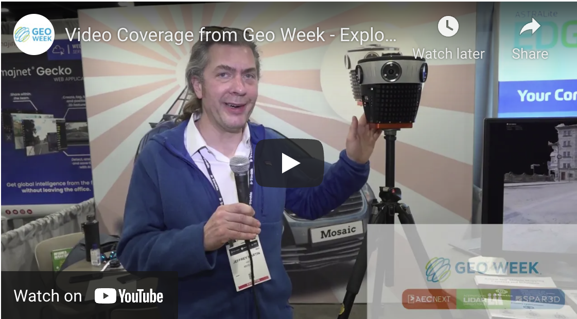
Last month, Mosaic traveled to Denver, Colorado, for Geo Week 2022. While there, our CEO and founder, Jeffrey Martin, gave an interview about our line of 360-degree mobile mapping cameras.
Despite being in the data and image capturing business, we don’t have too many of our own videos to share. So, this is a great opportunity to see the camera in detail and hear directly from our CEO.
Martin gives a great summary of our flagship camera – the Mosaic 51 – highlighting the core features and use cases. He also touches on the other two mobile mapping systems that we provide – the Mosaic X (a global shutter variant on the Mosaic 51) and the Mosaic Viking – the world’s highest resolution 360-degree mobile mapping camera.
It’s the perfect elevator pitch – only 90 seconds long.
The full article from Geo Week, “Highlighting the Urban Surveying & Mapping Capabilities of the Mosaic 51 at Geo Week 2022,” can be found here.
Geospatial World Magazine interview
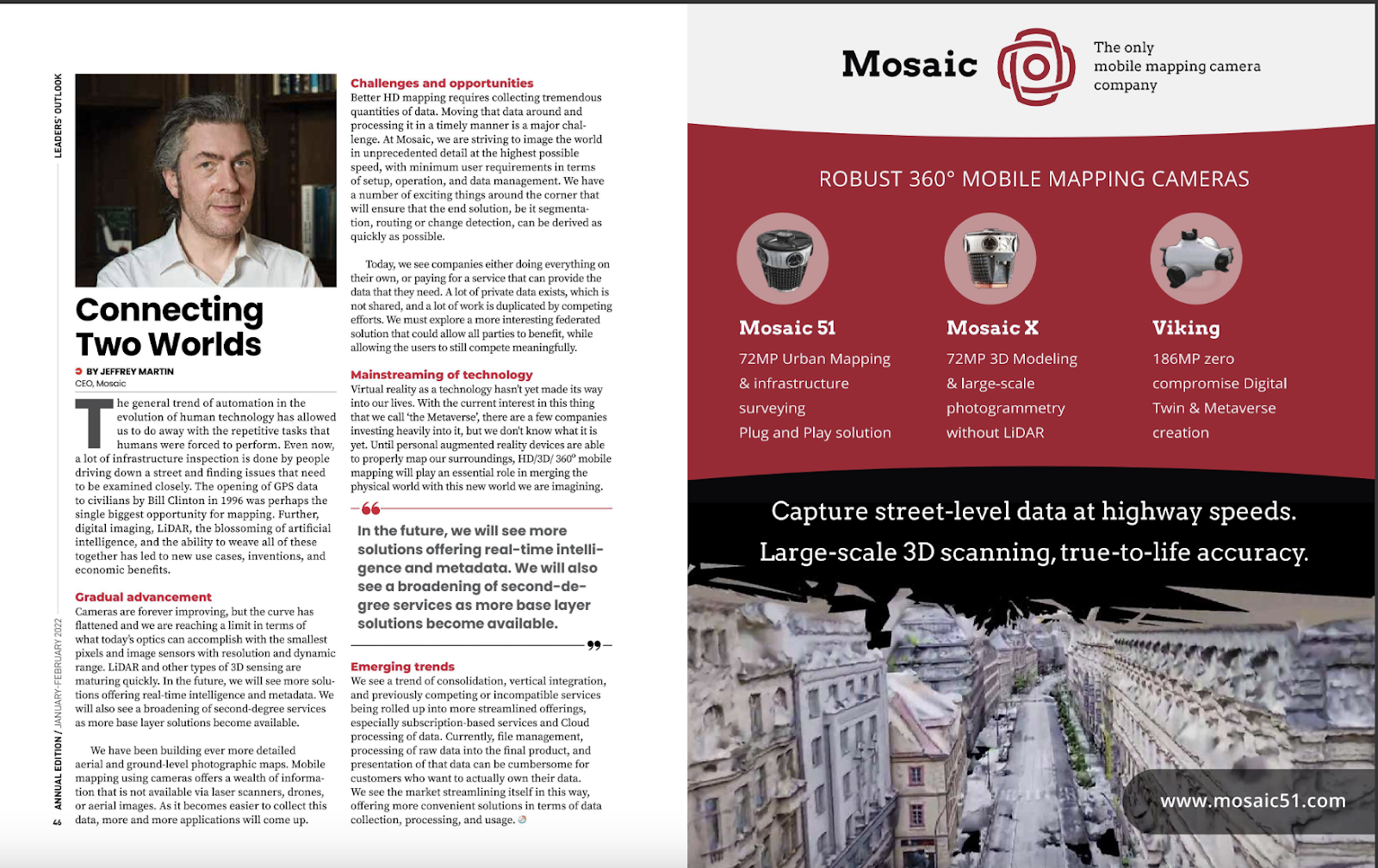
Mosaic was also featured in Geospatial World Magazine, one of the leading geospatial domains. He addressed current and relevant issues on geospatial technology. Martin was highlighted in the Annual Leader Outlook section. It includes other innovative and well-known industry leaders such as Esri founder and president, Jack Dangermond, Hexagon CEO Ola Rollen, and Dr. Stephen Volz, from NOAA, Satellite and Information Systems division.
“Connecting Two Worlds”
The article by Martin is called “Connecting Two Worlds.” While slightly cheesy, Martin makes several valid points about the many possibilities of connecting the real and digital worlds. But there are also many challenges.
“Until personal AR devices are able to properly map our surroundings, HD/3D/360º mobile mapping will play an essential role in merging the physical world with the new world we are imagining.”
The article highlights advances in automation, but also emphasizes that some industries have yet to adopt emerging technologies. Digital imaging, LiDAR, and AI have the potential to bring profits to those willing to take the necessary steps.
He explains that although the data is of higher quality now, the collection process produces a tremendous quantity of data.
“Moving that data around and processing it in a timely manner is a major challenge”
This is where Mosaic comes in.
“We are striving to image the world in unprecedented detail at the highest possible speed, with minimum user requirements in terms of setup, operation, and data management.”
Another major problem is who is collecting this data and who has access to it. There are a lot of companies and governments that end up collecting data (such as street-level images) of the same cities, towns, and communities, thereby doubling efforts and costs. The idea of a ‘federated solution that could allow all parties to benefit, while allowing the users to still compete meaningfully’ is something to consider for the future.
Place‘s mission is to create maps that are “open, reliable, and accessible and place them in a perpetual legal trust to serve the public interest.” They are working on something similar to this solution, so check them out if you are interested.
One of the other issues covered in the article is how the use of mobile mapping with 360-degree cameras, in lieu of OR in collaboration with laser scanners, LiDAR, drones, and aerial images, can offer a wealth of information about the world around us.
There is also, of course, mention of the Metaverse, which seems to be on everyone’s minds lately.
Read the full article here on the Geospatial World Magazine (SKIP TO PAGES 46-47).


