Catsurveys, a leading UK surveying company, aimed to enhance its geospatial service offerings. Their goal was to improve the precision and utility of their artificial intelligence asset identification tool, thereby providing clients with superior data quality for various applications.
Daniel Davis, Head of Delivery, and Simon Jefferson, Head of Commercial & Business Development at Catsurveys, shared insights on the recent integration.
Strategic Approach
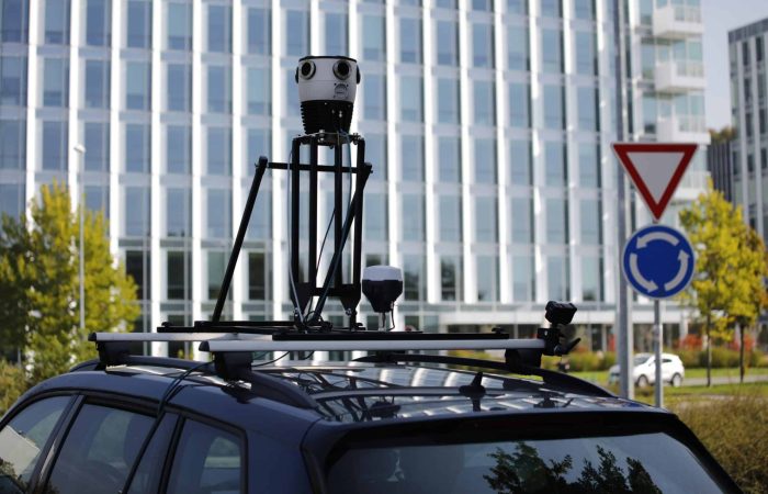
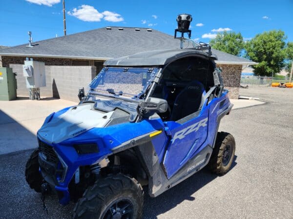
The decision to integrate a highly accurate external GNSS with the Mosaic 51 Cameras into Catsurveys’ operations was driven by the need to improve geolocation accuracy. This enhancement is crucial for providing high-quality data to their artificial intelligence asset identification tool and is expected to increase the tool’s success rate and aid in collecting survey-grade data. Such data is invaluable for photogrammetry and accurate asset localization for clients.
Early Achievements
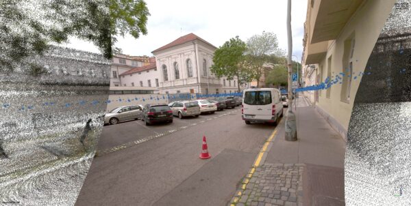
From the outset, the combination of cm-level precision gained from an external GNSS and Mosaic Cameras has shown advantageous potential. The successful trial phase has set the stage for significant advancements anticipated in 2024. This strategic integration is expected to result in improved data collection accuracy and a more efficient point cloud creation process.
Client Impact and Future Potential
The technology has already attracted interest from various clients, signaling a promising future for its application. Although the primary focus is internal optimization, the potential client benefits include enhanced value and cost reductions. The versatility of the data, augmented by a multi-band RTK GNSS receiver with centimeter precision, facilitates the creation of customized solutions tailored to specific client needs, moving beyond standard, ‘off the shelf’ services.
“Adding an Emlid Reach RS2 receiver makes the data more versatile and thus more attractive for building bespoke outputs for clients. Our approach focuses on addressing the clients’ issues first and then building a solution from there rather than offering a generic service. The ability to use the data in multiple ways simplifies this process.”
Simon Jefferson, Head of Commercial & Business Development
Catsurveys’ innovative integration of the Emlid Reach and Mosaic 51 Camera is poised to revolutionize its service offerings, promising to enhance client satisfaction with high-precision, tailored geospatial solutions.
Explore firsthand reviews from Dan and other Mosaic partners on our YouTube channel:
Catsurveys, one of our first customers, has an inspiring story! Learn how this top UK surveying company managed to scale quickly and reduce costs by 20% while capturing enhanced surveying data with a 360 mobile mapping camera. Explore their journey at the link 👈🏽
An award-winning, multidisciplinary surveying firm based in the UK, Catsurveys Ltd excels in delivering intricate data solutions that optimize project execution and elevate health and safety performance. Leveraging cutting-edge technology, they offer intelligent surveying and consultancy services, consistently achieving superior project outcomes.

Emlid is a leading provider of cost-effective GNSS receivers tailored for RTK or PPK surveying, complemented by geospatial software for streamlined data collection and post-processing. Emlid's signature product, the Reach RTK GNSS receiver, combines affordability and user-friendliness while delivering centimeter-level accuracy, revolutionizing surveying and navigation.

