
In early February 2021, amidst the global COVID-19 pandemic, India’s Department of Science and Technology (DST) declared that national, Indian-run firms would no longer need approval or licenses in order to gather and disseminate topographical geospatial data.
This was a HUGE breakthrough for national companies of all shapes, sizes, and industries who have suffered from bureaucratic nightmares for decades. With legislation in place since the time of British rule, Indian companies were not allowed to freely access data collected by government entities, nor collect geospatial data on their own, without prior written approval, until now.
As if breaking free from their shackles, many road mapping and app creating companies are spreading their wings and preparing to soar.
None more so than the Indian owned MapMyIndia, a national technology company which specializes in building digital maps, providing telematic services, and location-based SaaS and GIS AI services. The company has already had considerable success since their foundation in 1992. And if they stay on their current trajectory, they have a very good chance at closing the distance between Google Maps in India and themselves.
But before we get into the nuts and bolts of that, let’s understand this recent turn of events and what it means for India in general. And to do that, we have to understand what geospatial data and all of the ways companies have found to put it to use.
What is geospatial data?
Geospatial data is geographical data that concerns assets or events. For example: a building, river, bridge, volcanic explosion, incidents of crime or poverty.
Geospatial data can be both static or moving. Examples of moving data is: the spread of a pandemic, weather patterns, a moving vehicle, or even a human.
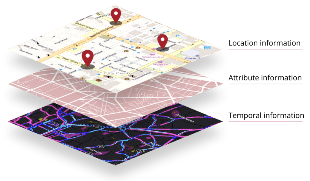
Geospatial data contains:
- Location information: the specific coordinates of the asset or event
- Attribute information: characteristics or features about the asset or event, in the forms of images, videos, vector, or raster datasets
- Temporal information: the time in which the asset or event is or occurred
Common everyday uses of geospatial data
- Transportation apps like Uber, Lyft, and Bolt
- Food delivery apps like Instacart, Zomato, and Swiggy
- E-commerce sites like Alibaba and Amazon
Industries benefiting from geospatial data
- Urban development
- Smart cities
- Construction
- Agriculture
- Mining
Devices and technology capable of collecting geospatial data

- Ground-based survey techniques
- Photogrammetry via (un)manned aerial vehicles
- Vehicle mounted mobile mapping systems
- LiDAR
- Radar
- Interferometry
- Mobile phone sensors
- Satellite-based remote sensing
India’s Geospatial Data Policy Changes
Former Indian Policy for geospatial use
Previously, all India geospatial data collected in the country by governmental agencies, such as security, law enforcement, and the Survey of India, were not available freely for public use. If businesses wanted to access and utilize the data, they had to jump through hoops that involved a complicated chain of permission requests and paperwork.
Meanwhile, foreign companies, such as Google Earth, were able to collect and capitalize on this sort of data. This meant that foreign businesses were controlling most of the access to geospatial data, putting Indian companies at a huge disadvantage.
Here are some of the main points about the previous policy:
- Strict restrictions regarding collecting, storage, use, sale and distribution of geo-spatial data and mapping
- Key players: Indian government and government-run agencies
- Accessibility: private companies needed to traverse a series of requests to different governmental departments, including the Department of Defense and Home Ministries.
- Knowledge of up to 15 different government policies concerning the handling of India geospatial data was necessary but confusing to follow
Present Indian Policy for geospatial use
But as of mid-February 2021, Indian companies will no longer be reliant on foreign companies for mapping data. Nor will they be forced to spend months filling out paperwork and getting stamps of approval to access the data.
There are still some guidelines and restrictions in place, set forth by the Indian government. But it will be up to the companies to police themselves and self-certify as follows. The original statement released by the DST did state that there would be no ‘no zones’. However, they have published a list of attributes that cannot be linked to the mapping data.
Some of these guidelines include:
- On-site spatial accuracy will be one meter for horizontal or Planimetry and three meters for vertical or Elevation
- Gravity anomaly will be 1 milli-gal
- Vertical accuracy of Bathymetric data in territorial waters will be 10 meters for up to 500 meters from the shore-line and 100 meters after that
- Any data which surpasses the above restrictions cannot uploaded to the cloud; only stored and processed on a domestic cloud or within the physical boundaries of India
Interesting, there are further restrictions for foreign companies
- They can only license from Indian entities digital maps/geospatial data with spatial accuracy/value finer than the threshold value (as mentioned above) only with the purpose of serving customers within India.
- Access to maps and geospatial data will only be available through APIs that do not allow the data to pass licensee companies or their servers.
- The re-use or resale of this data is prohibited.
With the new rules, these geospatial data would be available without taking any approval from any ministry or government agencies. These six months would come down to nil.
Agendra Kumar
Kumar is the managing director of ESRI India. And the six months refers to the standard length of time it took to jump through hoops and obtain governmental permission to access and use geospatial data.
Why the ‘sudden’ change in policy?
While 70 years is not quite ‘sudden’, the change did catch many by surprise.
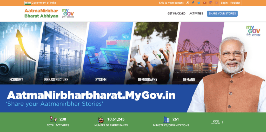
When the Modi government made the announcement, it acknowledged its primary reason for doing so. They believe that deregulation will (hopefully) be a step in the right direction towards two primary goals for India. The first is the country’s goal of reaching a GDP of $5 trillion. The second is establishing more self-reliance, otherwise known as AatmaNirbharBharat Abhiyan (Indian self-reliance).
Why free geospatial data
According to the DST, accessibility of India’s geospatial data will
- Benefit the economy by allowing Indian companies to compete at a global level
- Boost innovation
- Increase sustainability, particularly the ‘Blue economy’ (sustainable deep sea mining, offshore oil and gas, and fisheries)
- Enhance infrastructure, development, and social development
- Better prepare the country for emergency situations
- Achieve AatmaNirbharBharat Abhiyan
What that really means
- Accelerate development of apps and platforms similar to the ones listed earlier (delivery, transport, etc.) by removing the red tape to access, use, and share India geospatial data
- Create new jobs from the rapid acceleration
- Increase the amount of data gathered about India. Currently India lacks data concerning infrastructure, development, and business
- Speed up the enormous task of mapping all of India. Previously, forecasters estimated it would take the Indian government decades
- Surge in investment in the geo-spatial sector
- Grow the export of data to foreign companies and countries
- Easily capture data for land surveys through the use of drones
- Immediately access information during disaster relief efforts
- Efficient use of water resources by properly understanding soil and weather conditions
- Increase users of MapMyIndia, competing directly with Google maps in India.
- agriculture, environment protection, power, water, transportation, communication, health (tracking of diseases, patients, hospitals, etc.) relying heavily on this data.
- Forecasts estimate that this policy change could cause the Indian GDP to grow 4-5%.
Who is MapMyIndia?
So back to the original point – does Google Maps in India have to look over their shoulder?
MapMyIndia launched the first Indian interactive digital mapping portal www.mapmyindia.com in 2004. The husband and wife powerhouse duo, Rakesh and Rashmi Verma, faced the decision of whether to take on Google Maps at that point in time. They decided to go the enterprise route, and business shot off from there.
They then progressed to a GPS navigation service called Road Pilot in 2010, which came preloaded with villages, towns, and cities throughout India.
Since then, they have expanded their services to navigation, tracking analytics, web mapping, and IoT for desktop and mobile devices. Their navigation comes packed full with turn-by-turn navigation, spoken instructions for vehicles, public transit information, and street view. The offline app offers 3D terrain and city models.
In addition, they have expanded to neighboring countries such as Sri Lanka, Bangladesh, Bhutan and Nepal.
Some of the top national and international developers and tech companies, such as Amazon, Paytm, Alexa voice, Uber, Ola, Grofers and many more already utilize the newest technology – cloud mapping. It is also employed by government agencies like the Central Board of Direct Taxes.
How does MapMyIndia Compare to Google Maps in India?
While Google Maps certainly is the most popular and ubiquitous map and navigational service used to date globally, MapMyIndia is already giving Google Maps a run for its money. Estimates put Google Maps’ market share at about 62%-67% worldwide. MapMyIndia claims an astounding 80% of the market share in location intelligence space and 95% for the GPS navigation in India. That mostly consists of top automakers such as BMW, Tata, Honda, and Toyota
Remember that India is currently the second most populous country in the world, at 1.38 billion, only slightly behind China (1st place) and leaps and bounds past the United States in third place. This puts India’s population at between 15-20% of the whole world population according to 2020 calculations.
While at the moment, many Indians use Google Maps as well as MapMyIndia, if they start to shift to ONLY MapMyIndia, and the platform itself starts to spread, Google Maps will certainly have to keep an eye on them.
Problems with Google Maps in India
- Dead ends, national borders ‘moved’
- Lack of data and images about rural India
How is MapMyIndia better?
‘Made in India’ has home field advantage, support of the state, and a desire to put Indian companies first.
The platform provides its users with 3D maps that offer ISRO’s Bhuvan Satellite views.
There are features such as voice guidance and live location sharing.
It can track your phone’s location if logged in from multiple devices.
Users are already very excited about the extreme level of geospatial details achieved by using MapMyIndia rather than Google Maps.
Another hugely impactful feature is one which allows users to report bad traffic and roads, which reflects in real-time.
We know India better than everyone.
Rakesh Verma
While Google Maps is reliable in big cities, MMI beats Google Maps in more remote areas. They claim that they have mapped 6.5 million kilometers (4 million miles) of road over the last 25 years, driving to each corner of the country.
Top MapMyIndia execs speak to the quality and richness of the data which they have acquired over this time. Their curated data for businesses is one of the key factors which entices other companies to choose MMI’s API rather than Google’s.
Commitment to privacy. For now, MMI says it won’t be using ads as a form of revenue and will focus on users’ privacy. They currently have a sustainable business plan, with good returns for investors and cash reserves. Their current revenue comes from licensing map products, their services, and solutions.
During COVID, the consumer’s Move app by MapMyIndia has seen great success and increased usage. The app installed a coronavirus dashboard that gives district-wide COVID-19 updates, information about coronavirus centers, labs, and containment zones.
How is Google Maps better?
Strong partnership ecosystem and dominance of real estate in the consumer space. Google has been working with partners and serving customers around the world for nearly 2 decades. In that time, they have amassed an astounding amount of clout and data.
Data is beneficial on several fronts. For one thing, it’s extremely useful for developers for building maps, routing, or visualization purposes.
And second, something we probably already know at this point, Google has TONS of consumer data, which many companies exploit for ad revenue.
Sanchit Vir Gogia, founder of Greyhound Research, a tech consultancy firm, says that it is possible for MMI to increase their data by extending partnerships to last-mile connectivity and allowing the sharing of real-time traffic data.
Google is the go-to app for many businesses. At this point in time, the majority of delivery services and drivers still tend to use Google Maps, and habits are hard to break.
How is MMI can improve
Changing habits is always a difficult procedure, but there are some ways in which MMI could improve their services and entice drivers, logistics companies, and others to make the switch.
This includes supporting more local languages, finding a better solution to traffic issues, or using intuitive technology to help locals communicate more effectively with one another.
CEO Rohan Verma himself reported that their solution will differ from Google Maps and other foreign mapping apps in that it will be more detailed and comprehensive, privacy-centric, and hyper-localized.
So does MapMyIndia have a fighting chance?
With the newest changes to India geospatial data policies, there are high hopes that MapMyIndia can finally have a fighting chance and compete with the Goliaths.
Their partnership with Indian Space Research Organisation (ISRO), a governmental organization, has left many experts believing that the local company could gain incredible added value and benefit greatly from this liberalization.
Verma said MapmyIndia’s user maps, apps and services would “integrate with ISRO’s huge catalogue of satellite imagery, and earth observation data, and would be much better.”
Locals immediately jumped at the chance to throw some shade at Google Maps. They posted images with the hashtag: ‘When you follow Google Maps in India’ as seen below. Check out some of the more hilarious depictions resulting from drivers having followed poor directions.


Let us know if you have experienced anything similar in India, or anywhere else due to following Google Maps. And what are your predictions – will MapMyIndia become one of Google Maps main competitors, both within and outside of India?


