
Our team breaks down the most common misconceptions we hear about mobile mapping.
Separating fact from fiction
Like any new technology, mobile mapping is often shrouded in mysteries and rumors. This week, we sat down with the Mosaic sales team to discuss the most common myths our clients believe before jumping into the mobile mapping game.
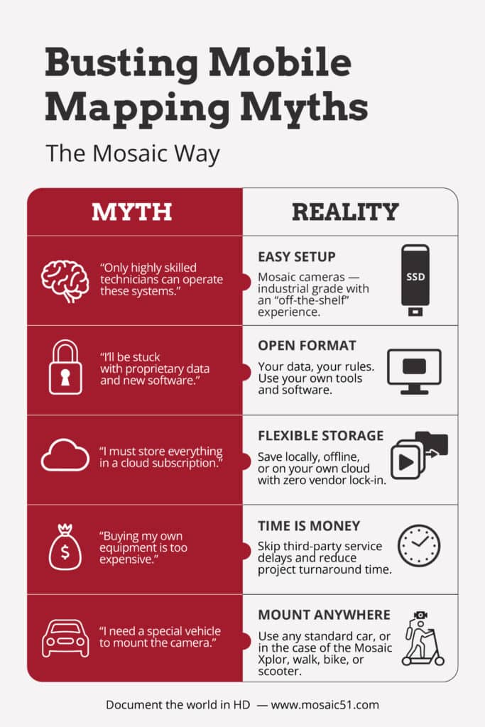
The top 7 mobile mapping myths
Myth #1: “Only highly skilled technicians can operate a mobile mapping system.”
We hear this from many potential clients, and it couldn’t be further from the truth! While any new technology requires some level of training, Mosaic mobile mapping systems are among the easiest to set up and operate in the industry.
Our equipment is specifically designed with low barriers of entry, while still providing high-resolution 360° imagery. Mosaic provides an “off-the-shelf” experience, so you can get on the road collecting data the same day.
Unlike some competitors, you do not even need to have a computer in the car during data collection, nor do you need to swap out micro-SSDs multiple times per trip.
New technology can be intimidating, but Mosaic takes the guesswork out of gathering street-view imagery. This reduces costs and keeps your most highly skilled and resource-intensive employees in the office.
Myth #2: “I’ll be captive to vendor-locked data that requires training on new software.”
This myth really depends on which mobile mapping company you choose. Many other vendors lock their data, but Mosaic products always provide data in a non-proprietary, non-vendor-locked format.
Non-proprietary data is the most efficient way to use the programs and work processes that your team is already comfortable using while integrating a new mobile mapping system into your workflow.
We also understand that a single project and data collection may undergo several different departments and software processes before becoming the final product. When you own your data, you own your workflow.
While we offer an in-house processor, anonymizer, and 3D helper tool, these add-ons are not required for accessing and manipulating your data. Mosaic is compatible with over 20 software and platforms for 360° viewing, photogrammetry, 3D modeling, and 360° + LiDAR. These include notable names such as Mapillary, ESRI ArcGIS, and Mapersive.
Myth #3: “I have to use an outside company’s cloud data storage and subscription services.”
This is a very relevant concern in our globalized world. Cloud data storage exposes your company to unnecessary external risks and can even be illegal in certain industries and countries. Several countries have laws against storing sensitive data offshore, and for government contracts, it is particularly crucial to store your data securely.
Subscription-based data storage services also incur additional expenses. You may save money with small short-term projects, but if you stay subscribed for several years, your ROI declines. You also run the risk of losing access to your data over a missed bill, an expired credit card, the storage company’s closure, or a data breach.
Purchasing a Mosaic street-view camera is a solution to ensure your company’s compliance with data protection laws. Your image data is transferred directly from the camera’s SSD card to your local computer. Then, store it where and how you’d like. You can even put it in cloud storage if you’d like, but the freedom to choose is up to you.
Myth #4: “High-resolution cameras are not durable.”
Who says you have to sacrifice quality imagery for durability? Mosaic’s lineup of cameras captures images with resolutions of 12.3K, 13.5K, and even 20K in intense environments. From the bumpy, cobblestoned streets of Europe to the hot and humid jungles of Brazil, Mosaic is on the adventure with you.
Our cameras are IP64 certified and have been field-tested to IP67, while still delivering top-notch quality.
Myth #5: “Owning my own mobile mapping equipment is too expensive.”
The first lesson learned in business is that time is money!
When you own your mobile mapping equipment, you save precious time that would otherwise be spent reaching out to data collection agencies, filing drone permits, and finding someone skilled enough to launch a new technology. This is especially important for time-sensitive data collections, such as following a natural disaster.
An investment in your own mobile mapping equipment pays back dividends on your ROI and shortens product delivery timelines for your clients.
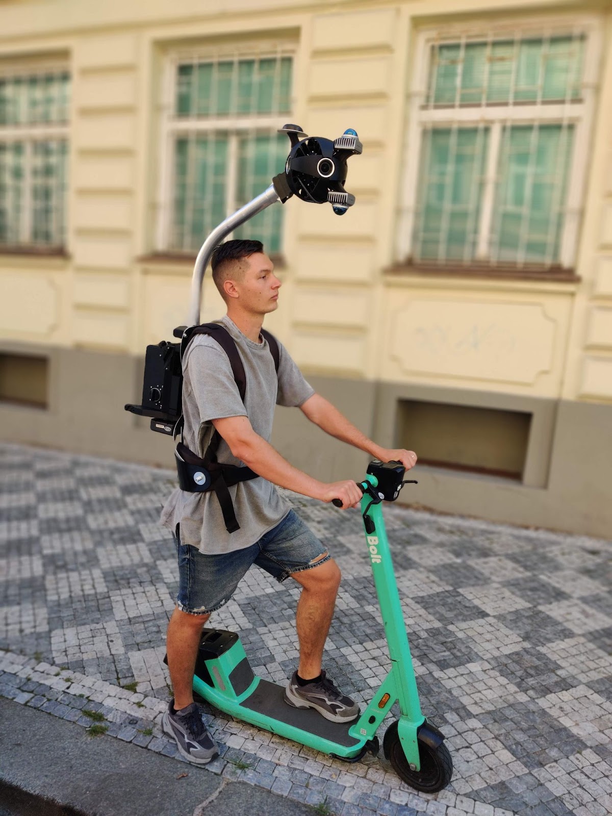
Myth #6: “I need a specific type of car to collect data.”
Our Mosaic 51, Mosaic X, and Mosaic Viking fit on top of any regular passenger vehicle with our car mount. You can install the car mount in minutes and be on the road collecting data on the same day with your personal vehicle.
In fact, with the Mosaic Xplor, you don’t even need a car! Collect data on a bike, scooter, motorcycle, or on foot. This addition to the Mosaic lineup collects data on pedestrian paths, inside buildings, and in sensitive ecological environments.
Myth #7: “I can only collect data using frames-per-second.”
This is a common problem with prosumer-grade cameras.
Frames-per-second is an appropriate setting for many tasks, such as driving on highways. However, in urban settings with stop-and-go traffic, frames-per-second capture results in a significant amount of extra data.
Identical frames captured during the minutes spent at each stoplight and waiting at pedestrian crossings add to repetitive data that needs to be stored and sifted through later. This wastes storage space and increases the post-processing time.
A frames-per-meter, or distance-based, approach is much more appropriate for urban data collection. Mosaic offers both frames-per-second and distance-based image capture to fit a wide variety of data capture situations.
Conclusion
Introducing a new technology to your workflow does not have to be scary; you just have to have the facts and the right team behind you.
Contact our team of myth-busters today to learn more about Mosaic’s unique solutions to common mobile mapping problems.


