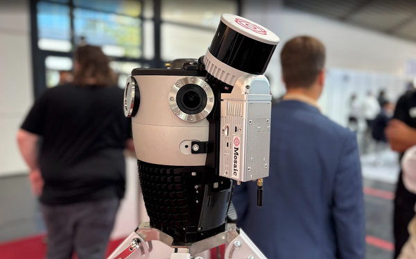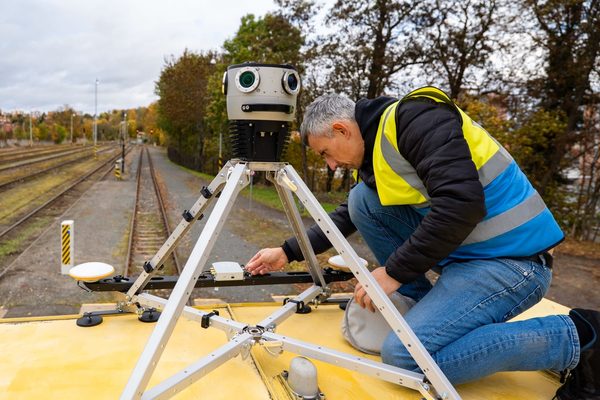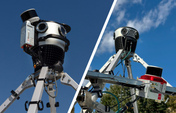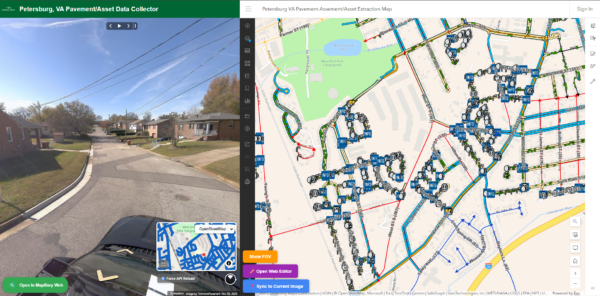
A side-by-side look at the Ladybug6, Panodux DuxCam G2S, Insta360 X4, Mosaic 51, and Mosaic X to help you pick the right 360° camera for your next mapping project.
Every year, we take stock of the mobile mapping camera landscape, and 2026 is shaping up to be a busy one. Broadband build-out under the BEAD program is finally reaching the construction stage, city-scale 3D reconstruction and Gaussian Splats are moving from novelty to standard deliverable, and AI-assisted feature extraction is raising the bar for what “good enough” imagery looks like.
That means the camera you choose has more downstream consequences than ever. A camera that works fine for a walkthrough video might not hold up to a pole loading analysis. A camera built for survey-grade accuracy might be overkill (and overpriced) for a quick documentation pass.
This guide compares five cameras across the spectrum, from prosumer-grade 360° cameras to industrial mobile mapping systems, so you can match the tool to the job.
We looked at five cameras this year: the Ladybug6 from Teledyne, the Panodux DuxCam G2S, the Insta360 X4, and our own Mosaic 51 and Mosaic X.
What to look for in a mobile mapping camera in 2026
Before comparing individual cameras, it helps to know which specifications are the most important for mobile mapping work. We evaluated each camera on the following criteria:
- Resolution: how much detail the camera captures, and whether that detail is usable at typical mobile mapping distances (5 to 15 meters from the subject).
- Shutter type: global shutter sensors capture the entire frame at once, avoiding the distortion that rolling shutter sensors can introduce at higher driving speeds.
- Spatial accuracy: how precisely a pixel in the image corresponds to a real-world coordinate, typically expressed in millimeters at a given distance.
- Weatherproofing: IP ratings that indicate how well a camera holds up to dust, rain, heat, and cold in the field.
- Onboard GNSS and storage: whether the camera can operate as a standalone unit, or whether it requires an external workstation, laptop, or additional hardware to function.
2026 mobile mapping camera comparison chart
Here is how the five cameras stack up on paper. Specifications are drawn from each manufacturer’s published documentation as of mid-2026.
| Spec | Ladybug6 | Panodux DuxCam G2S | Insta360 X4 | Mosaic 51 | Mosaic X |
| Resolution | 72 MP | 72 MP (6 x 12 MP) | Up to 72 MP photo / 8K video | 75.5 MP and 12.3K equirectangular | 92.1 MP and 13.5K equirectangular |
| Shutter type | Global shutter | Global shutter | Rolling shutter | Rolling shutter | Global shutter |
| Spatial accuracy | ± 2 mm at 10 m | ± 2 mm at 10 m | Not rated for survey use | Under 2 mm at 10 m (with GNSS add-on) | Under 2 mm at 10 m |
| Weatherproofing | IP65 body, IP67 connectors | IP66 | IPX8 (10 m), IP5X dust | IP67-tested | IP67-tested |
| Onboard GNSS / storage | No (external workstation required) | GNSS module, 128GB onboard storage | No dedicated GNSS; relies on phone pairing | Onboard GNSS, computer, 1–2 TB storage | Onboard GNSS, computer, 1–2 TB storage |
| Best for | Established survey ecosystems | Budget global-shutter survey work | Light documentation, walkthroughs | Rugged, all-in-one field capture | Highway-speed 3D and photogrammetry |
360° camera spotlights
Ladybug6
tl;dr: A well-established, survey-grade camera with deep roots in the geospatial industry, but one that requires a full external workstation to operate.
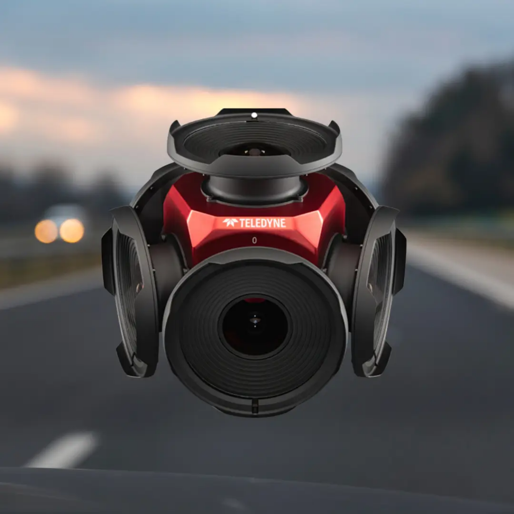
The Ladybug6 is Teledyne’s latest entry in a camera line that has anchored many mobile mapping systems for over a decade. It captures 72 megapixel images with a global shutter, delivering spatial accuracy of ± 2 mm at 10 meters, matching what many high-end survey cameras claim.
The IP65-rated body and IP67-rated connectors make it dependable across a wide temperature range, from -30 °C to 50 °C.
Pros
- 72 MP global shutter resolution with survey-grade spatial accuracy
- Broad compatibility with established mobile mapping systems, including Trimble, RIEGL, and Leica MMS
- Wide operating temperature range and industrial-grade connectors
Cons
- No onboard GNSS or IMU; positioning data must come from an external sensor
- No onboard storage or compute, so it requires a dedicated in-vehicle workstation
- More complex data capture setup compared to standalone systems, allowing for more points of failure
- External USB storage drive causes connectivity issues
Best for
Teams already invested in an established mobile mapping system (Trimble, RIEGL, or similar) who need a proven, survey-grade camera to slot into that existing workflow.
Panodux DuxCam G2S
tl;dr: A newer global-shutter camera offering competitive resolution and accuracy at what appears to be a lower price point, geared toward budget-conscious survey teams.
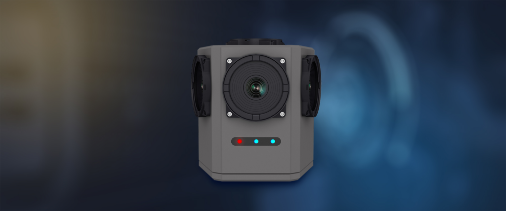
The Panodux DuxCam G2S is a newer entrant built around a 1.1-inch global shutter sensor and a six-lens array, producing 72 megapixel images at up to 20 fps.
Panodux states a spatial accuracy of ± 2 mm at 10 meters, on par with the Ladybug6, and the camera supports BeiDou and GPS dual-mode positioning with PPS time synchronization. Its aircraft-aluminum housing carries an IP66 rating and an operating range of -20 °C to 50 °C.
Pros
- 72 MP global shutter imagery with survey-grade spatial accuracy claims
- Fast capture rate of up to 20 frames per second at full resolution
- Built-in dual-mode GNSS positioning with hardware and software trigger support
Cons
- Newer to the market, with a shorter track record than Ladybug6 or Mosaic in large-scale deployments
- IP66 rating is solid but a step below the IP67 rating found on Ladybug6 and Mosaic cameras
Best for
Teams seeking a global-shutter camera with competitive specs, particularly for projects in regions where BeiDou positioning support is valuable.
Insta360 X4
tl;dr: A capable consumer/prosumer-grade 360° camera for lightweight documentation, but not built for survey-grade accuracy or heavy field use.
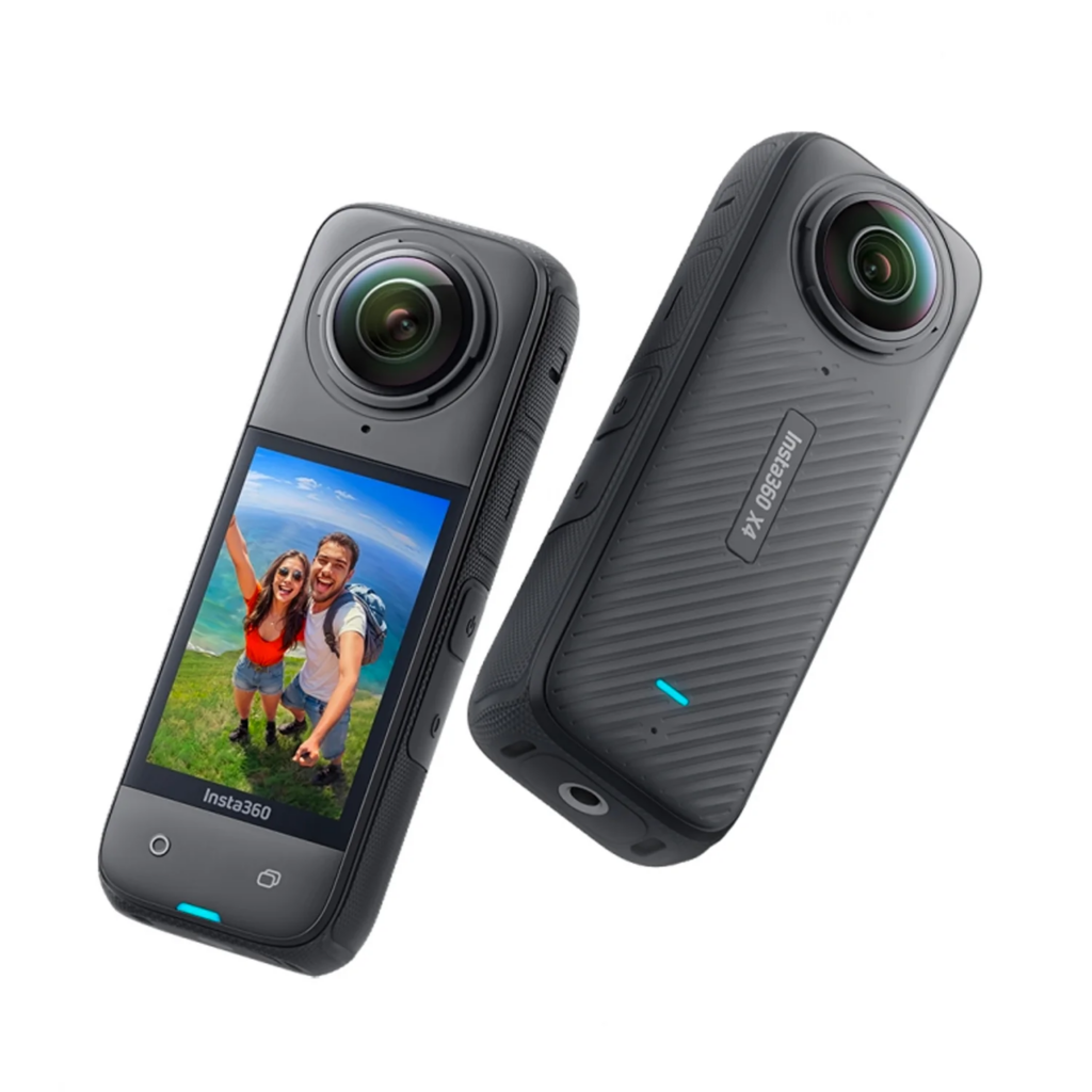
The Insta360 X4 is a compact, dual-lens 360° camera built primarily for content creators, though its low price and 8K video options have made it a popular entry point for teams testing whether 360° capture fits their workflow at all.
It is rated IPX8 for underwater use up to 10 meters (camera only), operates from -20 °C to 40 °C, weighs just 203 grams, and stores footage to a microSD card.
Pros
- Low price point relative to every other camera on this list
- Waterproof to 10 meters without a housing
- Lightweight, compact, and simple to operate for quick documentation tasks
Cons
- Rolling shutter sensors, which can distort imagery captured at driving speed
- No published spatial accuracy rating; not designed for survey-grade measurement
- Does not operate well outside of the recommended temperature range or in humid conditions
- No onboard GNSS receiver; relies on a paired smartphone for location tagging
- Relies on microSD storage rather than a large internal drive built for continuous, all-day capture
Best for
Light documentation, real estate walkthroughs, or teams evaluating whether 360° capture is worth adopting before investing in survey-grade equipment.
Mosaic 51
tl;dr: A rugged, standalone all-in-one camera built for single-operator field capture in demanding conditions.
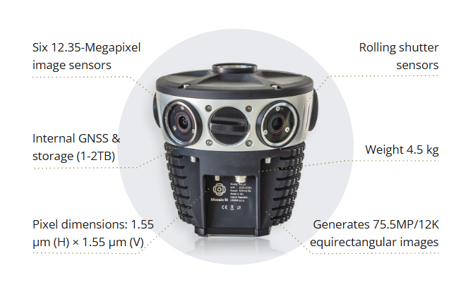
The Mosaic 51 captures 12.3K equirectangular panoramas across six 12.35 MP sensors, with an onboard GNSS receiver, built-in computer, and 1 to 2 TB of internal storage.
That means a single operator can mount the camera, power it on, and drive without a dedicated in-vehicle workstation. It’s been field-tested in conditions ranging from Tuvalu’s humid, remote islands to harsh Nordic winters.
Pros
- Standalone design with onboard GNSS, computer, and storage; no external workstation required
- IP67-tested for dust, water, heat, and cold
- Single-operator workflow that reduces training time and field crew size
- No vendor lock-in for imagery; the captured imagery is compatible with more than 20 third-party software programs
Cons
- Rolling shutter sensors, which require more careful driving speed management than global shutter cameras
- Millimeter-level spatial accuracy requires pairing with an external RTK GNSS receiver, such as an Emlid Reach RS3, but is typical of cameras.
Best for
Municipalities, utilities, and field teams that need a durable, self-contained camera they can deploy quickly in variable conditions, without managing a separate computer or storage system.
Mosaic X
tl;dr: A global shutter standalone camera built for highway-speed capture, photogrammetry, and large-scale 3D reconstruction.
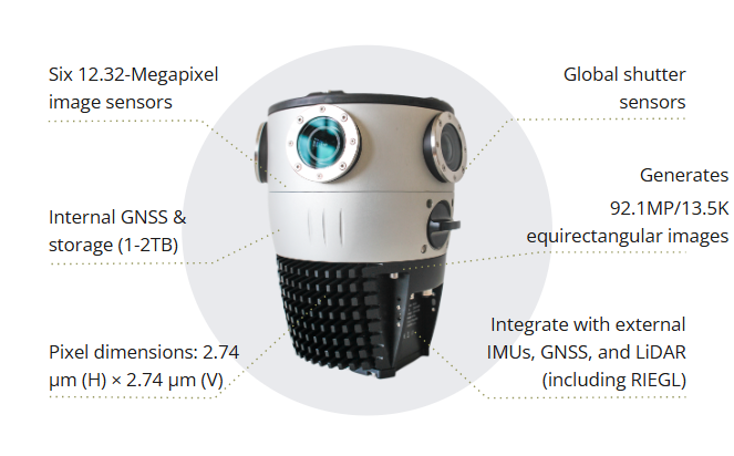
The Mosaic X pairs six 12.32 MP global shutter sensors to produce 13.5K equirectangular panoramas, with the same standalone onboard GNSS, computer, and 1 to 2 TB storage found in the Mosaic 51.
The global shutter eliminates the distortion that rolling shutter cameras can introduce at speed, which matters for both highway-speed corridor mapping and downstream 3D reconstruction, including photogrammetry, textured meshes, and Gaussian Splats.
Pros
- Global shutter sensors deliver distortion-free capture at city and highway speeds
- Standalone design with onboard GNSS, computer, and 1–2 TB storage
- IP67-tested and built for continuous, single-operator field use
- Integrates with external LiDAR, GNSS, and IMU systems, including RIEGL, Trimble, and Leica MMS
Cons
- Source imagery arrives as six unstitched video files, adding a post-processing step for teams that want a finished 360° panorama (made easier with the Mosaic Processor)
- Millimeter-level accuracy still requires an external RTK GNSS receiver for the most demanding survey work, but that is typical for cameras
Best for
Teams doing large-scale photogrammetry, 3D reconstruction, or Gaussian Splats. Also good for capturing at highway speeds where a global shutter matters most.
Which camera is right for your project?
If your team is documenting a property or producing walkthrough content on a limited budget, the Insta360 X4 is a reasonable starting point, with the caveat that it is not built for survey-grade measurement. If you are already invested in an established mobile mapping system and need a proven, high-resolution camera to slot into that workflow, the Ladybug6 remains a dependable choice, and the Panodux DuxCam G2S is worth evaluating as a newer, similarly specified alternative.
For teams that want a rugged, standalone system that a single operator can run without a separate workstation, both Mosaic cameras are built around that principle. The Mosaic 51 is the more budget-friendly all-in-one option for general urban and infrastructure mapping, while the Mosaic X’s global shutter sensors make it the stronger choice for highway-speed corridor work and any project headed toward large-scale 3D reconstruction.
Frequently asked questions
What is the most accurate mobile mapping camera in 2026?
Several cameras on this list, including the Ladybug6, Panodux DuxCam G2S, Mosaic 51, and Mosaic X, publish a spatial accuracy rating of roughly ± 2 mm at 10 meters. Reaching that accuracy in the field typically also depends on pairing the camera with a precise GNSS receiver.
Can the Insta360 X4 be used for professional surveying?
The Insta360 X4 is a higher-end consumer-grade camera (also called “prosumer”). It does not have a published spatial accuracy rating or onboard GNSS receiver, so it is better suited to light documentation than to engineering-grade survey work.
What is the difference between global shutter and rolling shutter for mobile mapping?
A global shutter captures an entire image frame at the same instant, while a rolling shutter captures it line by line. At driving speed, a rolling shutter can introduce subtle distortion in moving scenes, which is why cameras built for highway-speed capture, such as the Ladybug6, Panodux DuxCam G2S, and Mosaic X, use global shutter sensors. Read more in our rolling vs. global shutter breakdown: Global Shutter vs Rolling Shutter Camera Effects Explained.
Do these cameras require external GPS or storage?
It depends on the camera. The Ladybug6 and Insta360 X4 both require an external system for full functionality, either a workstation or a paired smartphone (in the case of the Insta360 X4). The Panodux DuxCam G2S includes a GNSS positioning module and has 128 GB of onboard storage. The Mosaic 51 and Mosaic X are standalone systems with onboard GNSS, computing, and 1 to 2 TB of internal storage.
Which camera is best for large-scale Gaussian Splats or 3D reconstruction?
Global shutter cameras generally produce cleaner input data for photogrammetry and 3D reconstruction. The Mosaic X is purpose-built for this kind of work, thanks to its global shutter sensors and standalone, highway-speed capture design. Learn more about how this technology works in our explainer on Gaussian Splats: Points, Triangles, Blobs, and Ellipsoids: What Exactly are Gaussian Splats?.
Conclusion
It doesn’t have to be difficult to find the best mobile mapping camera for your specific mix of budget, accuracy requirements, and field conditions.
What has changed the most since last year is how much more that choice matters, as more projects move downstream into AI-assisted feature extraction, engineering-grade documentation, and large-scale 3D reconstructions. More stakeholders are expecting imagery alongside other deliverables, as well.
If you would like help matching a camera system to your specific project requirements, reach out to our team directly.