
Featured
The Best Surveying 360 Cameras for Mobile Mapping in 2022
Check out our list of the top 5 best surveying cameras for mobile mapping in 2021. Specs, survey camera prices, and expert opinion on who is the clear winner.

Check out our list of the top 5 best surveying cameras for mobile mapping in 2021. Specs, survey camera prices, and expert opinion on who is the clear winner.
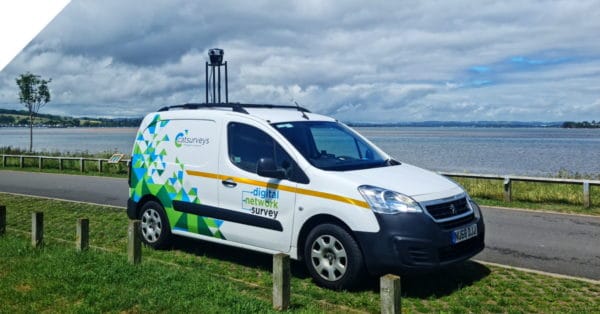
Looking to scale rapidly, reduce operational costs, and capture better data? Find out more with a real telecom surveying case study.
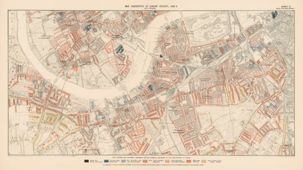
Land surveying and cadastral surveying maps are incredibly important for land registries. See the newest technology helping surveyors.

Mobile mapping is seen as the future of BIM – building information modeling. See how Mosaic’s mobile mapping cameras are up to the task.

See the requirements for metaverse cameras, the hardware that will help us build the metaverse, the next platform of human interaction.

What’s the best technique for creating a point cloud? Let’s face off lidar vs photogrammetry and find out. What is a point cloud? A point cloud is a set of


