
Geo Week 2025 Recap
As we look back on Geo Week 2025, Mosaic is strengthening partnerships and driving the future of geospatial imaging.
As we look back on Geo Week 2025, Mosaic is strengthening partnerships and driving the future of geospatial imaging.

Mosaic and ARX have teamed up to provide Brazil with the highest-resolution imaging available for urban infrastructure and cadastre projects.

Mosaic’s collaboration with Chulalongkorn University’s Smart Mobility Research Center promises to improve 3D mapping capabilities to meet the needs of transportation infrastructure
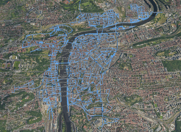
Access 15 terapixels of Prague’s detailed imagery for your research, for computer vision, photogrammetry, point cloud generation, 3D modeling and more!
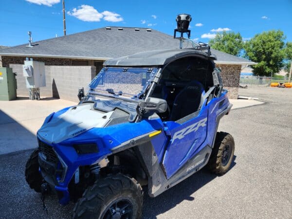
Remote visits and surveys increase safety, efficiency and allow more decisions makers to take part. Learn more.
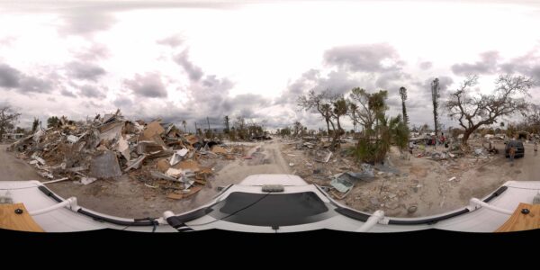
Discover the urgency of capturing perishable data post-disaster, vital for swift recovery efforts. Explore how Mosaic Camera Systems revolutionize data collection.


