SLAM technology lets a device build a map and track its own position at the same time, with no GPS required. Here is a practical guide to how it works, when to use it, and why it matters for mobile mapping.
Quick answer: SLAM, or Simultaneous Localization and Mapping, is a computational method that allows a device to build a map of an unknown environment while simultaneously tracking its own position within that map. It relies on sensors like cameras, LiDAR, and IMUs to perceive the world in real time. SLAM is especially valuable in GPS-denied environments, such as tunnels, dense urban canyons, and indoor spaces, where satellite-based positioning cannot be used.
Most mapping systems know where they are because a satellite tells them so. But what happens when the satellite signal disappears underground, in dense foliage, or inside a building? That is the exact problem SLAM was built to solve.
What does SLAM stand for?
SLAM stands for Simultaneous Localization and Mapping. The name describes exactly what the technology does: it localizes (figures out where the device is) and maps (builds a model of the surrounding environment) at the same time.
The “simultaneous” part is what makes it difficult, but also powerful. A system cannot build an accurate map without knowing where it is, but it also cannot know where it is without first having a map. SLAM solves this chicken-and-egg problem by refining both the map and the position estimate in real time as new sensor data arrives.
SLAM was first formalized as a research problem in robotics during the 1980s and 1990s. Today it appears in everything from autonomous vehicles and surgical robots to consumer vacuum cleaners and, increasingly, professional mobile mapping systems.
How does SLAM work?
At its core, SLAM is a software algorithm that fuses sensor data to answer two questions continuously: “What does the environment look like?” and “Where am I in it?”
Here is the step by step process.
Step 1: Sensor data collection
The device gathers raw data from its onboard sensors. Depending on the system, this may include a LiDAR point cloud, camera images, IMU readings (acceleration and rotation), and wheel odometry or GPS where available.
Step 2: Feature extraction
The SLAM algorithm identifies recognizable features in the incoming data. For a camera, these might be corners or edges in an image. For a LiDAR, they might be distinctive shapes or surfaces in the point cloud. These features serve as landmarks.
Step 3: Data association
The algorithm compares newly detected features with those seen in previous sensor scans. When a match is found, the system determines how the device has moved between the two observations. This is called “loop closure,” and it is one of the most computationally demanding parts of SLAM.
Step 4: State estimation
Using the matched features, the algorithm estimates the device’s updated position and orientation. Techniques like the Extended Kalman Filter (EKF), particle filters, or graph-based optimization methods are commonly used at this stage.
Step 5: Map update
The algorithm adds new information to the evolving map, incorporating the latest sensor observations and the updated position estimate. The map becomes more complete and more accurate with each pass.
This cycle repeats many times per second, allowing SLAM to operate in real time even as conditions change.
What sensors does SLAM use?
SLAM is not a single sensor. It is a fusion strategy, and the quality of the output depends heavily on the quality and combination of the sensors feeding it.
Cameras
Cameras are the most affordable SLAM input. Visual SLAM (vSLAM) uses image sequences to track feature points across frames, reconstructing both the camera’s trajectory and a sparse 3D map of the scene. The limitations are sensitivity to lighting changes and lack of direct depth measurement.
LiDAR
LiDAR-based SLAM is the standard for professional mobile mapping. LiDAR measures exact distances by sending laser pulses and timing their return. This produces dense, geometrically accurate point clouds that give the SLAM algorithm reliable, lighting-independent data to work with. LiDAR SLAM is more computationally expensive than visual SLAM, but significantly more accurate in outdoor and large-scale environments.
IMU (Inertial Measurement Unit)
An IMU measures acceleration and angular rotation. On its own, IMU data drifts over time: small errors in each reading accumulate into large position errors. But combined with LiDAR or camera data, an IMU fills in the gaps between sensor scans and provides reliable short-term motion estimates. This fusion is sometimes called LiDAR-inertial odometry, and it is the backbone of most high-performance SLAM systems.
Multi-sensor fusion
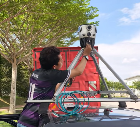
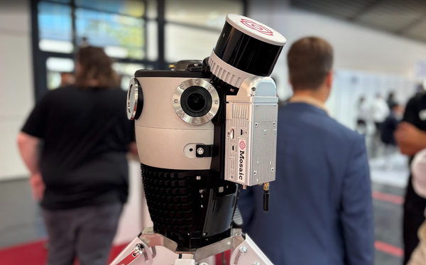
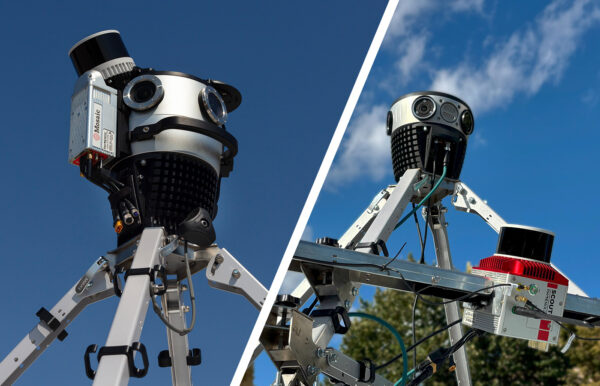
The most capable SLAM systems combine all three: LiDAR for accurate geometry, cameras for visual context and texture, and IMU for motion continuity. This is the approach used in professional-grade mobile mapping platforms. The Mosaic Xplor, for example, integrates with external LiDAR scanners and IMU units, allowing precise timestamps to synchronize each sensor’s data stream to the nanosecond.
SLAM vs GNSS: when is SLAM used instead?
GNSS (Global Navigation Satellite System, the broader category that includes GPS) is the default positioning technology for outdoor mobile mapping. Under clear sky conditions with RTK correction, a good GNSS receiver can achieve horizontal accuracy of 2 to 5 centimeters. So why use SLAM at all?
When GNSS fails
GNSS requires line-of-sight to multiple satellites, but it can fail in several common scenarios. In all of these cases below, SLAM can maintain accurate positioning where GNSS cannot.
- Tunnels and underground spaces
- Dense urban canyons
- Forests and dense canopy
- Indoor environments
When GNSS is unavailable or impractical
Some mapping applications operate entirely without satellite infrastructure, such as emergency response in collapsed buildings, underground mine surveying, and indoor asset documentation. SLAM is currently the only practical positioning method in these environments.
When GNSS and SLAM work together
For most outdoor mobile mapping, SLAM and GNSS complement each other. GNSS provides the global reference frame, while SLAM fills in the gaps and corrects for drift. Tightly coupled GNSS/IMU/SLAM systems, like Mosaic Meridian, represent the current state of the art in mobile mapping accuracy.
To understand how IMU and GNSS differ from SLAM in more detail, see our full breakdown: GNSS and IMU in Mobile Mapping: How They Work Together.
How is SLAM used in mobile mapping?
Mobile mapping involves collecting geospatial data from a moving platform, whether that is a vehicle, a backpack, or a drone. SLAM plays an increasingly central role in making that data accurate, especially in challenging environments.
Improving trajectory accuracy
A mobile mapping run accumulates small positioning errors over time. SLAM’s loop closure mechanism corrects these errors when the system recognizes a previously visited location. The entire trajectory is then re-optimized, improving the accuracy of every data point collected during the run.
Enabling GPS-denied surveys
Urban canyon surveys, tunnel inspections, and indoor mapping all require accurate positioning without reliable GNSS, and SLAM makes these surveys possible. A mobile mapping system equipped with LiDAR SLAM can complete an underground infrastructure inspection with centimeter-level accuracy, producing data that would be impossible to collect with GNSS alone.
Accelerating fieldwork
Because SLAM corrects errors in post-processing, field teams can focus on coverage rather than on manually placing ground control points. Fewer GCPs and faster processing pipelines translate directly to lower project costs and faster deliverables.
SLAM in autonomous vehicles and robotics
SLAM’s roots are in robotics, and those applications remain among the most demanding.
Autonomous vehicles
Self-driving cars cannot rely on GNSS alone, as even small positioning errors can place a vehicle in the wrong lane. Automotive SLAM systems fuse LiDAR, cameras, and IMU data to maintain lane-level accuracy at highway speeds, even in urban environments where satellite signals are unreliable. The map built by SLAM can be used for navigation, obstacle detection, and route planning.
Mobile robots
Warehouse robots, inspection drones, and surgical systems all use SLAM variants. In these applications, the environment may change between runs: boxes moved in a warehouse, new obstacles in a corridor. SLAM’s real-time map update capability means these robots can adapt without requiring a pre-surveyed static map.
Augmented reality
AR headsets and mixed-reality devices use visual SLAM to anchor digital content to specific locations in the real world. For this application, the “map” is a sparse set of 3D feature points, and the “localization” is the pose of the device relative to those points. This is why AR experiences remain stable when you move your head: the SLAM algorithm is continuously tracking your position.
Smart home devices
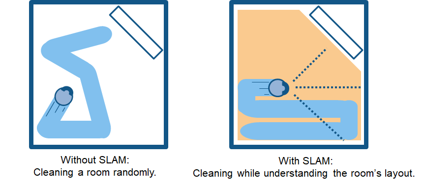
Robot vacuum cleaners were among the first consumer devices to use SLAM commercially. They build a floor plan of the home on the first run and use it for efficient coverage on subsequent runs. The same principle applies to home security cameras that need to track moving objects accurately across a space.
Frequently asked questions
What is the difference between SLAM and GNSS?
GNSS determines position using satellite signals and is accurate to centimeters under ideal conditions. SLAM determines position by comparing sensor observations to a map it builds in real time, with no external infrastructure required. GNSS works outdoors with clear sky view, but SLAM works anywhere the sensors can perceive the environment. Most professional mobile mapping systems use both together.
Can SLAM work without LiDAR?
Yes. Visual SLAM uses cameras only and is widely used in augmented reality, robotics, and consumer devices. However, for outdoor mobile mapping where geometric accuracy is critical, LiDAR-based SLAM significantly outperforms camera-only systems. The depth measurements LiDAR provides are more precise and less affected by lighting conditions than visual feature matching.
How accurate is SLAM in mobile mapping?
Accuracy depends on the sensors, the environment, and the algorithm. LiDAR SLAM systems with IMU fusion and loop closure can achieve relative accuracy of 1 to 5 centimeters in well-structured environments. When GNSS corrections are available and integrated, absolute accuracy can match or approach RTK GNSS performance. Accuracy degrades in featureless environments, such as long straight tunnels, where there are few distinctive landmarks for the algorithm to match.
What is loop closure in SLAM?
Loop closure occurs when a SLAM system recognizes that it has returned to a previously visited location. The algorithm then uses that recognition to correct accumulated drift across the entire trajectory. Without loop closure, SLAM trajectories drift over long distances. With it, the final map is consistent and accurate even after a long survey run.
Is SLAM used in professional mobile mapping cameras?
Yes, and its role is growing. Professional mobile mapping systems increasingly integrate SLAM as a complement to GNSS, particularly for environments where satellite positioning is unreliable. SLAM is also being used to improve post-processing workflows, reducing the need for manual ground control points and accelerating the time from field collection to deliverable. See how this plays out in practice on the Mosaic case studies page.
Conclusion
SLAM is not a replacement for GNSS, but it does keep things working when GNSS cannot. For surveyors and mapping professionals operating in urban canyons, underground infrastructure, forested terrain, or indoor spaces, SLAM can make a huge difference.
Understanding what SLAM does and how it interacts with your other sensors is essential to planning surveys that deliver accurate results across every environment you work in.
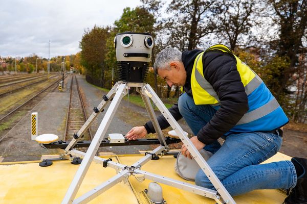
Title image courtesy of Laserscanning Europe
Meta description: SLAM stands for Simultaneous Localization and Mapping. Learn how it works, what sensors it uses, and when it outperforms GNSS in mobile mapping surveys.