These videos will show anyone working with a Mosaic 51 or Mosaic X how to get up and driving quickly and effortlessly
Check out this series of videos entitled “How to work with the Mosaic cameras”
Mobile mapping has never been easier. And we’ve got the proof right here. Find out how with little to almost zero training, you, your colleagues, or the guy next door can unpack, connect, and mount the Mosaic 51 and Mosaic X cameras – 2 of the most powerful and robust mobile mapping cameras to date.
“Remarkably, we required almost no training to use the Mosaic 51 or to instruct our clients in its usage,”
Iwu Emmanuel, Project Manager at Mapersive (part of Geomatic)
Check all of the videos below or access them on YouTube here →
The Mosaic 51 camera (and later the Mosaic X) was built and designed to be a user-friendly, single-man operation.
- No need to have multiple personnel onboard the vehicle during data capture
- No need to have a degree in GIS, surveying or mapping to operate these cameras
- No need to spend hours, days or weeks training a new employee
- No need to have a cumbersome, energy-demanding, and complicated computer or workstation within the vehicle
We were able to move the price point of individuals down somewhere in the region of 40%, being able to work like this.
Dan Davis, Catsurveys
These two camera systems were specifically designed to help mapping and surveying companies:
- Quickly and easily capture high resolution 360º street-view images
- Reduce site visits required by traditional surveying technologies and solutions
- Increase the ‘who’ behind data capture in order to allow senior technicians to work more efficiently
With these videos you or the driver can learn just how easy it is to operate a Mosaic camera.
Unboxing
First up is the “Unboxing” video. Here you will see what every Mosaic customer gets when they open their newly arrived shipment, straight from Prague (where we have been designing and manufacturing our cameras for several years now).
Our CEO, Jeffrey Martin, literally unpacks all of the cables that come in each package and shows you how to connect all of them.
Mounting
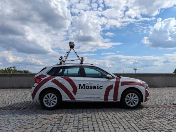
Next up find out how to mount the world’s only standalone mobile mapping cameras. The Mosaic 51 is only 5kgs (11lbs) and the Mosaic X is only 7kgs (15.4lbs), unlike many other mobile mapping systems. With a simple car roof mount* anyone can safely secure the camera on the top of the vehicle and make all of the necessary connections:
- GPS antenna
- Ethernet
- Power cable
- Aux port cable (optional)
*Updated December 2023: Mosaic customers are now able to purchase a ‘travel mount’ built by Mosaic engineers for our customers. Contact [email protected] for more information.
WebUI
Third in our ‘How to’ series is the WebUI video. Here viewers can learn how to work with the Mosaic WebUI including starting and stopping the recording, getting a GPS fix, and choosing FPS, as well as other parameters.
The most important thing to understand is that you do NOT need a computer in the vehicle and can start and stop the recording of these 360º mobile mapping cameras with only a smartphone, tablet or laptop.
Mosaic Stitching and Geo-Referencing Tool
Our team of software engineers developed a special tool that helps our customers render panorama images and integrate with positional data.
****Just a heads up: Before beginning, you must have MistikaVR installed on your computer. There are also a few FREE tools you need before getting started. Be sure to consult the ‘Readme’ file first in the corresponding documentation.
Watch this video to see just how easy it is for users to stitch their data from the Mosaic cameras.
Mistika VR
Mistika VR provides the best stitching for our cameras and does it at an optimal speed, utilizing properly all computation resources, including GPU.
The professional, precise software with the calibration template provided with each Mosaic camera enables users to stitch the imagery together all while allowing the user to complete other tasks at the same time, saving a lot of time and energy.
I compared four cameras for our county. On every single metric, the Mosaic 51 beat out its competitors: its image quality is best, it came with a powerful script to stitch the imagery together (using MistikaVR) and save us enormous amounts of processing time, and the imagery is nonproprietary so it comes in seamlessly to our ESRI software. My second choice of camera was over four times the cost of the Mosaic 51.
Pam Blackmore, GIS/GPS Technician II, Sevier County Office
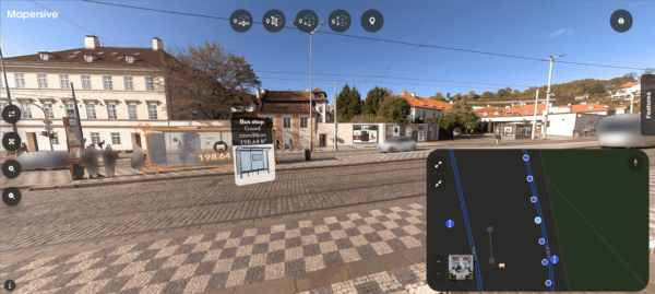
360º Street View Platform
Looking to learn the best way to VIEW your 360º street view images collected with the Mosaic camera?
Check out Mosaic’s most recent collaboration to learn how Mosaic customers can their data into a street viewing platform.
Check all of the videos above or access them on YouTube here →
If you are a Mosaic customer and still need help, don’t hesitate to reach out with any questions to [email protected]


