Integrating 360 Street View Imagery in ArcGIS: Enhancing Geospatial Visualizations with Mapillary
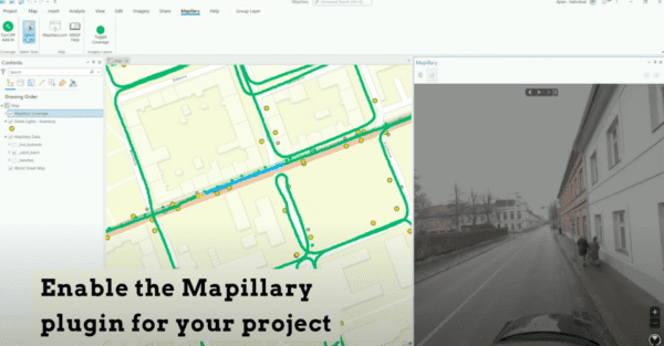
Unlock the full potential of ArcGIS with our guide on integrating Mapillary and Mosaic 360 cameras for dynamic street view imagery. Discover
Unlock the full potential of ArcGIS with our guide on integrating Mapillary and Mosaic 360 cameras for dynamic street view imagery. Discover

Discover an all-in-one solution with Mapillary and Mosaic for automatic, free AI on street view imagery. Learn step-by-step how to integrate high-res

Explore the versatile world of image capture methods – Satellite, Aerial, Drone, and Mobile Mapping – and Learn which is the best
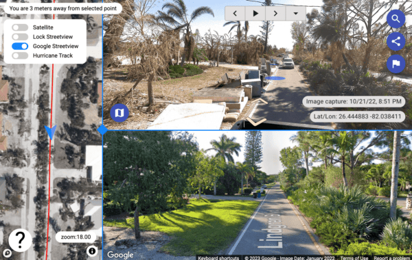
Effective post disaster debris management with 360º street view images from a mobile mapping camera assists with maximum FEMA reimbursement.

Customer success story: Field builds innovative MMS with Mosaic X and LiDAR to scan railways in Norway with high precision.

Follow our latest travels from Europe to the U.S. (twice) and Singapore as we visited more partners and customers and met new


