

Community
6 Geospatial Trends to Watch in 2026: Insights from Intergeo 2025
We interviewed industry experts at Intergeo 2025 to see what geospatial trends we can expect in 2026.
Featured
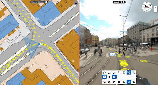
Choosing the Best Method for Road and Infrastructure Surveying
Navigating road and infrastructure surveying doesn’t have to be difficult. Learn how to use open source solutions like Google Street View or create your DIY solutions with Mosaic.

Featured
Frequently Asked Questions about Mosaic
Find all your FAQS about Mosaic here! Asked and Answered.
Community
The Winners of our 2026 Calendar Competition
A few months ago, we put out a call for the best photos our customers have taken of their Mosaic cameras to be put in our 2026 monthly calendar. Many
Featured
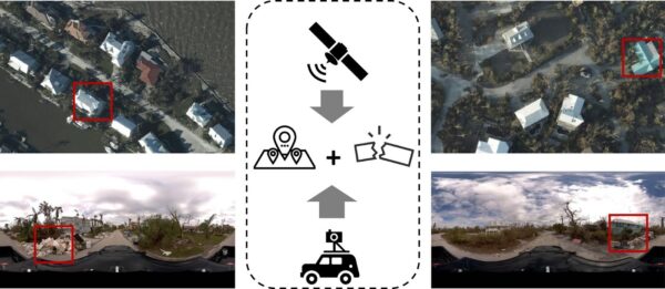
A Job Only Street View Can Do: An Academic Case Study of Hurricane Ian
There are some scenes only street-view imagery can capture. These researchers are using Mosaic imagery from Hurricane Ian to train GeoAI models to identify post-disaster damage levels. When Hurricane Ian

Featured
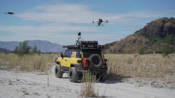
Introducing the Mosaic Processor and Anonymizer
Process, analyze, and visualize your data with Mosaic’s software line of post-processing tools.


