Featured
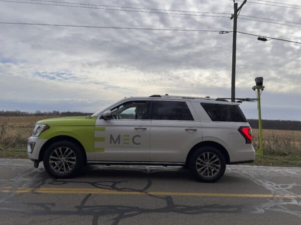
Case Study: Midwest Energy & Communications’ Innovative Approach to Utility Mapping with the Mosaic X Camera
Read how Midwest Energy & Communications harnessed their Mosaic X camera for superior data capture, resulting in streamlined operations, improved safety, and high-quality infrastructure mapping, driving forward their utility services.
Community
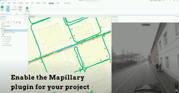
Integrating 360 Street View Imagery in ArcGIS: Enhancing Geospatial Visualizations with Mapillary
Unlock the full potential of ArcGIS with our guide on integrating Mapillary and Mosaic 360 cameras for dynamic street view imagery. Discover how to enrich your geospatial projects with up-to-date, panoramic visuals, and learn about the benefits of collecting your own data. Perfect for ArcGIS Pro and Web App Builder users seeking to leverage street-level imagery for insightful analysis and compelling map visualizations.
Community
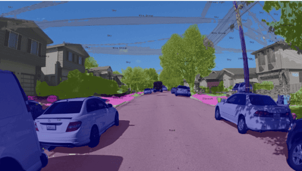
Mapillary & Mosaic: All-in-One Solution for Automatic and Free Object Detection for Street View Imagery
Discover an all-in-one solution with Mapillary and Mosaic for automatic, free AI on street view imagery. Learn step-by-step how to integrate high-res Mosaic 360º imagery into Mapillary and ESRI for seamless asset identification and segmentation
Featured
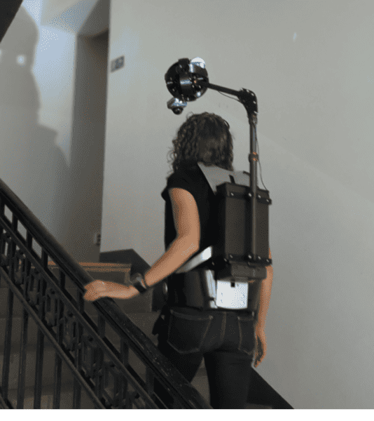
Mosiac Xplor: Unlocking Mobility for Geospatial & 3D Scanning in Challenging Environments
Meet Mosaic Xplor, a revolutionary solution combining cutting-edge mobile mapping backpack camera with LiDAR and GNSS, set to redefine geospatial and 3D scanning.
Featured
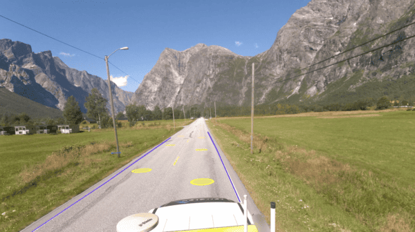
New mobile mapping solution makes managing road networks easier and more efficient
Discover how Field’s advanced mobile mapping solution helps you efficiently assess and prioritize road repairs in the challenging Nordic climate. Ensure safety and optimize your road network maintenance effortlessly.
Industry
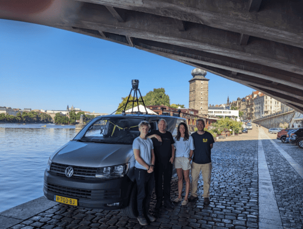
Revolutionizing Data Collection: Mosaic’s 360º Cameras & SmartDelta in Prague
Smart Delta and Mosaic testing out a multi-sensor mobile mapping system including the Mosaic X camera, LiDAR, high-precision GNSS, and thermal camera, all collected with the Smart Delta system which enables users to pair high quality imagery with other high-end sensors according to their needs.


